![]()

|
|
|
|
" Skye 2. ~ Talisker and the Minginish Peninsular " Date & Time: Mon/Tuesday 24/25th June 2013 Locations : Scotland ~ the Isle of Skye, Places visited : Talisker Bay, Carbost, Fairy Pools, Glen Brittle, Sligachan. Accommodation : Blà Bhein (pronounced blah vane) B&B, Crossal, Carbost, Skye. With : Ann and the dogs, Harry and Bethan. Weather : Not encouraging . . . some sunshine but often overcast or low cloud.
|
Talisker and the Minginish Peninsular at EveryTrail [ Alter the settings to zoom or change the Map, use Everytrail to download the Gps route ] |
|
Settled in at Carbost we start to explore locally. To Whisky officianodos amongst you the name Talisker will be familiar as Skye's only distillery but there's more to the area than just the amber nectar . . . we go in search.
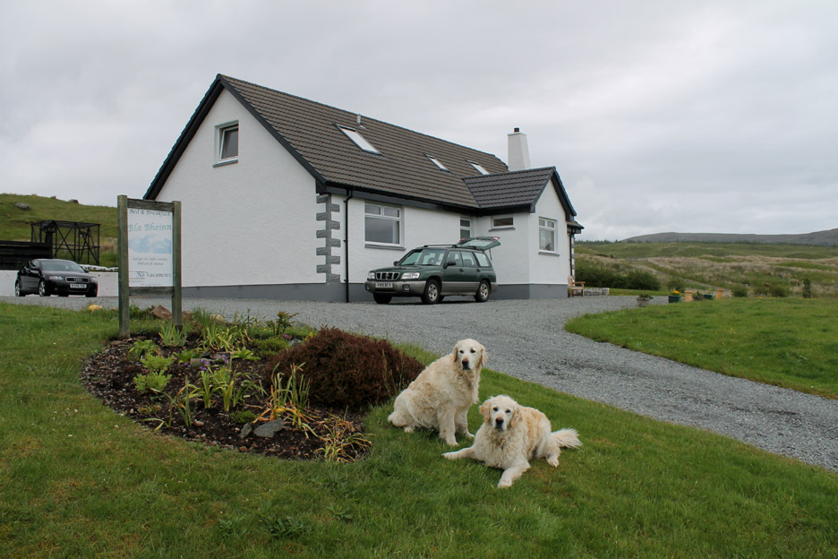
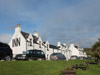
Blà Bhein, our lovely Bed and Breakfast accommodation just before we set off to explore.
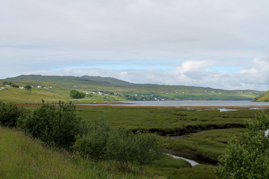
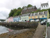
This is the sea loch of Loch Harport, with the village of Carbost, its pier, housing and fine pub in the centre of the picture. The employment prospects of the village were enhanced with the building of the distillery at a time of the depression and clearances in the 1830's, but more of that later . . .
First we are off to the original and genuine Talisker after which the Carbost Distillery was named . . . Talisker Bay. It was up over the moorland, with single track roads and passing places, travelling the short distance west over the Minginish Peninsular to the sea.
The impressive summit of Preshal More looks greater than its mapped 1030 feet as it towers over the white building of Talisker House. The estate was home to the Clan Macloed for 200 years but was owned by Hugh MacAskill from 1825 to 1849, the period when the distillery was built. For the historians and geologists amongst you, check out this link to Talisker House which includes more info on Preshal More and Preshal Beag.
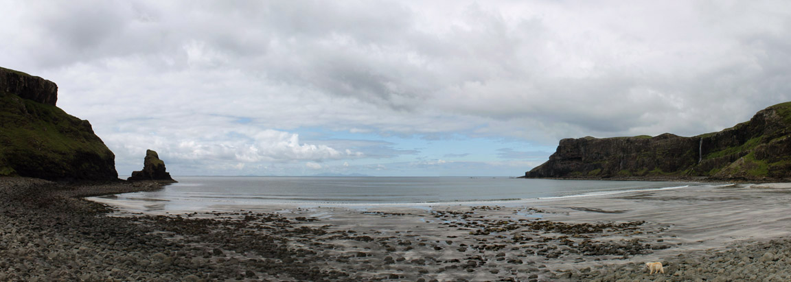
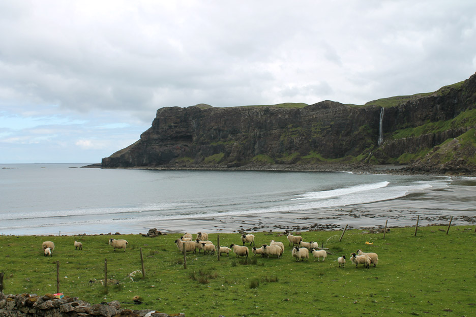
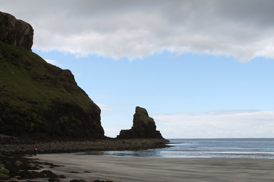
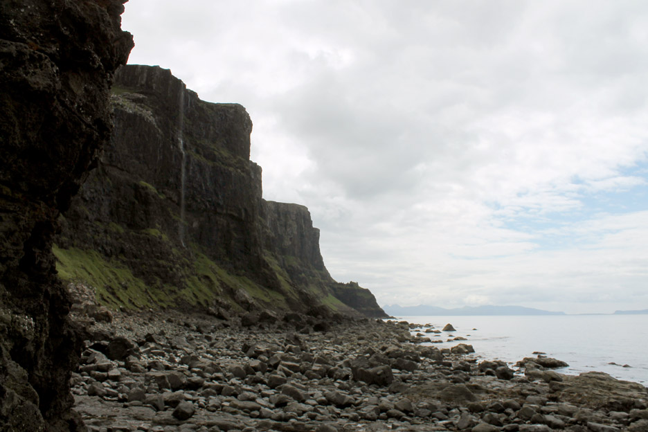
A wide shot of Talisker Bay . . . the tide is low enough for a broad stretch of sand but it is black not golden yellow . . . due to the nature of the local volcanic rock.
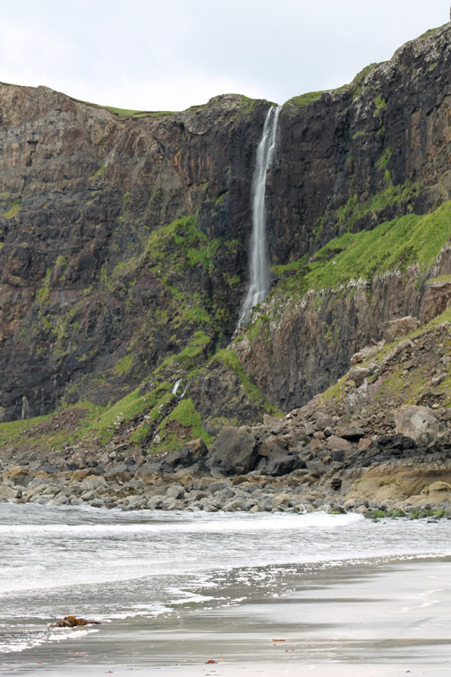
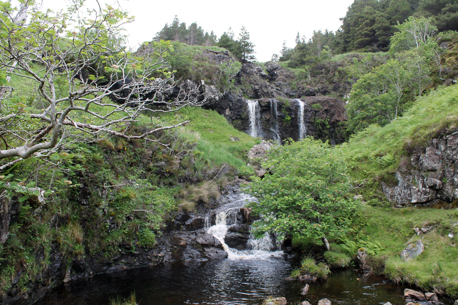
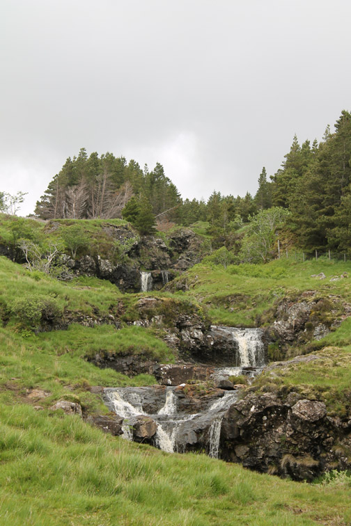
On one side of the bay is a fine waterfall cascading over the cliff.
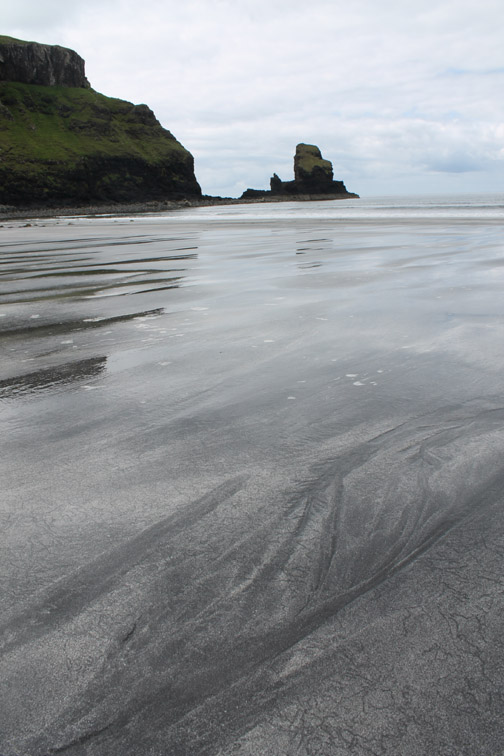
Sea shells have produced a fine layer of white sand that sits over the darker volcanic granules giving the beach unusual and ever changing surface patterns rarely seen on other, lighter coloured beaches.
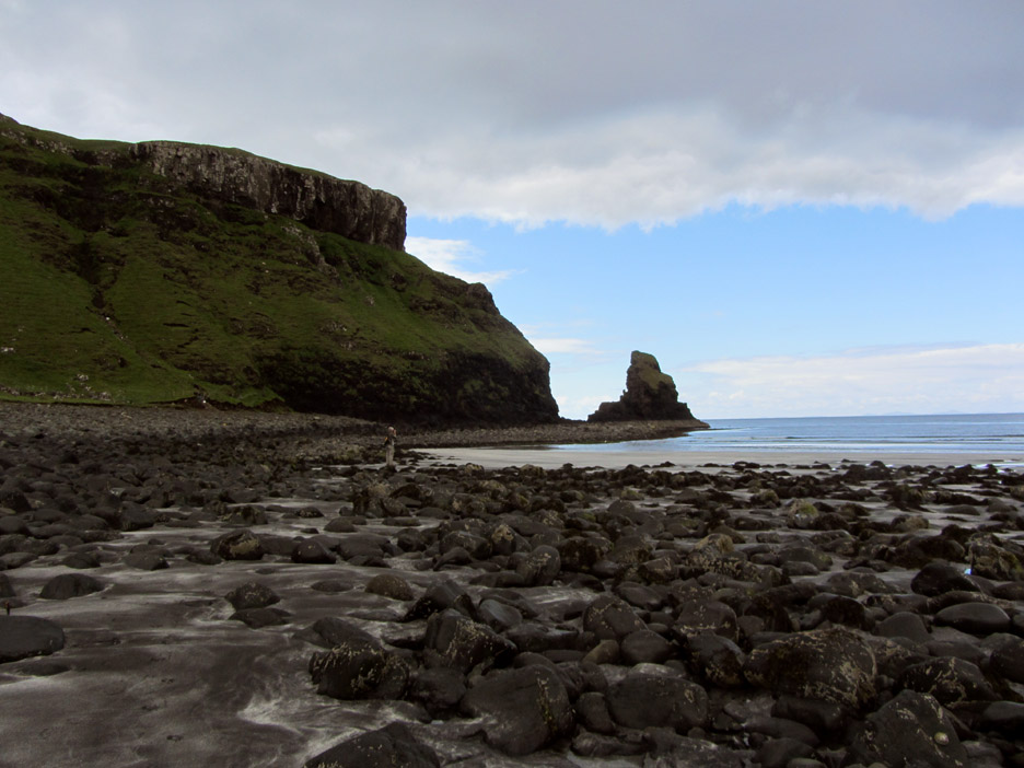
We walk from one side to the other . . . from the waterfall to the rock.
The darkness of the sand comes from the dark boulders of the storm raised beach.
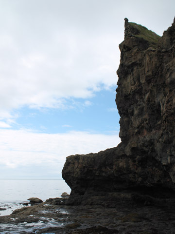
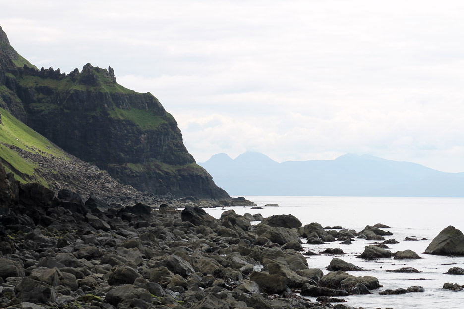
Over the slippery rocks and around the corner you suddenly get a view south along the coast. Here there is another fine waterfall cascading over the cliff . . .
. . . and in the distance, views of the high peaks on the Island of Rhum.
Time to be heading back to the car. The bright sunshine seen out to sea remained elusive over the land this morning so the colours are a little subdued.
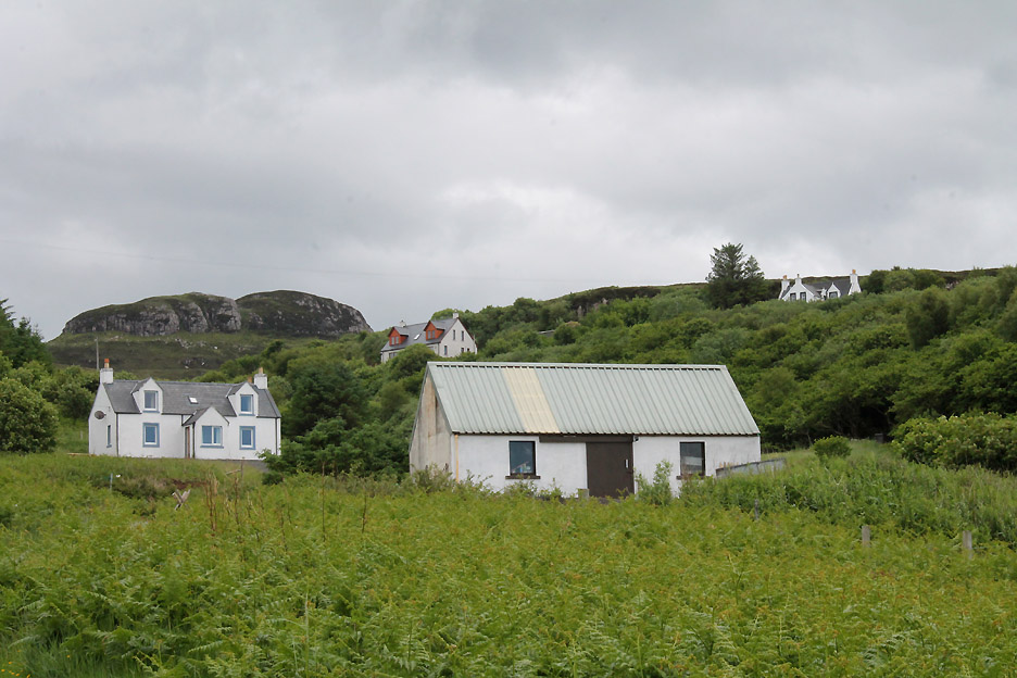
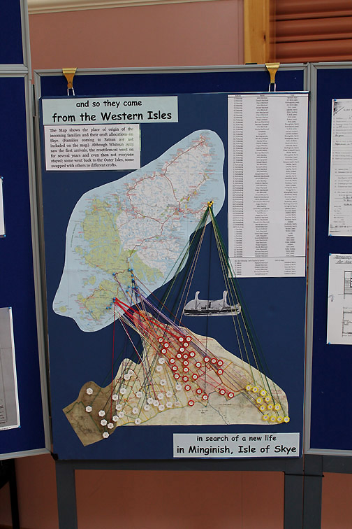
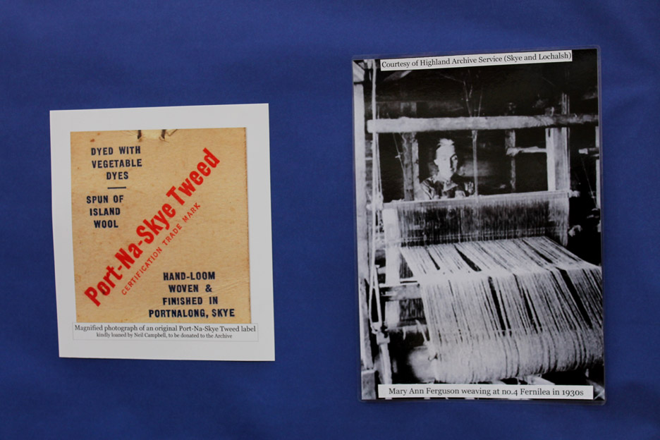
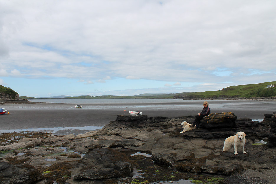
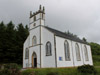
Back over towards Loch Harport now . . . at Portnalong and Fiskavaig villages. The area was famous/infamous for highland clearances when the landowners found sheep rearing paid better than collecting rents of the crofters. The background is well documented and probably better explained elsewhere, but for areas like this the modern, residual effect is a large number of densely packed houses and cottages close to the seashore where the crofting families who were not forced to emigrate were allowed to scrape a living. Here in Portnalong there is a slightly different story, and this came to light through a local exhibition of weaving.
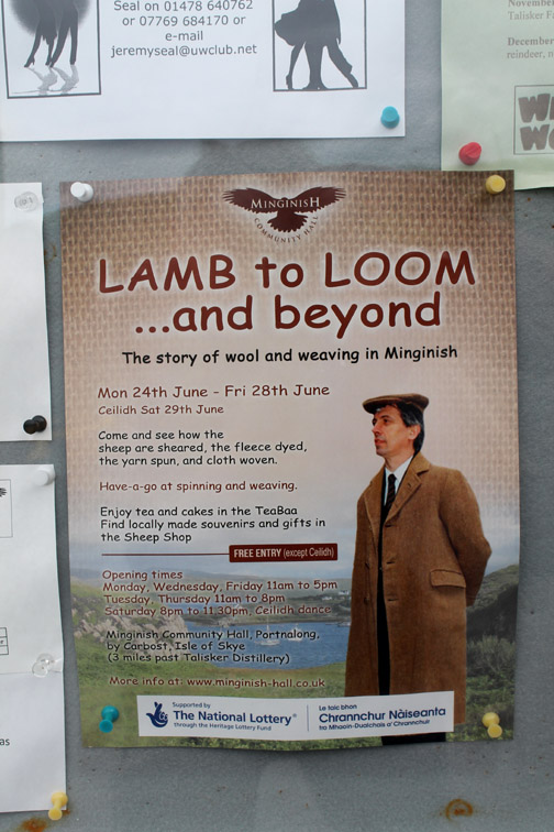
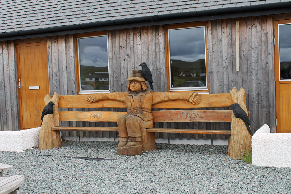
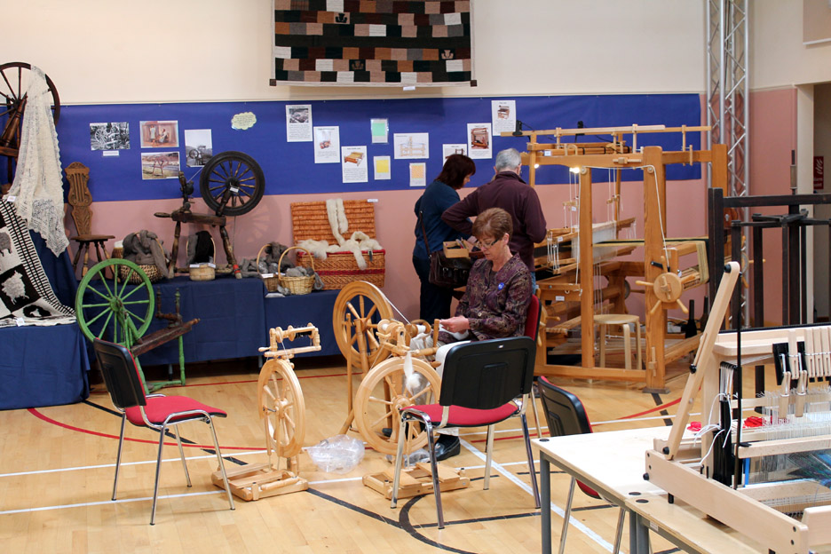
Come and enjoy the view from the fine seat at the Village Hall . . . before going inside to appreciate the "Lamb to Loom" exhibition. [ Please bear in mind the exhibition itself is now closed . . . but you can still go along and sit on the chair with the scarecrow ]
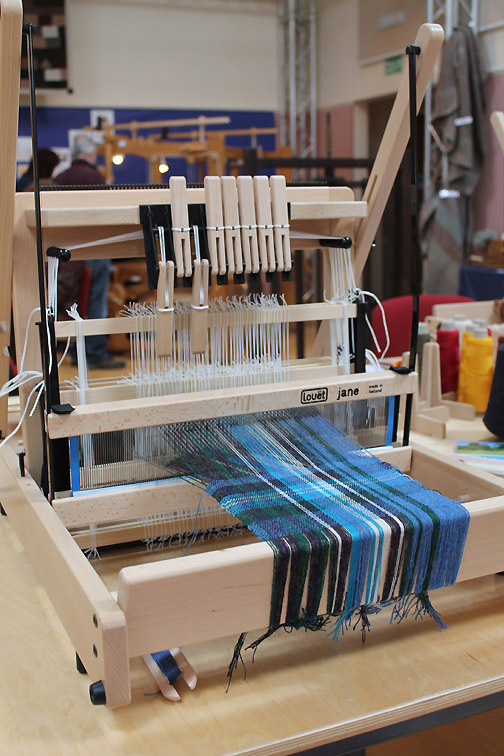
With local and Lottery funding the community has been able to buy a small loom for teaching in order to keep alive the skills of the local families in respect of this cottage industry.
There was chance to watch spinning and weaving on modern equipment too. Some of the old spinning wheels on display were the ones featured in the grainy black and white photos also displayed in the hall.
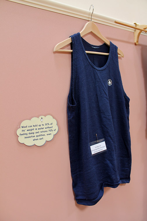
Read the note ... it is the same words as I use in work about modern wool base layers.
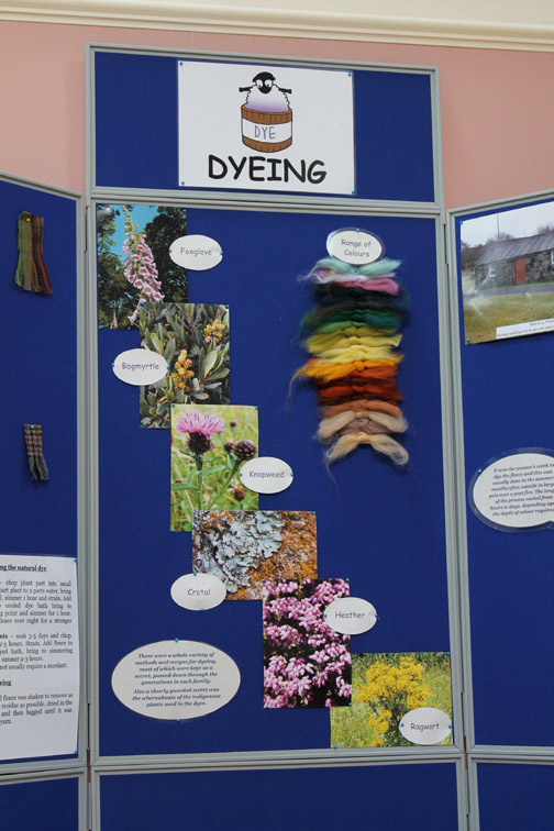
In its heyday Port-Na-Skye Tweed was equivalent to Harris Tweed. The exhibition is an attempt to recognise the past and so build for the future . . . to retain and develop those old skills once more.
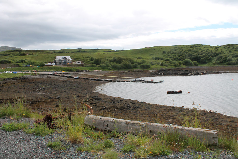
After the exhibition and a rather nice tea and cake, we ventured down to the shore, firstly to the pier . . .
. . . and then down to Fiskavaig Bay.
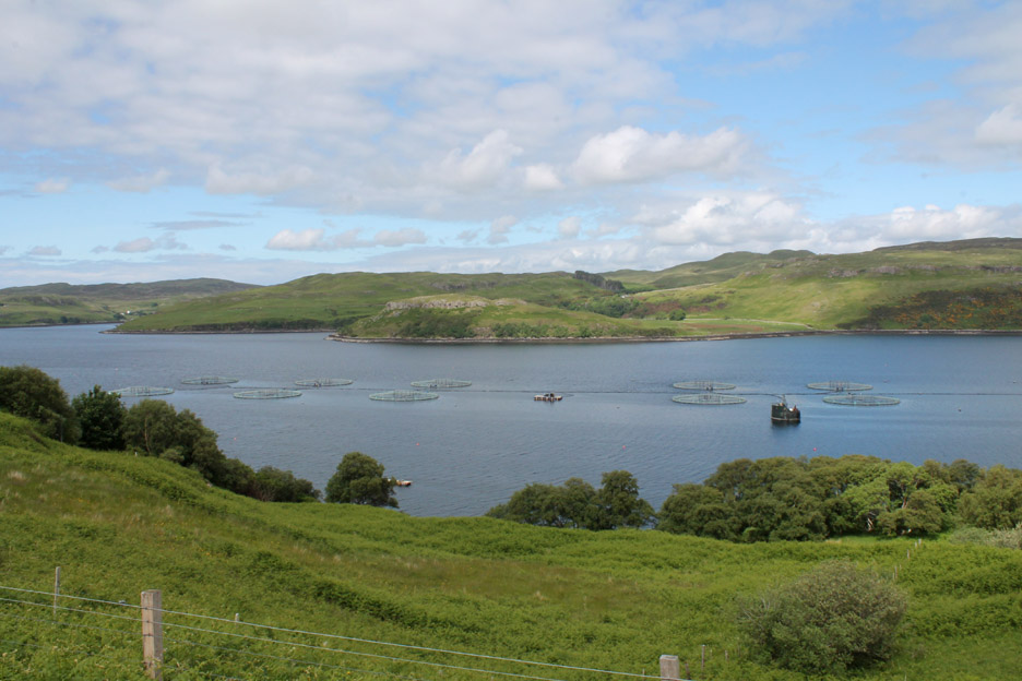
On the way back we passed the fish farms in Loch Harport where they breed salmon for sale world-wide. This is an example of modern industry supplementing the older ways of the world.
Another non-agricultural industry of course was just up the road . . . and just asking to be visited. Welcome to the world of Talisker.
The distillery was built at Carbost on Loch Harport because of the safe harbour for the import of raw materials (barley etc) and for export of the finished product (whisky) by sea . . . this continued until the advent of better roads in the latter part of the 20th Century.
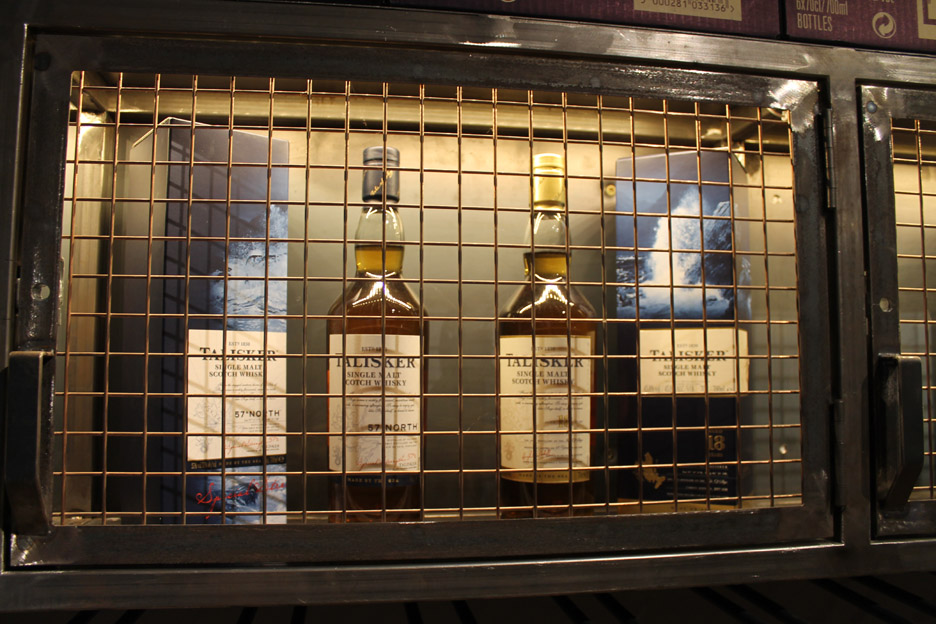
I'd dearly loved to have shown you round to explain the process, the stills, the mash tuns and all the processes but photography was prohibited . . . and I would have ended up behind bars like this classic 57 Degrees North single malt Talisker !
With the Black Cuillin in our sights we said goodbye and "Cheers" to the distillery and returned to our accommodation.
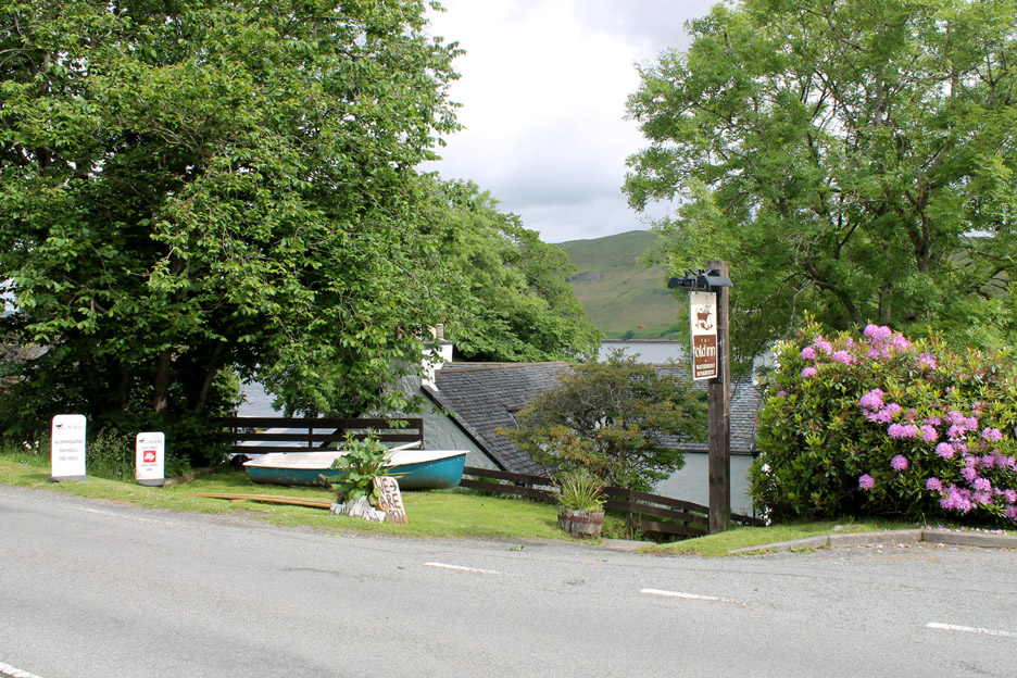
In the evening we were wined and dined at The Old Inn at Carbost (provided we paid of course) and the evening concluded with some fine traditional live music from local musicians on guitar, fiddles and mandolin. - - - o o o - - -
Click to start the three minute video . . . and then sit back and enjoy the music. ( Click on the YouTube full-screen logo to see a larger version of the video ) - - - o o o - - -
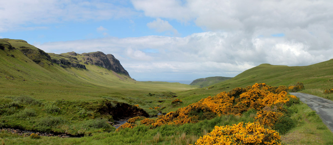
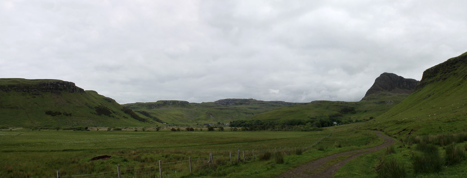
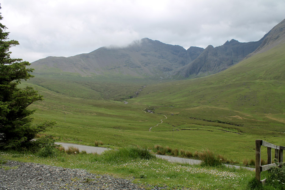
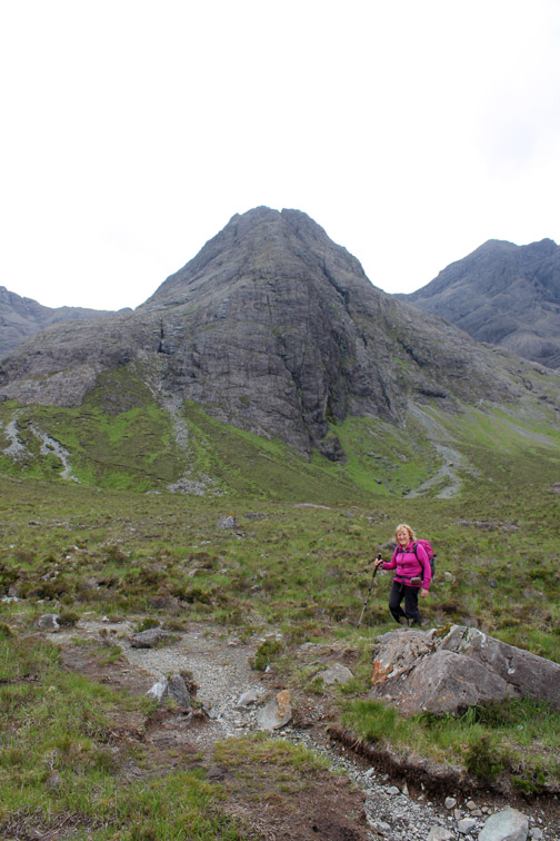
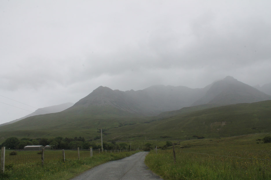
Next day we drove the short distance over to Glen Brittle for a walk up to the Fairy Pools and into the foothills of the Black Cuillin.
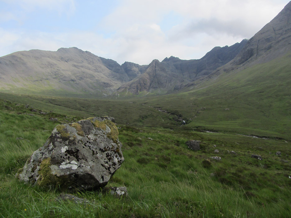
From the car park we could look across at our route following the path across to the river, up to the base of the crags and back to the left, skirting round under the ridge to join the Sligachan path back.
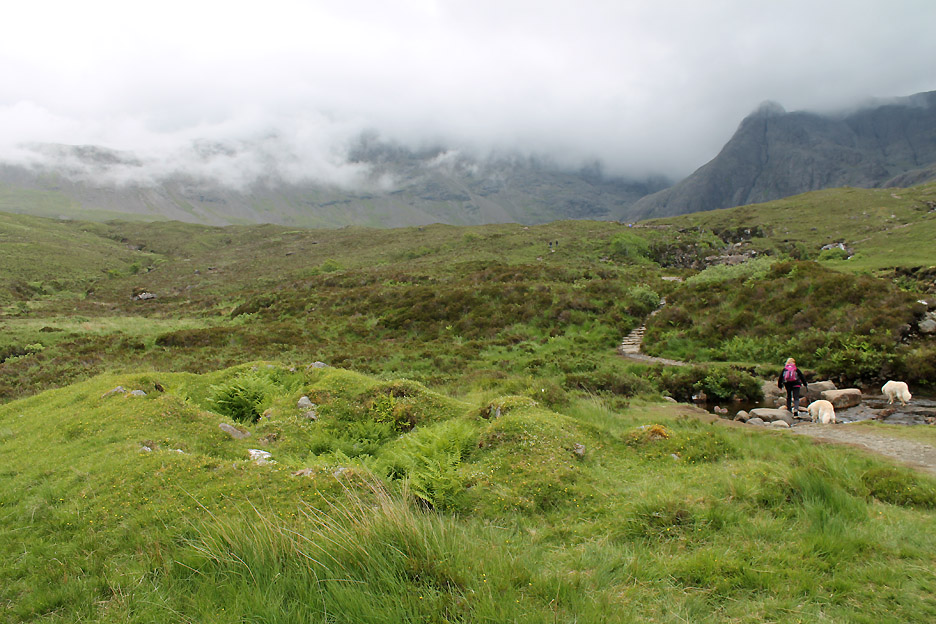
The cloud was rising then falling, promising fine weather and then closing in with the threat of rain.
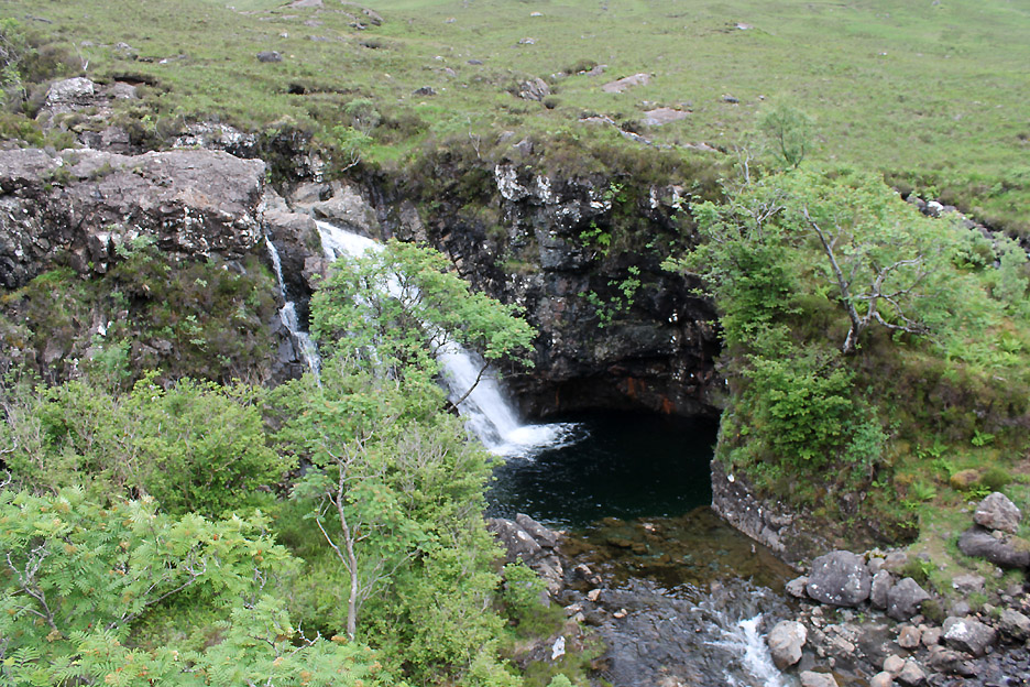
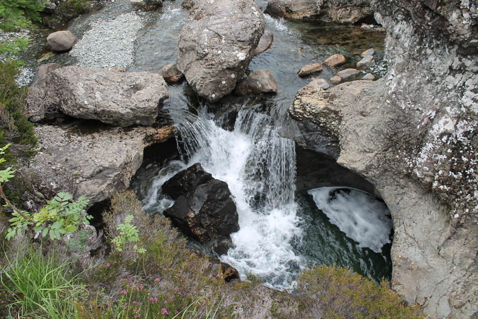
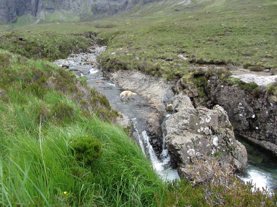
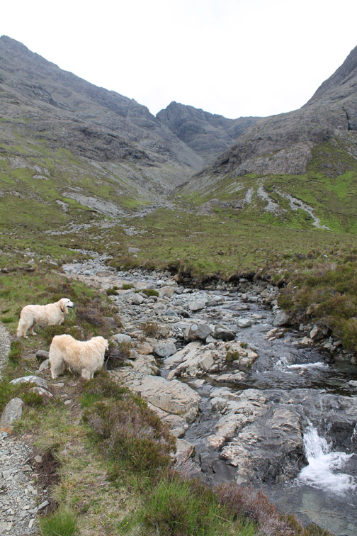
The river was the main attraction of this part of the walk. As it descended from the hills it has carved numerous pools and small ravines.
Each drop had a delightful waterfall and deep plunge pools.
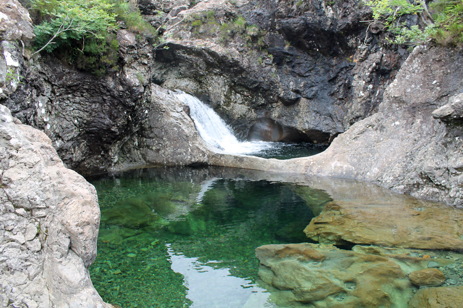
One even had a magical appearance as the foaming water beneath the falls changed to calm deep greens. The river dived under a rock arch and appeared on the other side as if born again. What a lovely place for a swim . . . if only the weather and the stream were a little bit warmer !
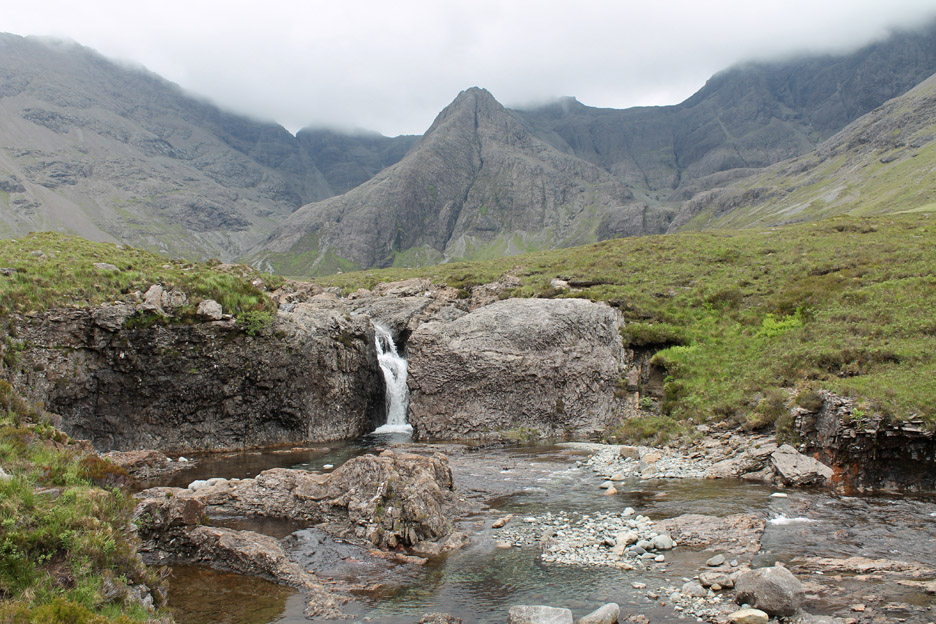
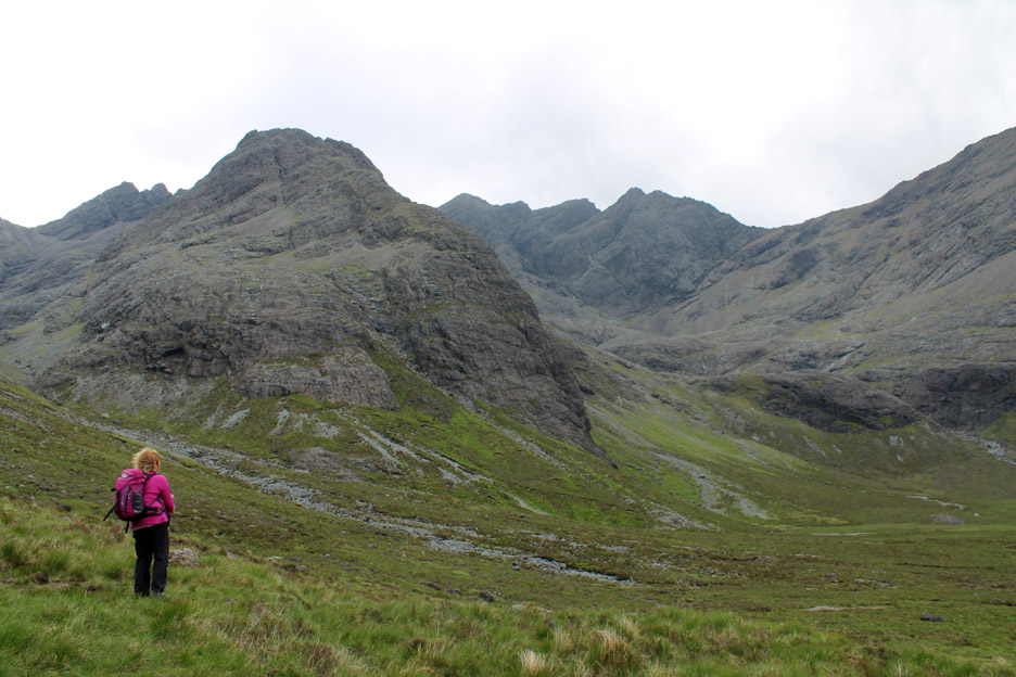
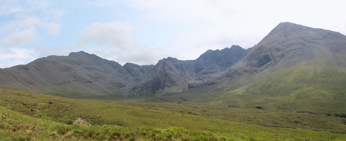
The top falls with the amphitheatre of the Cuillin Hills behind.
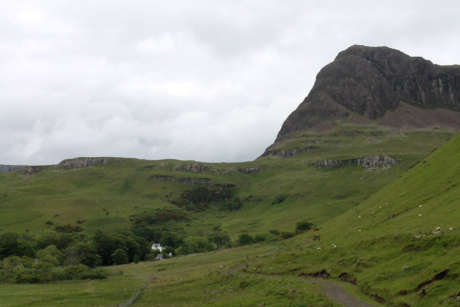
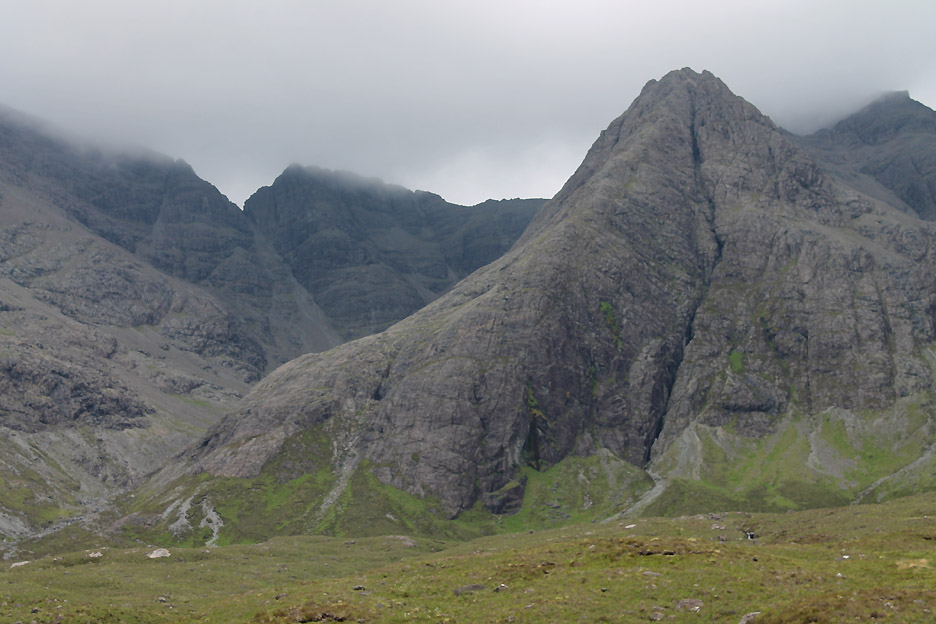
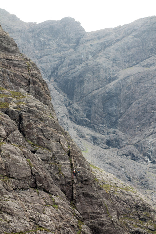
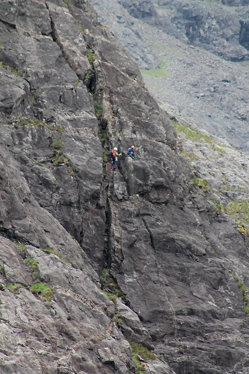
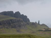
Sgurr An Fheadain. Disfiguring the face of the peak is the long dark gash of Waterpipe Gully, first climbed in 1895. Even today it is a serious rock climb, taking most of the day for experienced rock climbers to ascend successfully.
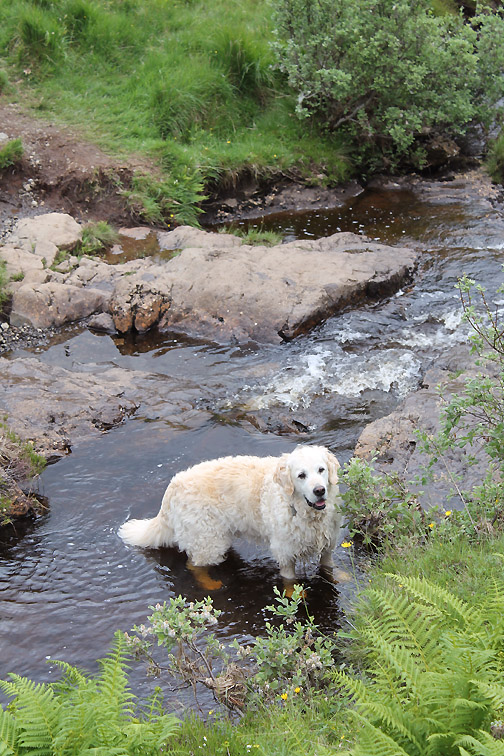
Despite the cool temperatures, Harry still felt the need to get his feet wet !
One last look from close up under the crags.
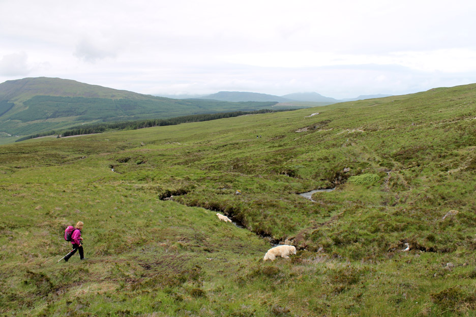
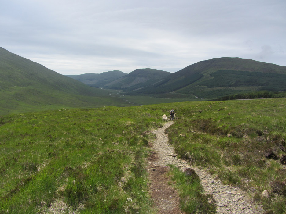
Heading north on a faint path across the moorland towards the nearby forestry.
The view was such that we stopped many times, our eyes drawn to the bare rock and the barren landscape of the Cuillin.
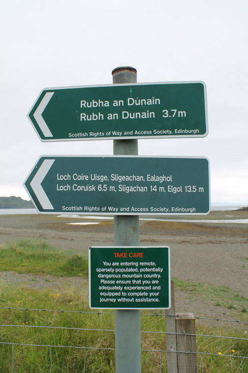
Close to the forest we picked up the path from Glen Brittle to Sligachan and then head downhill (west) on the last leg of the walk.
Looking across to Fairy Pools and the path that we used on our outward journey.
More beautiful waterfalls on our return route too.
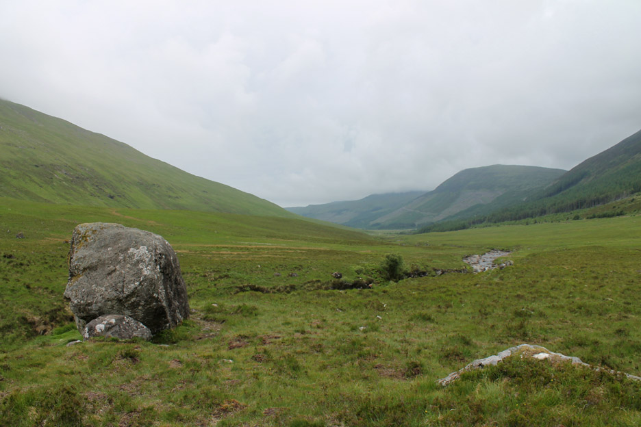
- - - o o o - - - Afterwards we took the opportunity to drive down the length of Glen Brittle to reacquaint ourselves with the views after so many years away from this part of Scotland.
Old stone walls are a throwback to the old "Black Houses" that used to belong to the people of the valley. Many of these were burned and the people evicted as part of "The Clearances"
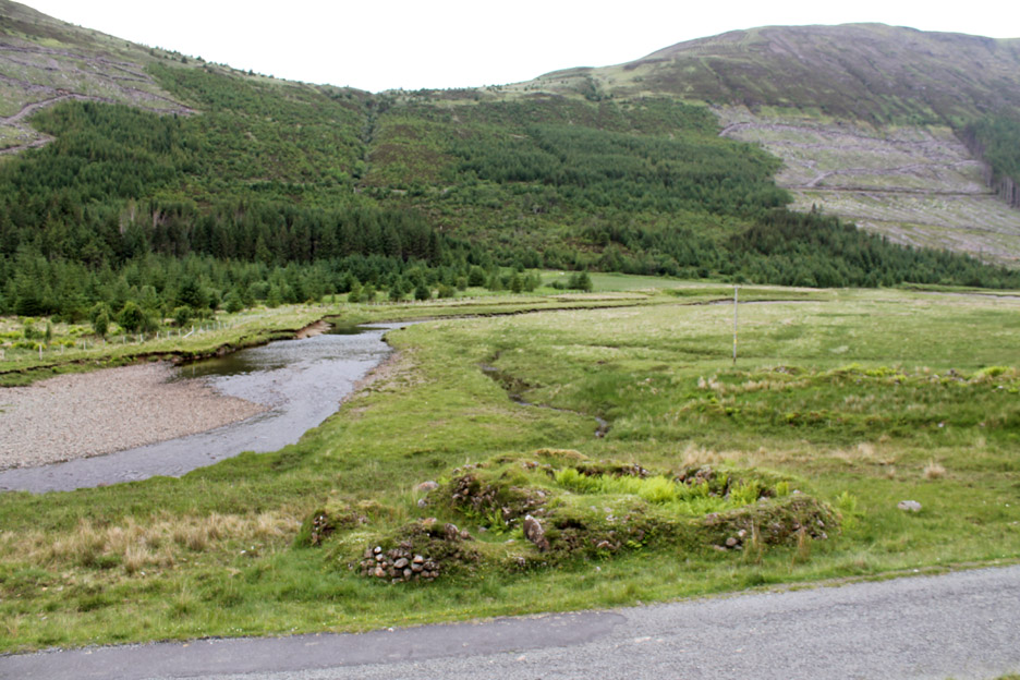
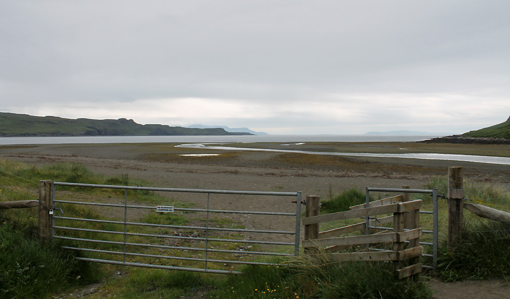
The wide beach at the head of the sea loch. Canna is the island to the right, the Isle of Rhum just behind the headland on the left.
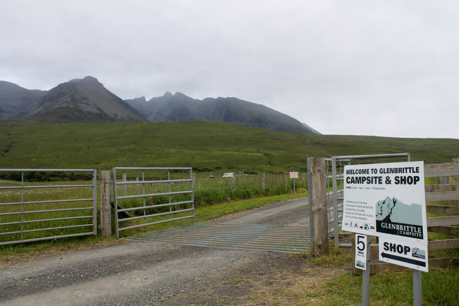
At the end of the road . . . the campsite of Glen Brittle. The valley above is the famous Coire Lagan on the western side of the highest Cuillin Hills.
Mmmm . . . the cloud descended again and this time with attitude . . . we were thinking of going back anyway ! - - - o o o - - -
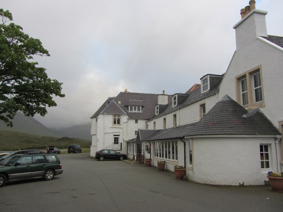
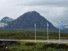
In the evening we made our way over to the Sligachan Inn for supper.
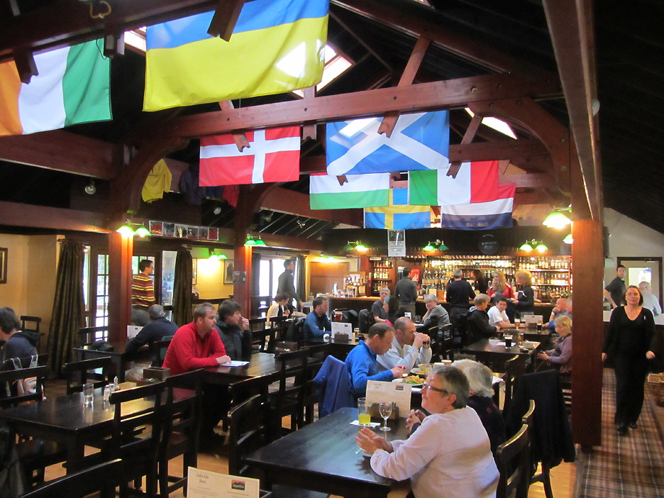
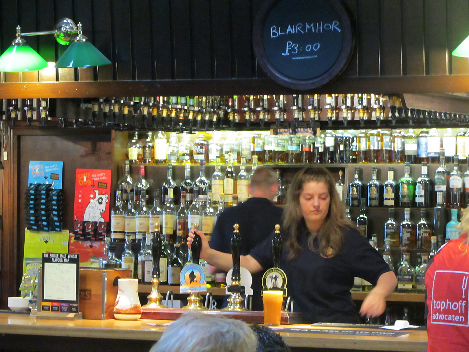
Inside the colourful flags and atmosphere of Seumas' Bar . . .
. . . where they pride themselves on stocking 370 different Scottish Malts. (give or take one or two depending on recent demand) " Sleep tight "
|
- - - o o o - - - Technical note: Pictures taken with either Ann's Canon Sureshot SX220 or my Canon 1100D Digital SLR. Resized in Photoshop, and built up on a Dreamweaver web builder. This site best viewed with . . . . a room in the Inn so we could have sampled a few more of them !
Email me here # © RmH # Go to Home page
|