|
|
|
 |
Remember: Press F11 for a
full screen view of this page. |
Web Counter when published 2
009 120 |
|
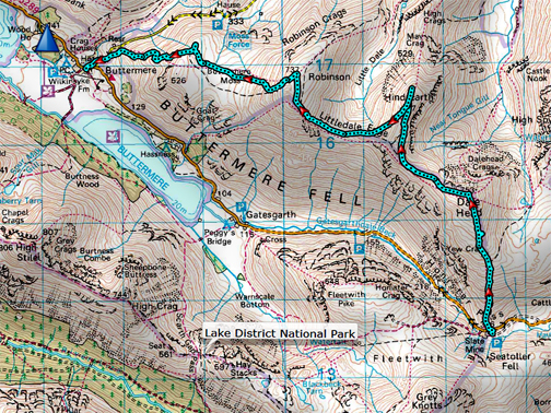
" Three Walks - Nine Summits " Date & start time: 17th April 2022. 10.45 am start. Location of Start : NT Car Park, Honister Slate Mine, Cumbria, Uk. ( NY 225 136 ) Places visited : Dale Head, Hindscarth, Robinson, High Snockrigg, Buttermere. Walk details : 6.4 mls, 2351ft of ascent, 3150ft of decent, 4 hours 5 mins. Highest point : Dale Head, 2,473ft - 753m. Walked with : Matt and Jenna and the dogs, Dylan and Dougal. Weather : Hazy high pressure with plenty of warm sunshine.
|
© Crown copyright. All rights reserved. Licence number PU 100034184. |
|
On this last full day of Easter, the family all have slightly different preferences about when and where to climb. Abi, Cathy and Mark fancied a brisk climb of Grasmoor, the two lads opted for an early start on the other side of the valley and Jenna, Matt and I preferred a more gentle climb and a classic descent from Honister to Buttermere. - - - o o o - - -
Their view down over Burtness Comb, with the green fields of Gatesgarth Farm far below.
Sam starts the High Crag descent via Gamlin End, here looking down towards Haystacks.
Mark, Boris and Bilbo completed the trio on their third mountain of the day, Grasmoor top. They started from the house in Loweswater and descended via Gasgale Gill, after a long day on the fells. - - - o o o - - -
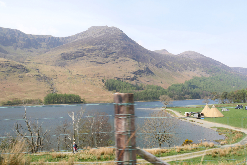
There's been a wedding on over the Easter in the grounds of Hassness House. The tepee marquees are being dismantled following the celebration in this sunny weekend.
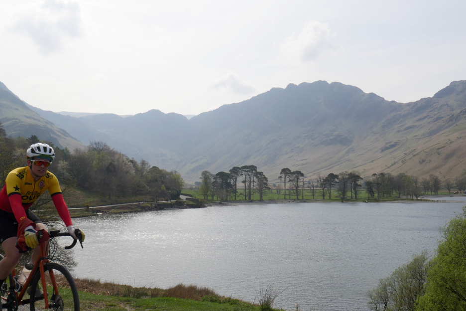
The Buttermere Pines, with a cyclist in the picture to make a change.
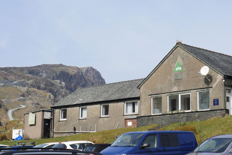
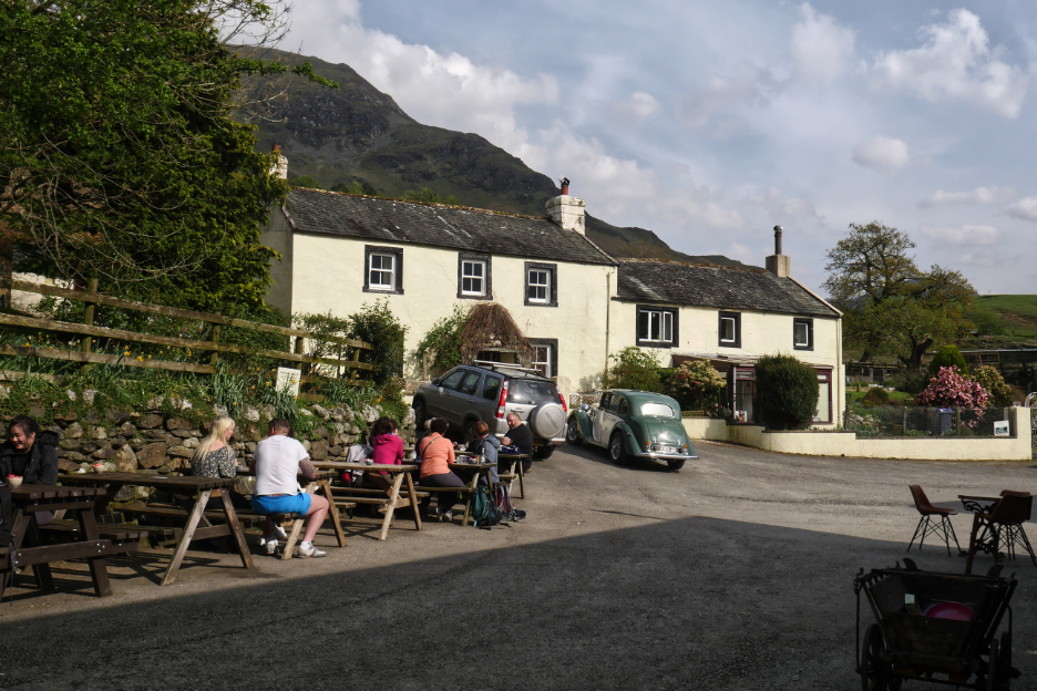
Honister Youth Hostel as we find one of the last parking spots in the National Trust car park.
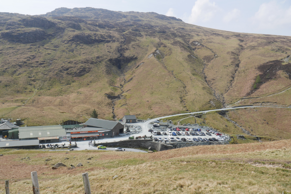
Our later morning start meant that the mine car park was already busy, as visitors flocked to the fells and the many activities on offer at the mine.
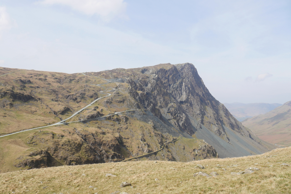
The dramatic cliffs of Honister Crags. The heat of the day meant that visibility would not be great today . . . but there's also no chance of rain either !
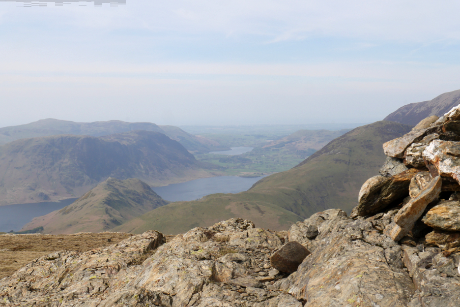
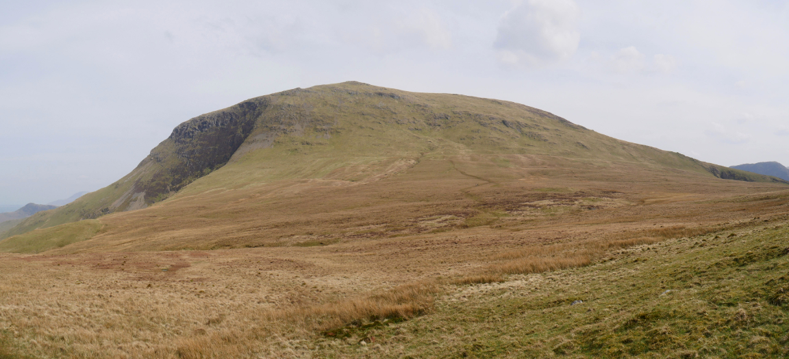
The three of us headed up the hour-long, reasonably gentle climb to Dale Head.
As we climb we finally lose sight of Honister Mine and now the surrounding fells draw the eye. Here we're looking over to Bowfell, Esk Pike, Dale Head, the Scafells with the rounded top of Great Gable in the centre. To the right is Kirkfell and Ennerdale's Pillar Fell.
Away to the right (as we climb) is the hazy ridge of Helvellyn and the Dodds.
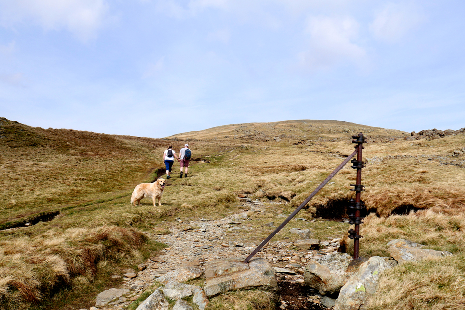
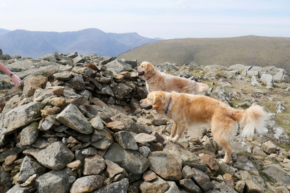
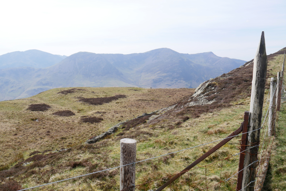
The old Victorian fence posts provide confirmation of the route towards the summit.
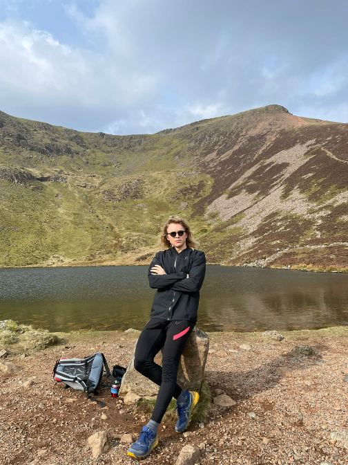
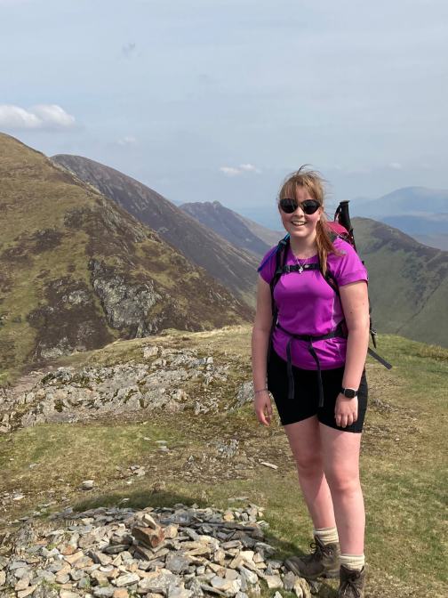
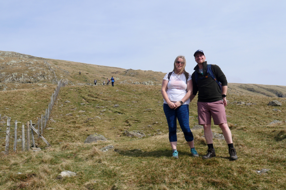
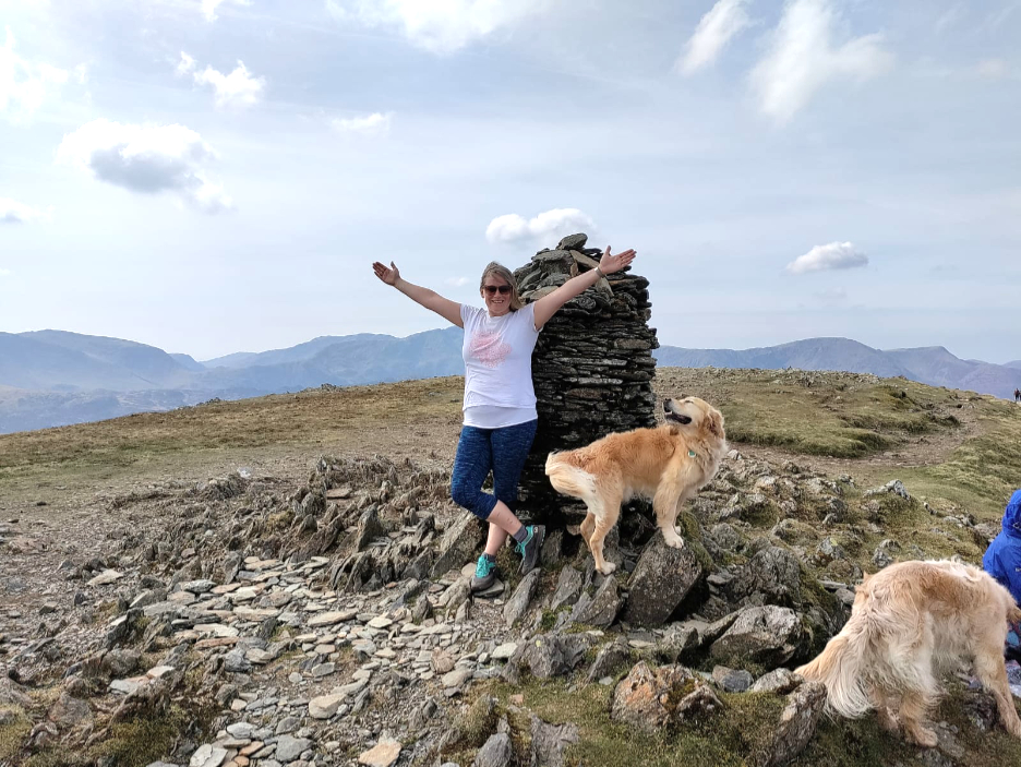
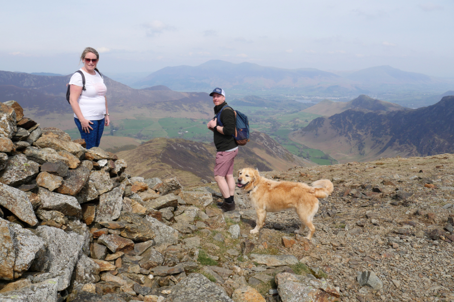
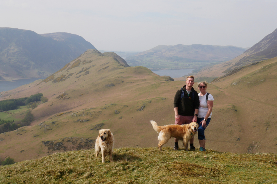
" When we could climb no higher, we hold our hands in the air in celebration." This is Jenna celebrating her highest summit of the holiday with Dougal joining in. The summit is nearly 2500 feet above sea level.
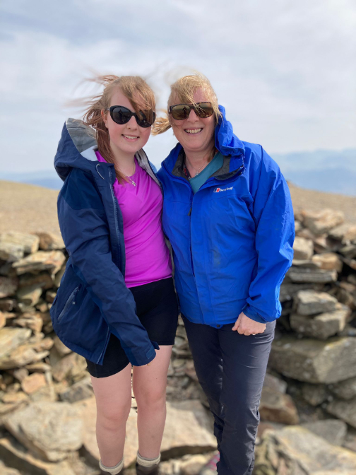
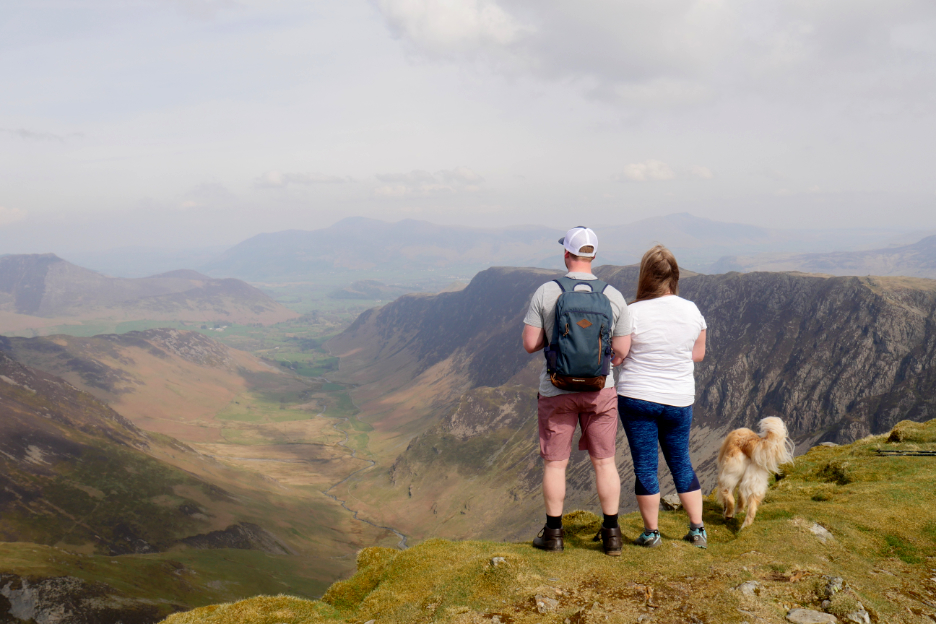
Time to stop on the edge and introduce Matt to the view.
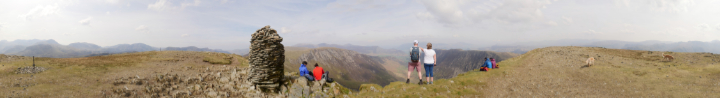
Click here or on the picture above for an annotated 360 degree panorama from the top of Dale Head today.
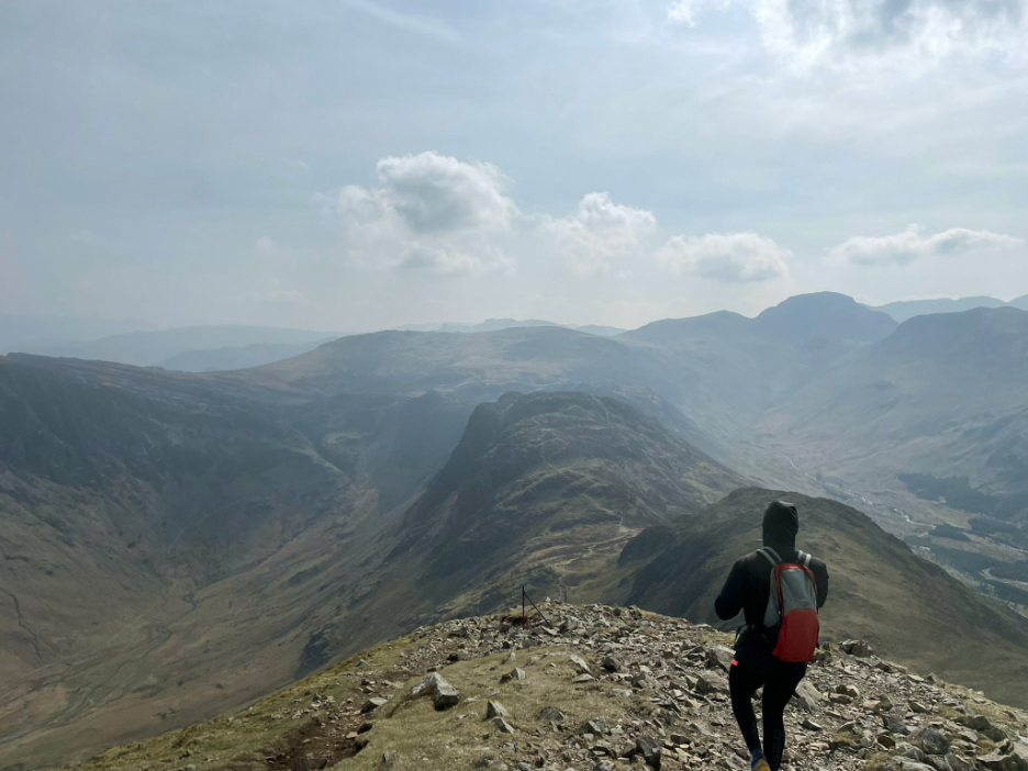
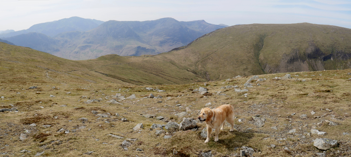
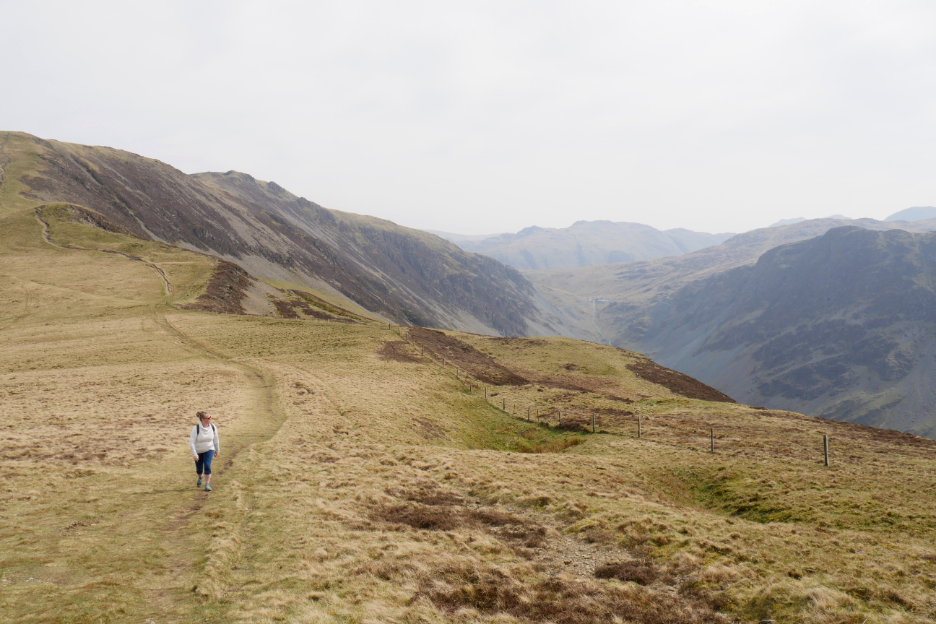
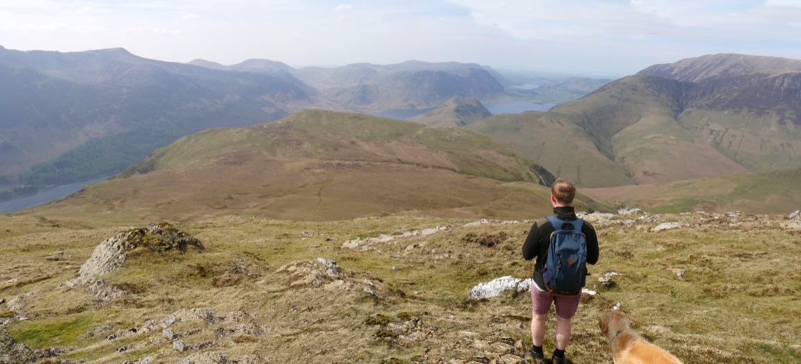
It's downhill all the way now, apart from a few 'ups' onto the next two summits.
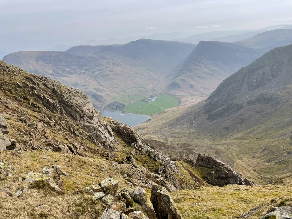
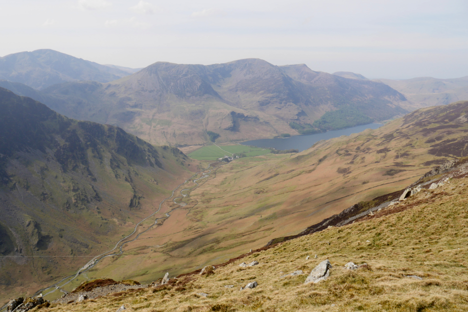
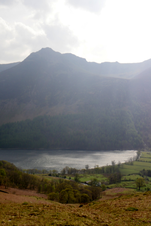
Looking down into Gatesgarthdale and Buttermere, with the High Stile Ridge on the far side. Matt and Sam would have crossed most of those three tops by now I would imagine.
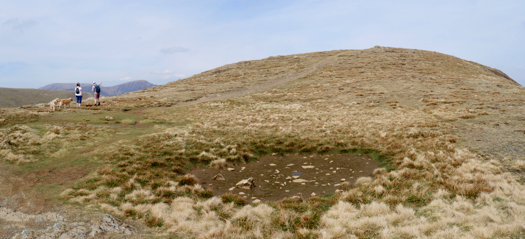
From the dip as we crossed Hindscarth Edge, we start an easy climb up past a dry moorland pool, aiming for our second top. One year we walked this way at about this time of year and the pool was full of water and frogs spawn . . . not so today.
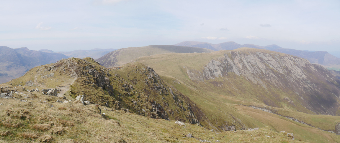
Looking back to the impressive bulk of Dale Head.
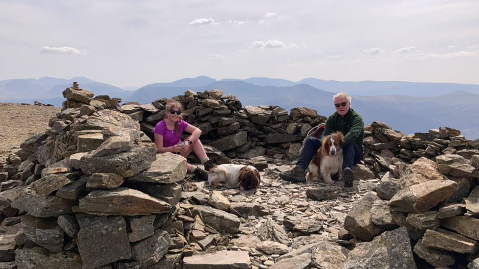
The small shelter on the summit of Hindscarth, offering protection only from the prevailing westerly winds.
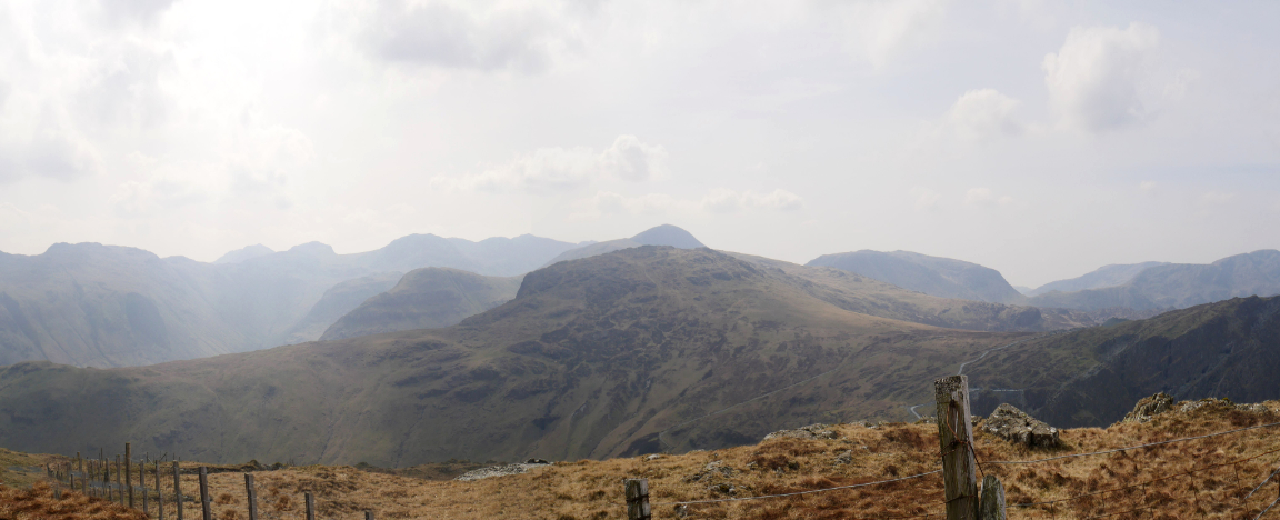
The larger shelter with the better view is a second one slightly down on the Scope End spur. This would be a good place to enjoy a light lunch and enjoy the views north towards Skiddaw and Blencathra.
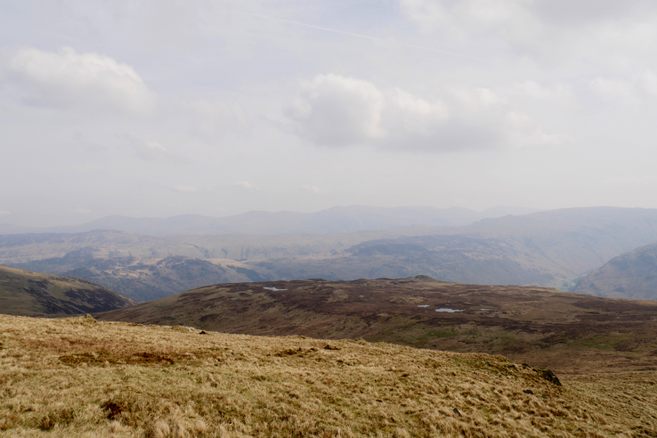
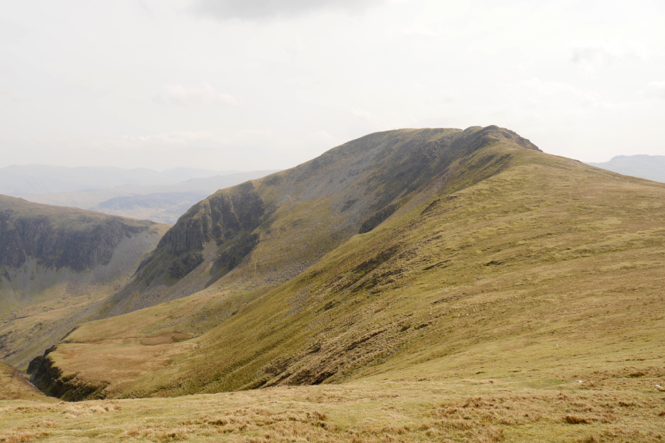
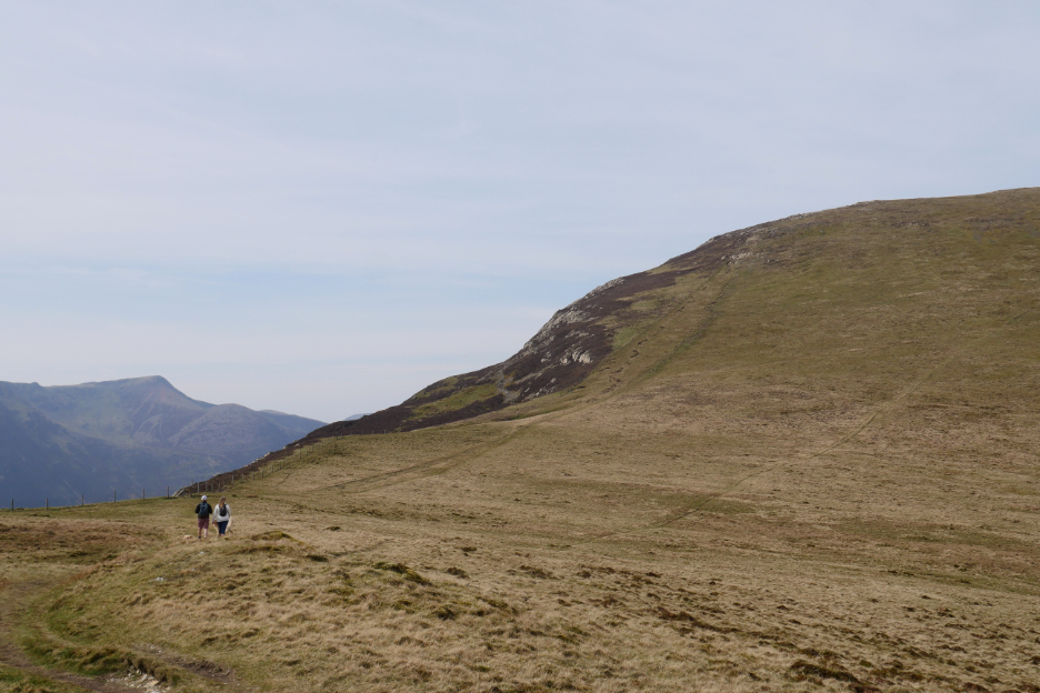
The second major undulation ahead now, as we drift off the summit and head for Littledale Edge.
Gentle slopes climb once we pass Little Dale down to the right. There an small reservoir gathered water to feed and power the Goldscope Mines.
The slopes to the right are steeper and notably stepped, characterised by a massive landslip way back in geological time. Apparently the flat moorland below would at one time have been part of the Little Dale Valley, but the Buttermere glaciers undermined the lower fellside and an historic earthquake probably did the rest.
The uneven, stepped ground on the Buttermere side can be clearly seen here. They are known as the Hackney Holes.
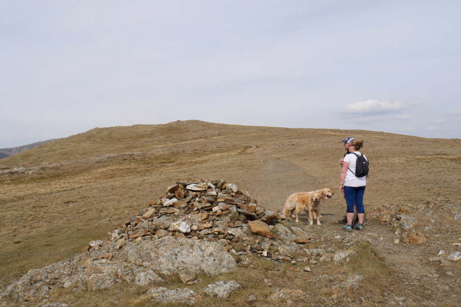
A cairn on the top of the ridge marks the point where the path to Robinson deviates north from the direct route.
Two parallel outcrops of rock characterise the summit of Robinson. The one on the western side holds a small shelter as I stand on the adjacent and matching eastern rocky outcrop.
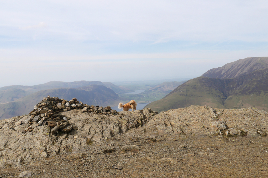
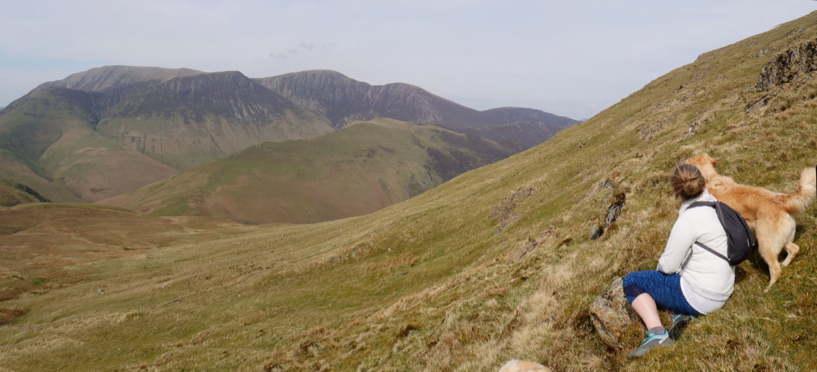
There's a fine view down to Crummock Water and Loweswater and away to The Solway Coast and Scotland on a clear day.
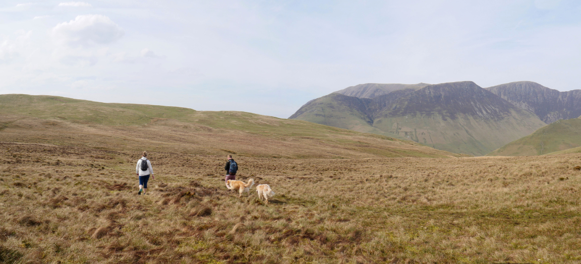
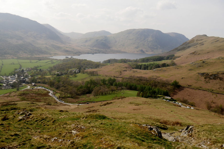
Now to find our way down to Buttermere via a crossing of Buttermere Moss below.
Looking across to Grasmoor where Abi, Cathy and Mark have been walking.
The dry Easter weather meant that a central crossing of the boggy valley wasn't a problem today.
Looking back at our third summit of Robinson as we reach the far side dry-shod.
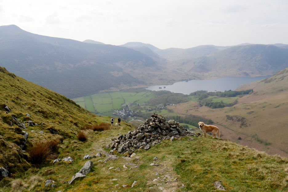
At the head of the peat track that leads down from Snockrigg towards Buttermere. Chance for a classic "edge of the fell" photo with Rannerdale Knotts in the background.
The "peat track" is where the peat from the bog at the top would have been carried or sledged down to the valley, to be used for heating and cooking in the ancient houses of the village.
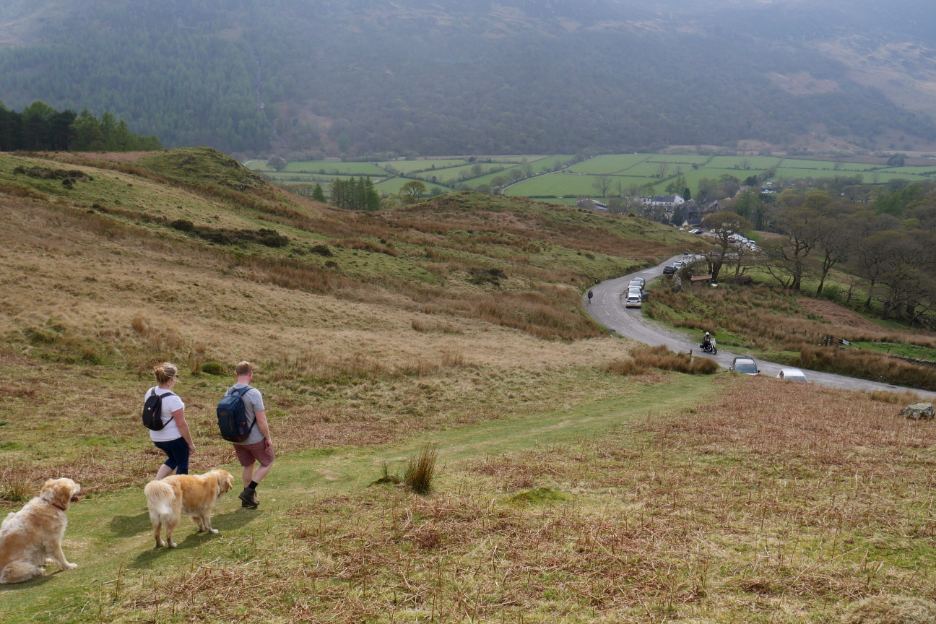
It's been a busy Easter holiday and so the parked cars spread a long way up the Newlands Valley road below.
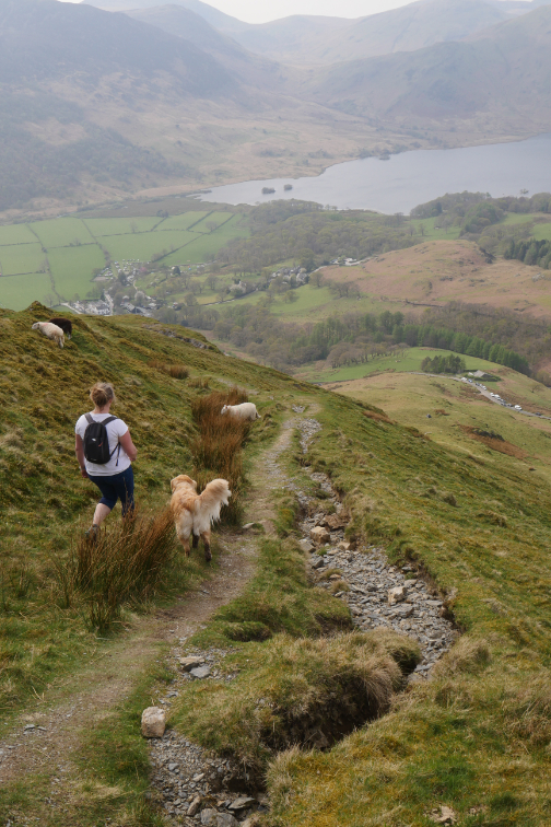
Nearly down now and the heat of the day increases slightly as we walk down into the valley
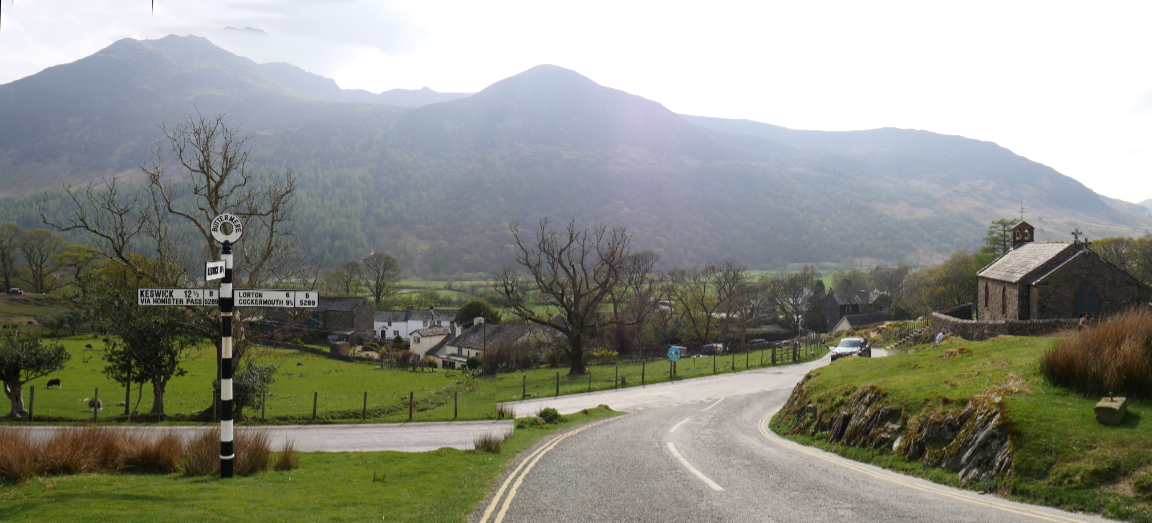
The signpost and St James Church at the top of the village.
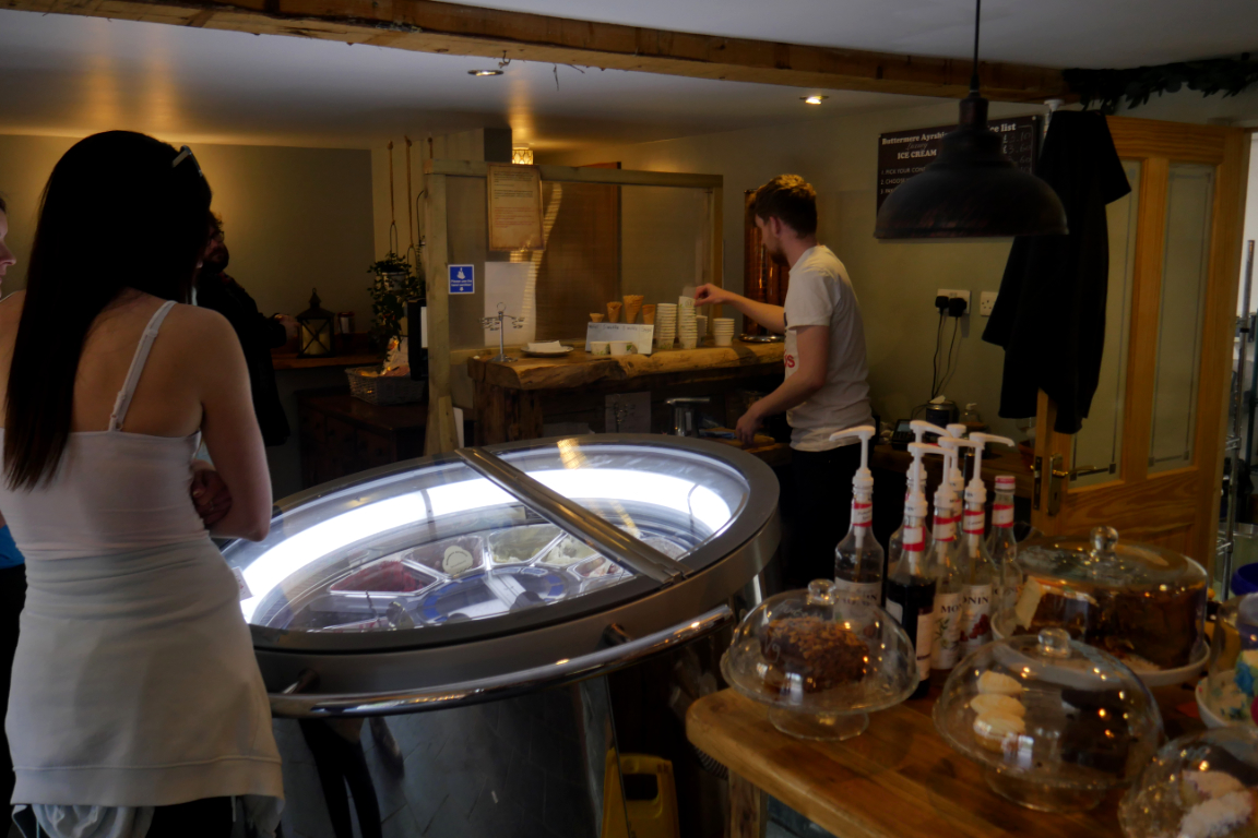
Inside is a rotating 'space machine' with many fine flavoured ice cream to quench our thirst on this very hot day. - - - o o o - - - |
Technical note: Pictures taken with my Panasonic Lumix Gx8 Camera.
Resized in Photoshop, and built up on a Dreamweaver web builder.
This site best viewed with . . . nine family summits under the belt today.
Go to Home Page . . . © RmH . . . Email me here
Previous walk - 15th April 2022 - Honister Via Ferrata Extreme
A previous time up here - 28th August 2013 - Dale Head to Buttermere Walk
Next walk - 20th April 2022 - Langstrath Black Moss Pot