|
|
|
 |
Remember: Press F11 for a
full screen view of this page. |
Web Counter when published 1
974 180 |
|
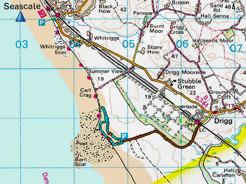
" The Sand Dunes at Drigg " Date & start time: 8th March 2022. am start. Location of Start : Road end by the beach at Drigg near Seascale, Cumbria, Uk. ( NY 049 985) Places visited : Lunch in The Woodland Tea Rooms, Santon Bridge, then over to Drigg. Walk details : 1.5 miles, 75ft of undulations, an hour's stroll. Highest point : Top of the dunes. Walked with : Loes and the dogs, Dylan and Dougal. Weather : Fine, but a strong and rather cool wind on the coast.
|
© Crown copyright. All rights reserved. Licence number PU 100034184. |
|
A day over on the west coast with Loes finds us south of Seascale, in order to explore the Drigg seashore that I've heard so much about. After failing to find a local pub for lunch we drove a short distance inland to Santon Bridge, before returning to the coast and spending an hour exploring the dunes.
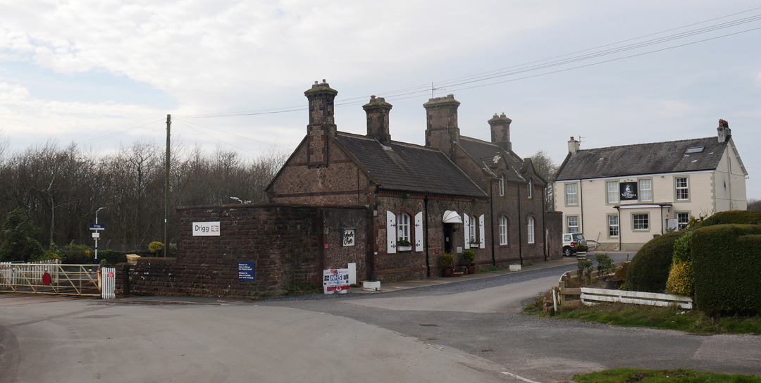
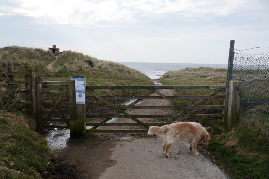
The route to the beach is via the railway crossing at Drigg on the west coast line. Sadly the pub in the background was not very encouraging about lunch as they had a party in . . . so we took our business elsewhere !
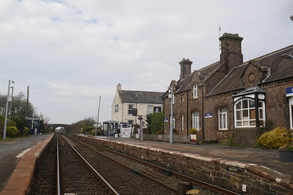
Back again after lunch and we make it across the railway, on the way to the beach. This is the 'down' line to Carlisle . . . down because it heads away from London.
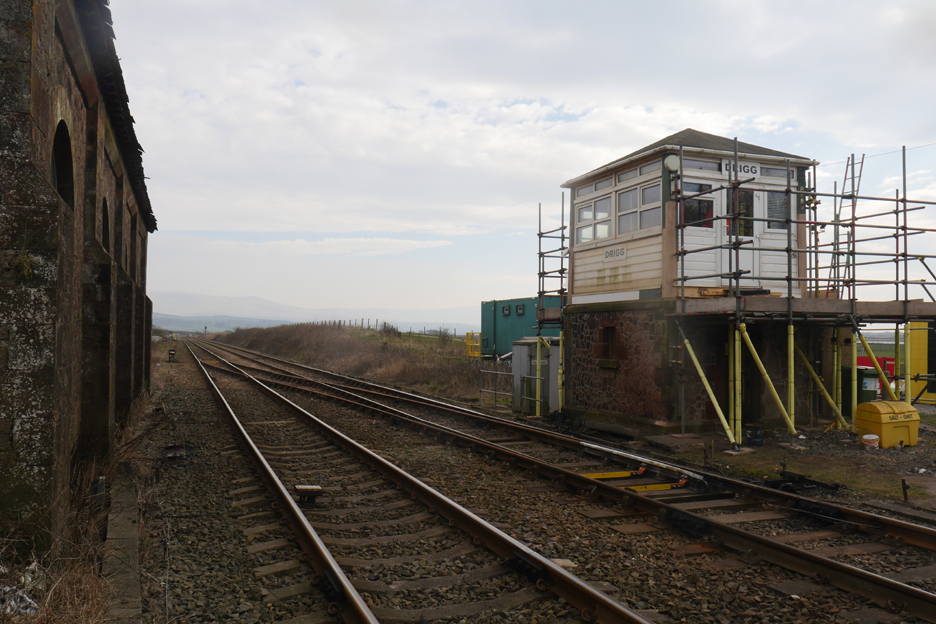
That would make this the up line . . . there be London via Lancaster. The signal Box at Drigg seems to be getting a bit of tender loving care.
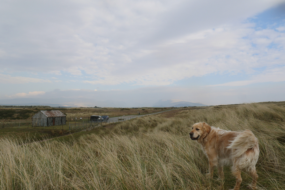
The road skirts around the Drigg Depository, home to wartime munitions and low level Sellafield radioactive waste (no pictures). It ends down at a small car park close to the seashore from where we start our walk.
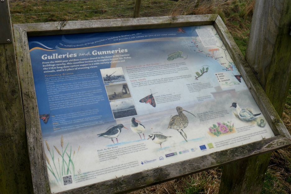
With this more west coast Cumbrian habitat comes a whole new set of wildlife. [ The Gunneries refers to the use of this area for practice firings during the war, and for many years following it. ]
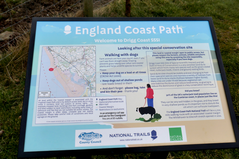
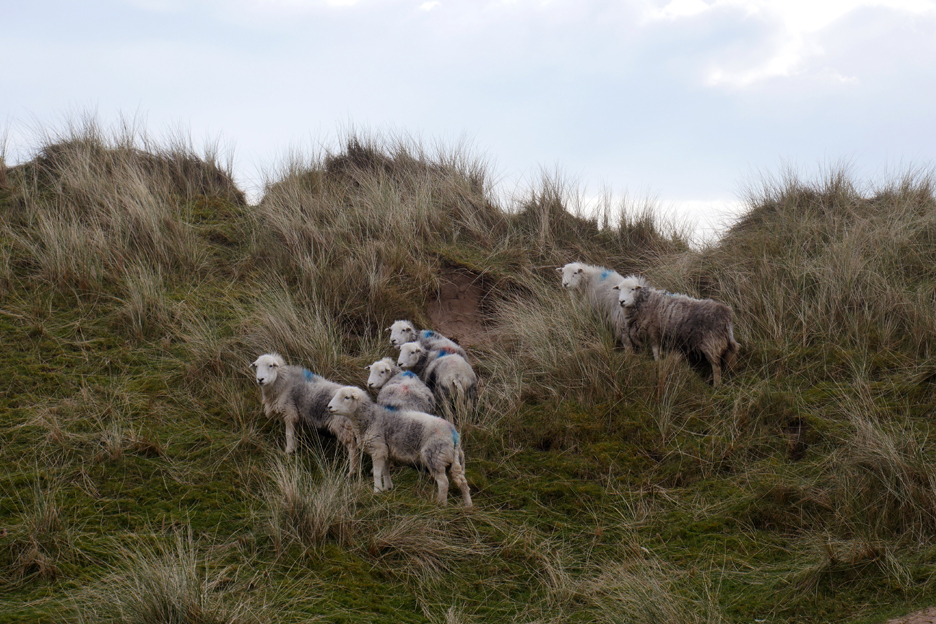
Now it is managed as a Site of Special scientific Interest (SSSI), which includes grazing by, surprisingly, Herdwick sheep and some cattle that we would see later.
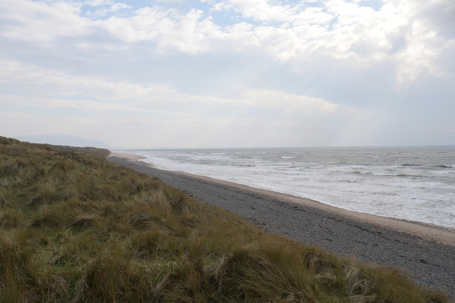
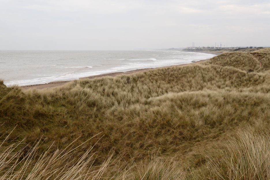
Drigg Beach is part of a shingle and sand coastal feature that extends from St Bees all the way down past Ravenglass to Black Comb. This part of the coast however has a more extensive dune systems that reaches further inland than many other places on the west coast.
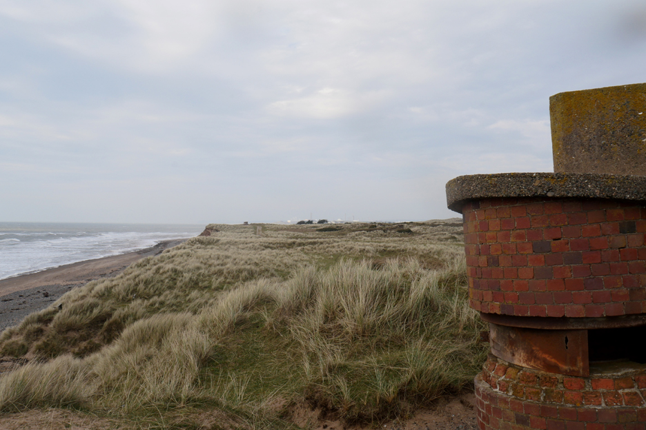
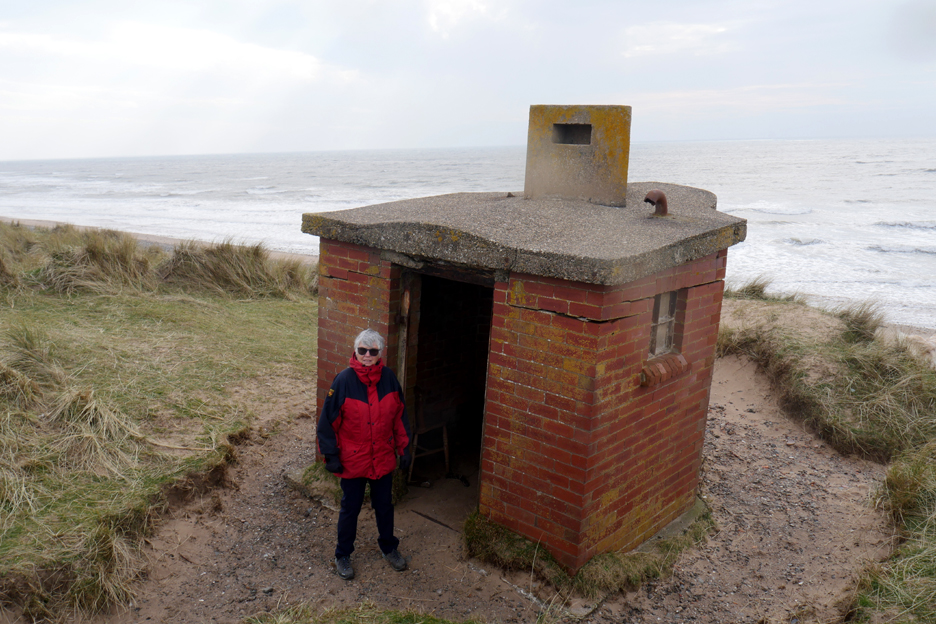
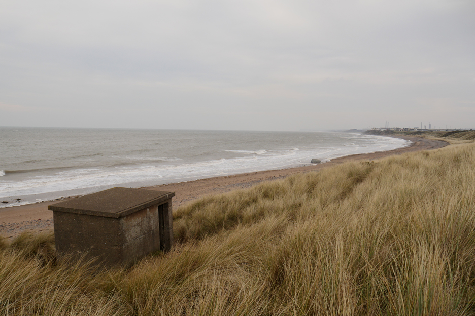
There are several old observation posts and wartime gun emplacements dotted about. They perch at crazy angles and are in varying states of repair due to the ravishes of time.
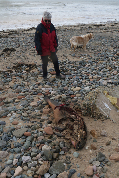
Loes seems to be trying for an audition for the new 'James Bond' lady. It is not sunny but the bright weather has darkened the shades and she really looks the part !
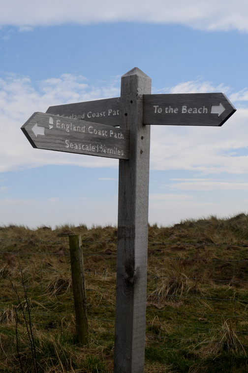
We walked along the beach for a while and then struck inland and joined the coastal path.
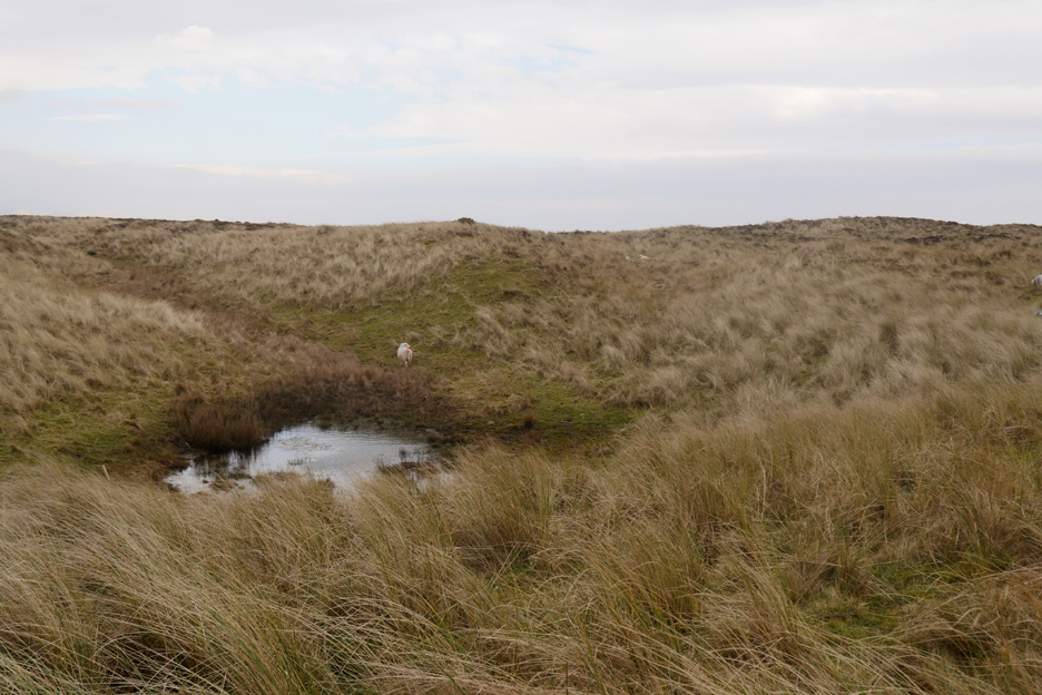
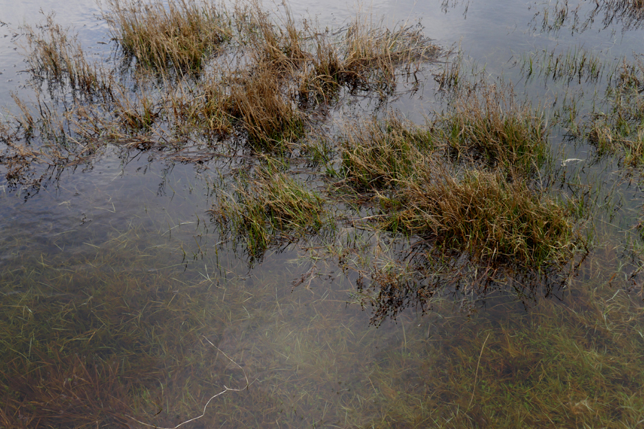
The area is famous for its population of Natterjack Toads
The sand dunes are good because the toads prefer shallow pools on dunes, heaths and marshes. This area holds the largest population of breeding Natterjacks in Britain.
A quick diversion failed to find any sign of the toads, or even some toad spawn.
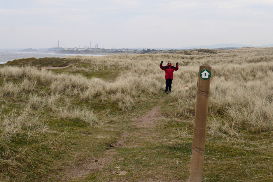
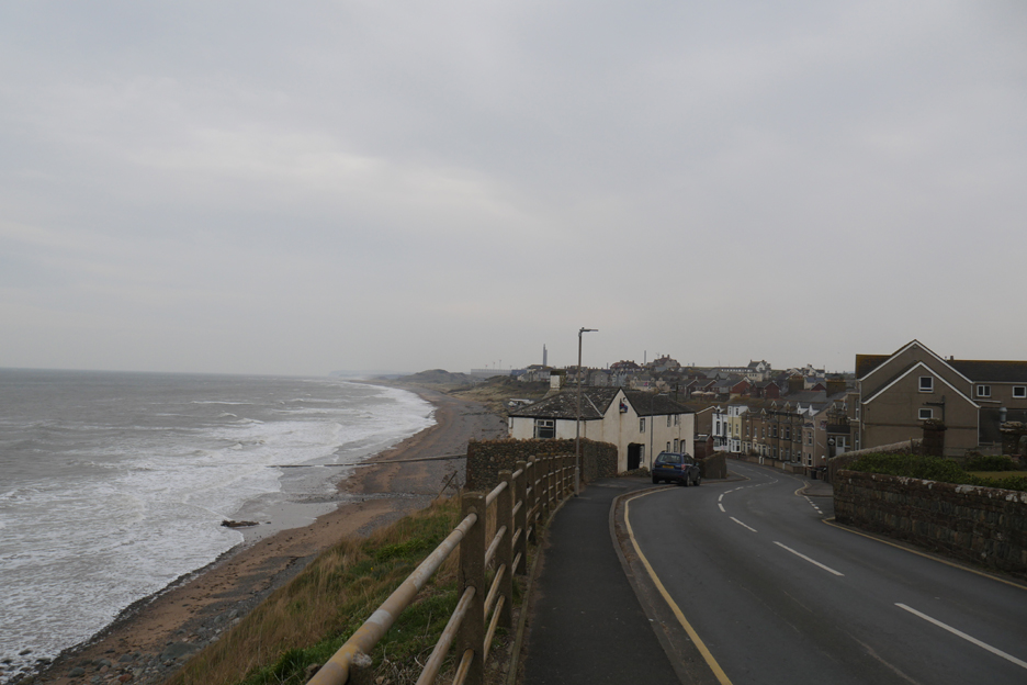
We walked on to the next shelter which gave us a view of Seascale, but more noticeably the towers and chimneys of Sellafield, further up the coast.
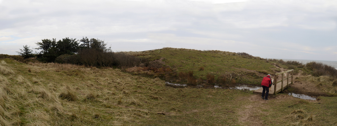
Loes talks to Dougal just before crossing the footbridge over one of the few damp water courses within the dunes.
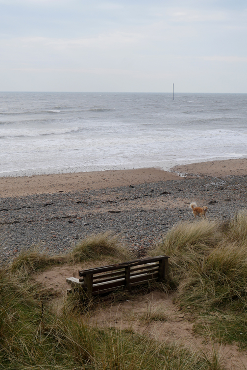
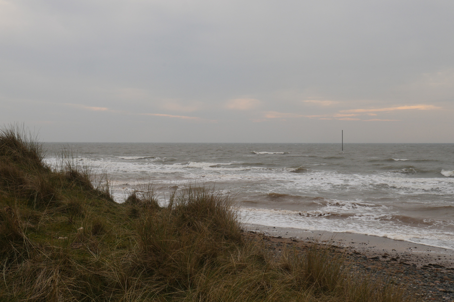
The post out to sea defines one end of the old firing range, and warns boats to keep clear of the area.
Back to the car now past a very dusty visitor information board on another brick structure and this old shed to the car which we parked earlier at the end of the road. - - - o o o - - - Our return trip was via the village of Seascale just up the coast . . .
Looking down from the Whitrig approach to the village.
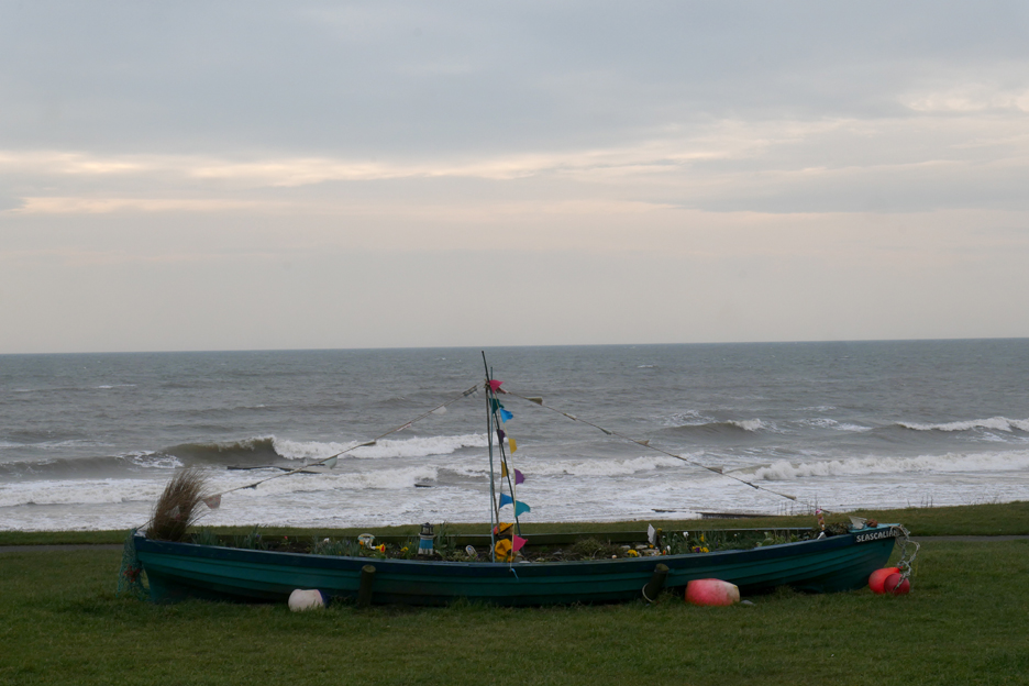
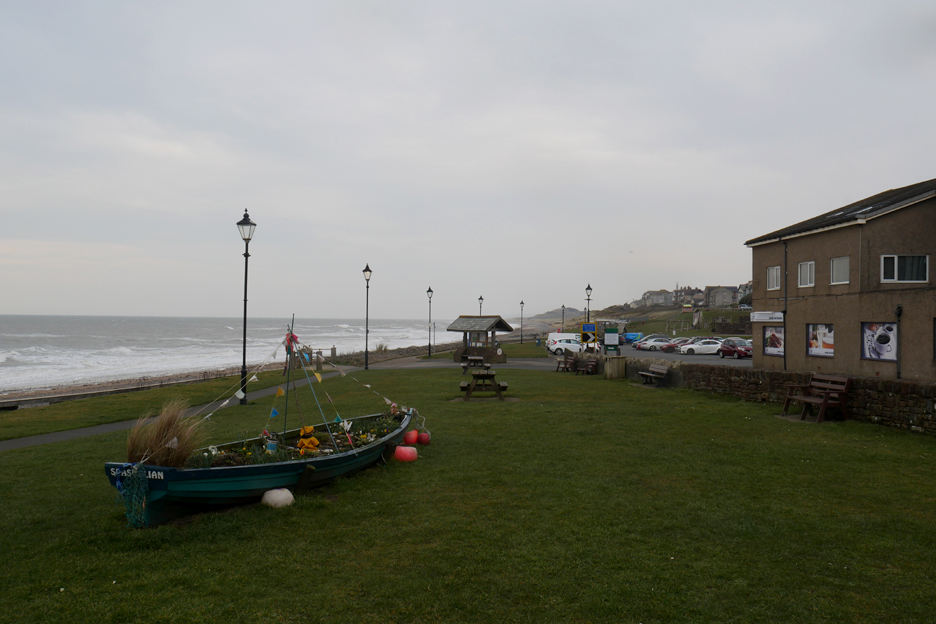
The appropriately named "Seascallion" decorated boat on the seafront.
The village was understandably quiet on this cool and windy March day. - - - o o o - - - |
Technical note: Pictures taken with my Panasonic Lumix Gx8 Camera.
Resized in Photoshop, and built up on a Dreamweaver web builder.
This site best viewed with . . . hmmm . . . some sunshine to show the dunes at their best ?
Go to Home Page . . . © RmH . . . Email me here
Previous walk - 5th March 2022 - Hollins to Hope Beck
A previous time up here - 19th June 2010 Muncaster Fell with Gareth& Kathryn
Next walk - 12th March 2022 - Brougham Castle Walk