|
|
|
 |
Remember: Press F11 for a
full screen view of this page. |
Web Counter when published 1
947 210 |
|
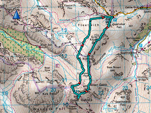
" Winter ascent of Great Gable " Date & start time: 5th December 2021. 10.30 am start. Location of Start : Honister Hause NT car park, Buttermere, Cumbria, Uk. ( NY 255 135 ). Places visited : Grey Knotts, Brandreth, Green Gable Great Gable, Beck Head descent. Walk details : 6.1 mls, 2600 ft of ascent, 5 hours 15 mins. Highest point : Great Gable, 2,949ft - 899m. Walked with : Paula, Sam, myself and the dogs, Dylan and Dougal. Weather : Overcast with a cool breeze, strong on occasions, sunshine later. Snow above approx 2000 ft contour, good walking on fresh snow. |
© Crown copyright. All rights reserved. Licence number PU 100034184. |
|
My daughter and my older nephew are up in the Lakes and with snow on the high fells and a good forecast we head to Honister for a classic fell walk up onto Great Gable via Grey Knotts and Brandreth. Whether we can complete the classic round is uncertain because conditions up there could be a lot different from the appearance of Great Gable from down here.
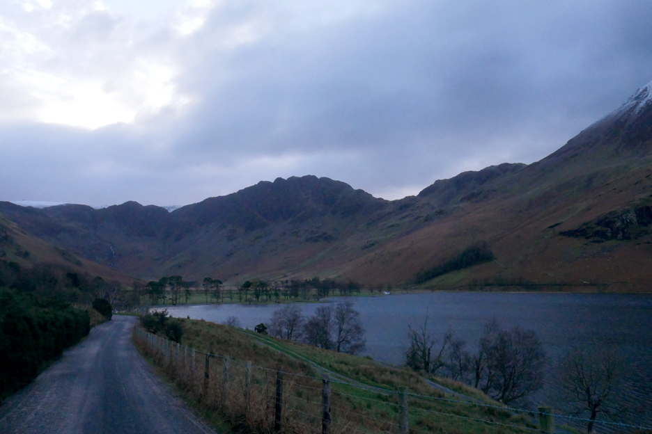
Driving up the Buttermere Valley, approaching the famous pines. The sky is overcast and colours are a little dark and muted as a result.
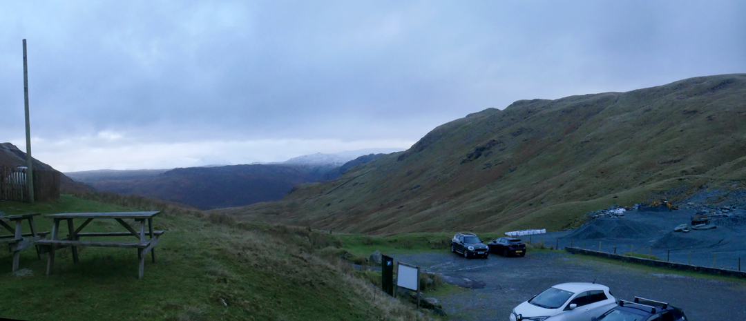
The view from Honister car park is exactly the same which means the prospect for the day is good. Long distance views are on offer and so is sunshine later in the afternoon.
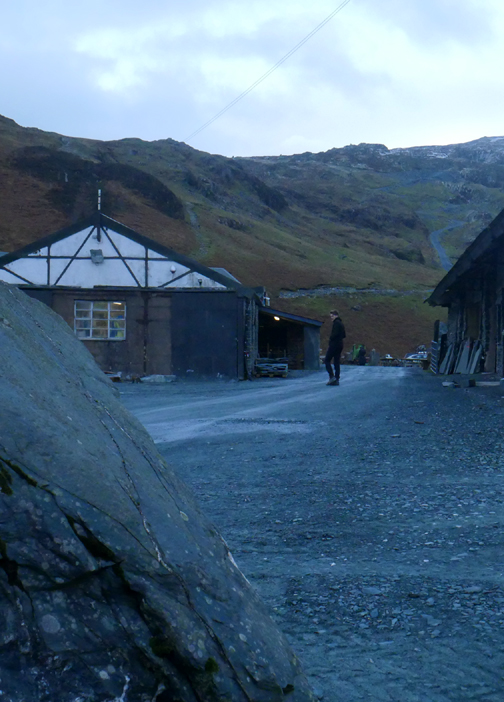
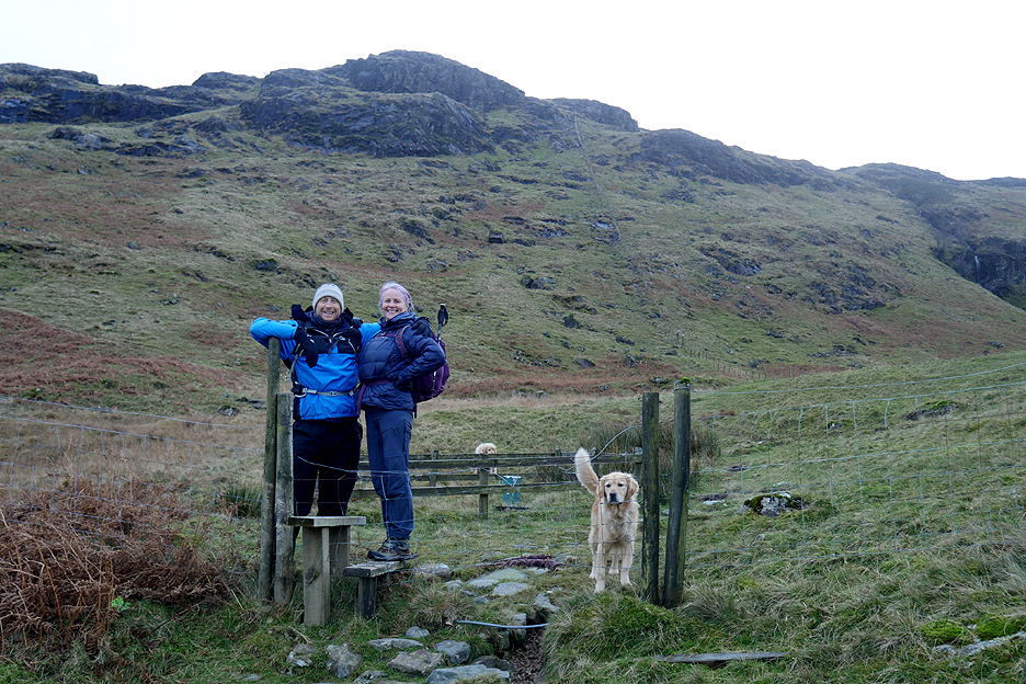
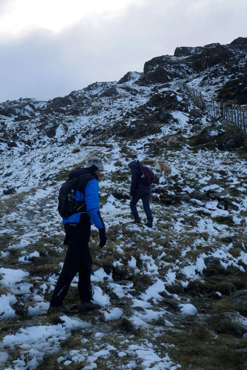
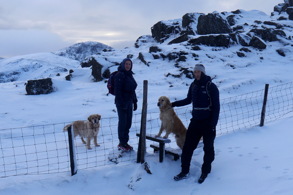
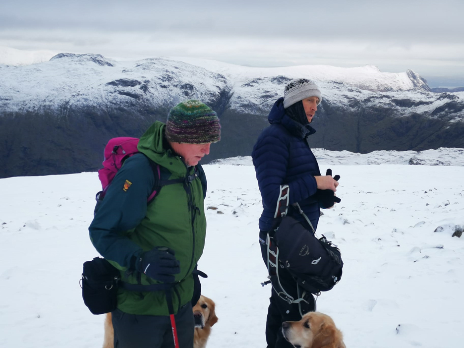
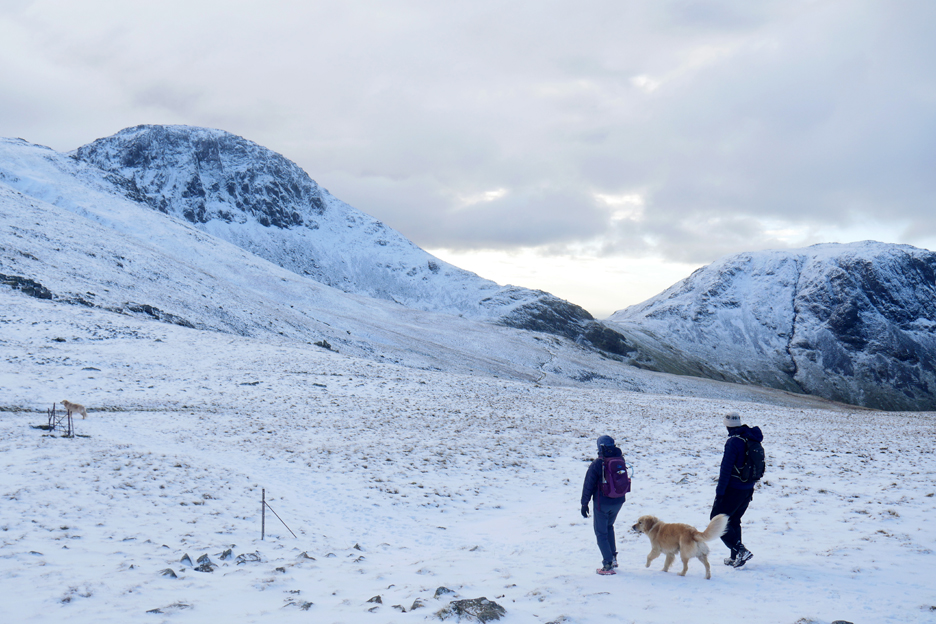
My companions for today . . . Sam and Paula. Our route after the stile and passing the Honister Rain Gauge is basically to follow the fence line up onto Grey Knotts.
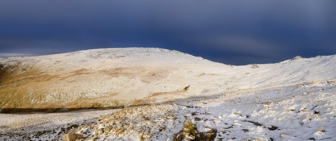
The snow line is about 2000 ft so the top of Black Star (Honister Crags) is suitably coloured.
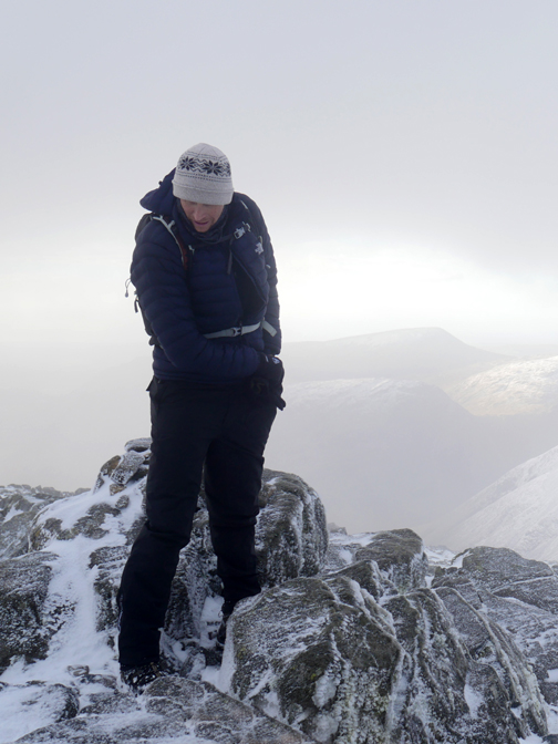
Sam's phone photo to show the third member of the group and his warm "Compo" hat !
Dale Head to the left of Sam's head. In the background to the right is the top of Maiden Moor and a bright white volcano !
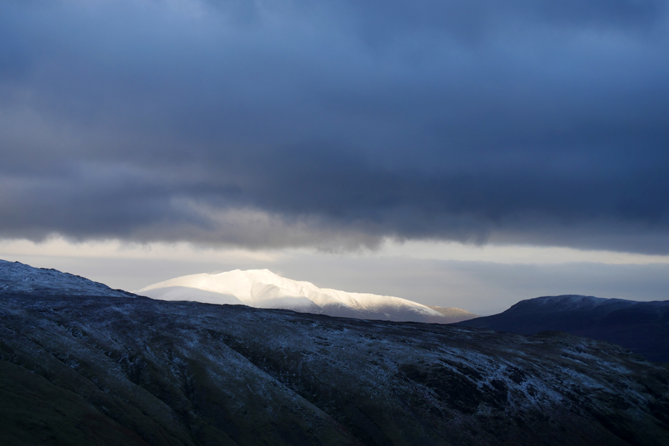
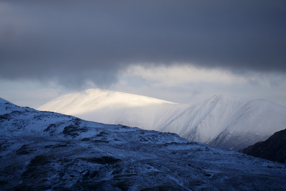
As Blencathra appeared over the mountain horizon the cloud cleared over there and the sun lit the fell really brightly.
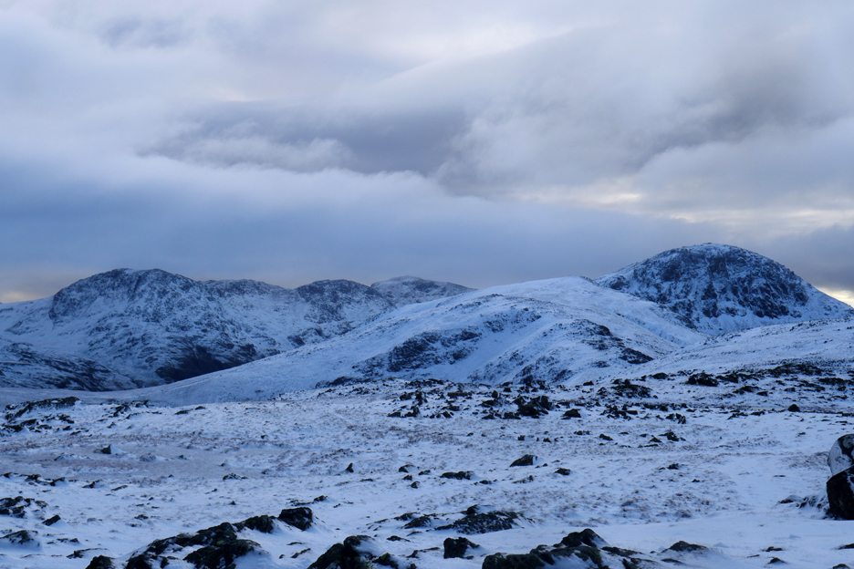
The steep slope is easing now and we have chance to enjoy the views across the valley. The snow white fell is Robinson with Crag Hill and Sail Fell beyond.
Higher still and Skiddaw is now the centrepiece of the sunshine on the northern fells.
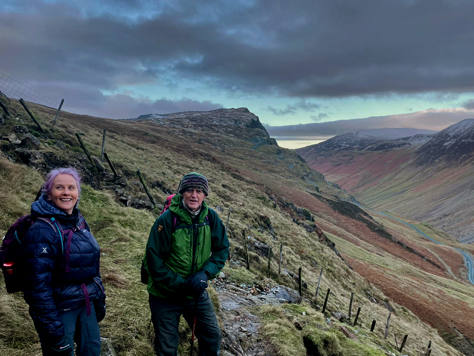
"We can see the top from up here" . . . not far to the summit now.
In fact it was a little further to the top than I remember but along the way the winter conditions added some lovely distance views and beautiful local ice features.
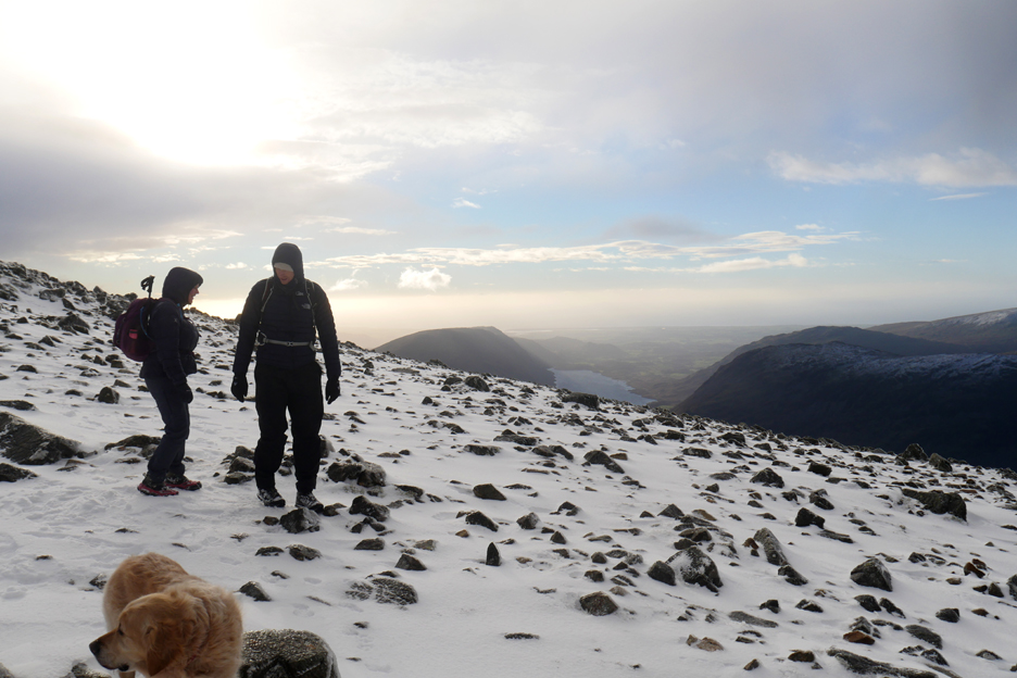
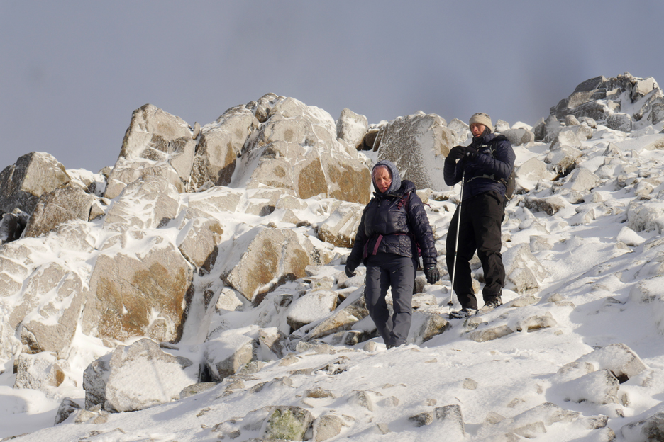
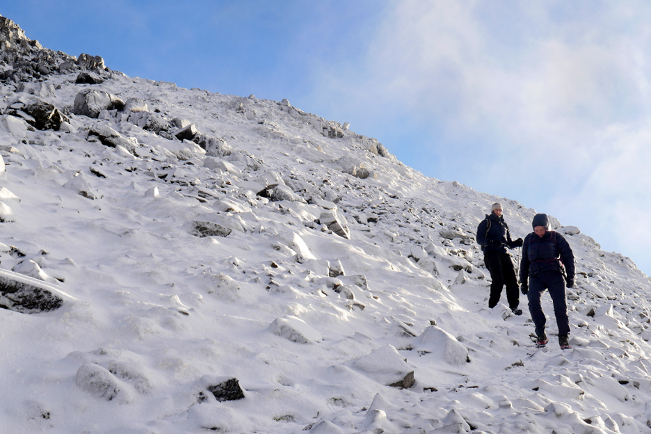
Crossing the final stile before the summit. By this time Paula and I had added microspikes to our boots for better grip. Sam had to manage without spikes as he didn't have any. [ Somewhere around here I remembered that I had an old pair deep in the boot of the car, which he could have used.] Still the snow conditions were good and he was coping well with his normal mountain boots.
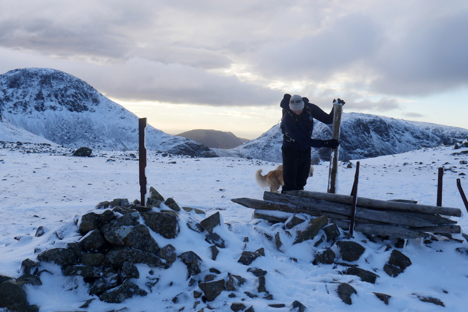
Topping out on our first summit of the day . . . Grey Knotts. The first part of the climb has been done and the view ahead is of the delightful high level walk towards Gable.
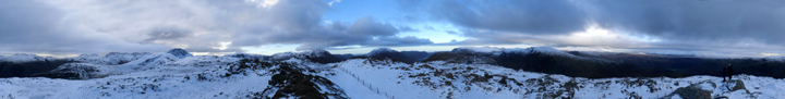
Click here or on the photo above for a 360 degree annotated panorama.
Paula's picture this time, looking across to Glaramara, High Raise and the Langdale Pikes.
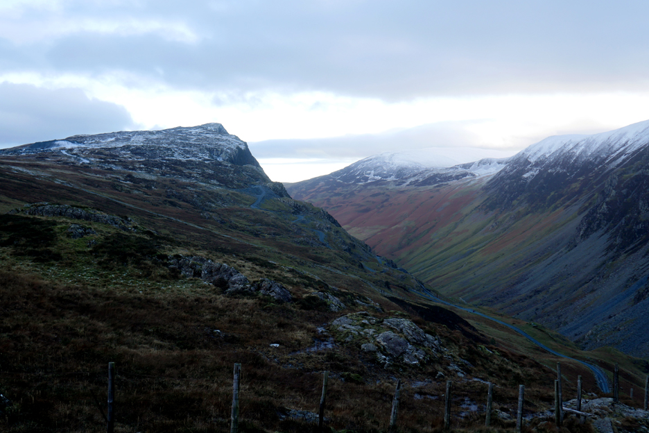
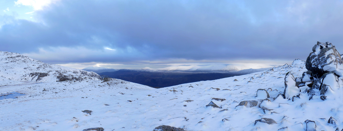
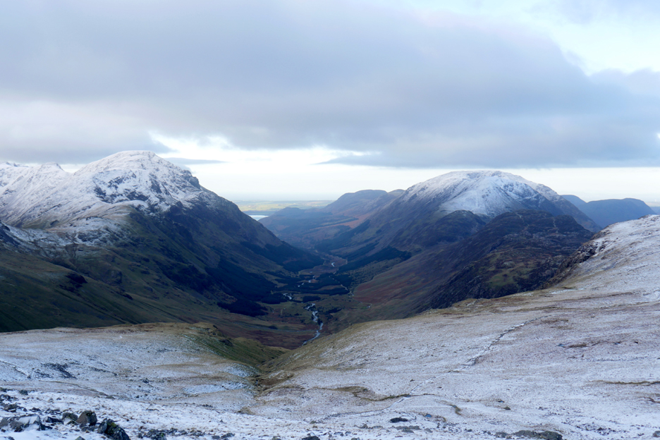
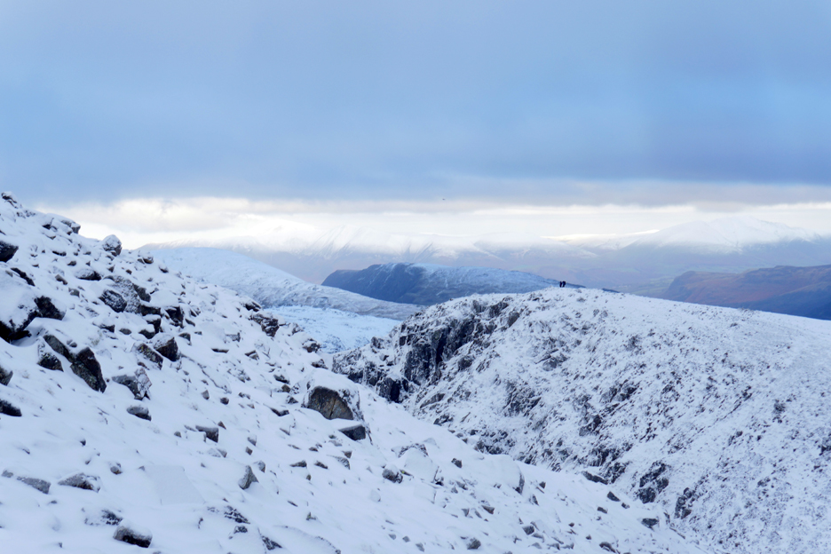
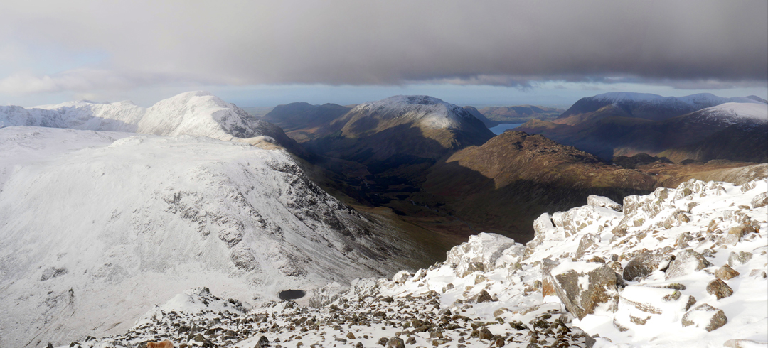
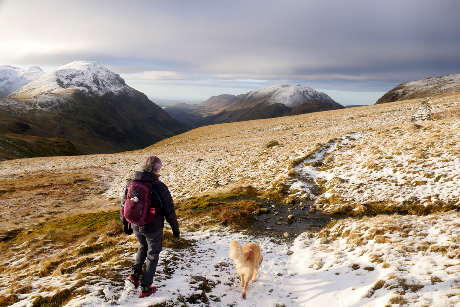
A delightful high level prospect ahead, however the deep Wasdale Valley divides us from the next high ground. That's the highest of all the Lakeland ridges, starting with Great End and ending with Scafell Pike.
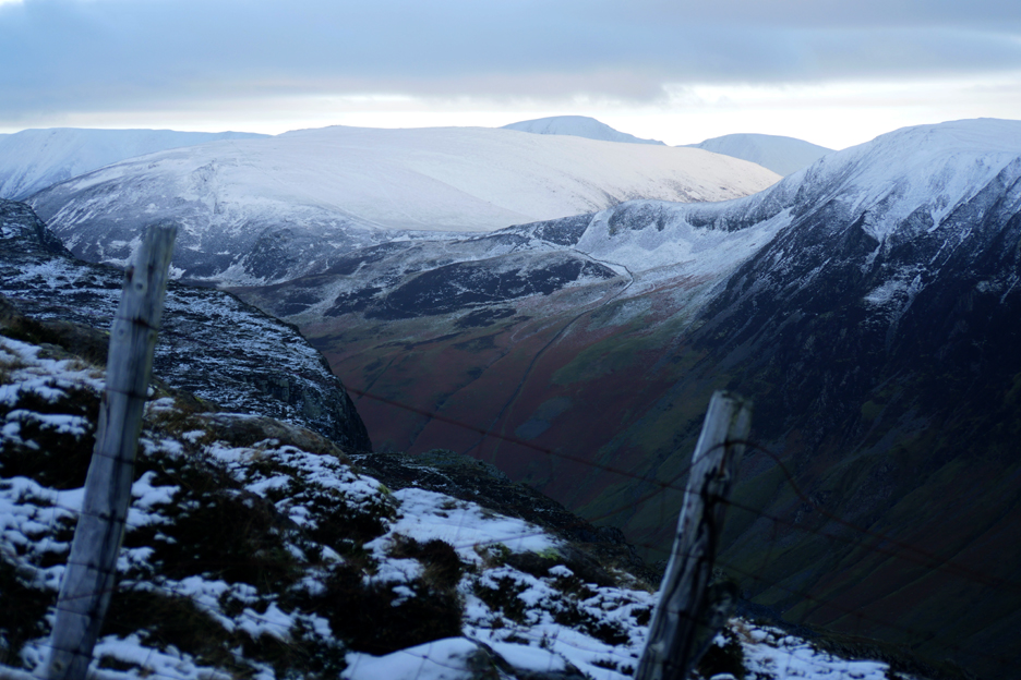
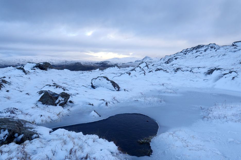
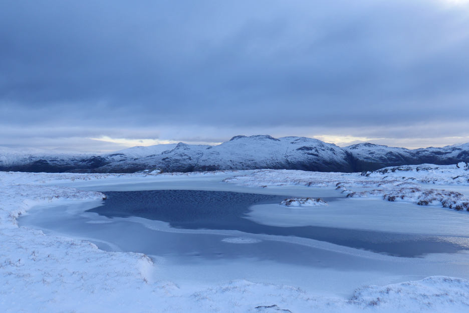
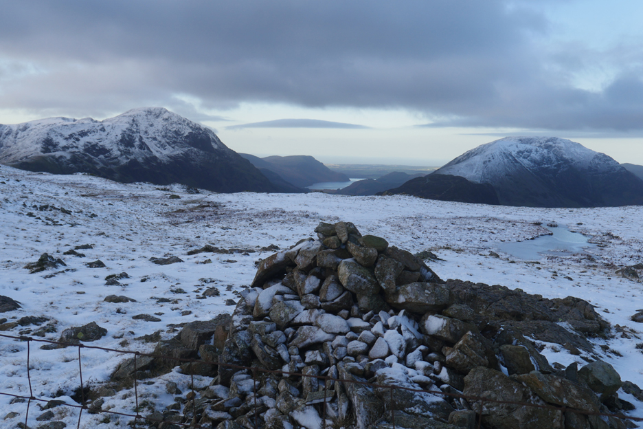
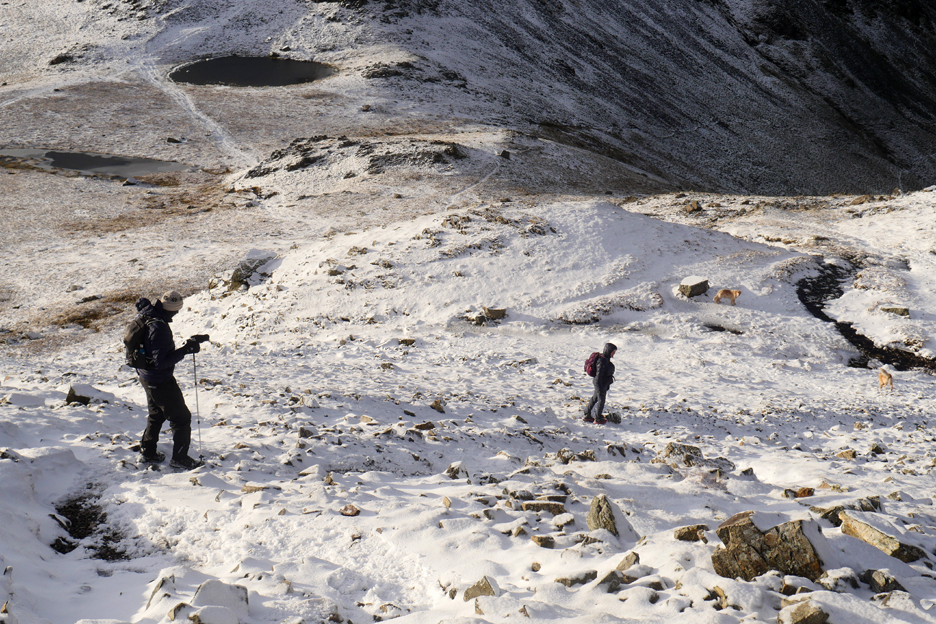
The walk towards Brandreth has several rather nice upland pools in the peat bogs and rock hollows. The major one of these reaches across from the edge of the steeper ground all the way back to the fence line.
The right hand end of the pool is hidden due to the viewpoint, but it extends all the way to the fence. Crossing this end of the ice covered obstruction is best done by staying close by the fence.
As we walk along we get our first view of Ennerdale Water between Pillar and High Stile.
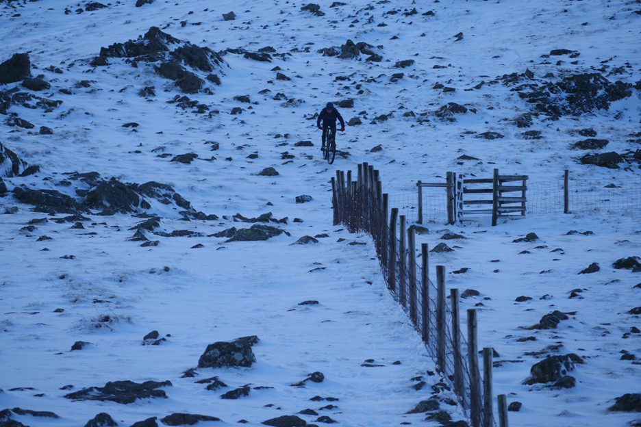
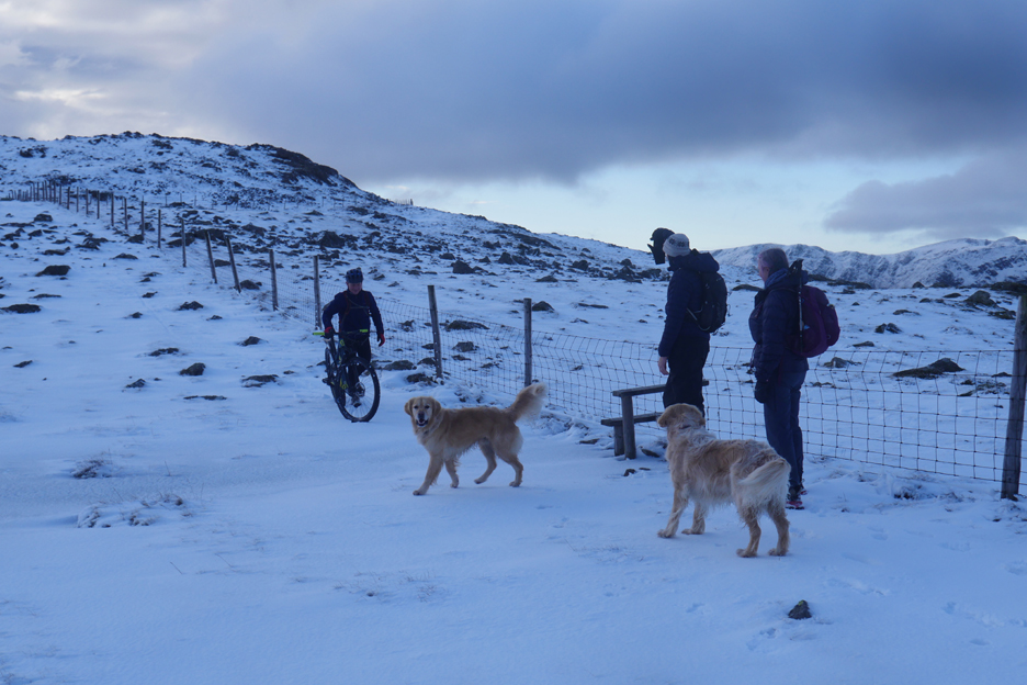
Takes all sorts . . . an enthusiastic middle aged gentleman on a mountain bike.
He stopped for a quick chat and commented that the deeper snow pockets were difficult to ride, so he has spent more time than normal either pushing or carrying his bike !
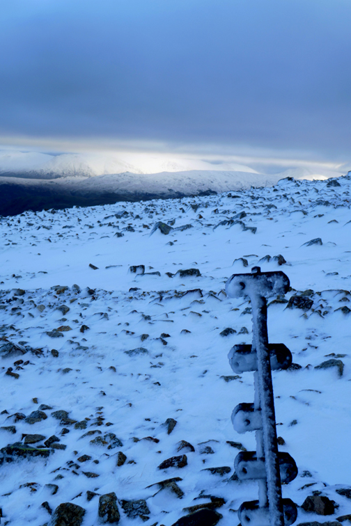
Brandreth ahead, the summit fence posts dark against a sunny western sky.
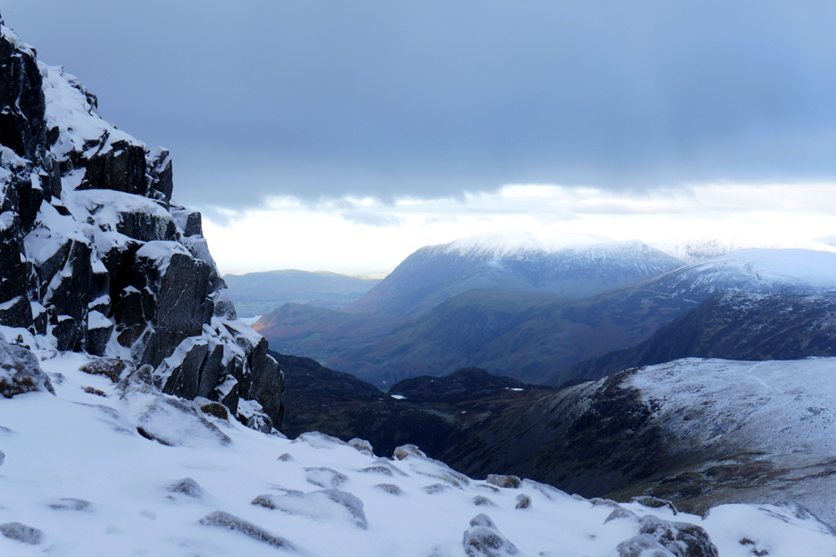
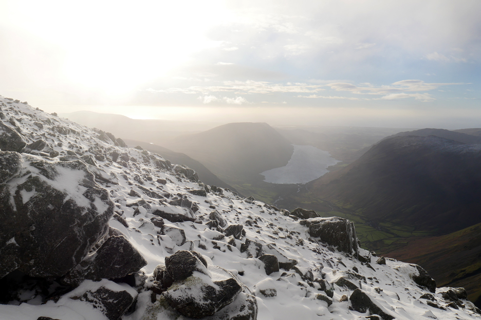
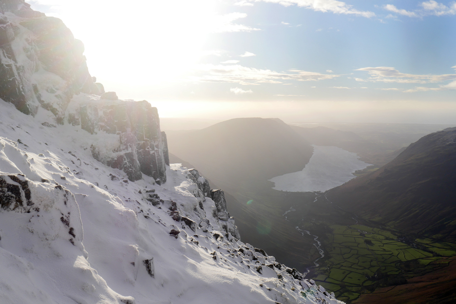
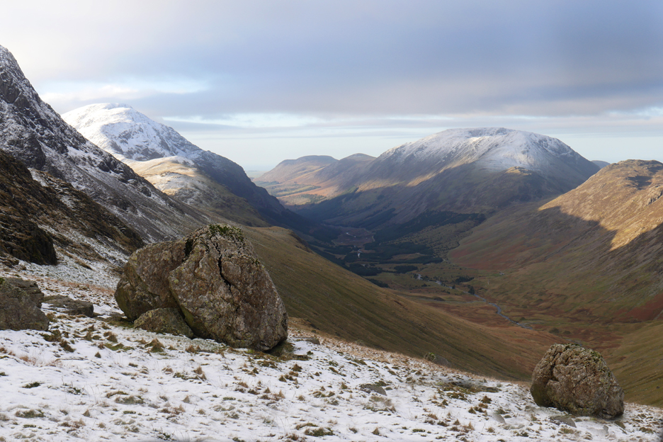
The old cast iron posts have some left over wooden stakes piled alongside. Through the gap caused by Beck Head Pass we can see the Illgill Head ridge, the Wasdale Screes and the distant Irish sea.
Descending from Brandreth, looking over to Pillar.
Crossing the flat ground near Brandreth Pools.
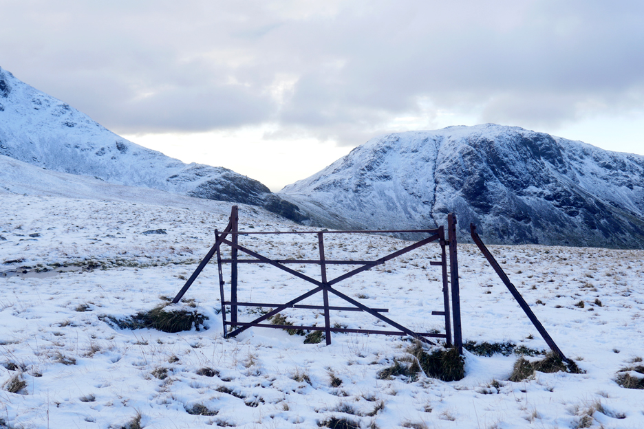
The old gate and occasional fence posts are all that remains of the Ennerdale enclosure fence.
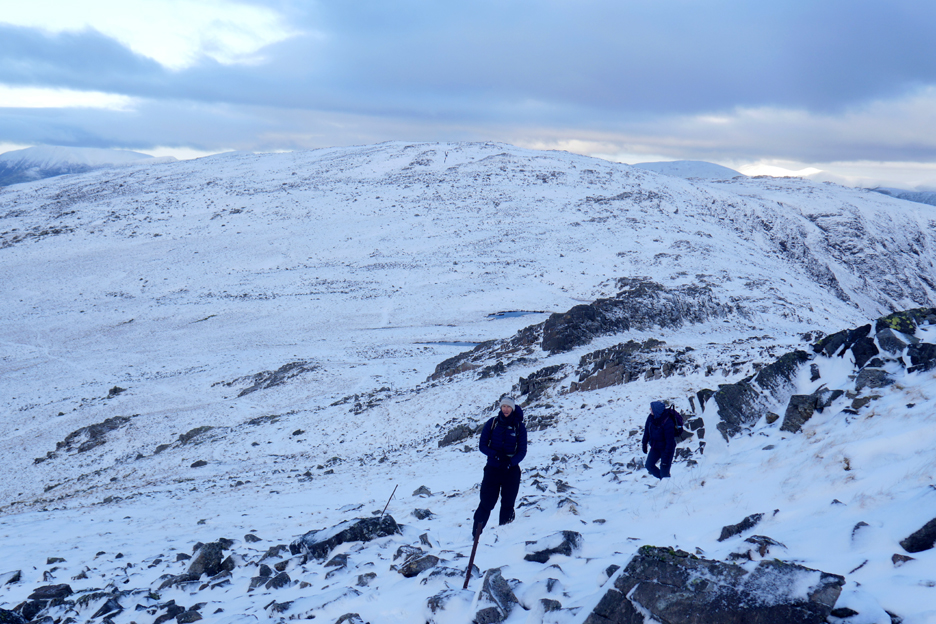
With snow on the ground all the normal paths are hidden so route decisions must be made as we progress. The main Brandreth path takes a line further over towards Borrowdale side but that has the strongest and coldest breeze.
We pass on the improving views of Helvellyn in favour of a more sheltered route this side of the crags.
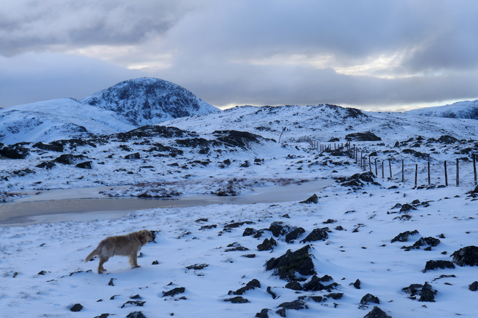
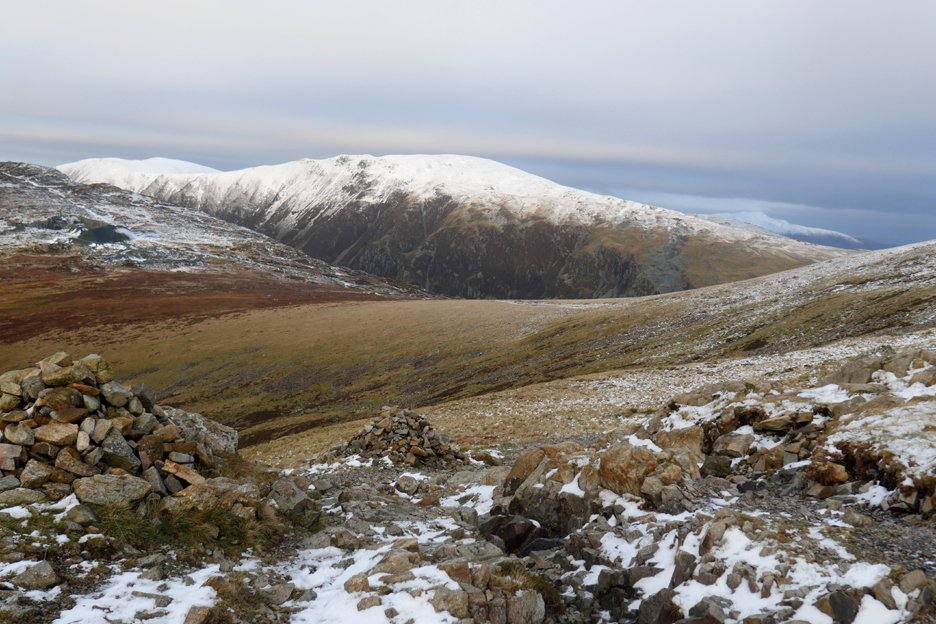
To our right, the ascent route up from Moses Trodd and the more colourful lower ground of Ennerdale below it. Haystacks at a modest altitude of 1940 feet or so has escaped having a snowy summit today.
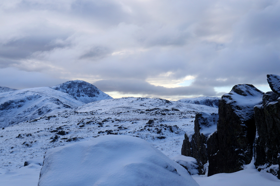
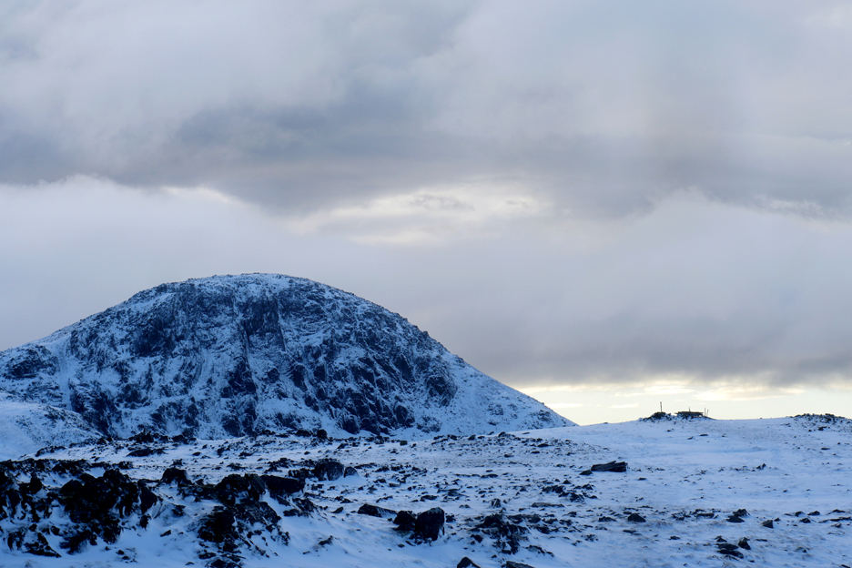
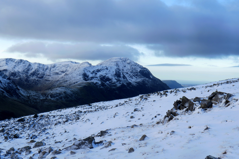
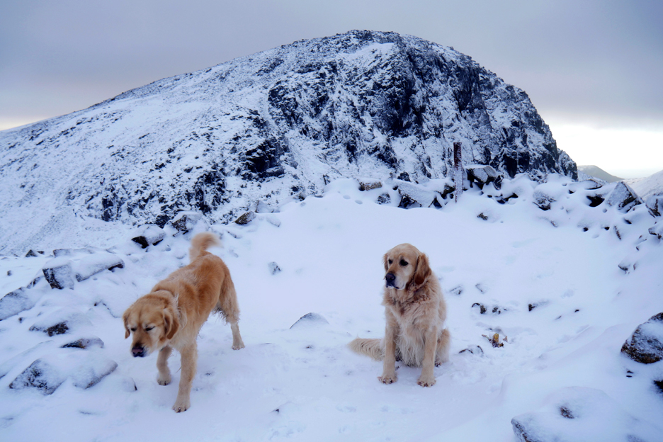
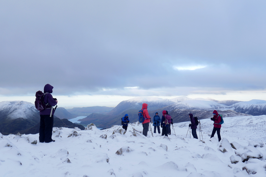
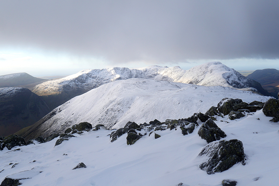
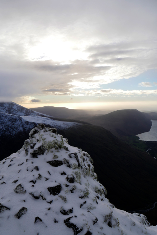
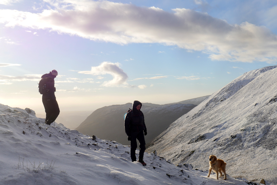
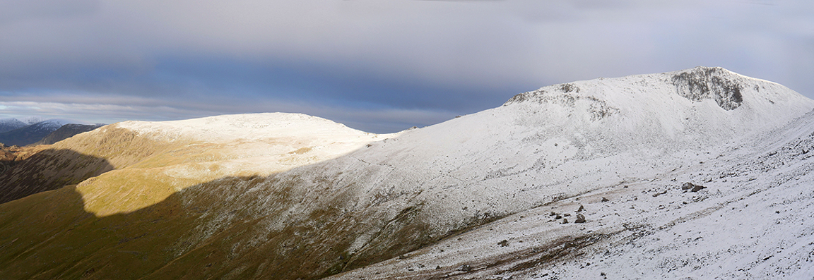
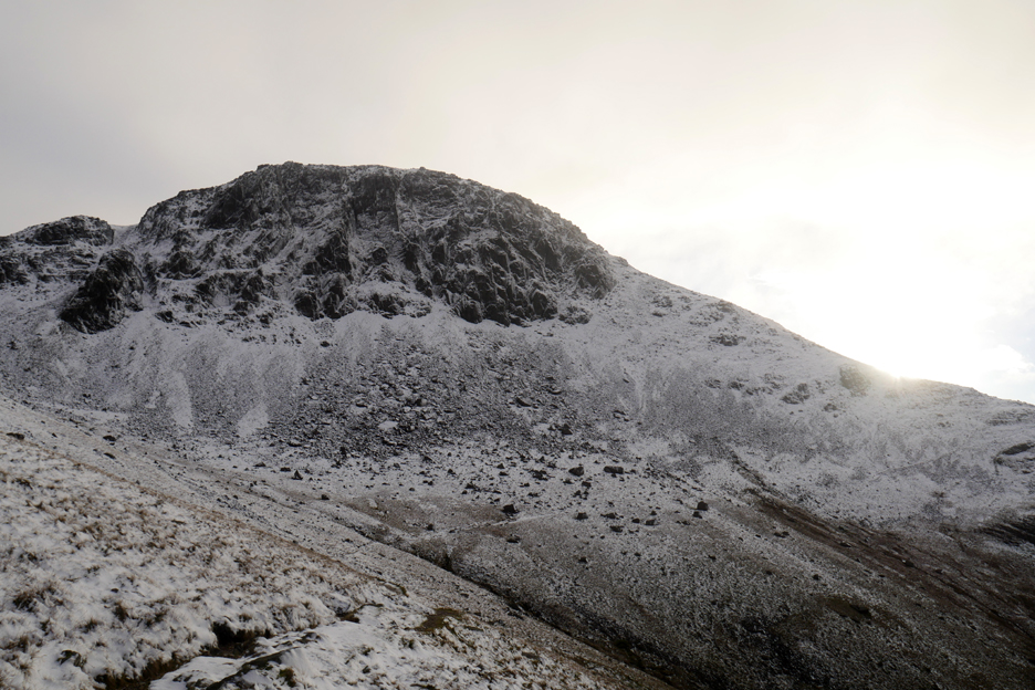
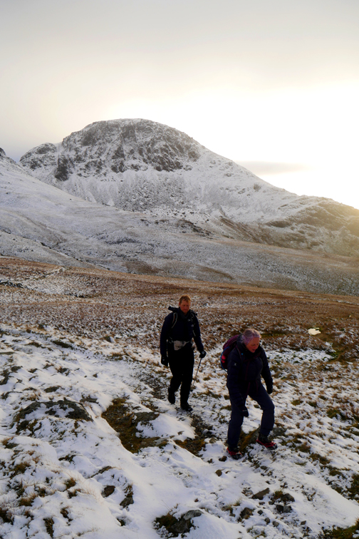
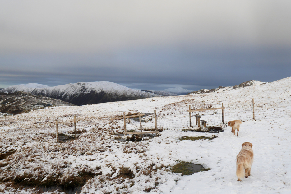
Green Gable however has not . . . and all the summit shelters are full of easterly blown snow. Behind the dogs was the majestic Great Gable . . .
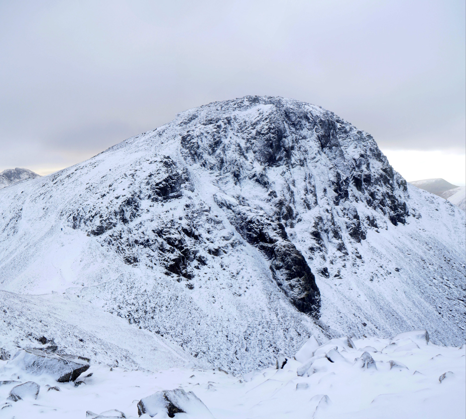
. . . stark in its black and white contrasting outline today.
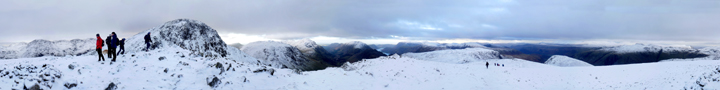
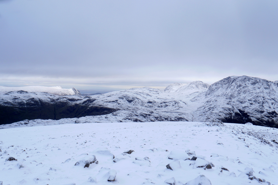
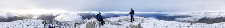
Take a look around before the masses arrive. Click here or on the photo above for a 360 degree annotated panorama.
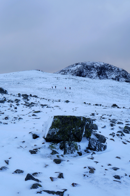
Time to leave the summit of Green Gable to the next group of fell walking visitors today.
Somewhere under our snowy mantle is a path ! In these clear conditions the route finding is not difficult and we start our descent following the line of shelters and a cairn.
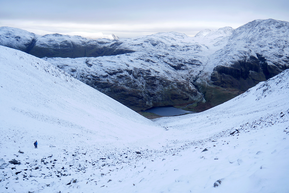
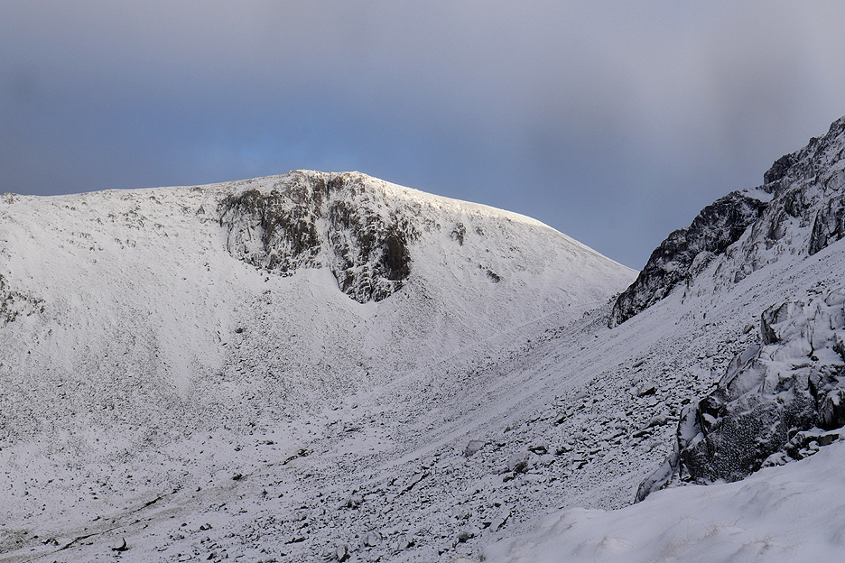
From Windy Gap we look down Aaron Slack to Styhead Tarn far below.
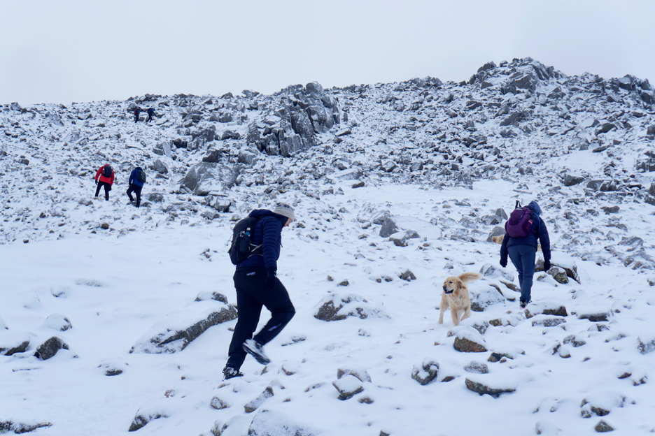
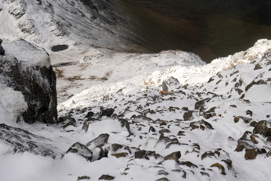
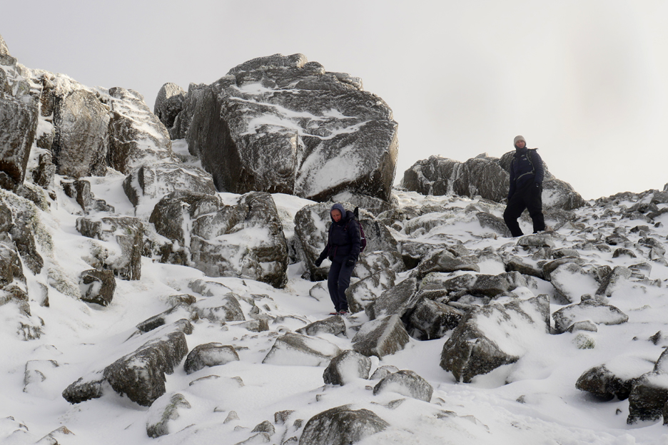
Route finding up Great Gable is more difficult once we reach the crags beyond Windy Gap. Even on sunny days there's a choice of routes up through the rocks ahead.
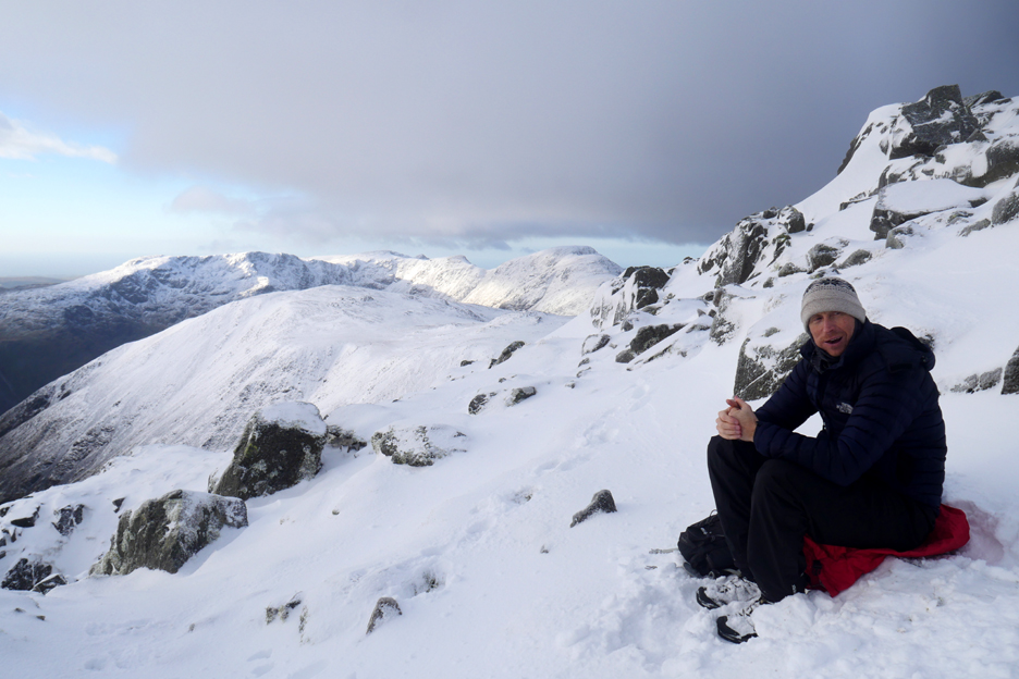
Taking a breath before negotiating the icy rocks. I look back at two folk standing on the top of our recent summit.
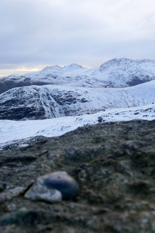
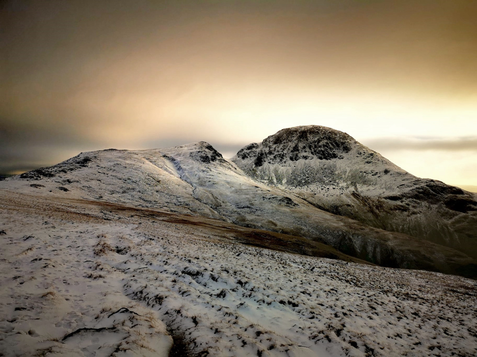
After the tricky climb, time to get the camera out again for a photo of the snow covered rocks and the distant summit of Grasmoor.
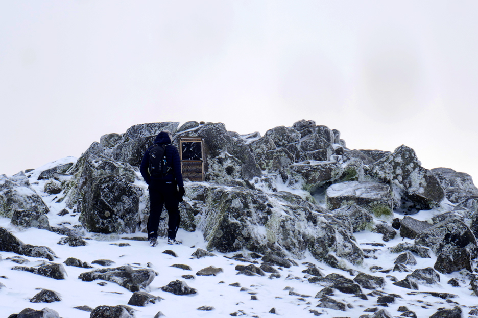
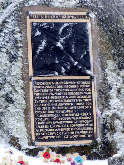
Ahead is the summit plaque on the top of Great Gable . . . it looks almost like a door with something interesting behind ! Sam has done well to climb in normal boots . . . we didn't have to share the pair of micro spikes after all. There's sufficient fresh snow that he could avoid most of the icy obstacles along the way.
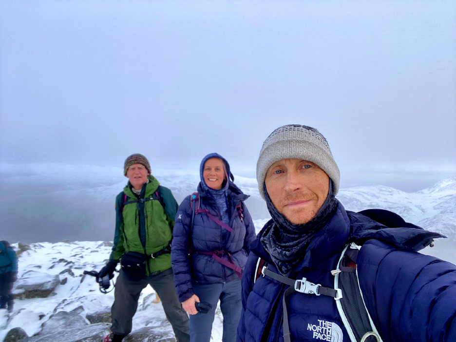
. . . for a 'summit selfie' of our group.
Once we moved from the top the couple in the background moved over for their photo. Click here or on the photo above for a 360 degree annotated panorama of them and the view.
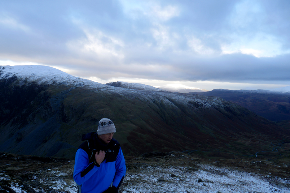
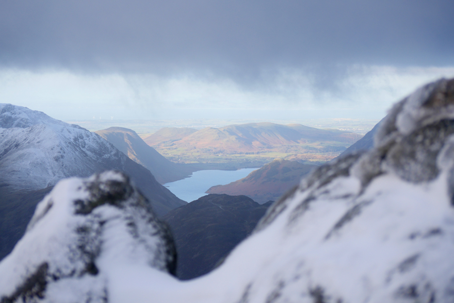
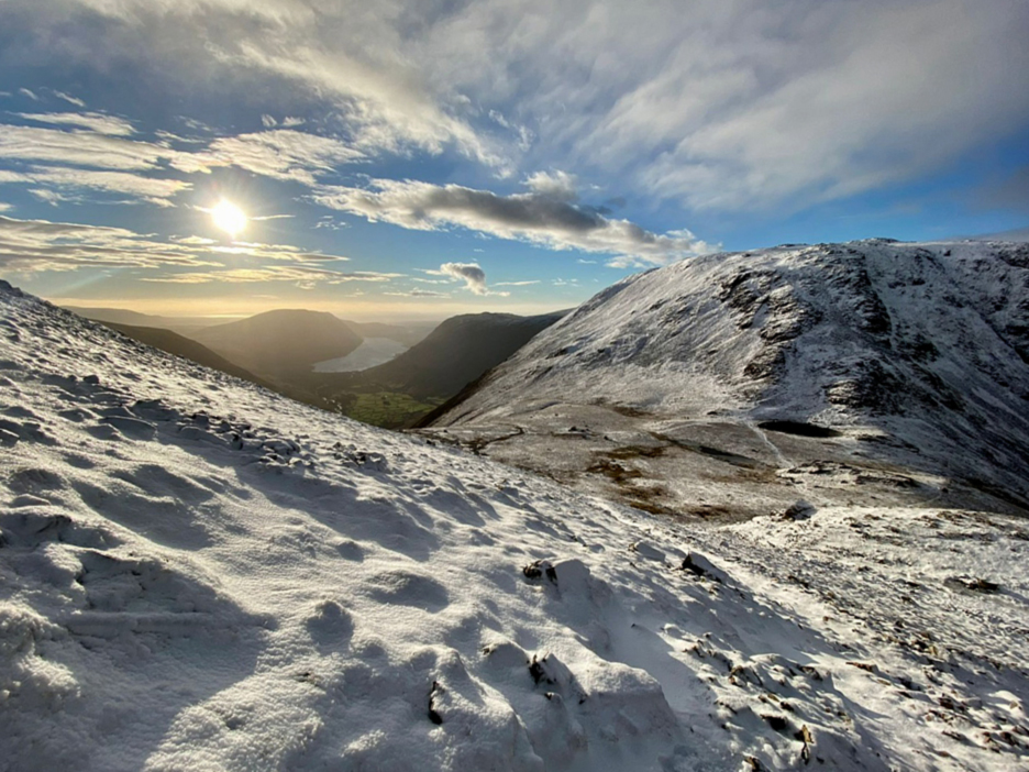
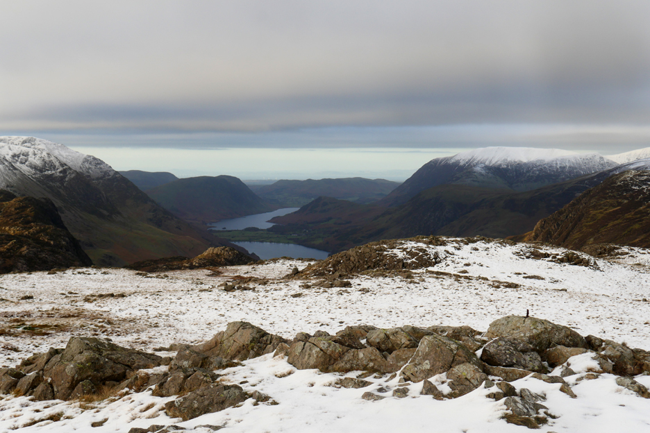
You can see my house from here ! It is quite cold here up on the summit but Low Fell and Loweswater now catch the first sun of their day.
The snow on the Ennerdale Fells seemed to glow even brighter than the photo here.
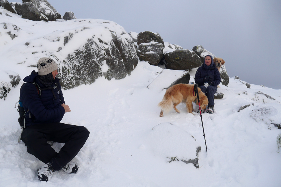
The shelters on Green Gable were full of snow so instead we chose a west facing spot on Gable for our lunch break.
It had a rather nice view across Robinson Cairn and down into the valley of Wasdale.
Sam enjoying the view and the last of his lunch.
The summit plateau would be easy to cross . . . but we'd have to hope for good conditions on the descent to Beck Head.
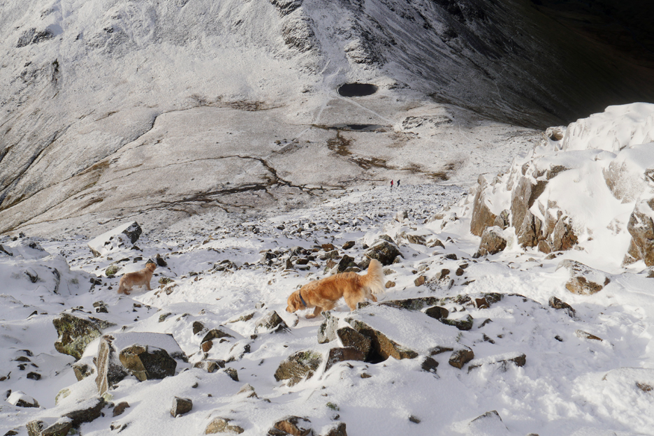
The rock looked icy and the path indistinct but it was a track we have used on many an occasion so we located Beck Head Tarn far below and headed down.
The sun brightened as we went.
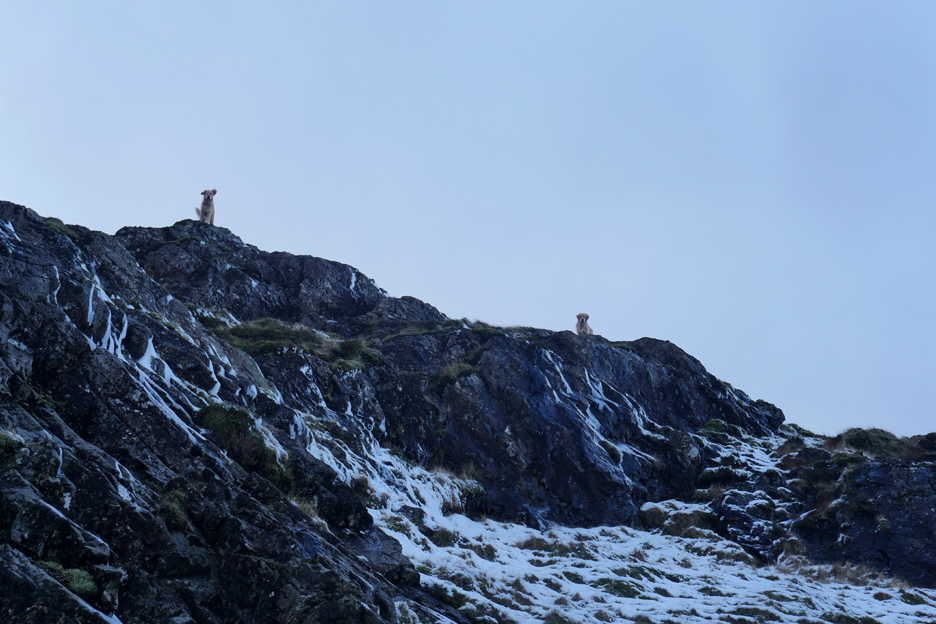
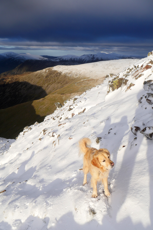
I followed the dogs as they often found a good line down the fell. Maybe they could smell the footprints of decades of walkers . . . or maybe they just spotted the easiest route.
Did I mention it was cold ?
. . . or steep !
Sam took advantage of a trek pole to make up for the lack of spikes.
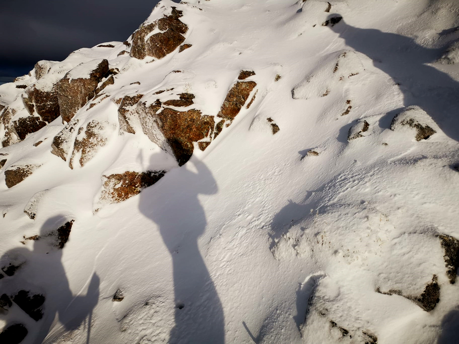
No point in rushing . . . in fact we'll stop for a shadow-selfie taken by Paula.
Time to concentrate again as we tackle the lower half of the route down to Beck Head.
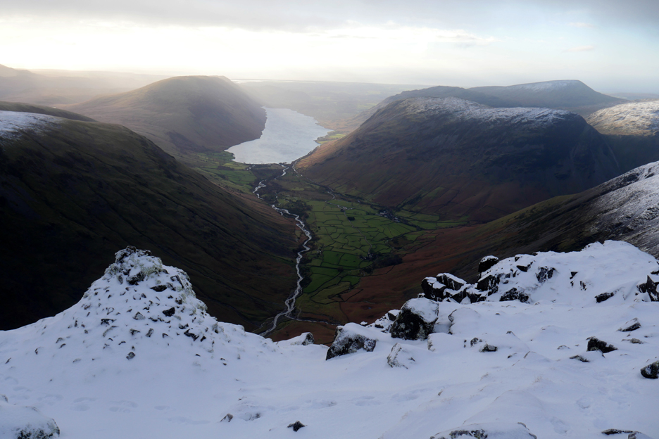
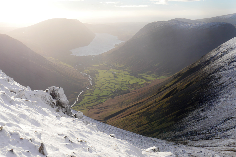
The Wasdale Valley is bathed in sunlight as we descend.
A recognisable path emerges despite being covered over by snow.
The final zig-zag as the going gets easier.
We can now swing away to the right to pick up the Moses Trod path that crosses Beck Head. We don't need to descend all the way to the tarn today . . . that's only required if you are going on to Kirk Fell.
Sam's phone-photo looking back at the lovely sunshine.
Green Gable comes into view again as we head north east along Moses Trod.
We are close under Gable Crags, looking up at our earlier summit.
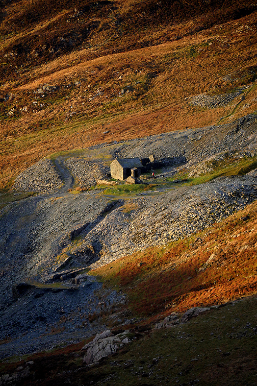
The large boulders below Gable Crags. Further down are the brown slopes of the Ennerdale Valley . . . with Black Sail Hostel on the right before the trees.
Out from the shadow caused by Great Gable . . . as the sunshine breaks over the ridge once more.
Sam's phone again as he looks back on a lovely climb in the snow.
Down here on the Trod the snow fall is far less heavy.
Rounding the corner to the modern Brandreth Fence we are more open to the east again. The colours are darker and the snow cover temporarily deeper.
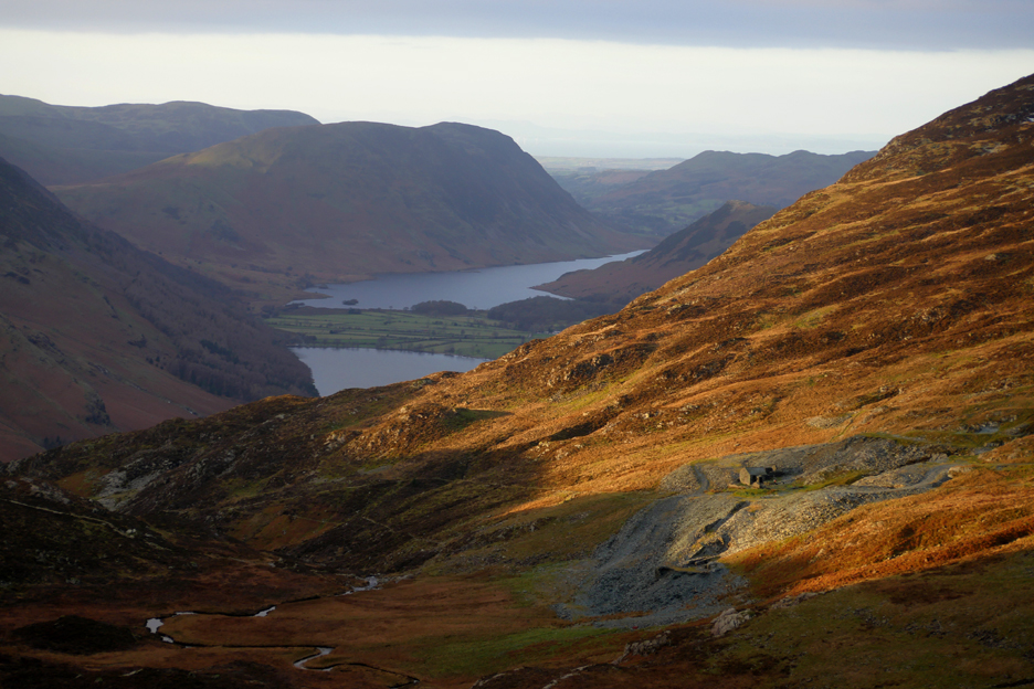
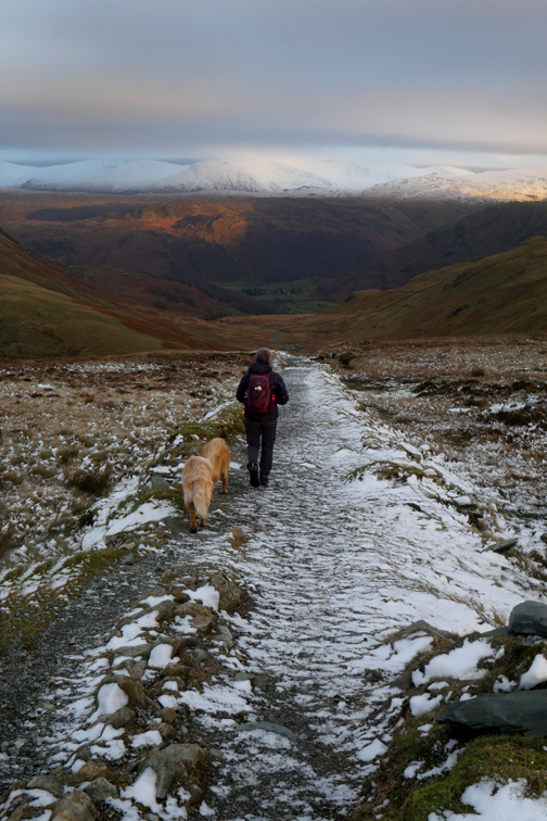
The classic view down the Buttermere and Crummock Valley from the turn beyond the stile.
'Tis downhill all the way now. The walk timing has worked out well and our 10.30am start brings us back down here in good time . . . and in good light.
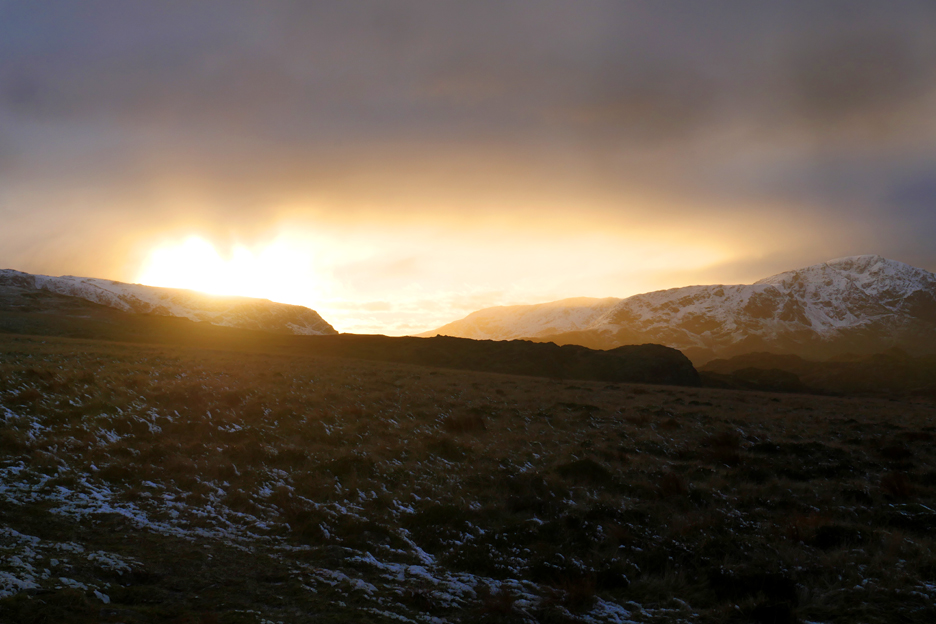
Talking of light . . . the sun re-appears once more to brighten our route home.
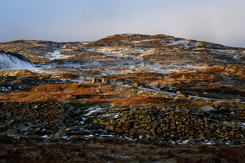
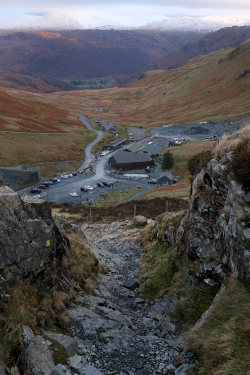
The next landmark on our route is the old Dram Road. The pile of stones in the foreground is the old Drum House foundations and behind them are the standing stones on the Quarry Rod.
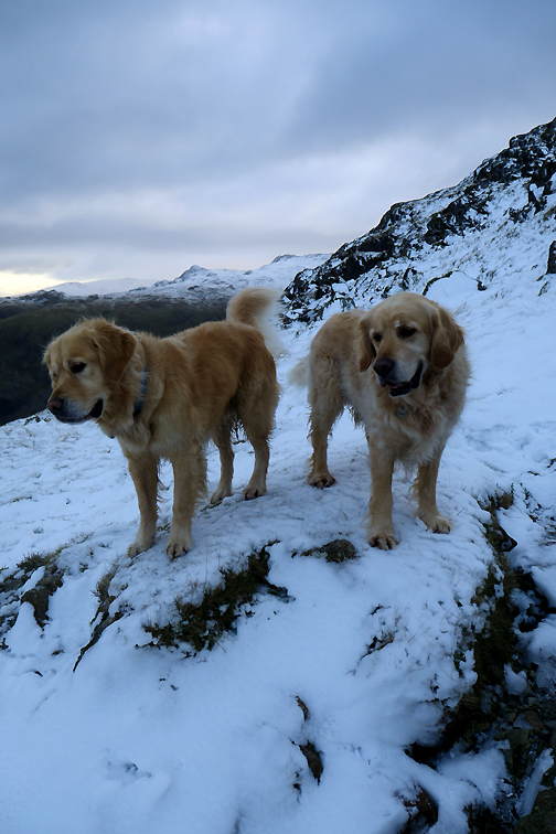
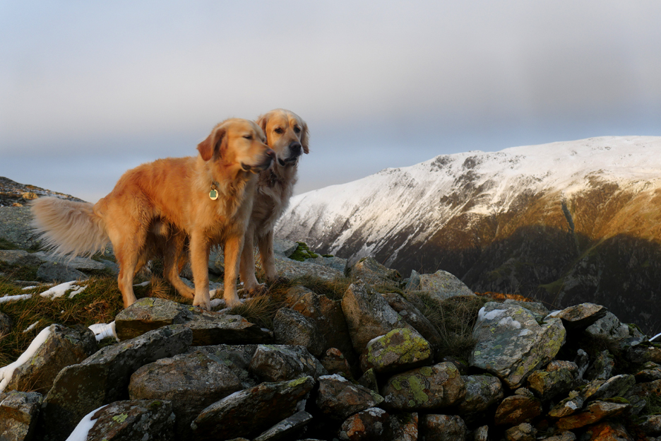
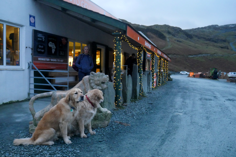
Dougal and Dylan stand for a moment on the Drum House embankment, catching the last of the sunshine on their fur.
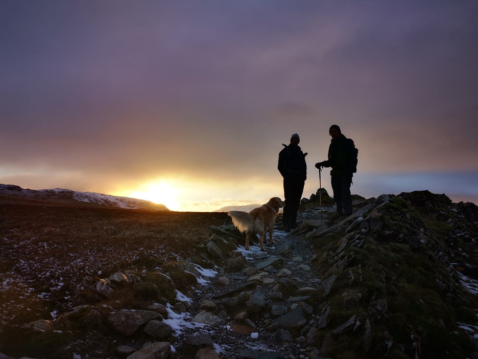
The sun starts to be hidden once more as Paula catches this late photo.
Don't forget to turn left at the heather . . . the fence will keep you from plummeting down the old route of the funicular railway.
- - - o o o - - -
- - - o o o - - -
- - - o o o - - - |
Technical note: Pictures taken with my Panasonic Lumix Gx8 Camera.
Resized in Photoshop, and built up on a Dreamweaver web builder.
This site best viewed with . . . three sets of microspikes.
Go to Home Page . . . © RmH . . . Email me here
Previous walk - 28th Nov Storm Arwen brings Loweswater Snow
A previous time up here - 2nd April - Great Gable on a Great Day
Next walk - Christmas Greetings from Loweswatercam