|
|
|
 |
Remember: Press F11 for a
full screen view of this page. |
Web Counter when published 1
916 675 |
|
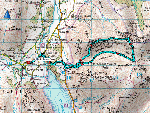
" Whiteside and Hopegill in the Mist !" Date & start time: 17th August 2021. 11.10 am start. Location of Start : By the red phone box, Loweswater, Cumbria, Uk. ( NY 143 211) Places visited : Whin Benn, Whiteside, Hopegill Head & slabs, back home via Gasgale Gill. Walk details : 8 mls, 2750 ft of ascent, 5 hours 30 mins. Highest point : Hopegill Head, 2502 ft - 770 m. Walked with : Paula, Abi, Martin and Myself, plus the dogs, Dylan and Dougal. Weather : Low Cloud down on the fells, but ever so slowly clearing.
|
© Crown copyright. All rights reserved. Licence number PU 100034184. |
|
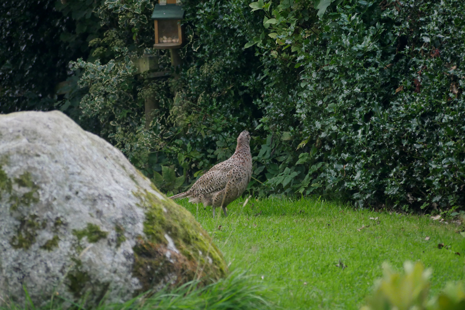
The route this time, a climb of Whiteside up onto Hopegill Head, was requested by my daughter Paula who is coming to Loweswater for a short visit. Over the weekend before she and the family arrived, I also had garden visits from this fine female pheasant, taking advantage of the food that has fallen off the bird table.
I still had the zoom lens on the camera so had to stand back to catch this photo, which might have been fortuitous because if I stand too close to the big window the larger birds and animals often get scared away.
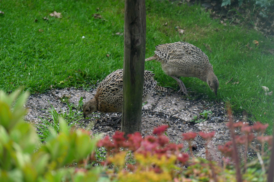
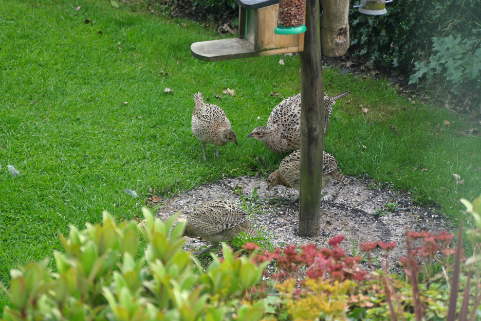
When I looked out again there were also two youngsters closer to the house.
So I waited and eventually a family of four all gathered together under the feeder to enjoy the remains of the food fallen from the table above. You could say that made it a very phleasant weekend !! - - - o o o - - - Paula, husband Al and my grand daughter Abi, arrived Monday and, despite the poor weather, they still fancied going out for a walk.
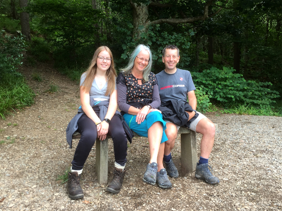
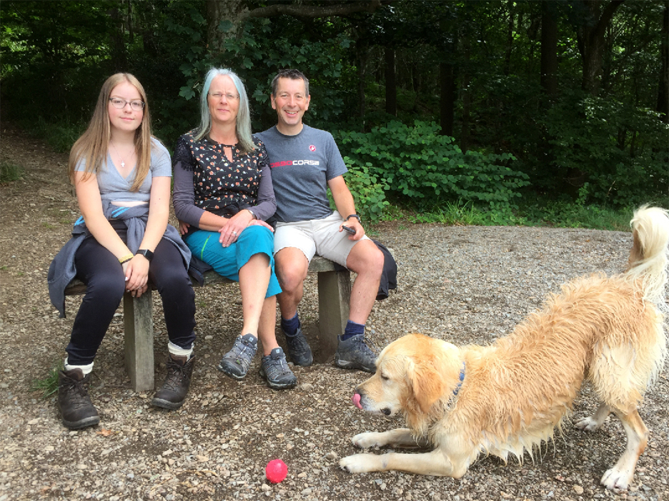
One outing was locally to Scale Hill and Lanthwaite Woods. Whilst down at the boathouse I tried to get all three to look at the camera for a family photo.
However there was something distracting them . . . the reason was obvious when I zoomed out. - - - o o o - - - On Tuesday Al, a keen road cyclist, chose to attempt the "Fred Whitton Cycle Challenge" around the Lakes, a ride which includes all the five major road passes during a 112 mile circuit of Cumbria. The top guys do it in six or seven hours, but eleven hours is not unusual or uncommon for the average sportive rider. Al, who started and ended here in Loweswater, achieved a very credible 9.5 hours door to door. - - - o o o - - -
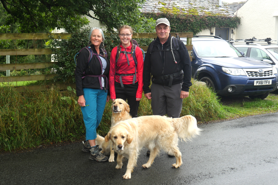
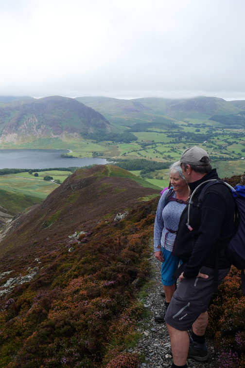
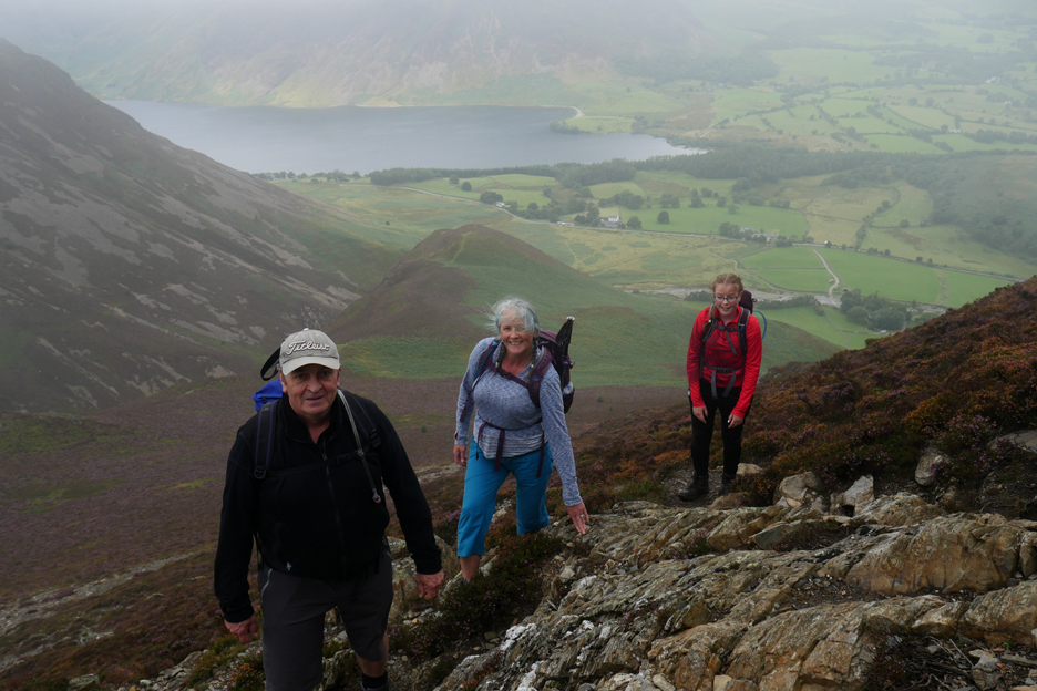
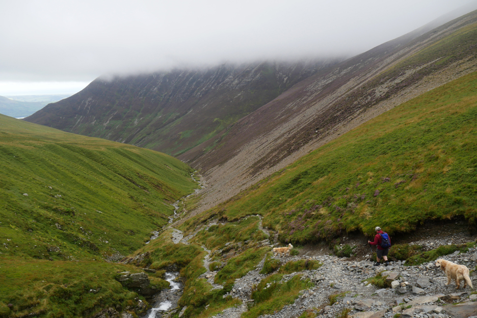
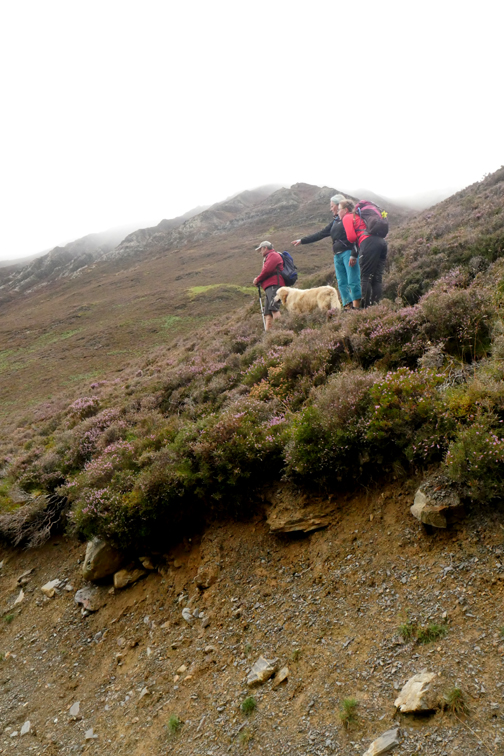
While Al was doing his cycle challenge Paula, Abi and I, joined by my neighbour Martin, chose to aim in a more upward direction. Paula and Abi wanted to walk the two major local summits of Whiteside and Hopegill Head.
Martin and I had climbed them in February in more winter conditions so this would be a worthwhile repeat climb for us. Then we had clear weather, but cold winter conditions caused sheet ice on some paths within the Gasgale Valley. Today it was low cloud, warm almost muggy air, the prospect of limited views but dry useable paths, a very different prospect.
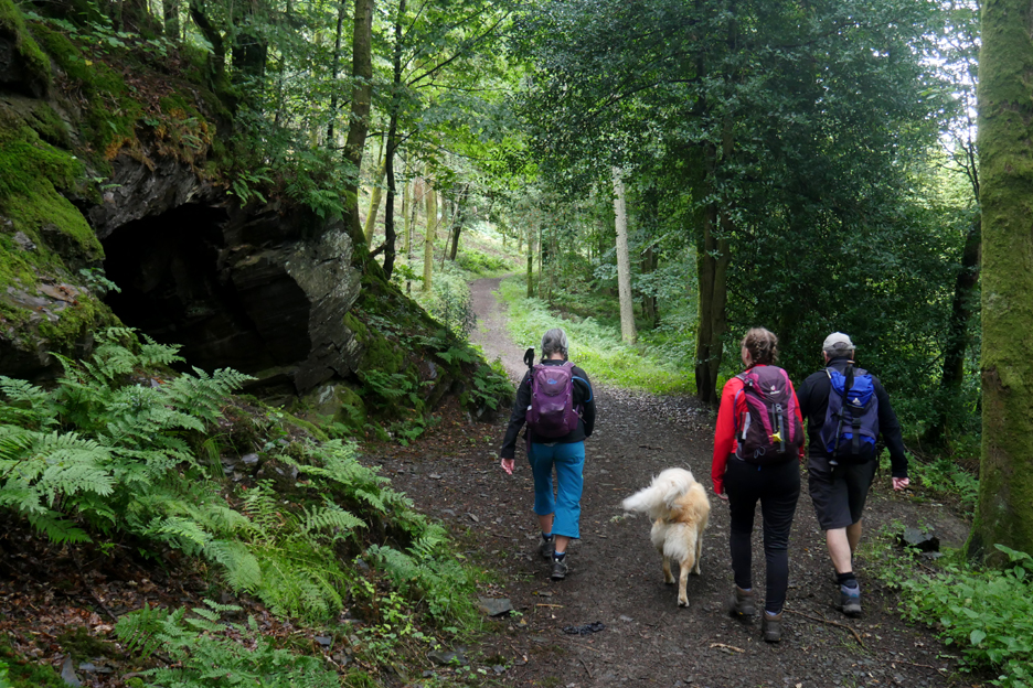
Walking from home included the bridle path through Lanthwaite Woods, passing Jonty's Cave along the way.
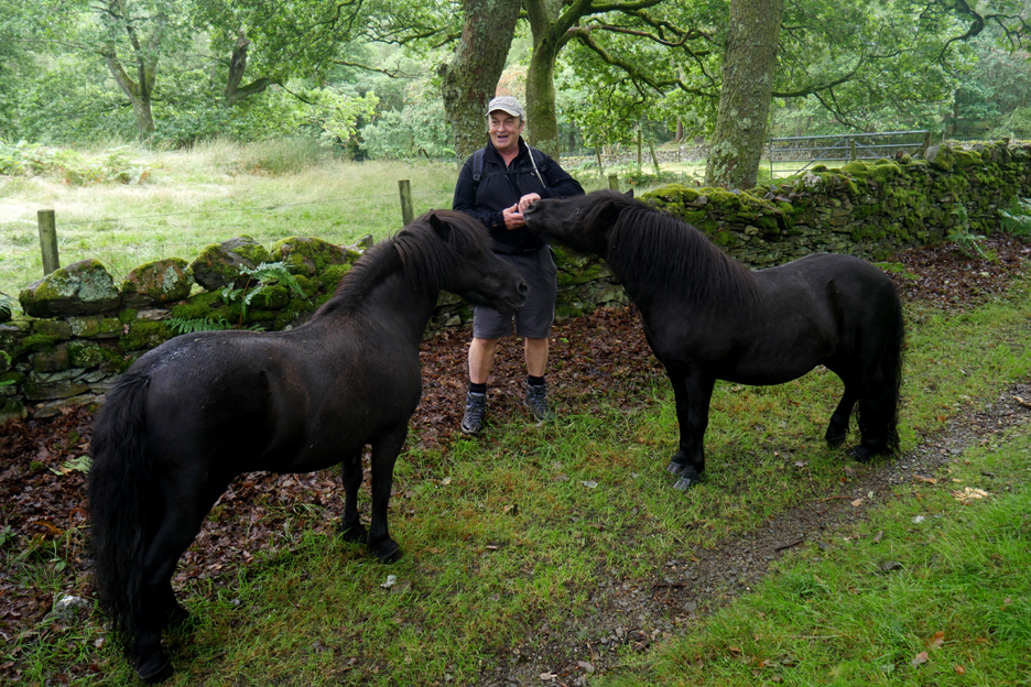
We met up with the two fell ponies that normally spend their days on Low Fell. With the bracken so high at the moment, perhaps their owner thought they would be better off down here in the valley.
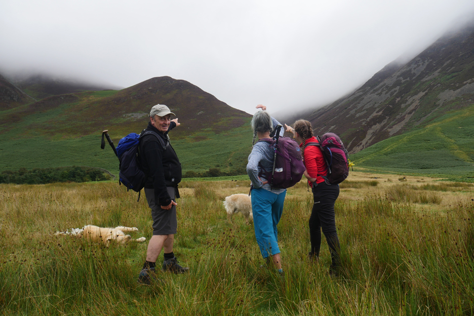
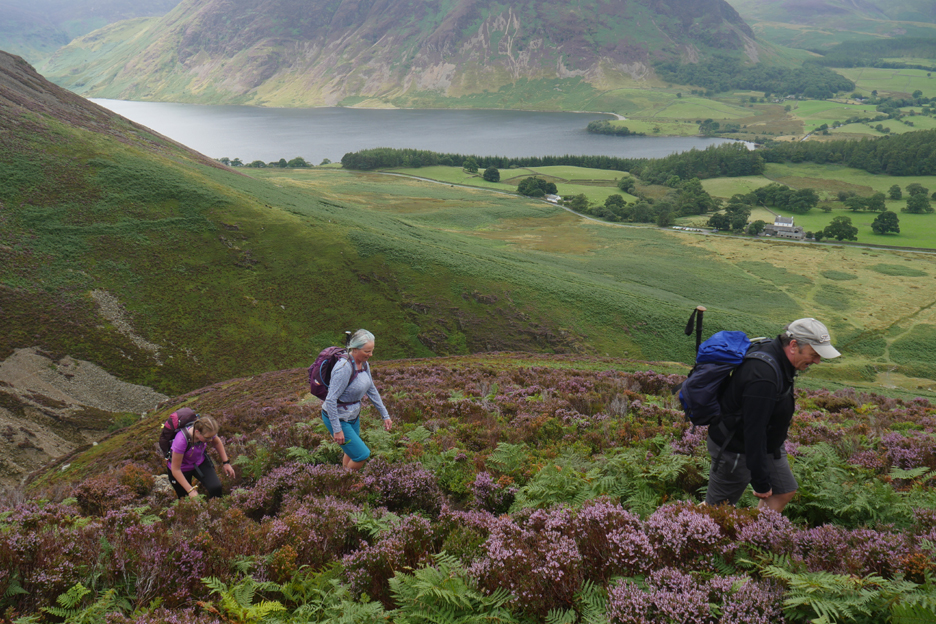
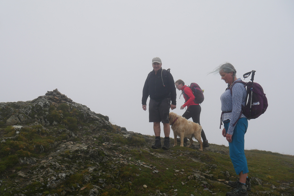
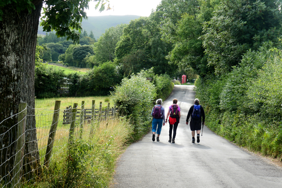
We crossed over the Buttermere Road and headed for the start of the main climb. I asked everyone to stop and pose for a nice photo . . . not the most brilliant idea !
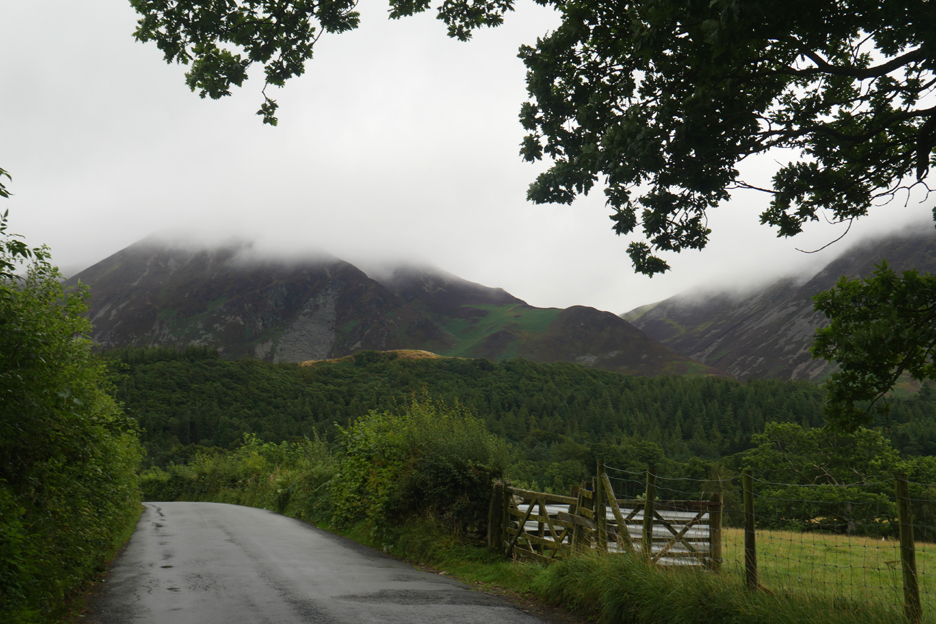
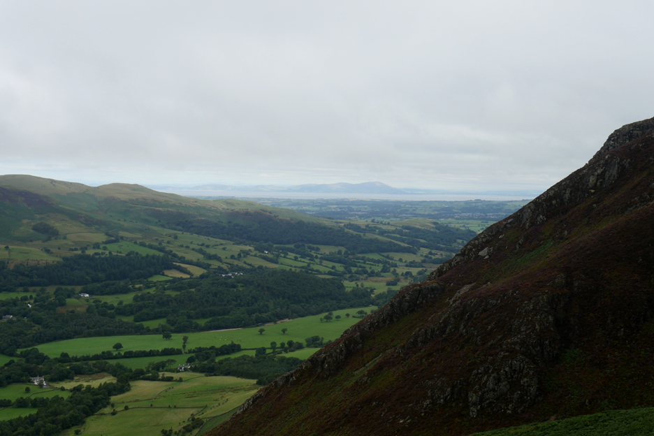
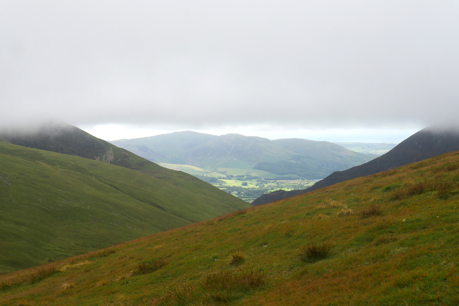
The weather down hear in the valley was fine, but once we climb above the first summit of Whin Benn it would be a different matter. The top of Whiteside is lost in the mist.
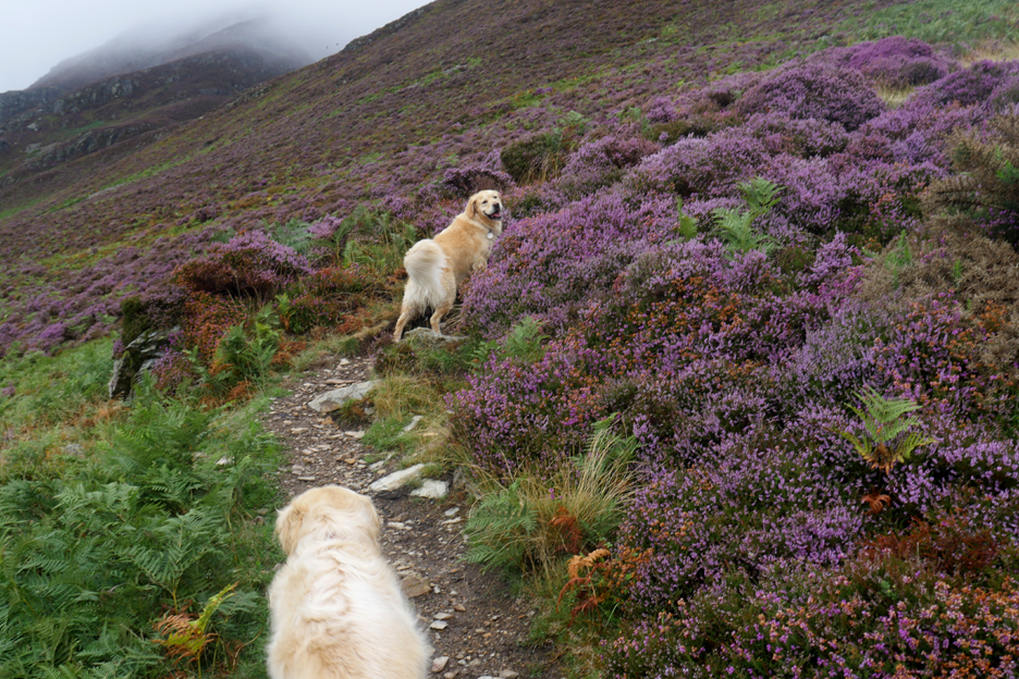
It is turning out a good year for the heather and the rich purple colour is quite vibrant in places.
Lower down it competes with the bracken.
Higher up the more alpine plant wins out.
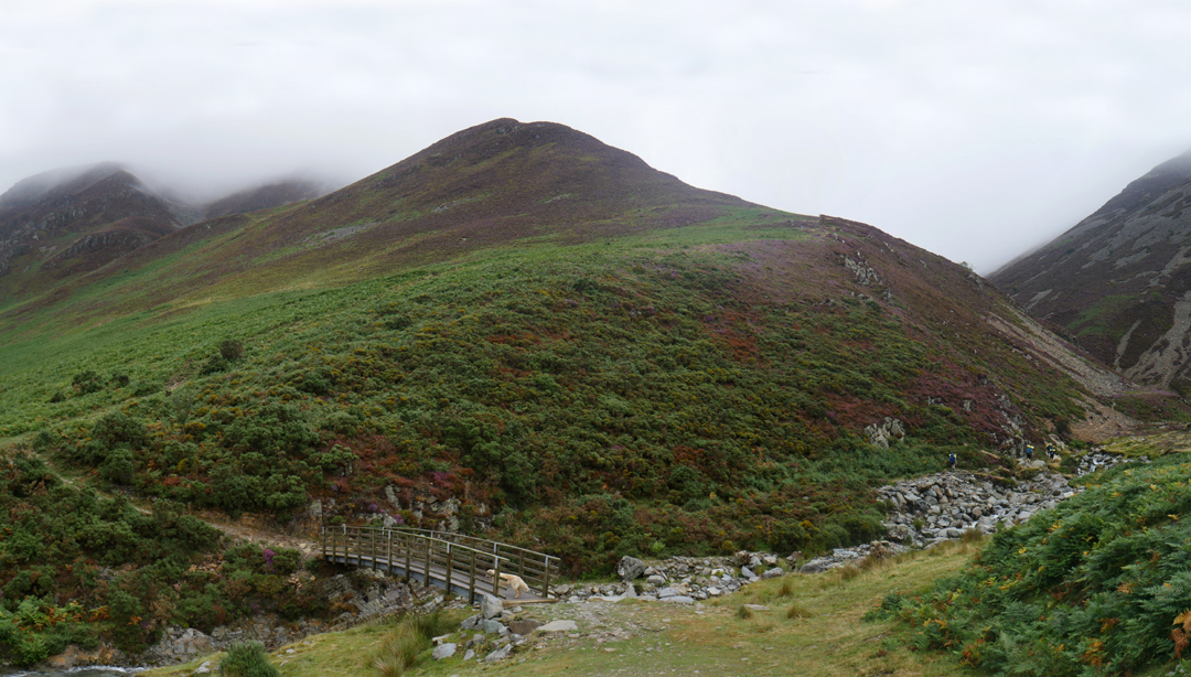
The path ahead from Whin Benn dips briefly then continues the climb up through more rich, knee deep heather.
As we climb the Scottish hills become more defined and more obviously separated from ourselves by the Solway Estuary.
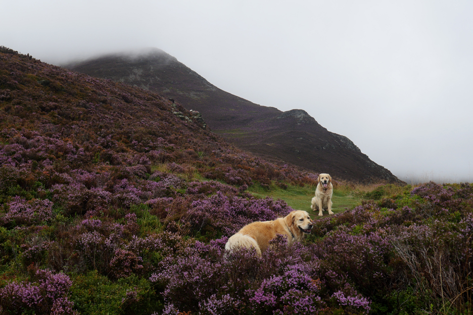
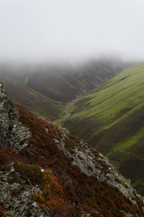
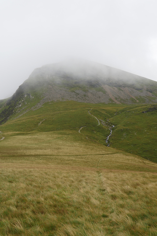
Above the next crag the colour and definition starts to fade as we enter the clouds.
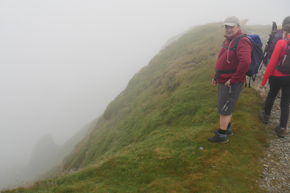
A warm breeze greets us as we top out on the first summit of Whiteside.
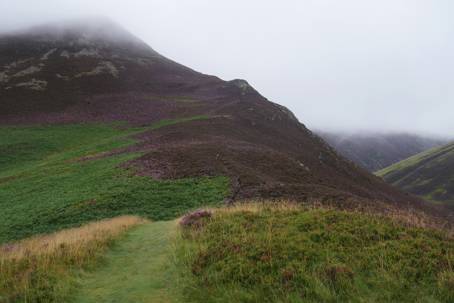
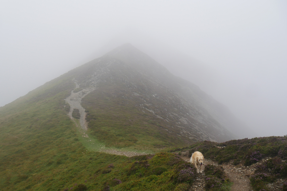
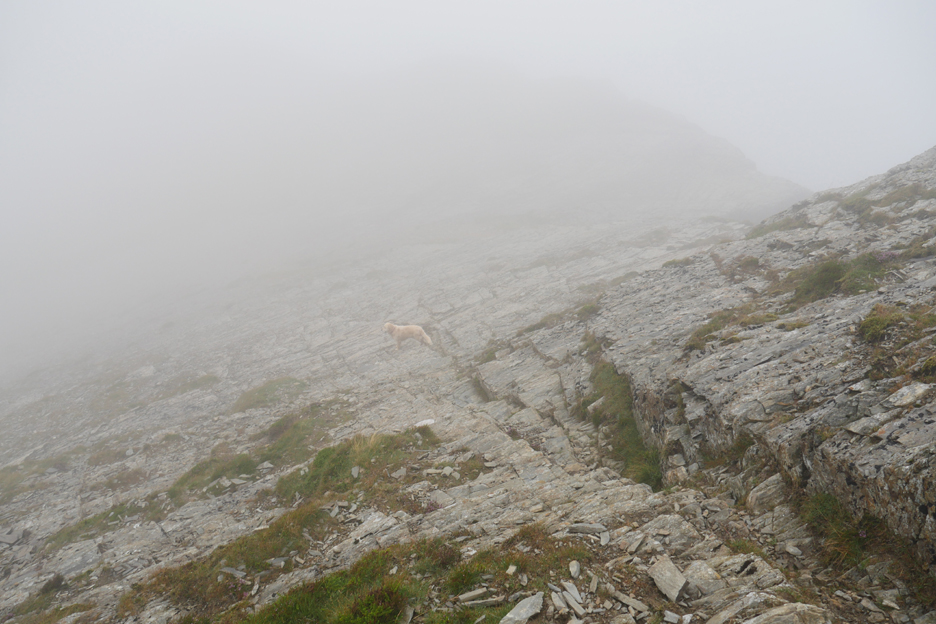
Just a few photos along the ridge as visibility was limited. Navigation along this, one of the finest upland ridges of Lakeland is easy . . . stick close to the pointed bit !
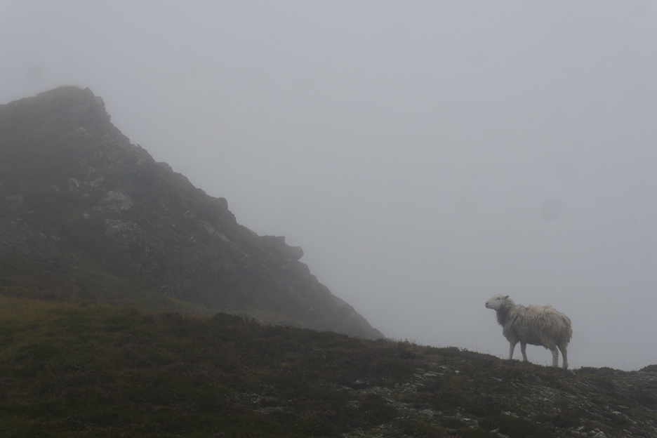
Don't be sheepish about enjoying your walk.
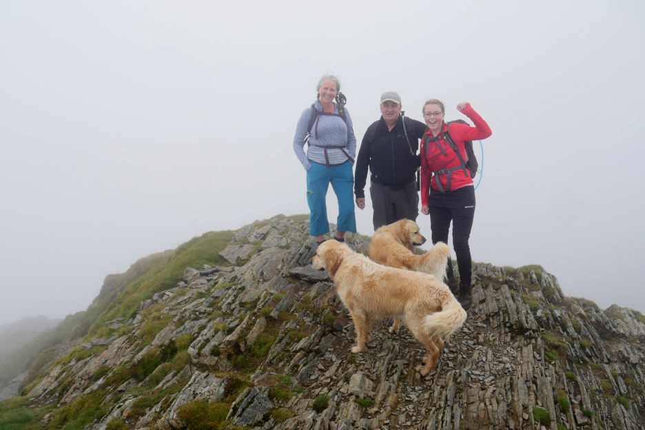
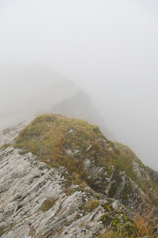
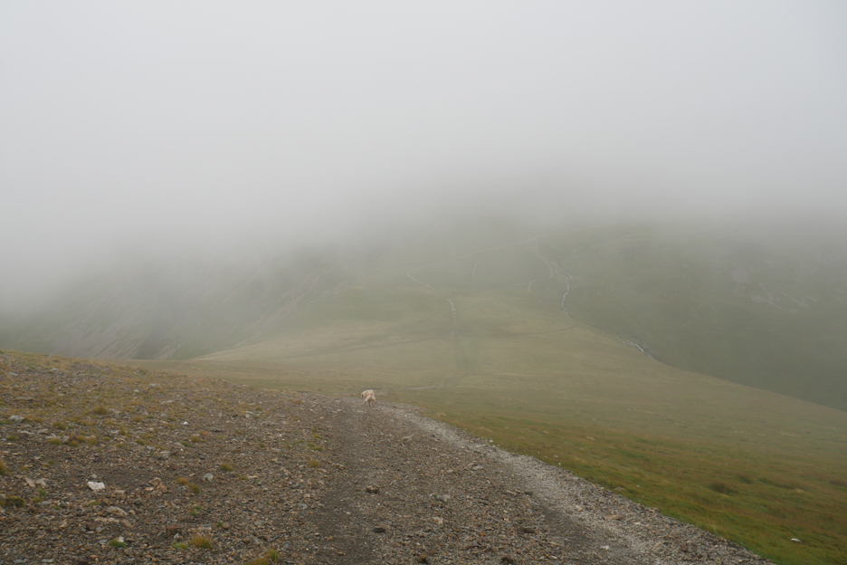
When you can climb no higher you've reached the summit of Hopegill Head . . . yeah.
When Martin and I were up here in February the Hopegill slabs were covered in ice so we couldn't safely appreciate them. Today they were okay for walking but the view was hidden, so we ventured down them a short way just to try and enjoy the location.
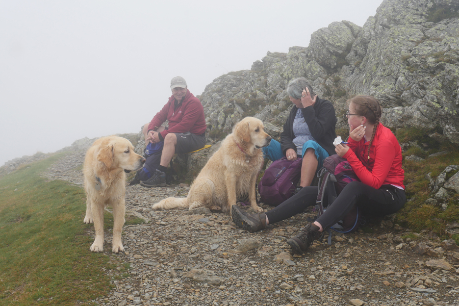
Returning to the top we found a nicely sheltered spot below the summit for a bite to eat.
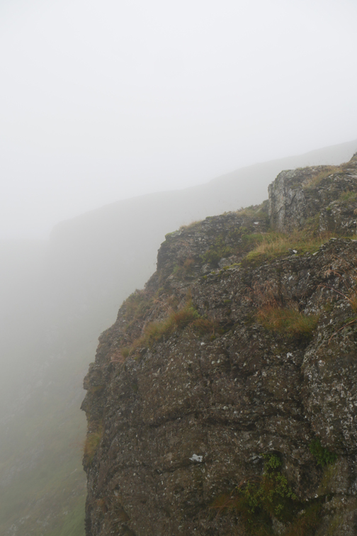
Under way again, the route starts close to the Hobcarton Crags. Soon the path divides, the one left close to the edge continues on towards Grisedale Pike, our one to the right takes us toward Sand Hill.
I don't know of the true origins of the name, but there's more gravel than sand on Sand Hill.
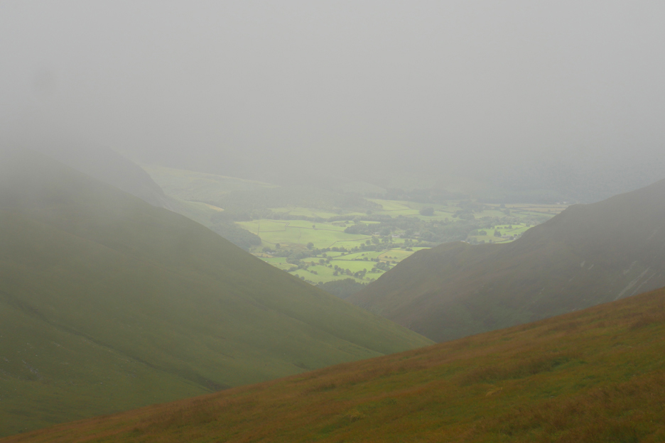
As we descend from the clouds the bright, almost emerald green of the contrasting Loweswater valley floor appears through the mist. There must be some sunshine down there to make it shine so vividly.
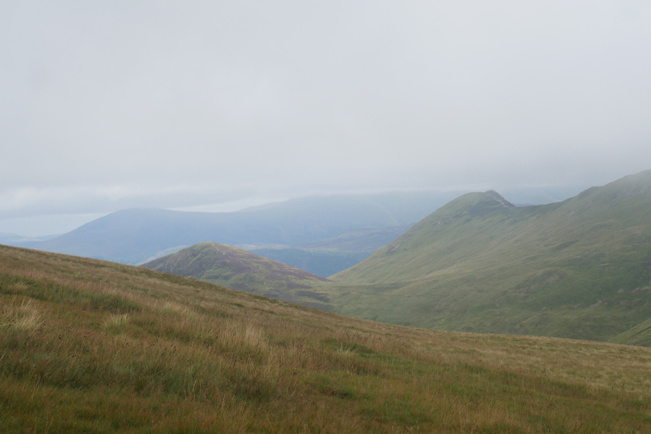
To the east there's a general overcast gloom over Causey Pike, Outerside, Clough Head and the Dodds.
Lower still and the Loweswater Fells of Blake and Burnbank are now seen below our low cloud level.
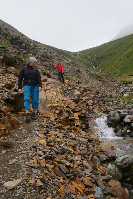
On the way down we crossed this very yellow outcrop of shale . . . there must be some added mineral content to the rock at this point.
Onward and downward . . . on paths that were ice covered in February.
We noticed a "dipper" flying down the beck ahead of us. It kept darting, forward close to the stream and landing alongside many of the rock pools ahead of us.
As we neared the end of the steep part of the descent it turned and flew back up the river, but I'm blowed if I can see it in the photo !
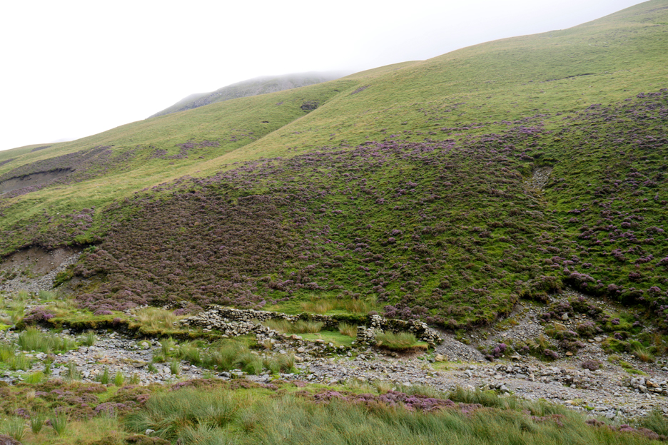
I took a picture of an old sheepfold instead. It was close to the river but suffered only minor damage in the floods and so survives to tell of earlier days and older farming practices.
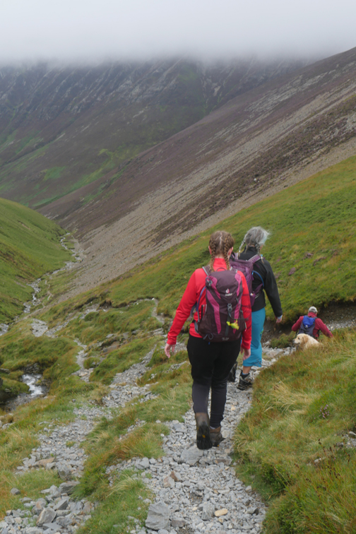
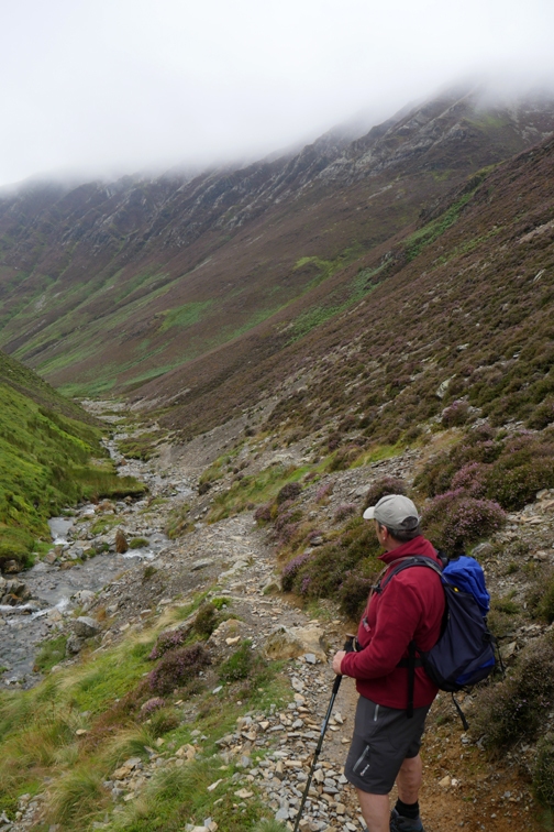
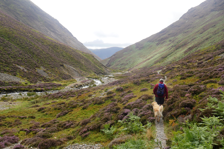
The steep descent complete, there just remains the deceptively long walk down the valley.
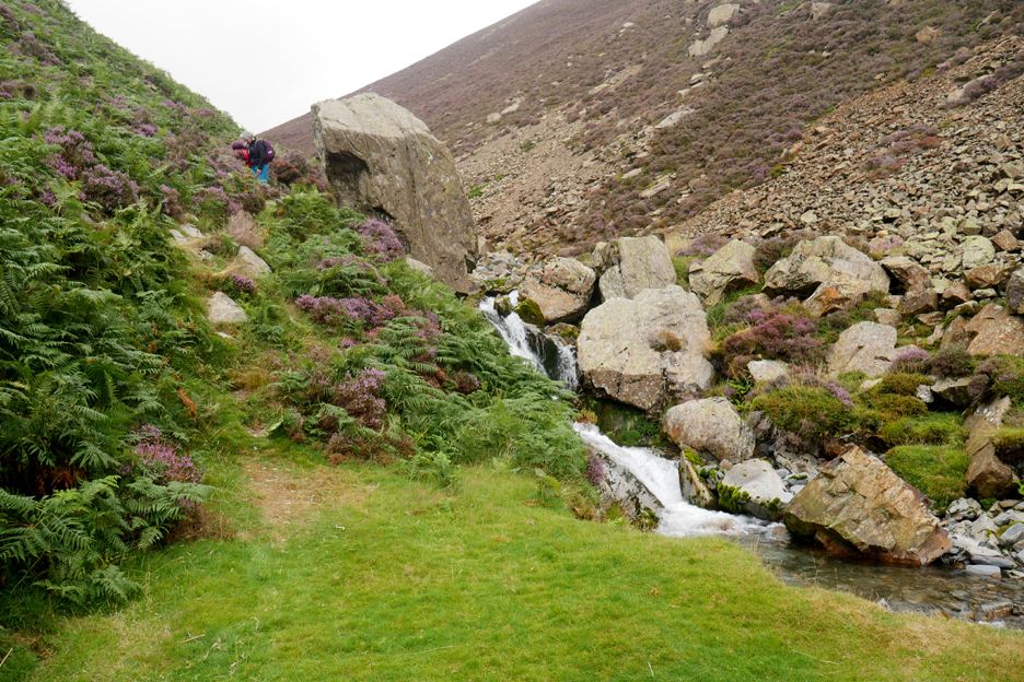
A fallen boulder and cold mountain pool are a landmark of the next slight twist and turn of the valley.
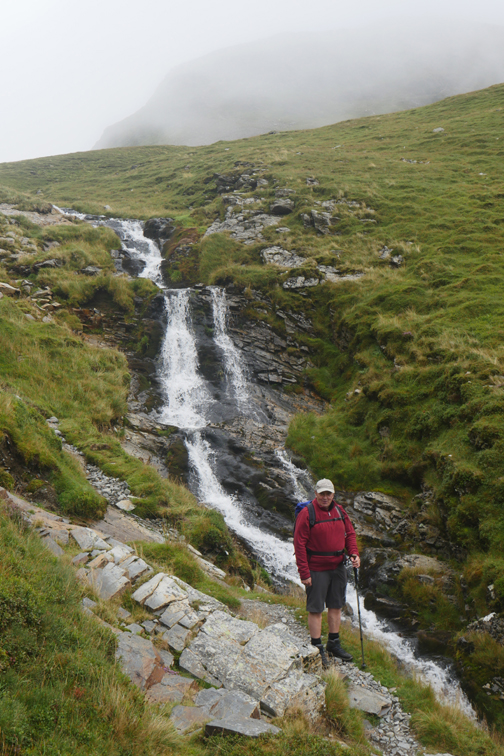
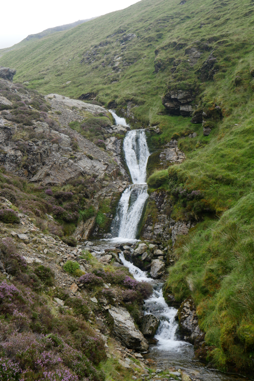
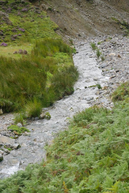
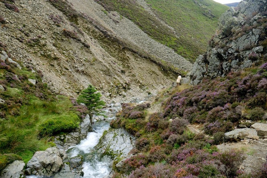
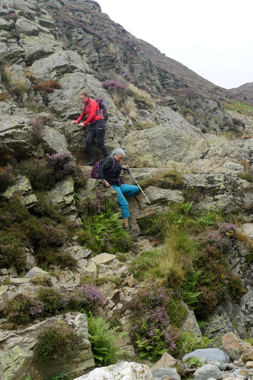
The valley narrows once again as we approach Gasgale's "bad step".
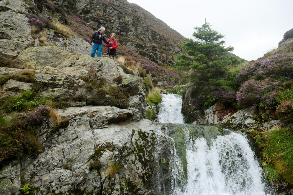
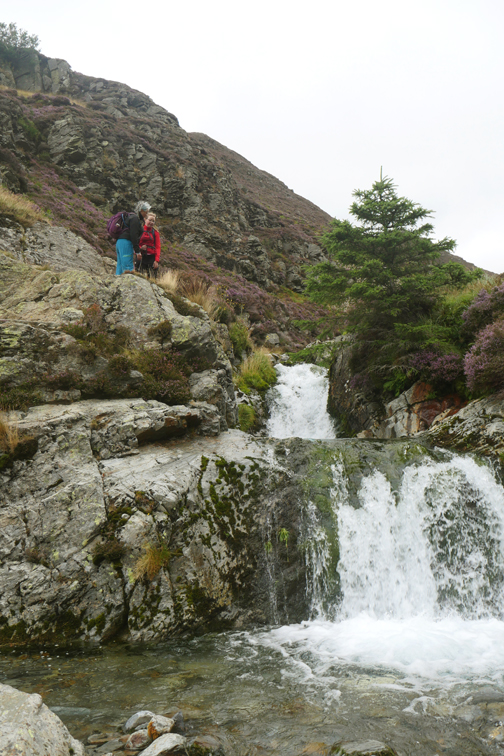
This is a very picturesque double waterfall, cascading over a twenty foot rock barrier. It comes complete with its own purple heather and green tree . . . but sadly no bright sunshine today.
Those of a more nervous disposition could have taken a higher path which branched off at the fallen boulder we saw earlier. That path traverses above the rock step, staying higher up on the lower slopes of Whin Ben. I however do love these two waterfalls as a place to visit in their own right.
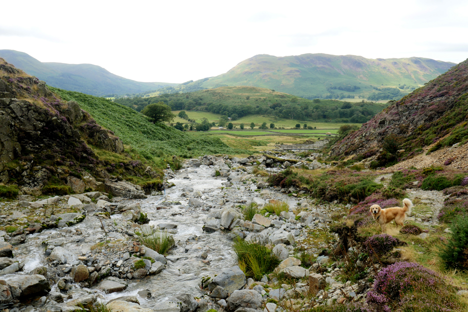
The rocky mountain stream fills most of the base of this narrow valley as we head down to cross back over the 'new' bridge that we used earlier.
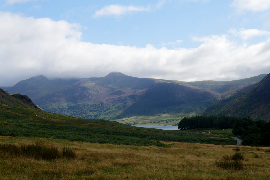
As the day progressed the weather must have improved 'in our absence'. Now we are down closer to those emerald green fields, the sky is clearing and the cloud is lifting off the Buttermere fells.
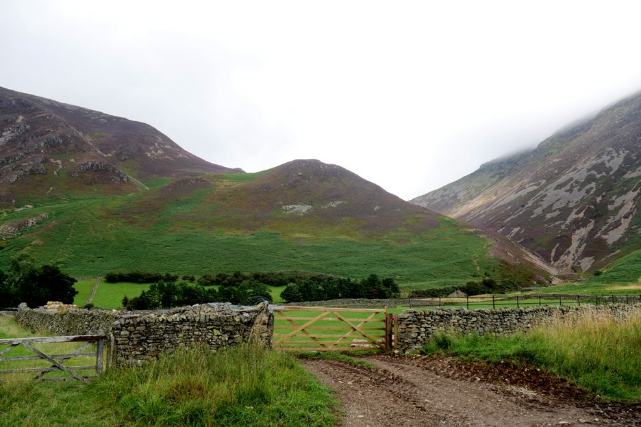
Looking back at Whin Benn from the road, the cloud base is higher on Whiteside as well.
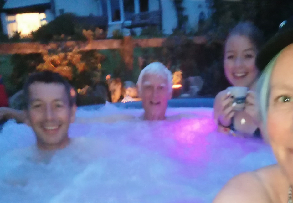
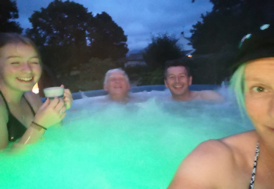
The long walk down the valley was extended somewhat by the walk back through Lanthwaite Woods. However the sun is out and the 'pure' nature of the walk, not using the car, has been very satisfying despite the extra length. - - - o o o - - - In the evening we relieved tired walking and cycling muscles in a daft sort of way.
A recent purchase of coloured underwater lights enhanced the rather extravagant purchase of a hot tub for the garden.
You've got to enjoy yourselves if you can, and no better way than having a complete day out with the family. - - - o o o - - - |
Technical note: Pictures taken with my Panasonic Lumix Gx8 Camera or Paula's phone.
Resized in Photoshop, and built up on a Dreamweaver web builder.
This site best viewed with . . . relaxation after the extended effort of the day.
Go to Home Page . . . © RmH . . . Email me here
Previous walk - 13th August Binsey with Loes - before tea
A previous time up here - 10th February - Pure Whiteside with Martin
Next walk - 23rd August Holme Woods with Frieke & Loes