![]()
Remember: Press F11 for a full
screen view of this page.
Web Counter when published 1 907 654
|
|
|
|
Remember: Press F11 for a full
screen view of this page. |
Web Counter when published 1 907 654 |
|
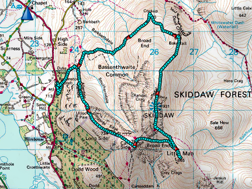
" The six Skiddaw summits with Martin " Date & start time: 1st July 2021. 11 am start. Location of Start : Roadside, close to the Ravenstone Hotel, Cumbria, Uk. ( NY 235 296 ) Places visited : Ullock Pike, Longside Edge, Carlside, Little Man, Skiddaw, Bakestall, Cockup. Walk details : 8.9 mls, 3475 ft of ascent, 6 hot hours. Highest point : Skiddaw, 3,053ft - 931m. Walked with : Martin and the dogs, Dylan and Dougal. Weather : Sunshine and blue skies, rather hot. |
© Crown copyright. All rights reserved. Licence number PU 100034184. |
|
I made a bit of a mistake before the start of this walk . . . not believing the weather forecast ! At home it was overcast and cool so I emptied some of my water out of the hydration bottle in the rucksack so as to save weight. As we emerged out of the trees at the start of the walk, the sun came out and stayed high in the sky for the rest of the day and that shortage of water was a slight regret to say the least !
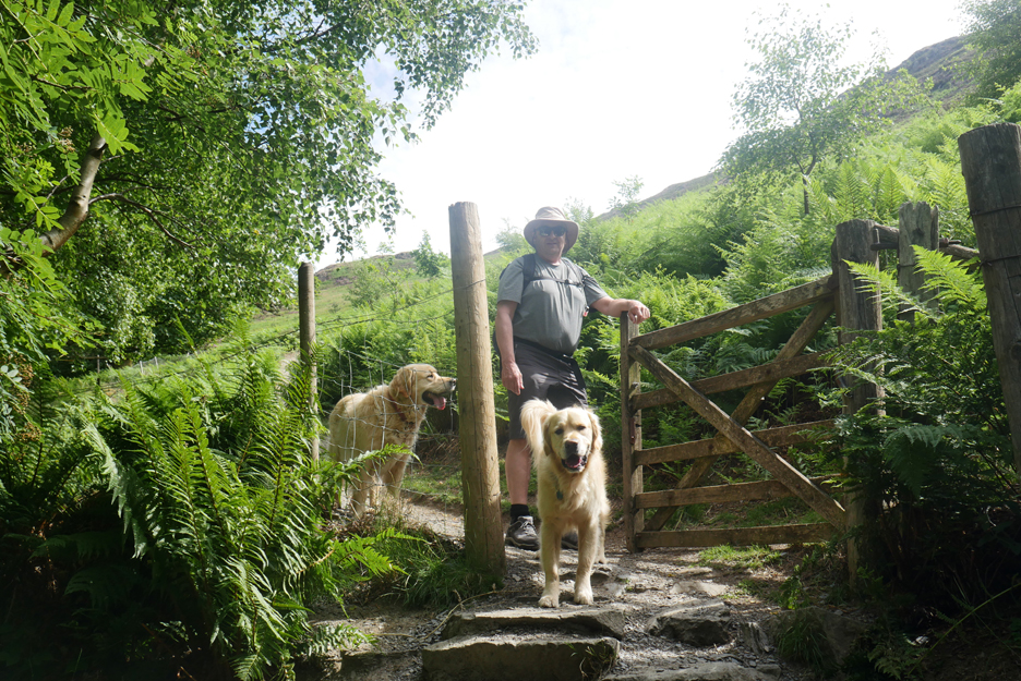
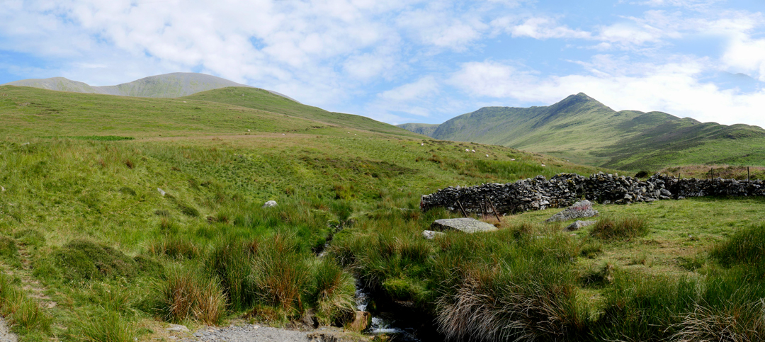
Parking on the roadside near to the hotel . . . where there's space for half a dozen cars.
Martin well prepared for the sunshine as we leave the trees.
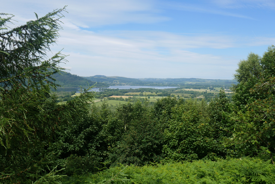
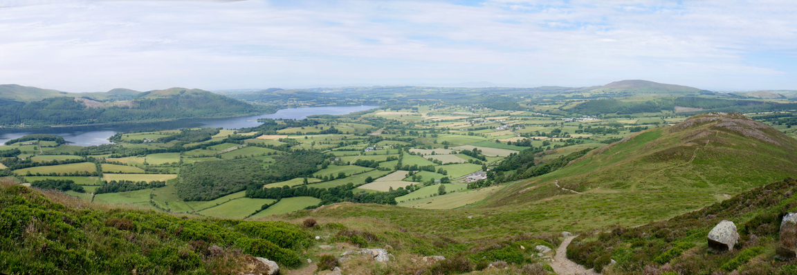
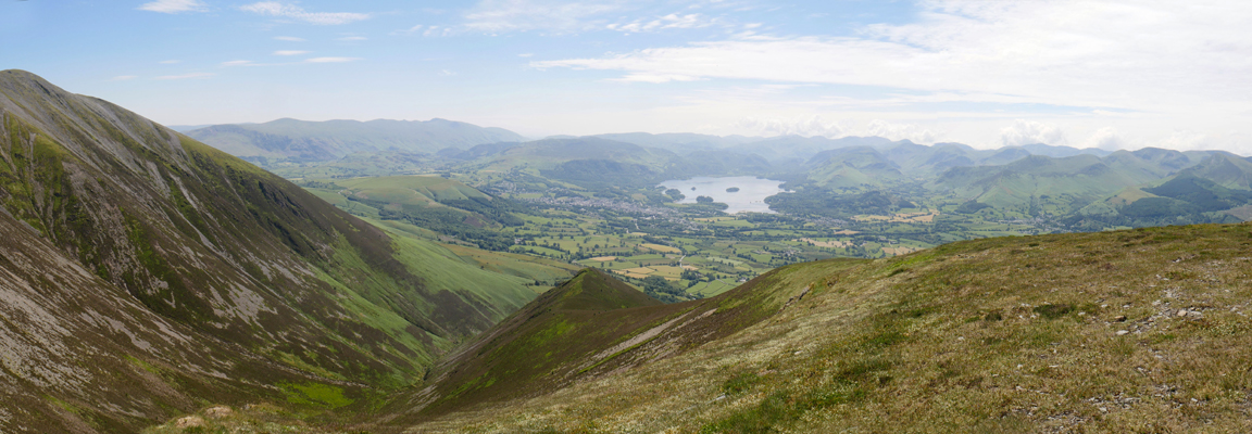
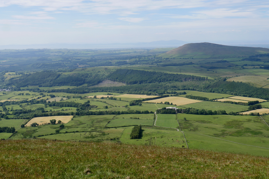
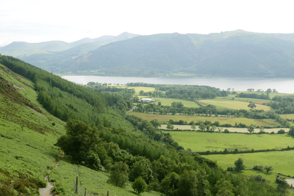
As we climb the we walk higher above the trees and we get a first proper view of Bassenthwaite Lake.
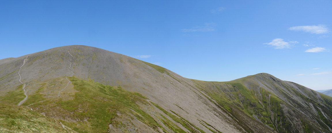
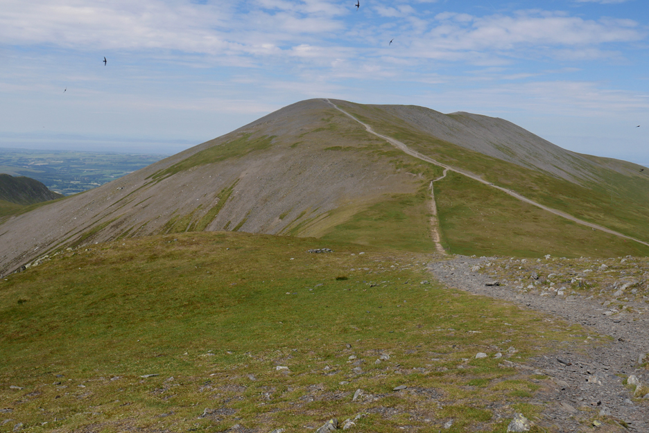
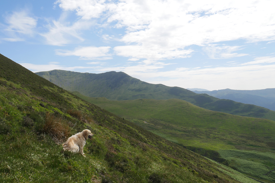
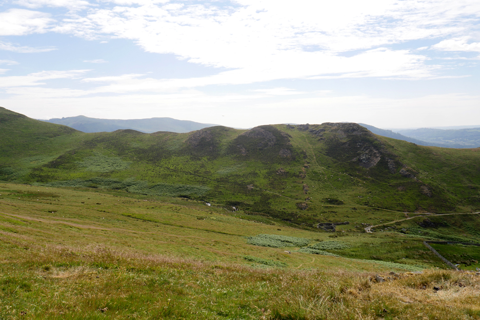
I think the ascent of Skiddaw via Ullock Pike is one of the more interesting climbs in the Lakes. It gives a variety of landscapes, surprise views, steep climbs, relaxing ridges and gradually we'll reach the many the summits on the route.
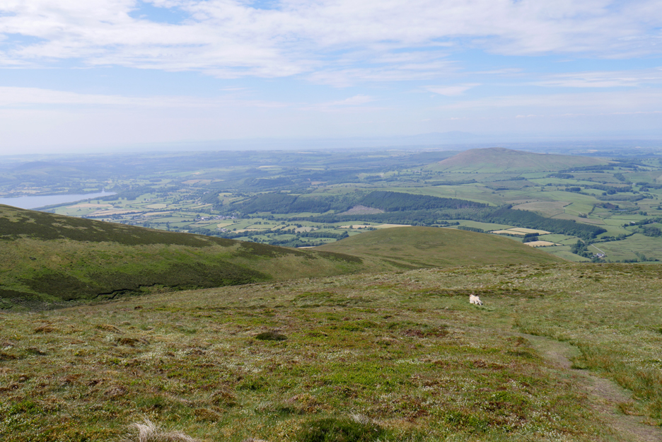
Looking back at the wider view north, from Sale Fell on the left to Binsey on the right.
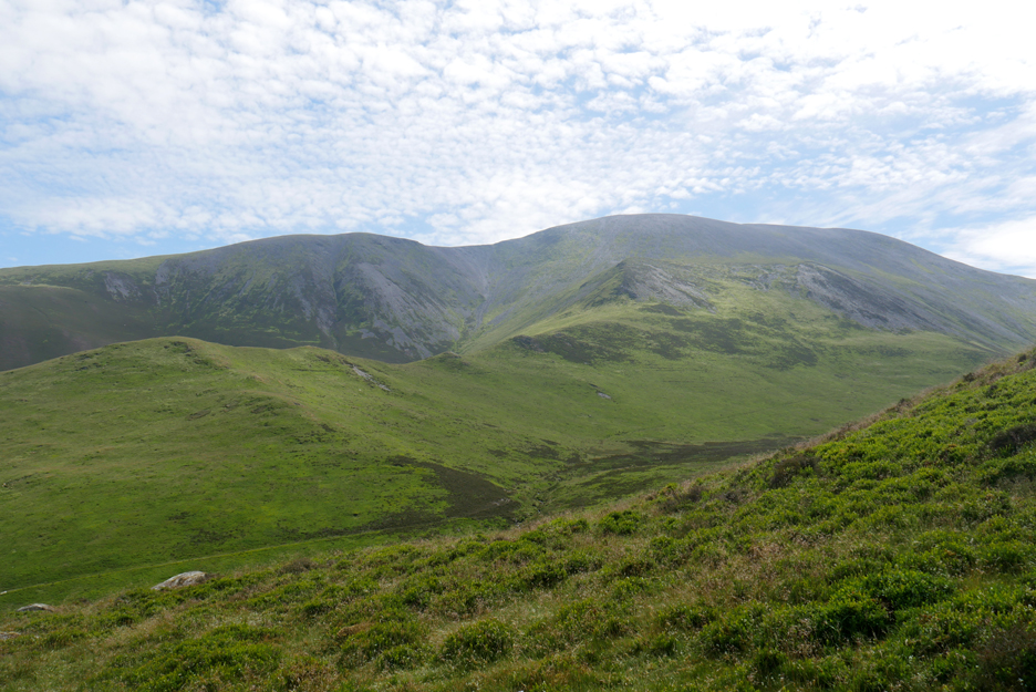
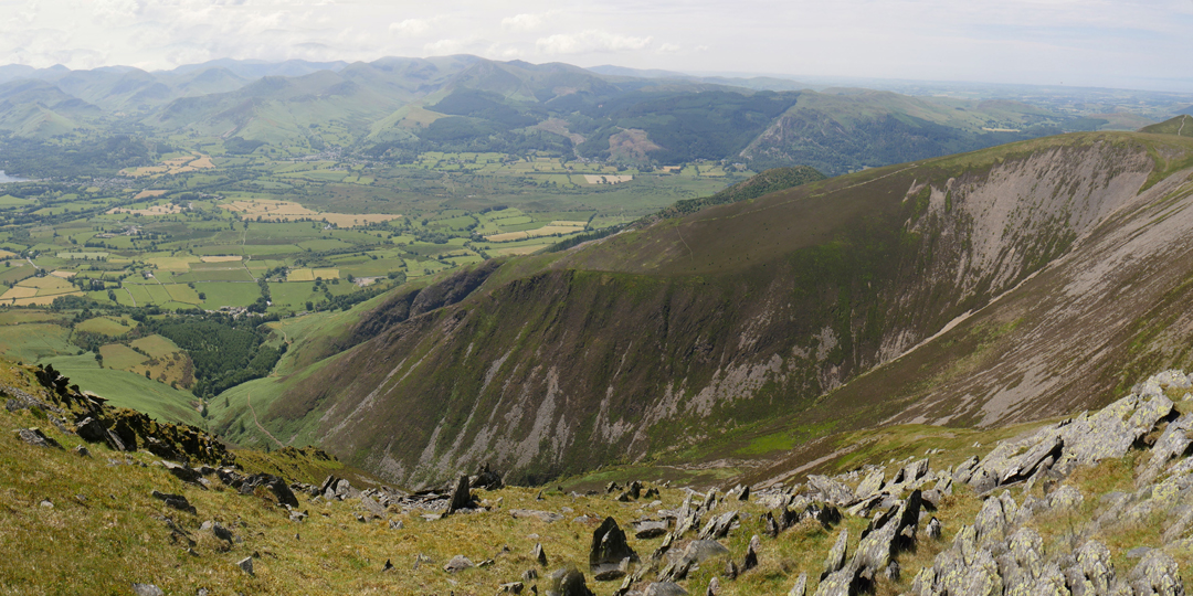
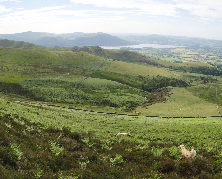
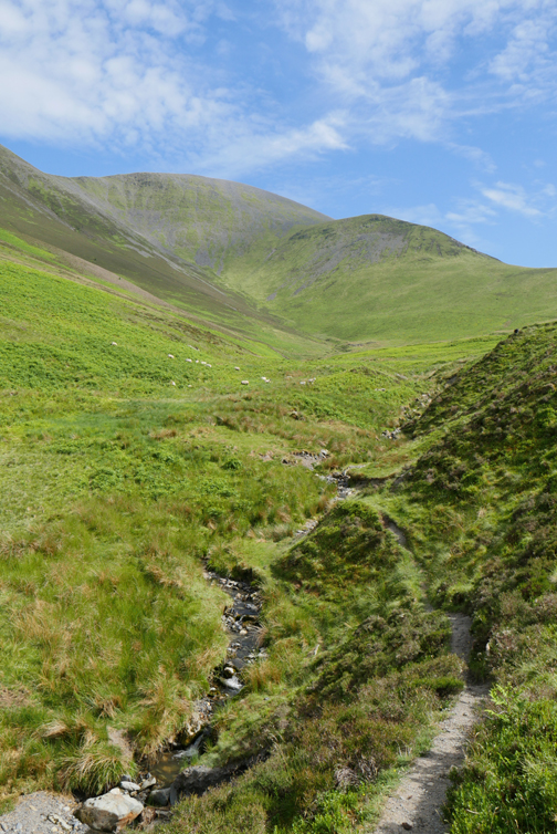
The strangely names Southerndale, as Southerndale Beck actually flows north. Behind it is Barkbethdale and beyond that is the summit of Skiddaw of course. The other nice thing about this walk is that the high point is usually in sight and so gives an idea of how you are ticking off the many feet of the climb.
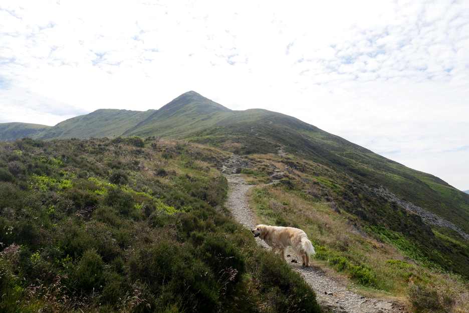
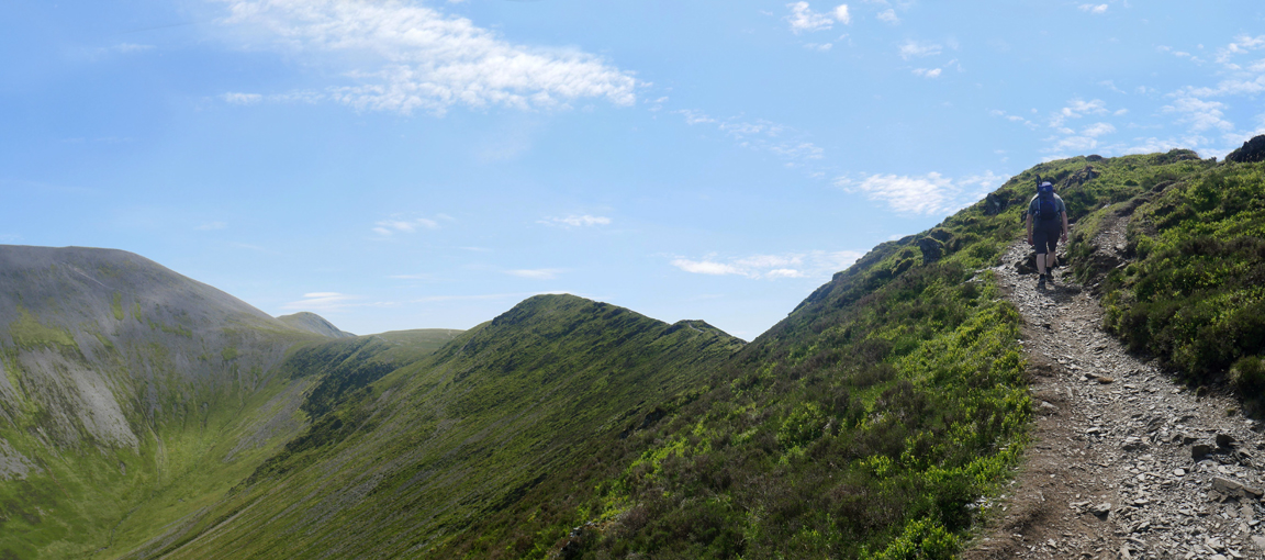
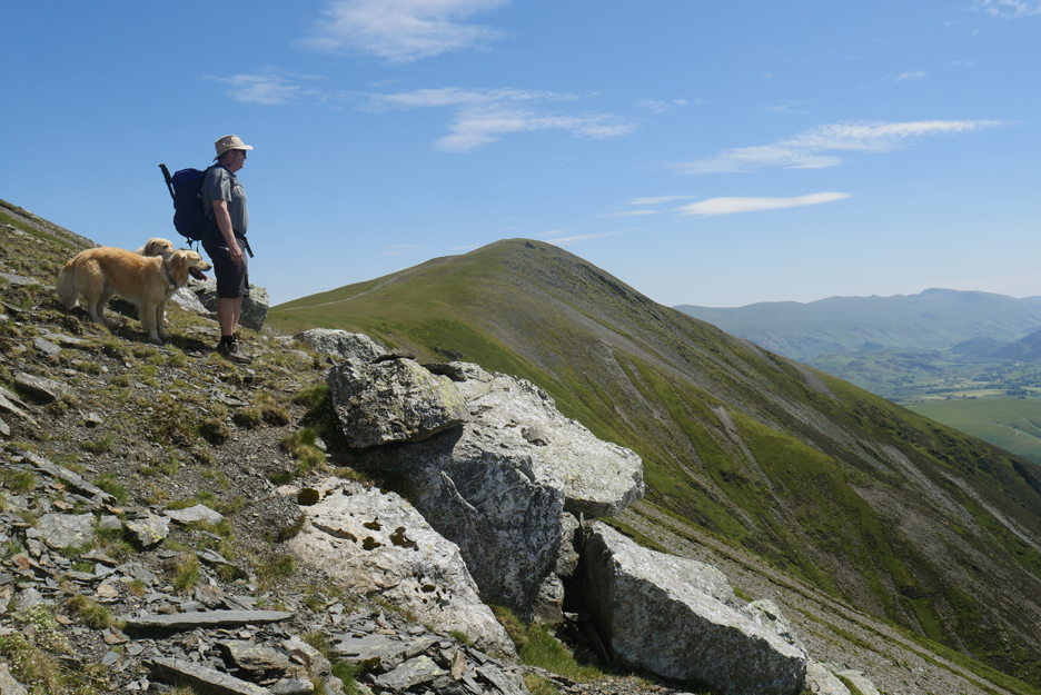
Martin leads the final part of the climb, to our first summit of Ullock Pike. This walk is well endowed with Wainwright "points" as it includes Ullock Pike, Longside, Carlside and Little Man, all here seen in the same picture.
Martin at the first summit cairn. It's been a warm climb but we had a couple of nice conversations with each other and fellow walkers we met on the way up.
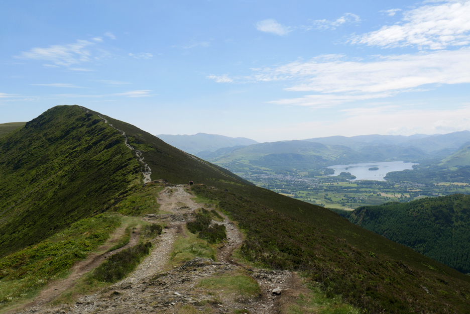
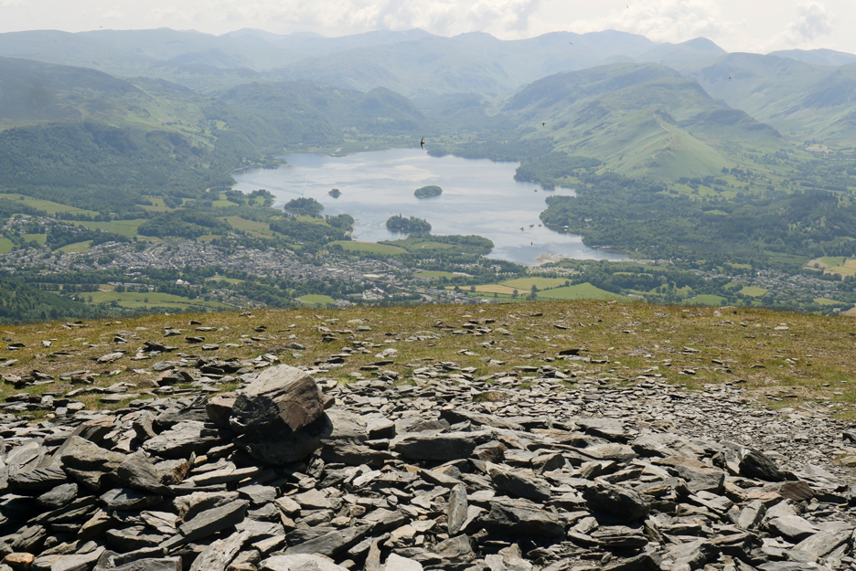
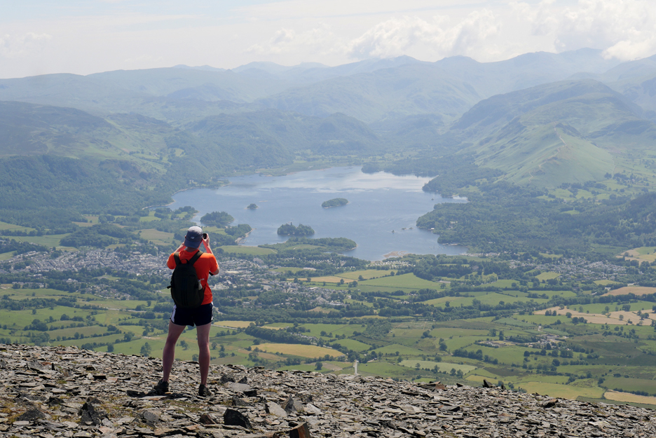
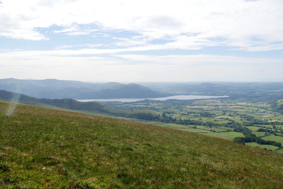
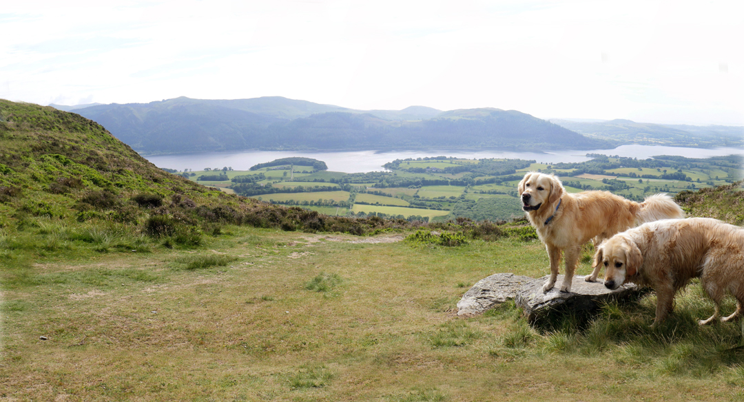
Ahead now is the classic view of Derwent Water and Keswick with the Helvellyn and the central fells rather muted in the blue heat haze of the day.
A ceremonial adding of a pebble to the cairn on Longside Edge. You'll need a lot more of those to get Ordnance Survey to increase the height of the fell !
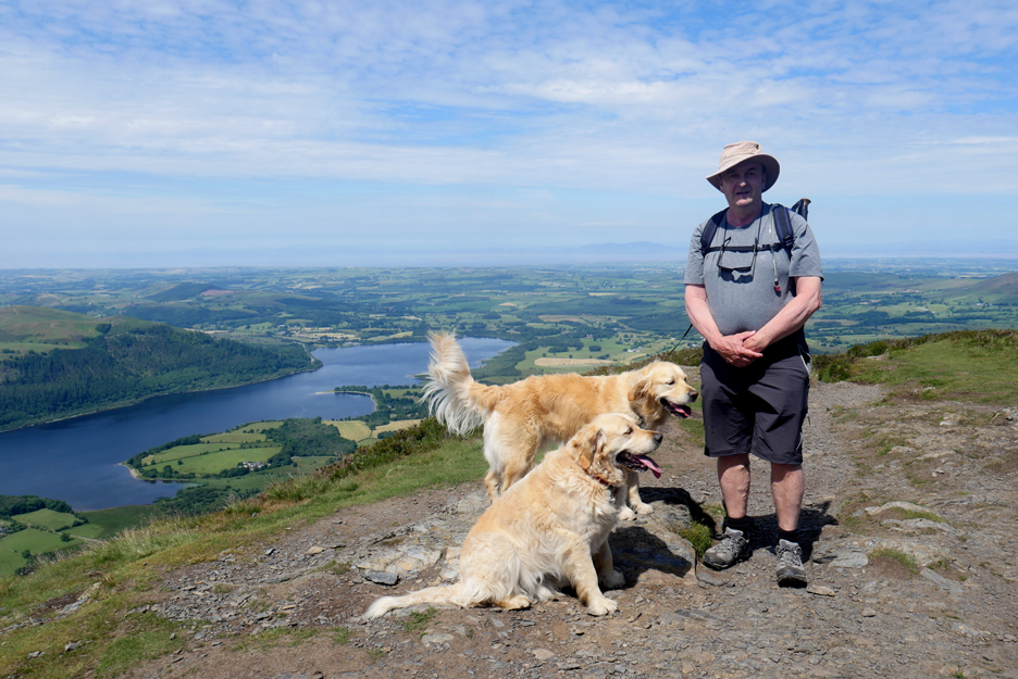
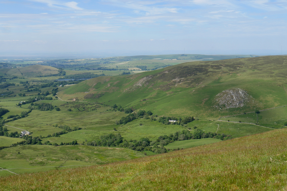
Carlside top and the view south is now fully revealed. The small Slades Beck passes Carsleddam on its way down to the Millbeck hamlet below. In days of yore, small dams and weirs on Slades Beck provided some of the drinking water for Keswick. In a few years even the more modern west coast supply will enter the history books as the new Thirlmere pipeline comes on stream.
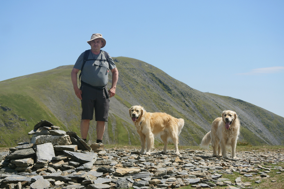
Yep, another summit photo, but this means that Martin's now up in the high forties of Wainwright summits climbed this year ! [ Considering he hadn't walked anything higher than the South Downs (southern England) before this year, that's brilliant.]
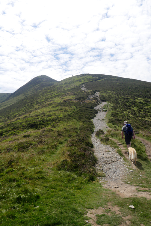
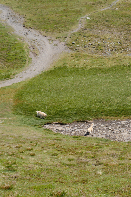
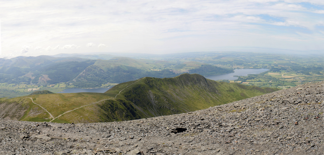
Where next ? When Ann and I completed our first round in 2001, our 214th fell was Skiddaw Little Man, seen here on the right. We had already climbed Skiddaw but these fells were closed due to the foot and mouth epidemic and Little Man was the last to be re-opened to walkers. If Martin left it out today it would be rather out on a limb for future walks so as the day was nice and conditions underfoot were good we'll go for it. After all it would be about the right place for lunch. - - - o o o - - - On the photo you can see the classic, direct path to Skiddaw on the left, the secondary path to the south top zig-zagging straight up, but we would take neither of these, in favour of the faintest of paths across Broad End, past what the Ordnance Survey marks as the 'fox bield' half way across.
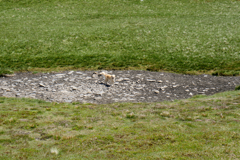
" What have you done to the water ? " Sadly for them the recent dry spell and hot temperatures have dried the mountain tarn, so nothing to drink here, nor even any mud to sit in. Water was a slight problem and I was starting to regret half-draining my water bottle earlier in the day.
Still, no matter, I had a flask of coffee, a sachet of juice plus the remains of what was in my hydration pack water bottle, so we set off on the route to explore this so called "fox bield".
The path across to it was hardly more than a sheep track, in fact no sensible sheep would come this way due to lack of grass. I think the track must be the creation of walkers alone . . . ahead were the stones.
Martin at the fox bield. To me these rocks have been mis-named on the map. The stones are massive and now lay scattered on the fellside in no particular order. It reminded me very much of the "White Stones" found locally on the descent path from Carlside, just a natural outcrop of hard rock amongst the softer Skiddaw Slate underlying the fell.
Looking back at the stones as we continue on the path across Broad End.
The route others have chosen varied based on their next objective. Some must have headed up direct for the summit, others stayed low like us, in order to reach Little Man. Consequently the faint path to the stones virtually disappeared and we each had to pick our own way across the sloping ground.
Not far now and we'd be on the coll between these two adjacent summits.
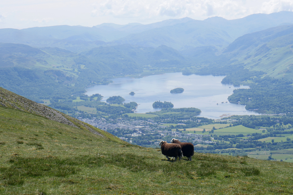
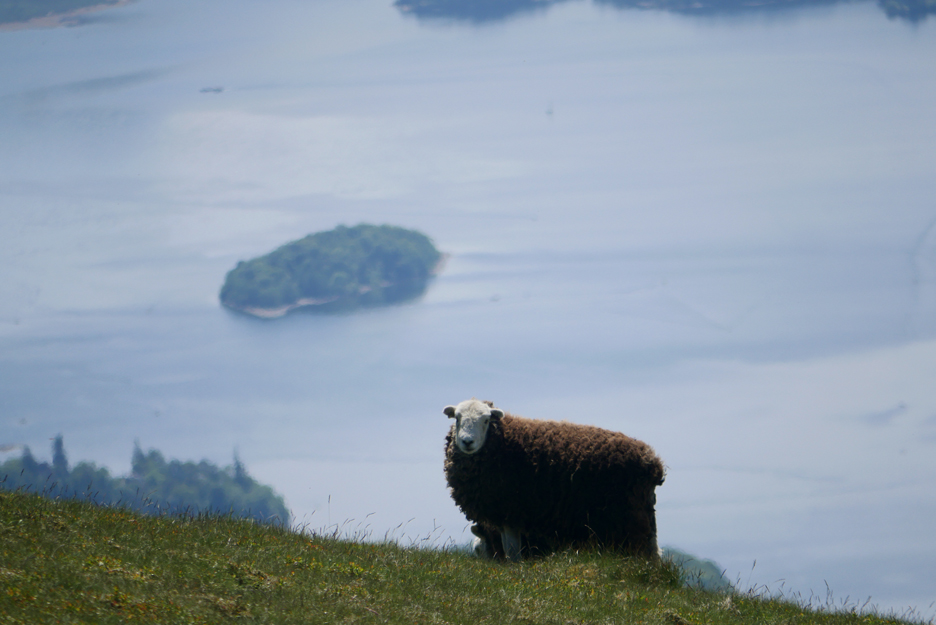
There were sheep up here and these two Herdwicks would make a great foreground for a photo of Derwent Water.
A close up with the bigger lens and the potential for a nice shot . . . if only the two sheep would move apart ? It wasn't to be as suddenly they moved away and out of the line of sight . . . I looked around to find out why.
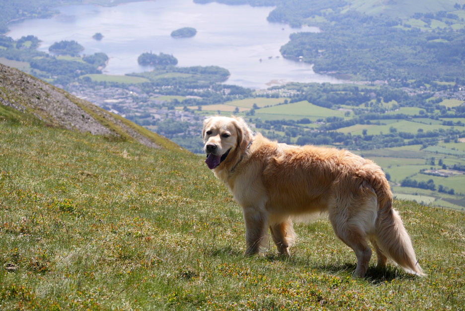
Someone else wanted to be in the picture !!
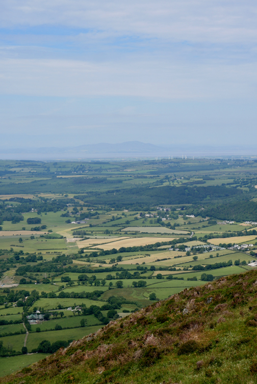
The view south from the top of Skiddaw Little Man. The high fells in the background extend from Bowfell and the Crinkles round to Great Gable with the highest, Scafell Pike, right of centre.
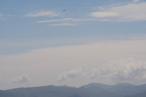
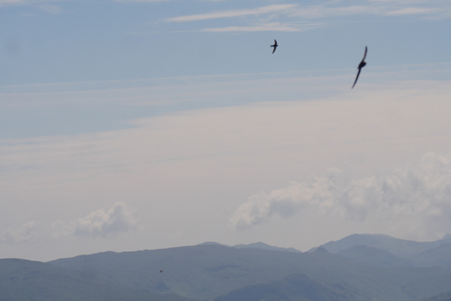
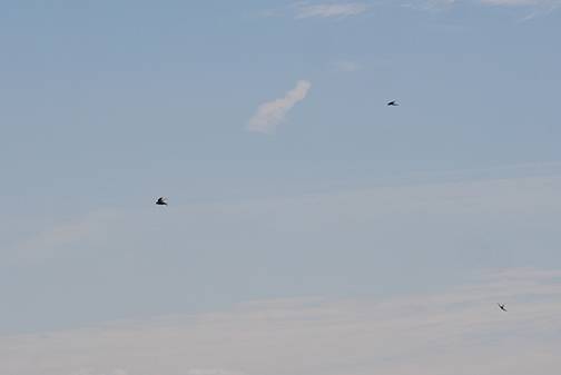
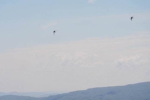
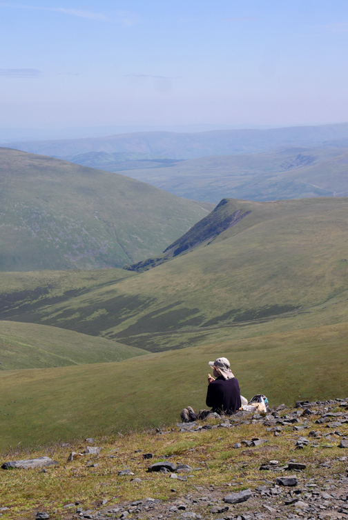
We vacated the summit in preference for this slight rise which would be a better place for lunch. As I prepared the photo for the web site (a few weeks after the walk) I was surprised about the black specs on the photo. Then I remembered that we were surrounded my the most wonderful flying display of Swallows criss-crossing the skies in search of their lunch.
To make up for the lack of landscape in the sky photos, I took this one of Carlside and the Keswick Valley from our lunch spot.
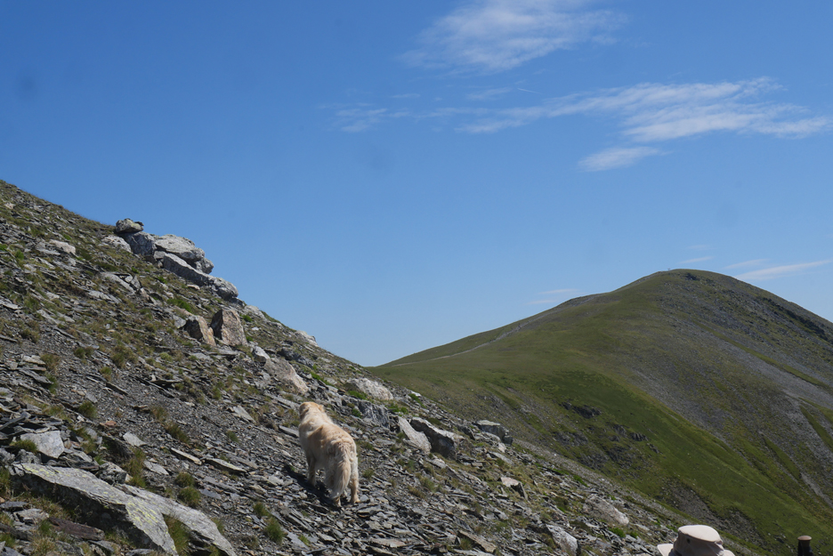
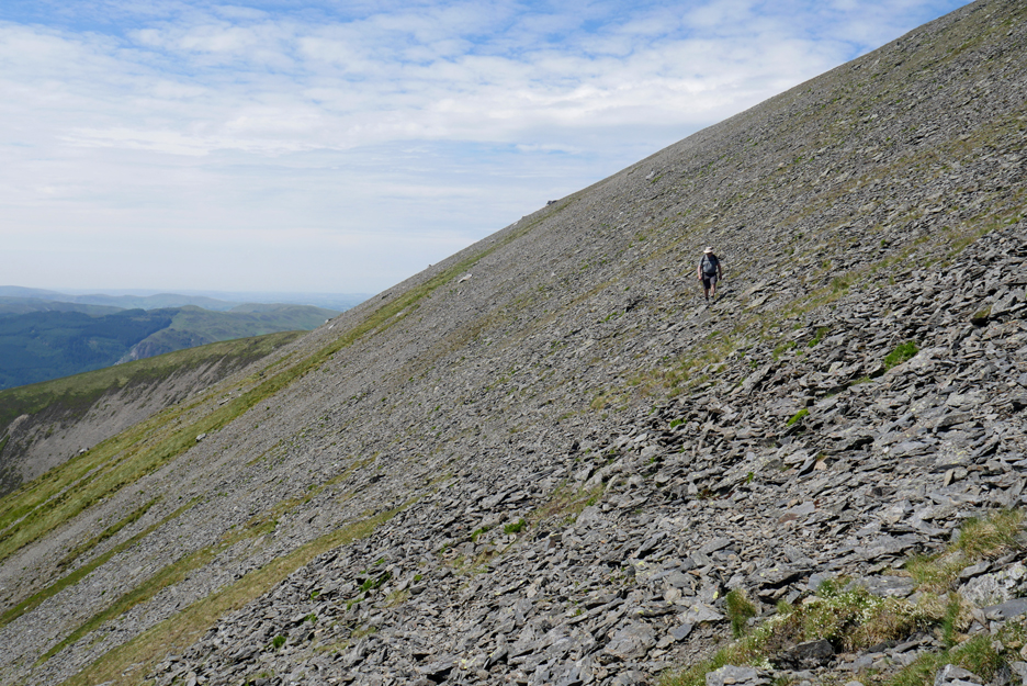
Moving on and it is time to climb the final ascent to the summit ridge.
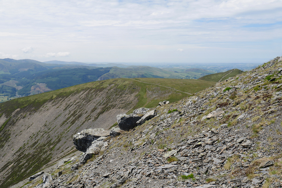
From south top we look down on Ullock Pike and Longside Edge that we climbed earlier. The faint path on the ground here is the one that climbs direct from Carlside below.
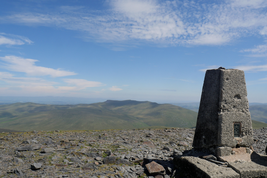
The view south from South Top, the reverse of the George Fisher's webcam located on the roof of the shop where I worked for a number of years.
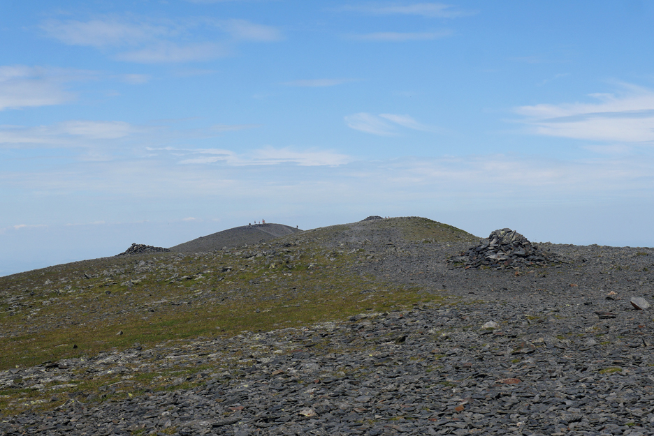
The true summit of Skiddaw is actually hidden from Keswick view as it set back a third of a mile along the ridge. There are several stone shelters along the way before we'll reach the high point where all the people are standing.
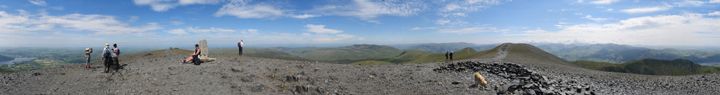
The trigonometric summit of Skiddaw, one of the Lakeland three thousanders, with Blencathra beyond.
On this sunny and very dry summit of Skiddaw it was time to share the last of my water with the dogs ! Martin did offer more if necessary but they were happy for now.
Click here or on the photo above for a 360 degree annotated panorama.
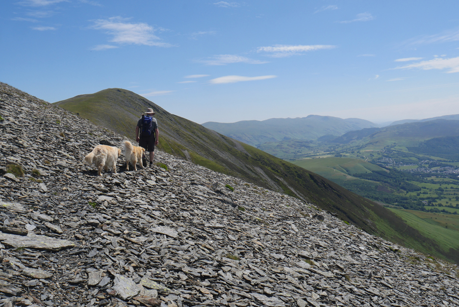
The immediate Skiddaw Massif includes one more named Wainwright summit, that of Bakestall. It would be churlish not to include it on our route back off the fell !
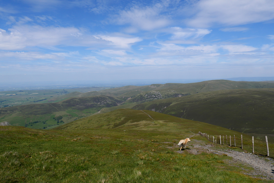
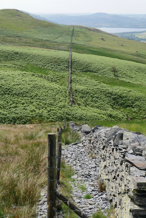
Navigation is easy to start as you just follow the fence soon after the top. Looking over it we enjoy the view of Skiddaw House, England's most remote hostel, tucked inside a enclosure of protective trees.
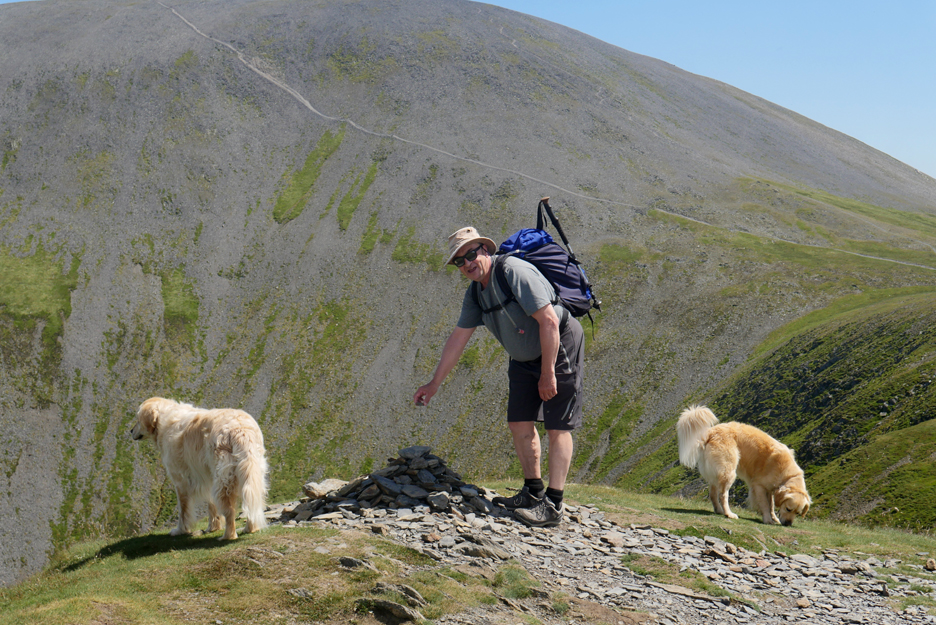
Bakestall with its rough cairn and a small standing stone at the better viewpoint.
All that remains is to gradually traverse around the northern end of the fell and head back to the car ar Ravenstone. Below us is the grassy mound goes by the Viking name of Cockup, not the one Denis Norden visited on his TV Show "It will be all Right on the Night" . . . that was Great Cockup half a mile away, but don't let that spoil a good story . . . we'll visit it anyway.
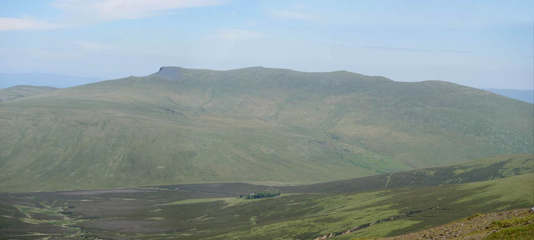
Great Cockup and Brockle Crags across the Dash Beck valley.
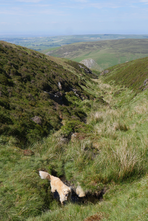
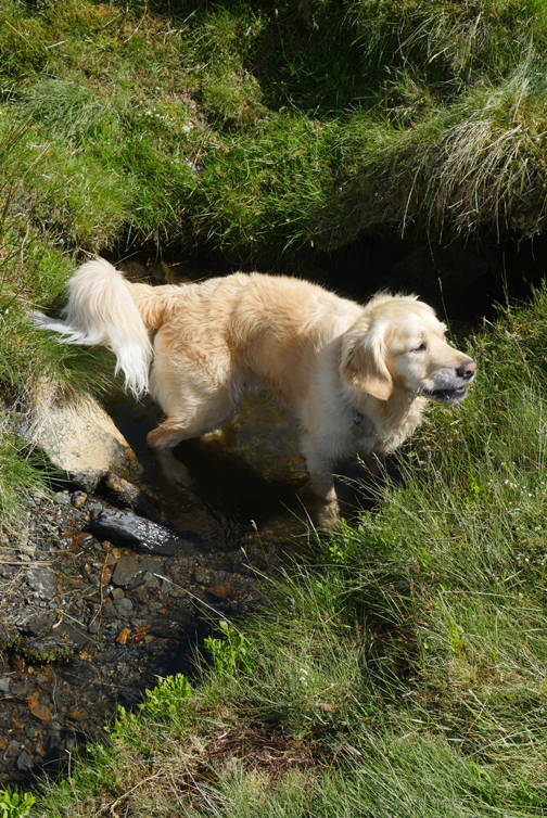
Dead Beck, the name presumably deriving from the same source as the adjacent Dead Crags. There's nothing dead about it, in fact it was the first occurrence of running water we had come across on the walk today, most welcomed by the dogs.
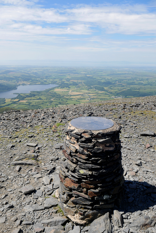
The view down to Peter House Farm and Bassenthwaite Village (extreme left) with Binsey right of centre.
The view across to Bass Lake.
There are no regular footpaths up here so we contoured around avoiding a few damp patches along the way. As a consequence we stayed a little too high . . . but the views were nice !
We really needed to be down there by the wall, so we had a rather tricky descent through the heather and bracken.
Rather than follow the wall directly we aimed off and found a path, the continuation of which you can see in the first photo. That took us over Barkbethdale Beck where we regained views back to Skiddaw.
Give or take the odd boggy section . . .
. . . we made it across to Southerndale and that welcome feeling that we were nearing the end of the walk. Ahead were the low crags of The Watches. It will be just one last short climb over the ridge then it's downhill all the way.
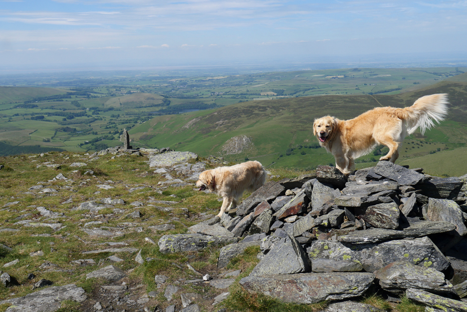
The sheep fold at the Southerndale crossing and a skyline of most of the six fell's we've climbed today.
We've rounded the circle as we rejoin the Ullock Pike path.
Just one foot in front of the other as we make our way slowly down at the end of this long, hot day.
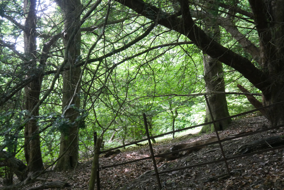
Into the cool of the trees that form part of the old Ravenstone Woodland. No, the photo isn't crooked, the path was a steep one !
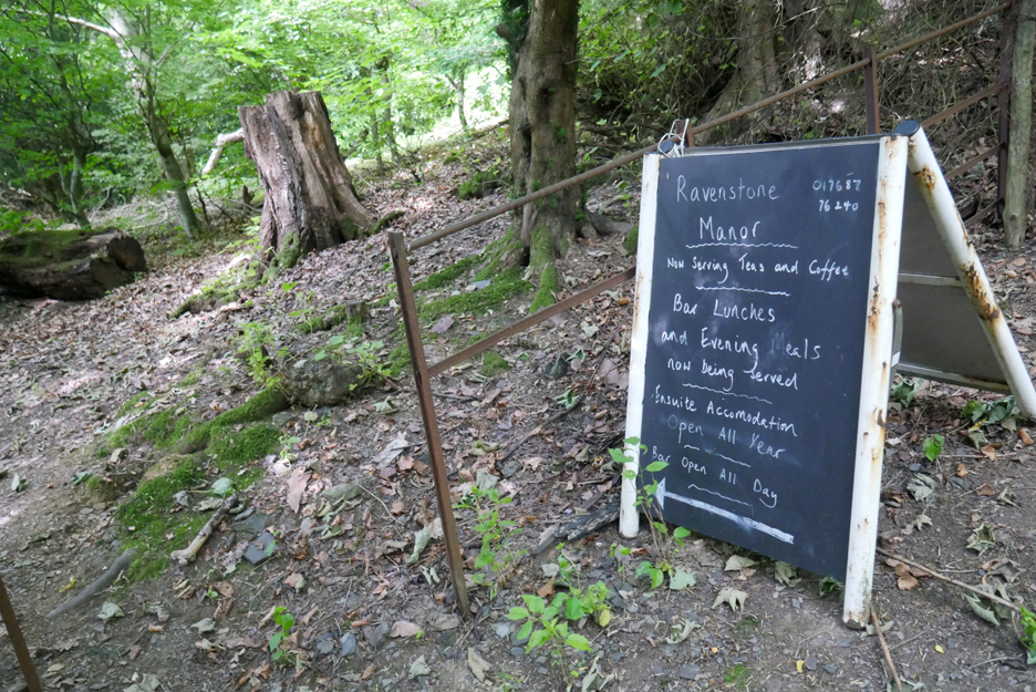
The old "A" board could have been left over from last year . . . but there was a chance it still applied today. It was a very simple decision to divert from the path, through the old gardens . . .
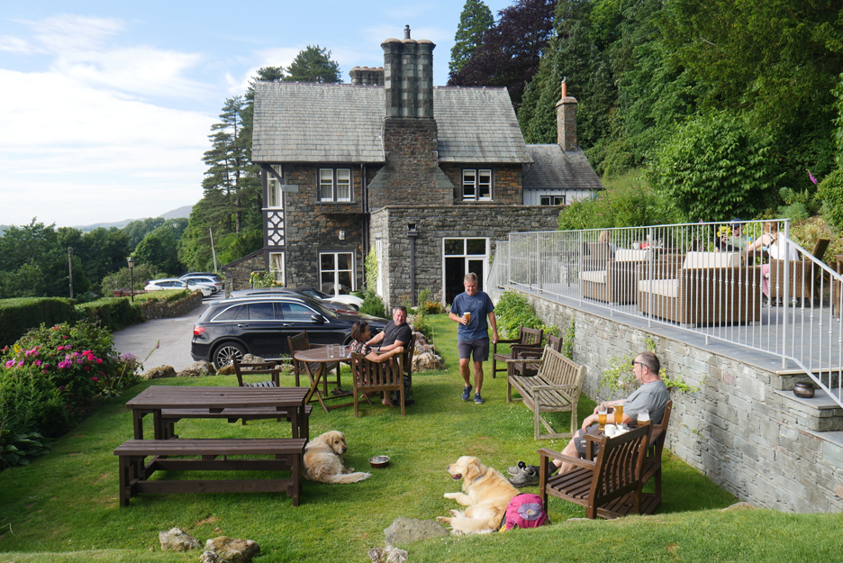
. . . where the hotel came up trumps with suitable refreshments, excellent service, a great view and pleasant conversation with others already in the garden. Having never called in before the hotel was a new delight and a very pleasant surprise, one to re-visit in days to come. ( Martin was so impressed he took his good lady there a few days later and enjoyed a really nice meal in their restaurant.) Now . . . where did we park the car ? - - - o o o - - - |
|
Technical note: Pictures generally taken with either a Panasonic Lumix TZ60 or my Panasonic Lumix Gx8 Camera. Resized in Photoshop, and built up on a Dreamweaver web builder. This site best viewed with . . . a beer, a cup of tea, another cup of tea, and a final squeeze of the pot. Go to Home Page . . . © RmH . . . Email me here Previous walk - 26th June Back Lanes and Mills, Cockermouth A previous time up here - 1st July Skiddaw Fells with Martin Next walk - 3rd July Loweswater's new Flower Meadow
|