![]()
Remember: Press F11 for a full
screen view of this page.
Web Counter when published 1 886 195
|
|
|
|
Remember: Press F11 for a full
screen view of this page. |
Web Counter when published 1 886 195 |
|
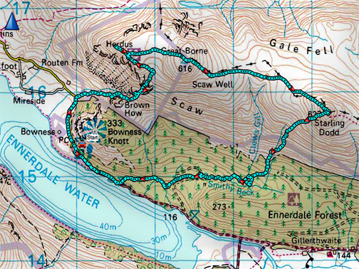
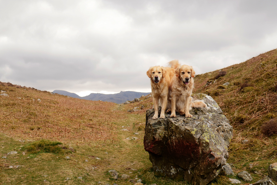
" Great Borne and Starling Dodd " Date & start time: 30th April 2021. 11 am start. Location of Start : Bowness Knott car park, Ennerdale, Cumbria, Uk. ( NY 109 154 ) Places visited : Fox bield, Herdus, Great Borne, Starling Dodd with a Smithy Beck return. Walk details : 6.8 mls, 2350 ft of ascent, 4 hours 30 mins. Highest point : Surprisingly, Starling Dodd by a short head, 2,076ft - 633m . Walked with : Martin and the dogs, Dylan and Dougal. Weather : Sunshine and an almost wintery, squally shower. |
© Crown copyright. All rights reserved. Licence number PU 100034184. |
|
Always a nice walk, this one is circular in nature, has a good climb, a delightful ridge walk and an interesting valley aspect to end. Martin and I step out of our valley and head for Ennerdale, aiming for Bowness Knott, though we'll not be climbing that particular summit today.
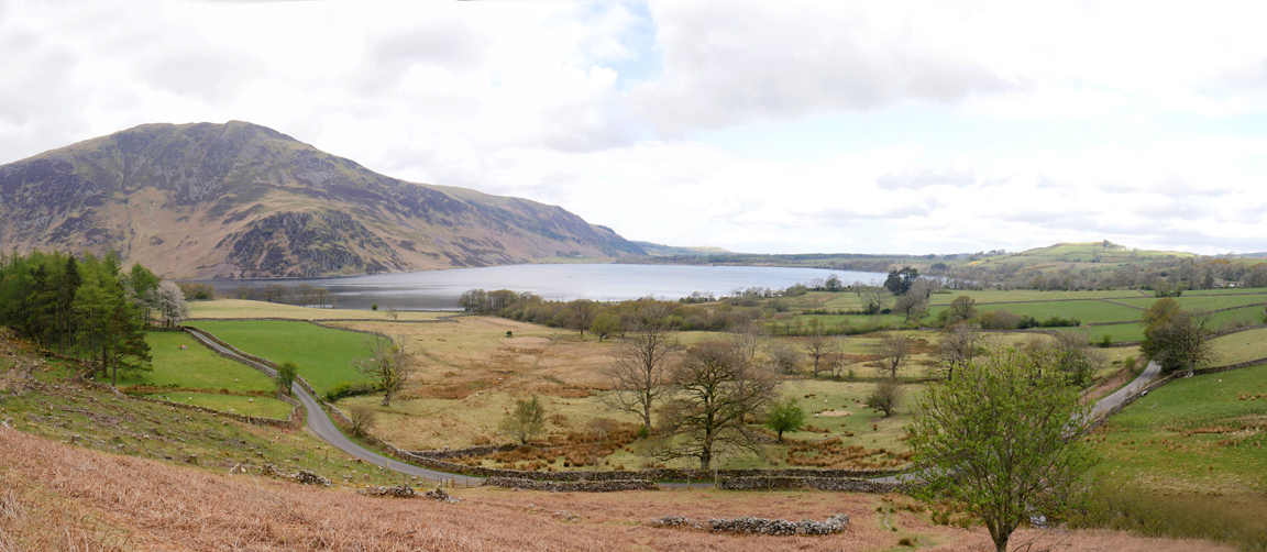
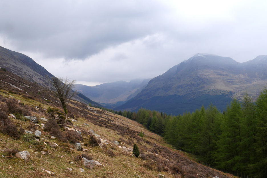
The view into Ennerdale as we round the corner beyond Cauder Brow. Ennerdale Water is visible to the right of Bowness Knott . . . which is where we'll start our walk today. To the left Great Borne summit seems to be just out of cloud and we have a clear view up the valley to Pillar Fell in the distance.
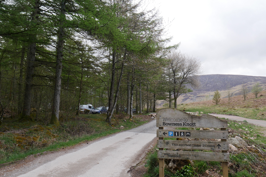
There's plenty of space at the large car park at the end of the road. The track to the right is the gravel road that leads up to Gillerthwaite Outdoor Centre and onwards into the upper valley . . . but the gate is locked !
Martin and I back-track along the road a short distance in order to start our climb of the impressive bulk of Herdus.
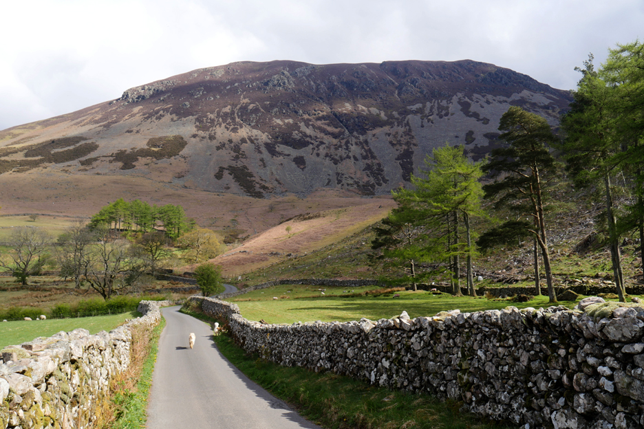
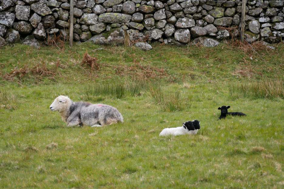
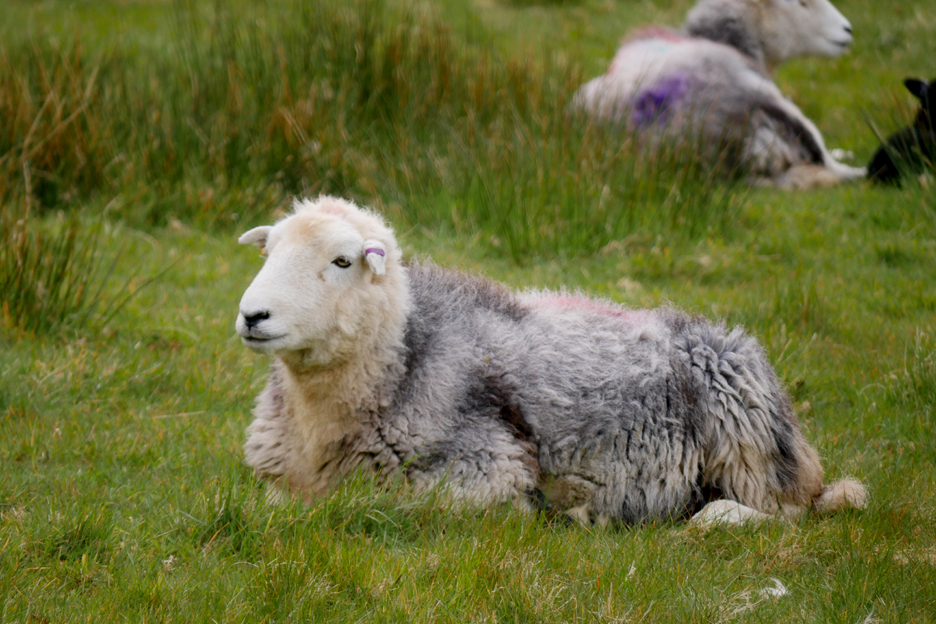
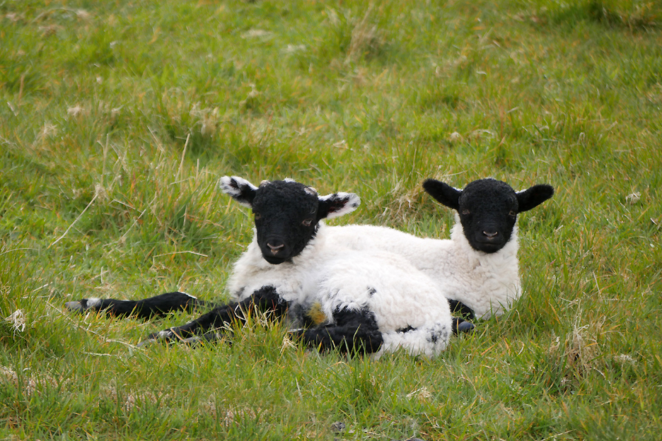
Pastoral calm in the fields alongside the road as the sheep and lambs sit and enjoy the milder weather.
That looks like one experienced Herdwick mum.
These are not her two lambs, they look more like Swaledales.
The path leaves the road to the right of the centre of the picture, where a stile can be found close to the road culvert and stream.
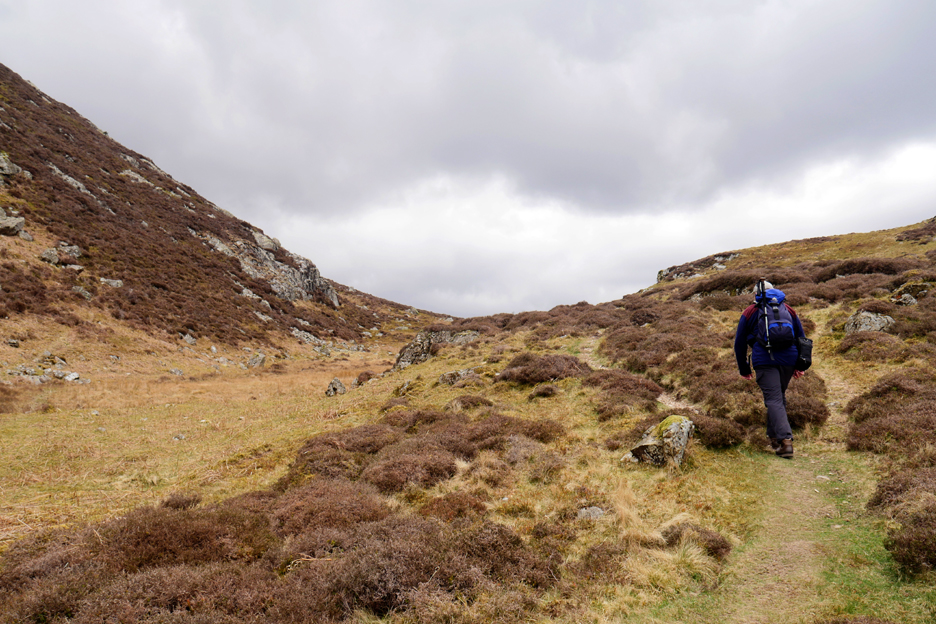
After the gentle warm up walk along the road, we are hopefully ready for the steeper climb ahead. However, each time I do this path it seems to be getting steeper . . . or am I just forgetting how steep it felt last time?
Rock-hoppers . . . on the hause between Bowness Knott and Great Borne. There were several of these large boulders that have obviously rolled down from high on the mountain in a past millennia.
After the seemingly steep walk up from the road . . . the path manages to get even steeper. However you can always stop and admire the improving views up Ennerdale Valley.
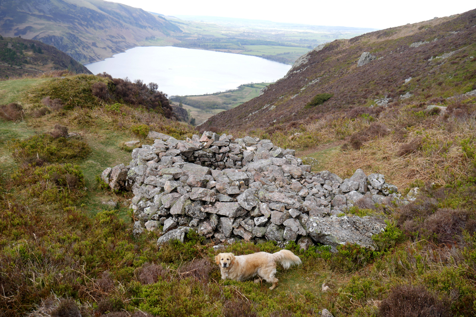
We're following Rake Beck directly upward as it cascades down the fell side along side us. I'm looking for an old walled enclosure but I might have missed it.
It is an old fox trap, or fox bield to use the vernacular. A bait of food was suspended on a plank over the hole and when the fox walked out to reach it, he would overbalance and fall in. The nature of the enclosure implied that he couldn't escape so suffered his demise after one final meal !
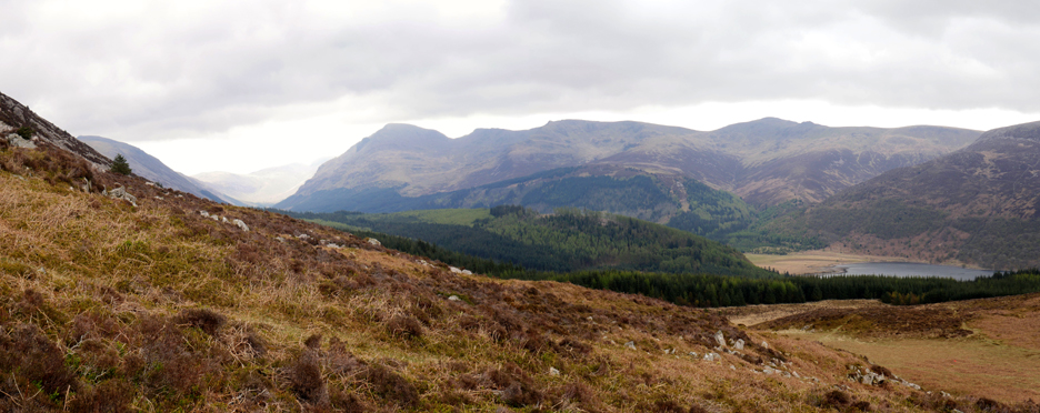
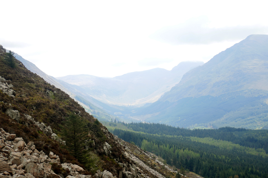
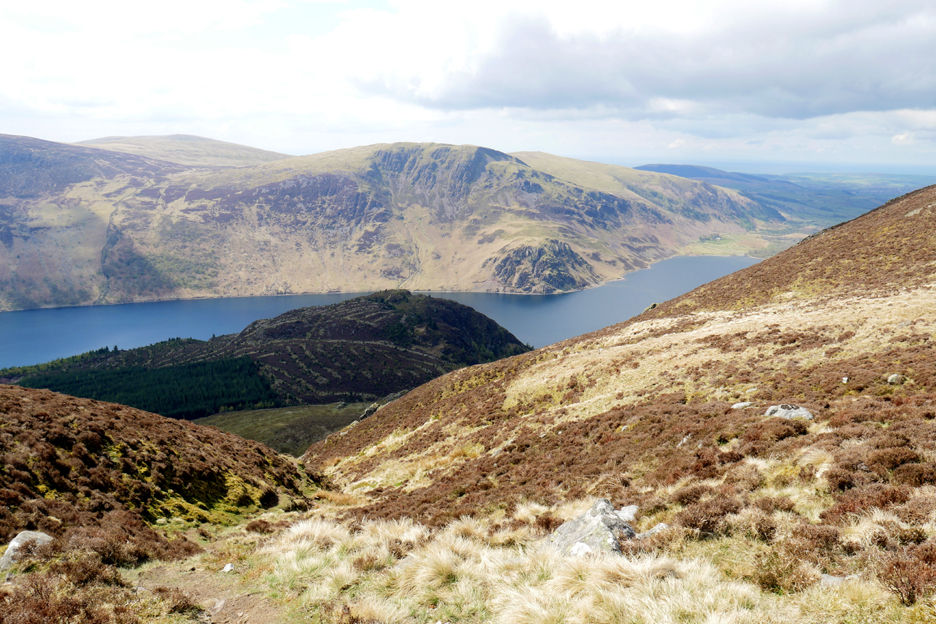
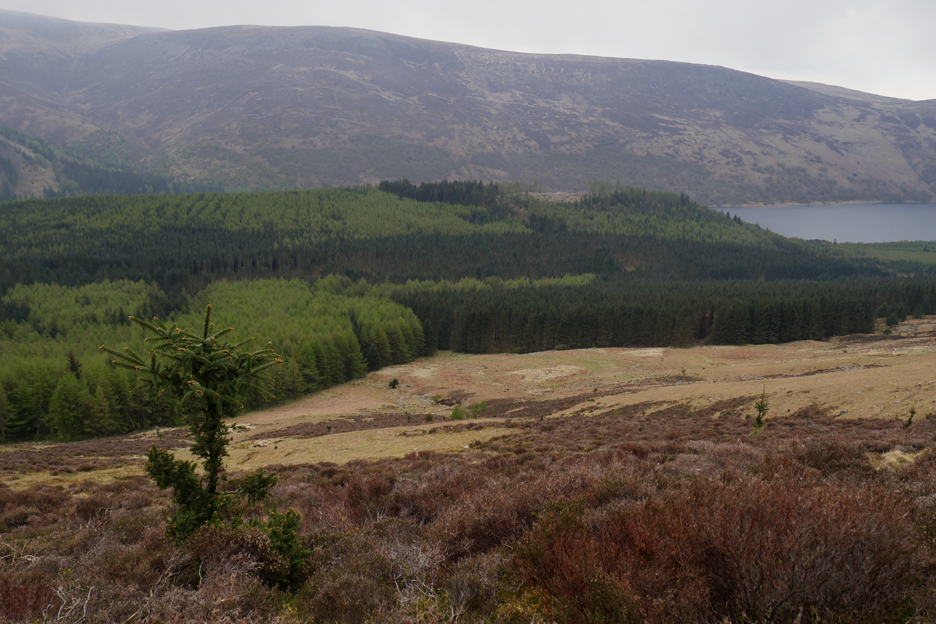
Onward now and we look across to Upper Ennerdale, now clear of the trees of Ennerdale Forest. At the head of the valley are the fells of Brandreth, Green Gable and Great Gable.
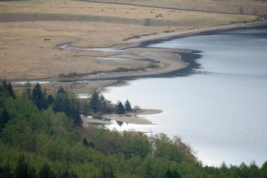
Looking down on the the head of Ennerdale Water. The main valley river, The Liza, enters the lake close to the trees on this side.
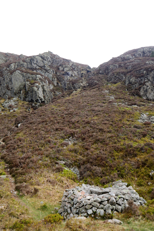
Rake Beck cascades over a rock step so we have to divert away from the stream. Technically it become a scramble as we needed to use hands as well as feet !
Soon afterwards the slopes eases and the climb is more or less complete.
Rather than head straight to Great Borne summit we divert across towards Herdus.
We find a well worn path and headed across to the 562 spot height. There's a convenient cairn which tells us that we had reached the right place.
After the steep climb it is time for a little relaxation and as we felt peckish we stop for a bit to eat. We chose a place close to the edge to appreciate the view out to the west. Afterwards we followed the path you see to the right in order to look down on the valley, but we don't follow it too far as it wasn't heading to we needed to be.
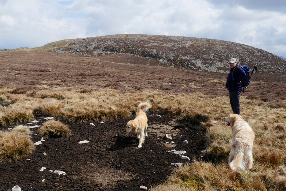
We back-tracked across the flatter top and headed over to the summit of Great Borne. The month of April has been so dry that the boggy ground and peat hags have all dried up.
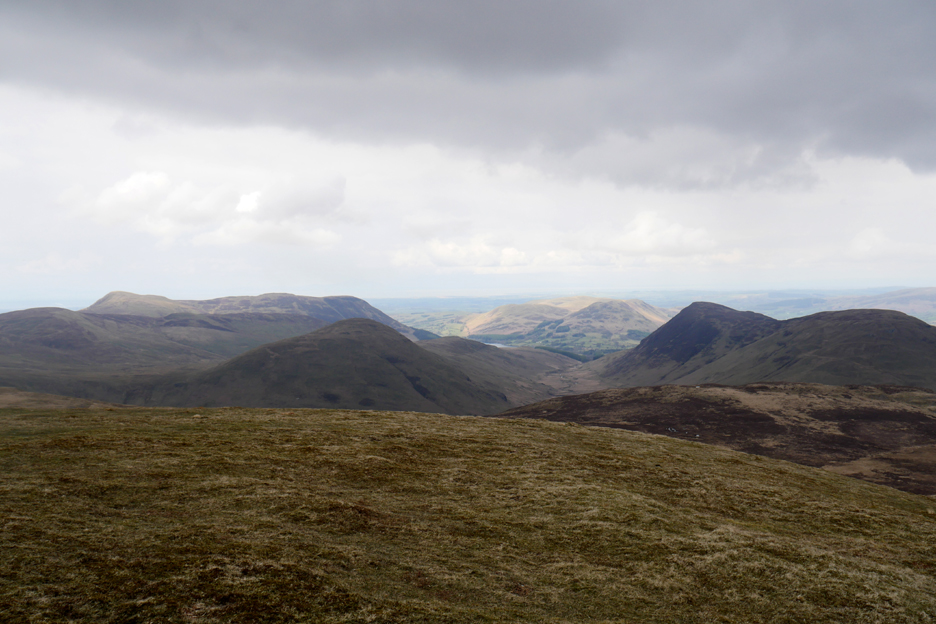
We look to our left as we climbed to the top but everything seems a little dis-organised. I know all the fells but working out which is which is confusing from this very different angle. Tracing the mid line of the picture we identify the darker Floutern Cop, then Hen Comb and Mellbreak, with Whiteside and Grasmoor in the distance.
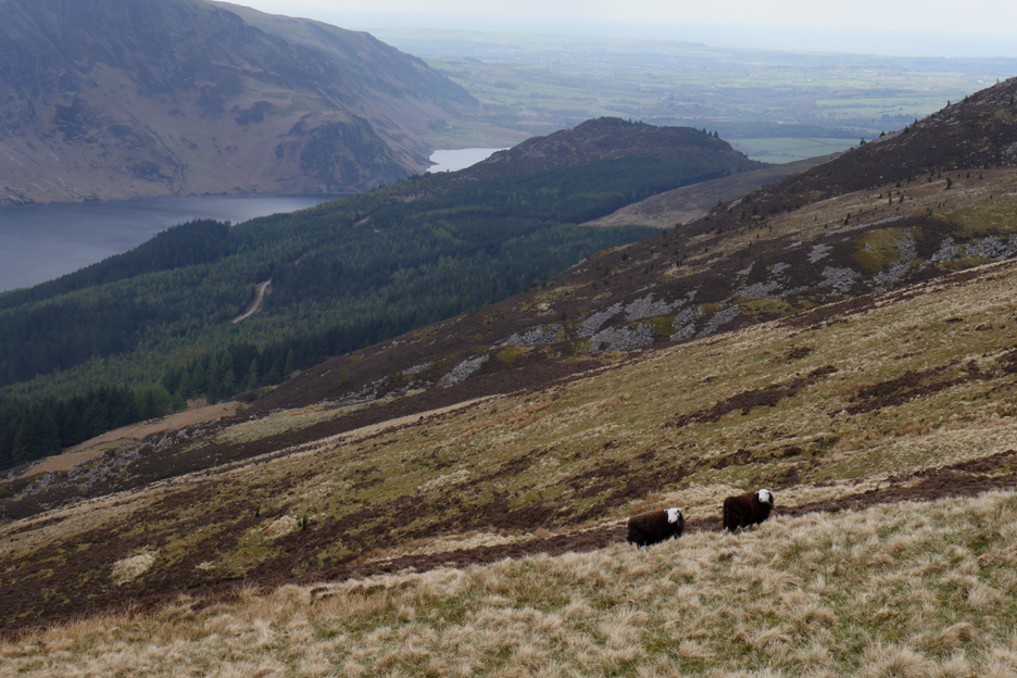
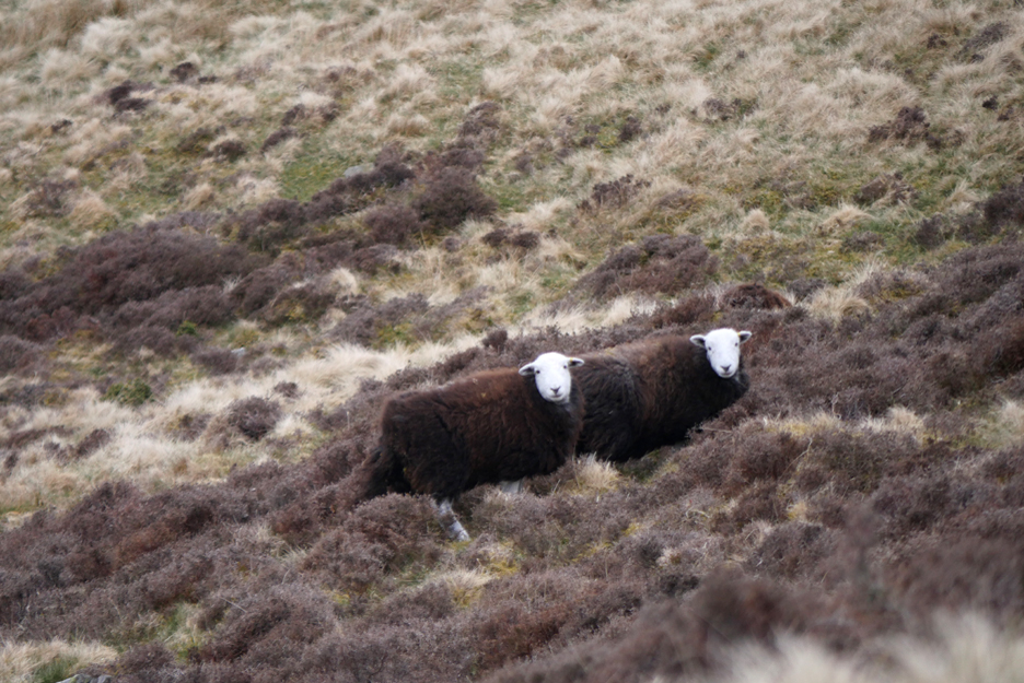
The Swaledale mountain sheep blend in with the rocks as we walk over to the summit of Great Borne.
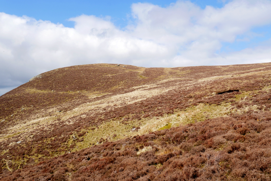
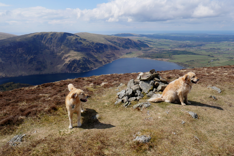
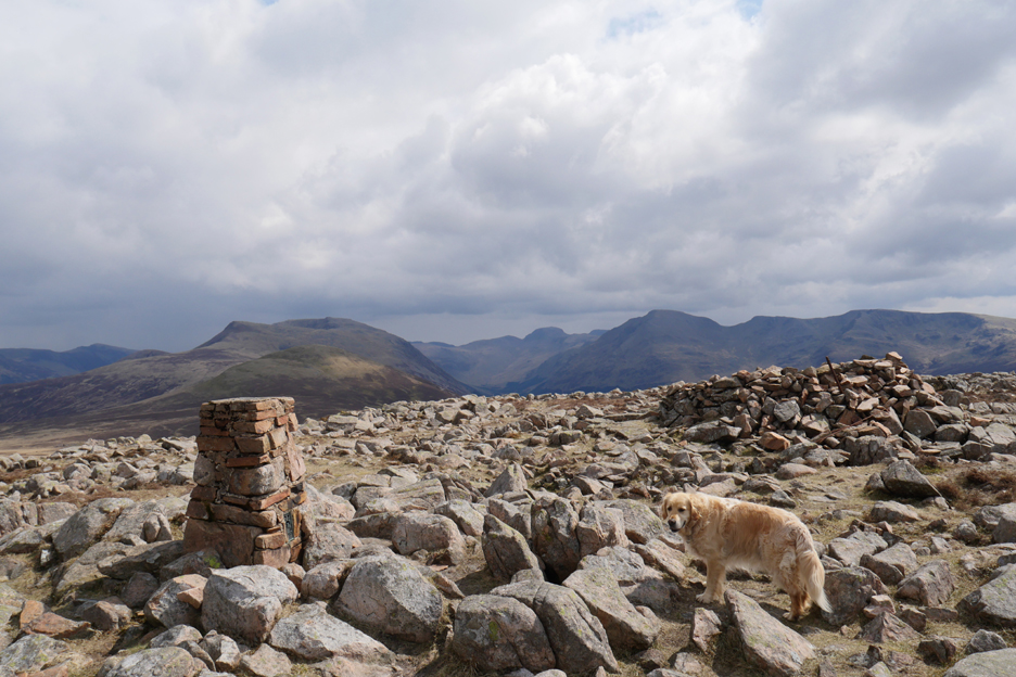
Great Borne is a remarkably rocky summit. The summit is graced with a trig point, a stone shelter and a great view.
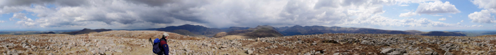
Click here or on the photo above for a 360 degree annotated panorama. There's no trig point in this picture as I was standing next to it.
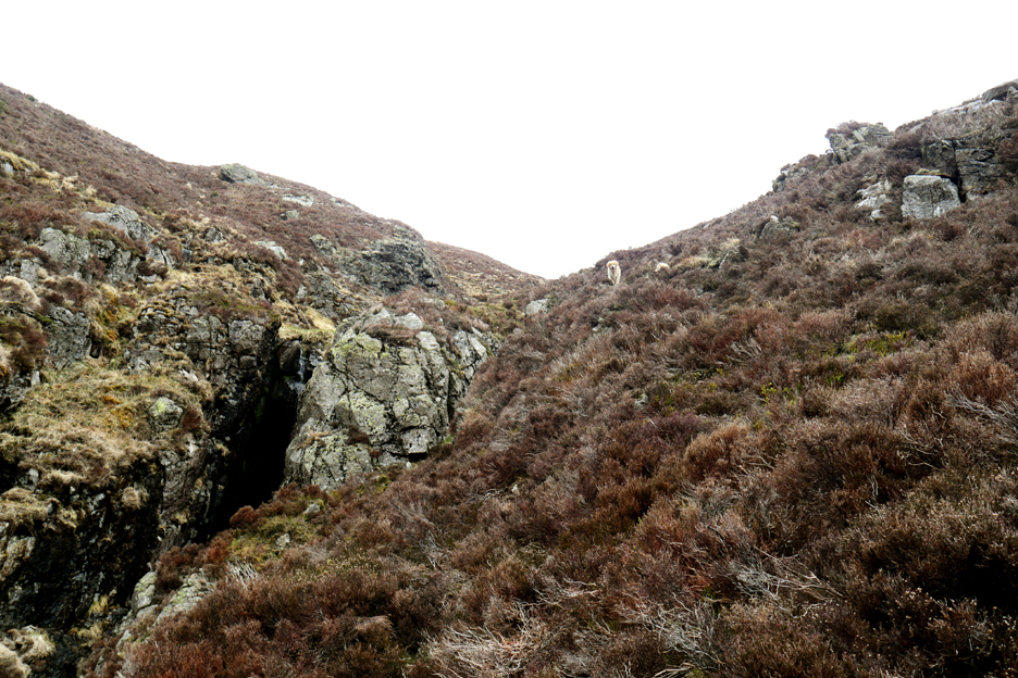
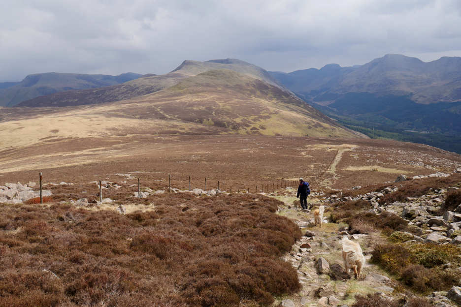
The path continues on along the ridge of this group of fells but our direct route is prevented by the fence which zig-zags across the fell for no apparent reason.
Looking back twenty minutes later . . . Great Borne is now a rocky, rounded top some distance away. We now follow the path which leaves the fence, heading in the general direction of the next summit.
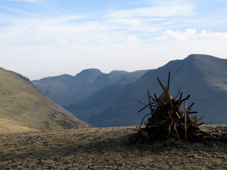
I always remember the summit as having a cairn made up of old fence posts (my photo from 2008).
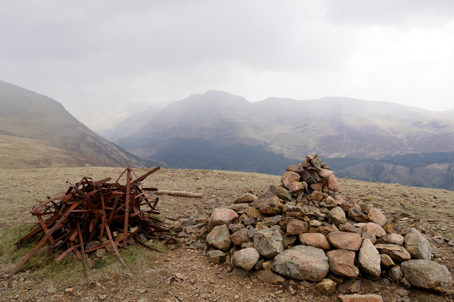
The truth was that it also had a stone cairn alongside . . . we're back to today's pictures as there's no blue sky.
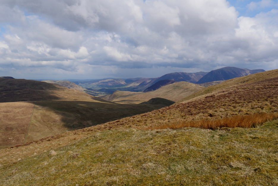
Looking north we are now opposite the head of Mosedale which means Hen Comb is to the left and Mellbreak is to the right of centre.
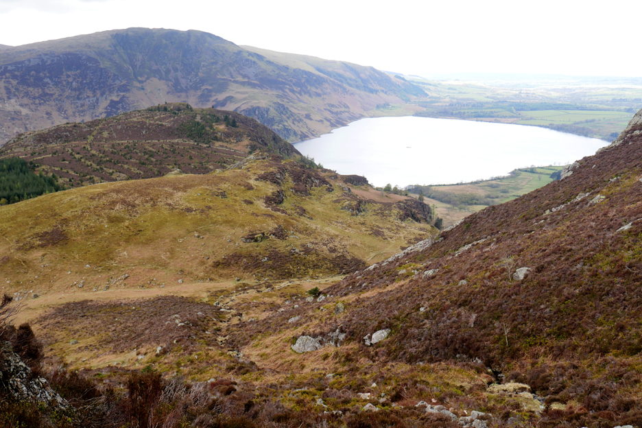
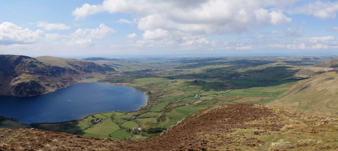
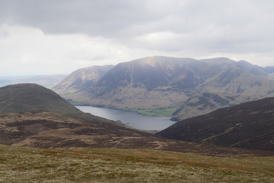
Looking over Gale Fell and the area drained by Scale Beck, the water of which cascades down over the edge to form Scale Force, the highest waterfall in Cumbria.
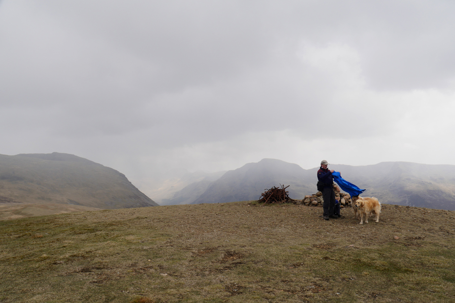
The poorer weather that surrounded us is now getting closer and the wind is increasing. Martin wisely takes his waterproofs out of the rucksack and tries to put it on without it blowing away.
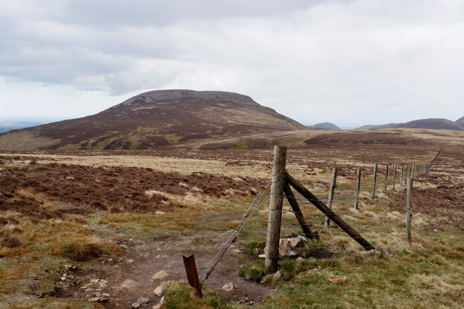
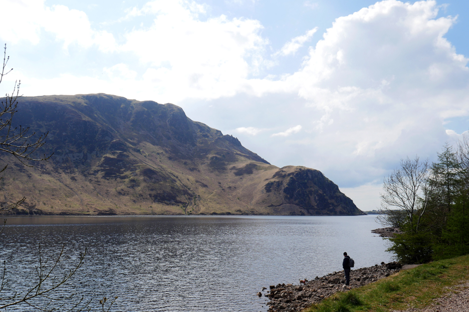
We'll pass on Red Pike, the next summit along the ridge, in favour of dropping back down into Ennerdale.
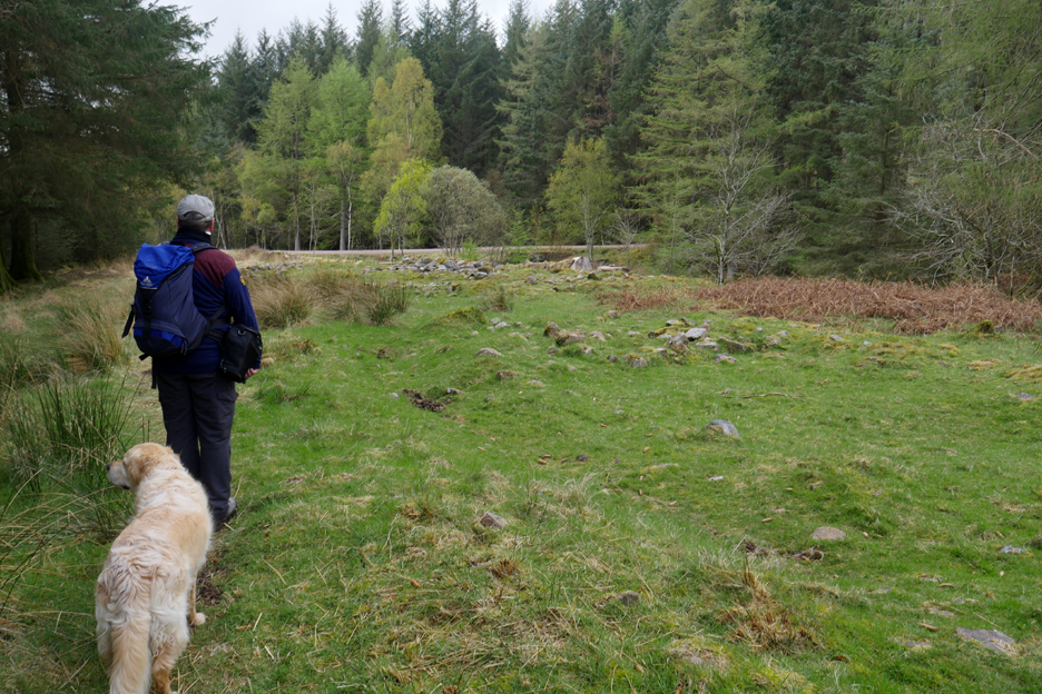
Bowness Knott is ahead but we'll descend close to the sheep and enter the forest below.
" If we suddenly run off your whole navigation will have to be recalculated ! "
We're heading for a path that enters the woods at the apex of the v-shape below. We pass several trees that have grown on the open fell, far away from the main part of the forest, their seeds probably distributed by birds.
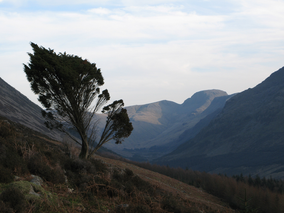
Looking up the valley before we enter the forest . . . that withered looking juniper tree looks familiar.
I photographed it nearly thirteen years ago on a previous visit.
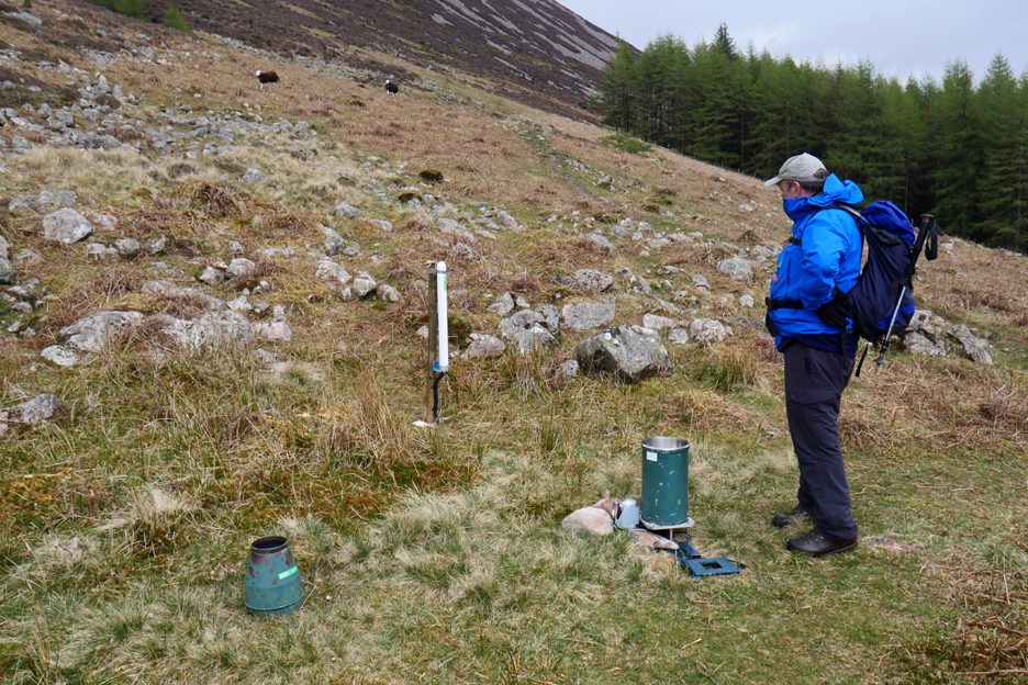
We also found the rain gauge equipment that I had found once before, lower down near to the forest. The white piece of equipment is relatively new, presumably a radio mast for transmitting the weather readings.
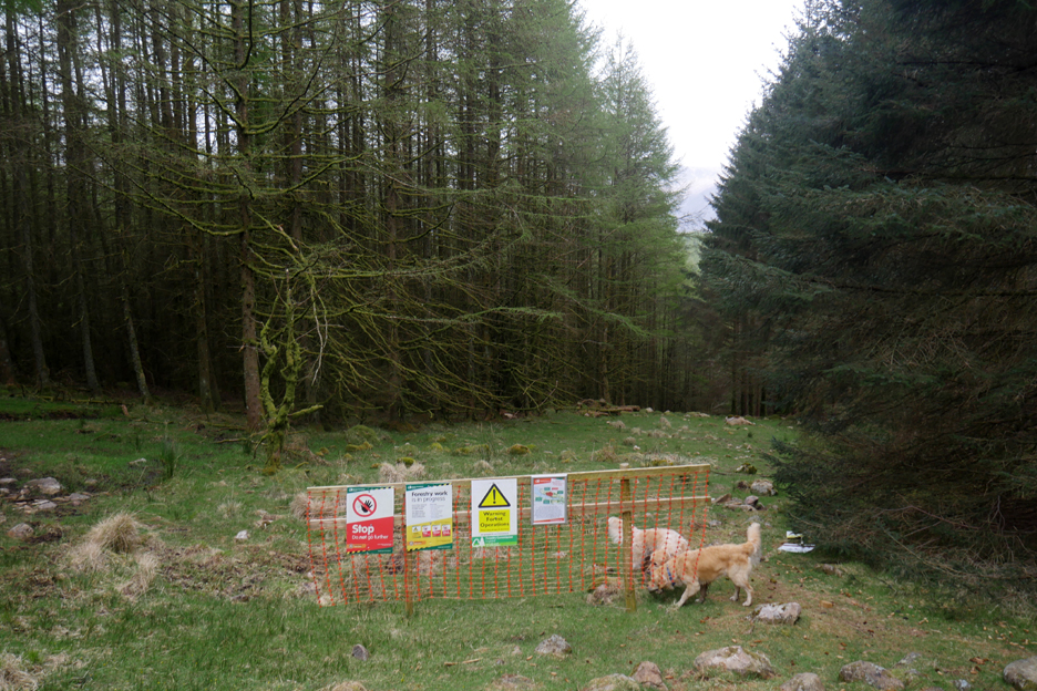
Beyond the fence into the forest we find some extensive woodland graffiti. Someone has gone out of their way to discourage us from walking this way due to forestry work. However there was no forestry activity and the so signs were redundant and therefore suitably ignored !
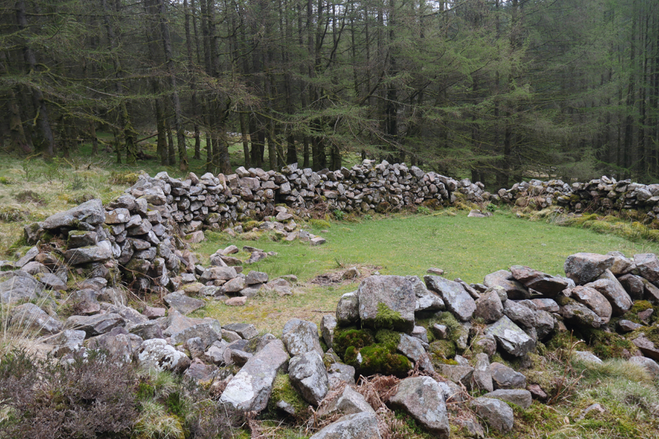
In the woods there appeared to be several old stone structures. This appeared to be an old sheep fold which would pre-date the post-war forest.
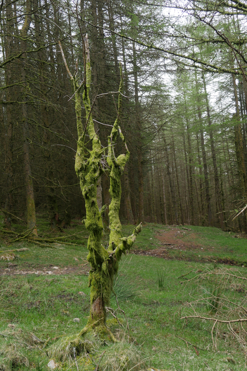
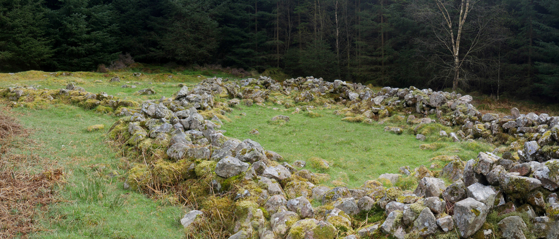
But this stone structure was different. The walls were not as well maintained and also appeared to have two concentric circles of stones. This was the first of several old houses that used to exist in the valley.
I've seen similar ground plans on historic Norwegian peasant homes. They had an inner wall for the home and an outer wall supporting an over hanging roof for the weather protection of animals and fuel.
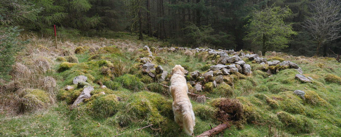
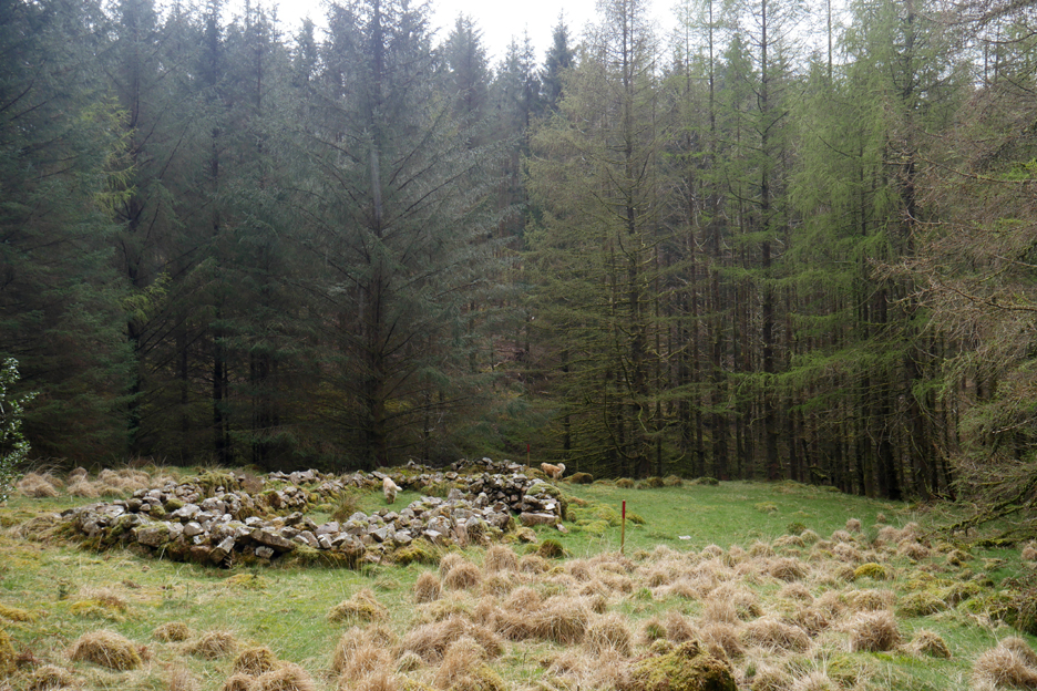
There's evidence of more houses lower down, closer to the forest track.
One last enclosure down by the forest road . . . but this one appears to be an animal enclosure once again.
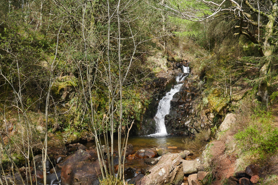
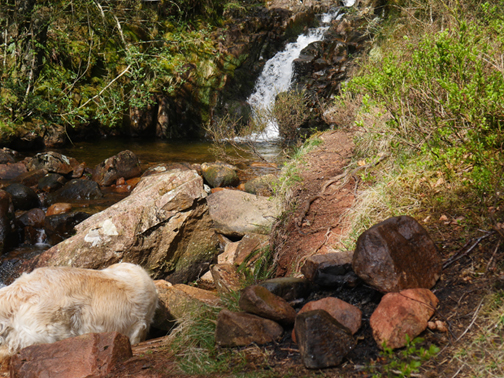
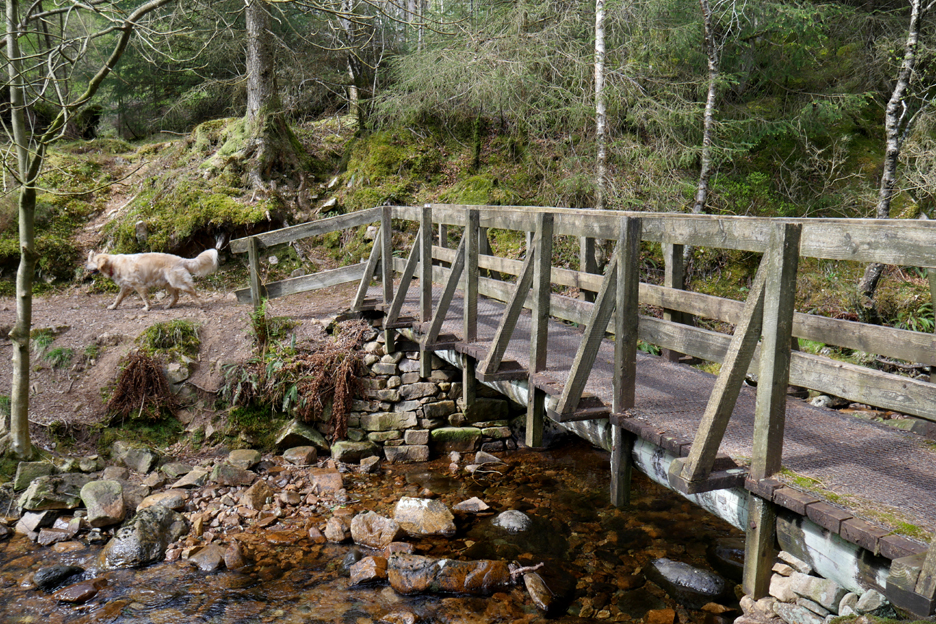
Smithy Beck drains to eastern slopes of Bowness Knott and there's a delightful, small waterfall alongside the path that takes it's name . . . the Smithy Beck Trail.
Dylan crossed over the bridge that spans Smithy Beck.
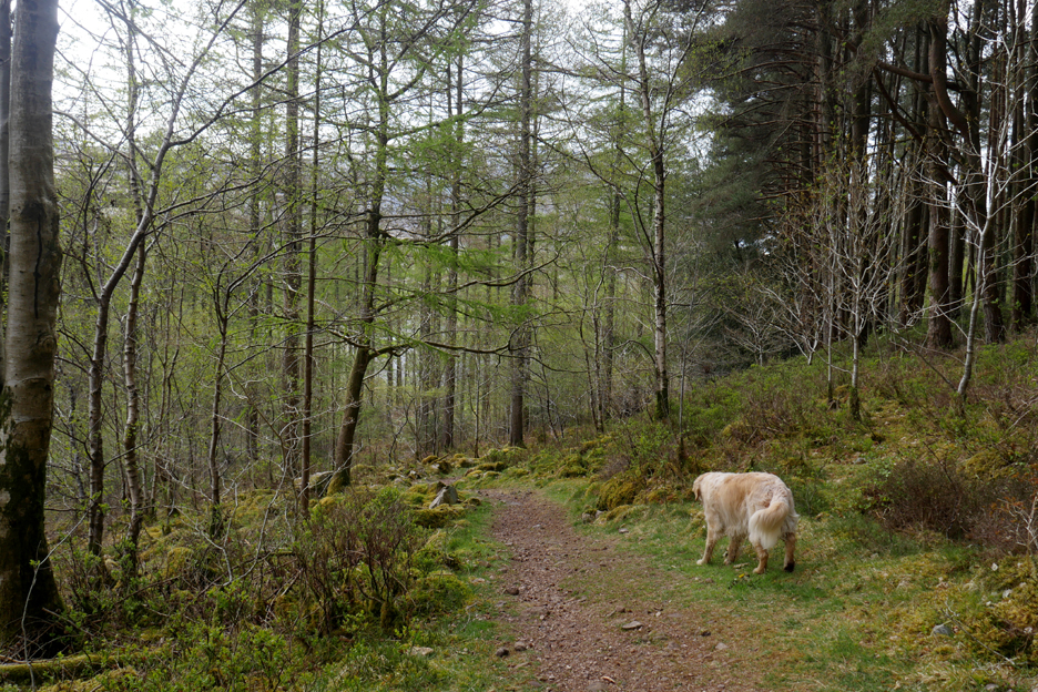
The trail takes us on a lovely path through the woods.
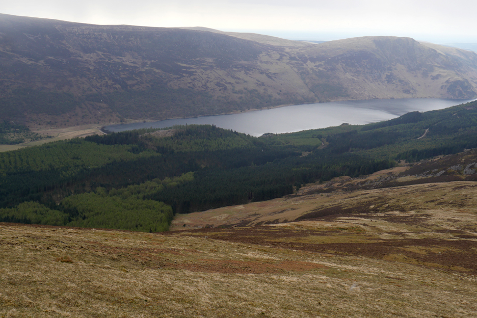
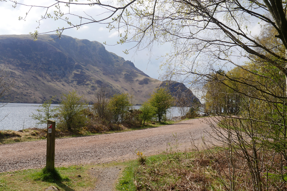
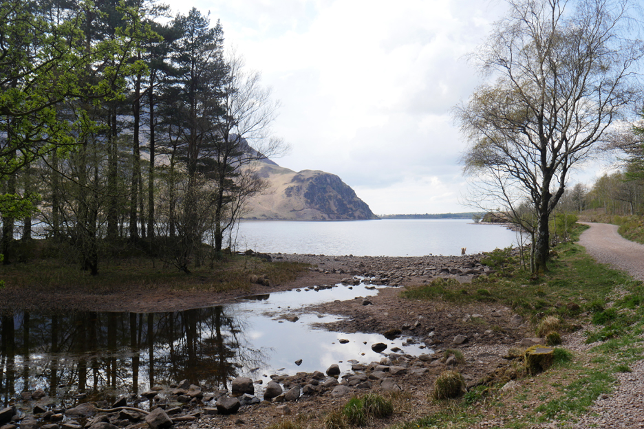
It emerges from the forest close to the lake and we join the lakeshore track for the walk back to the car.
Just the last half mile of the lakeshore track left to walk. Here we look back towards Pillar Fell. The outline of Steeple, the triangular peak, is shown to greatest effect from this viewpoint.
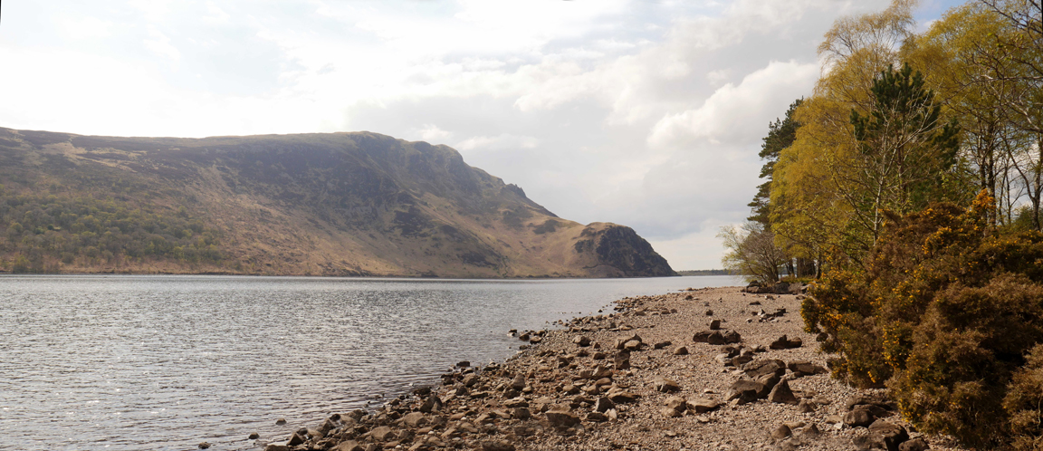
The low April rainfall has resulted in correspondingly low water levels in the lake, so there's a broad shoreline on view today.
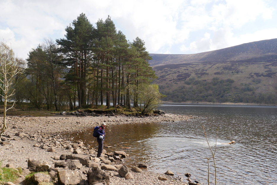
The low water level next to the small peninsular with the picnic tables results in the creation of a causeway between it and the shore.
However there's still enough water for Dougal to go swimming for sticks that Martin has thrown.
Crag Fell and Anglers Crag with the pinnacle rocks standing out on the skyline between the two.
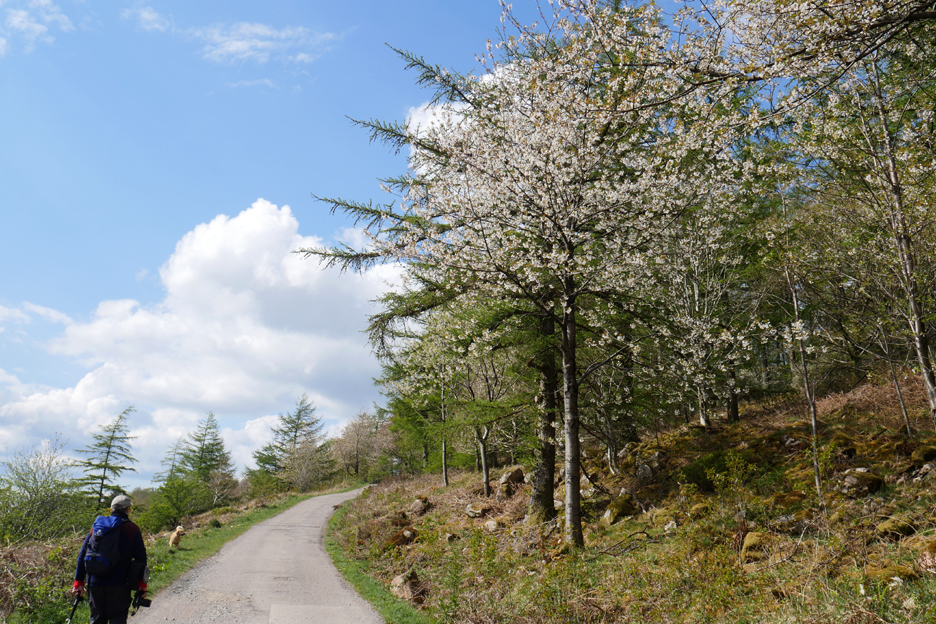
The final slightly tiring climb back to the car park is cheered by a grove of cherry trees in full bloom.
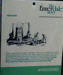
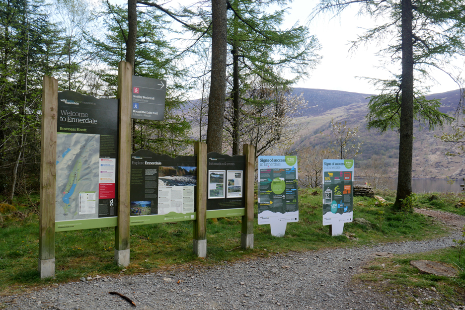
Everything you ever wanted to know is written out on the information boards for "Wild Ennerdale" back at the car park. Time now for a short drive down the valley for a cup of tea and some cake at The Gather in Ennerdale Bridge before returning home. - - - o o o - - -
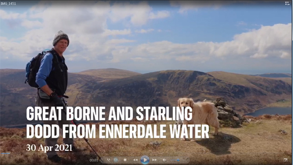
Martin was taking photos too of course and he offered me his view of the day. Click here or on the photo to play Martin's sideshow - - - o o o - - - Further reading about the the old buildings we found can be seen here - - - o o o - - - |
|
Technical note: Pictures generally taken with either a Panasonic Lumix TZ60 or my Panasonic Lumix Gx8 Camera. Resized in Photoshop, and built up on a Dreamweaver web builder. This site best viewed with . . . more information than is available nowadays. Go to Home Page . . . © RmH . . . Email me here Previous walk - Last Week in April - Local walks and Visitors A previous time up here - 9th Feb 2008 Sunshine on Great Borne, Ennerdale Next walk - 5th May 2021 - Round Crummock with Jane Next walk - 15th May - Up and Over Mellbreak
|