![]()
Remember: Press F11 for a full
screen view of this page.
Web Counter when published 1 882 170
|
|
|
|
Remember: Press F11 for a full
screen view of this page. |
Web Counter when published 1 882 170 |
|
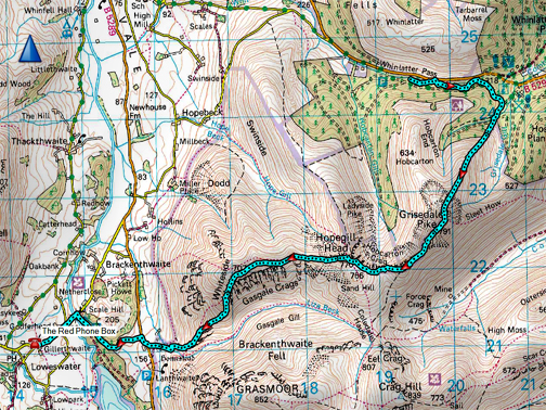
" Grisedale and Hopegill Head " Date & start time: Friday 9th April 2021. 11.15 am start. Location of Start : Near the Swinside Houses, Whinlatter, Cumbria, Uk. ( NY 192 145) Places visited : Grisedale Pike, Hopegill Head, Whiteside and home, a linear walk today. Walk details : 8 mls, 2612 ft of ascent, 3245 ft of descent, 4 hours 45 mins. Highest point : Grisedale Pike, 2593 ft - 791m. Walked with : Cathy, Mark and the dogs, Dylan and Dougal. Weather : Perfect sunshine and blue skies, cool in the breeze at times. |
© Crown copyright. All rights reserved. Licence number PU 100034184. |
|
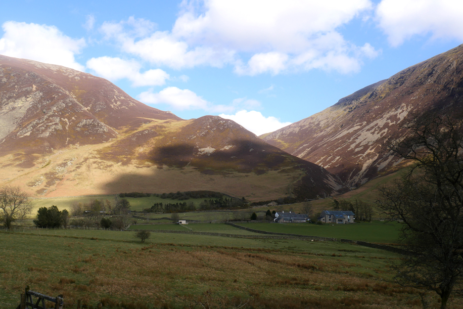
My eldest daughter Cathy and partner Mark are here and are able to enjoy the continuing sunshine that the Lakes has on offer this Easter. Like her sisters, she also wants to strike out and climb some high fells, so we drive to Whinlatter and then walk back on a linear route to home.
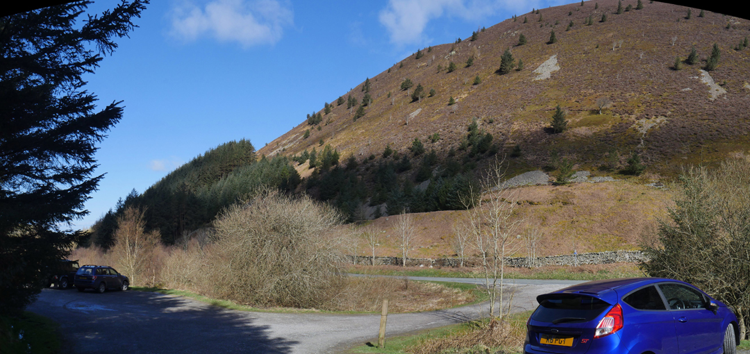
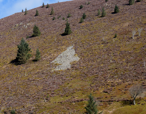
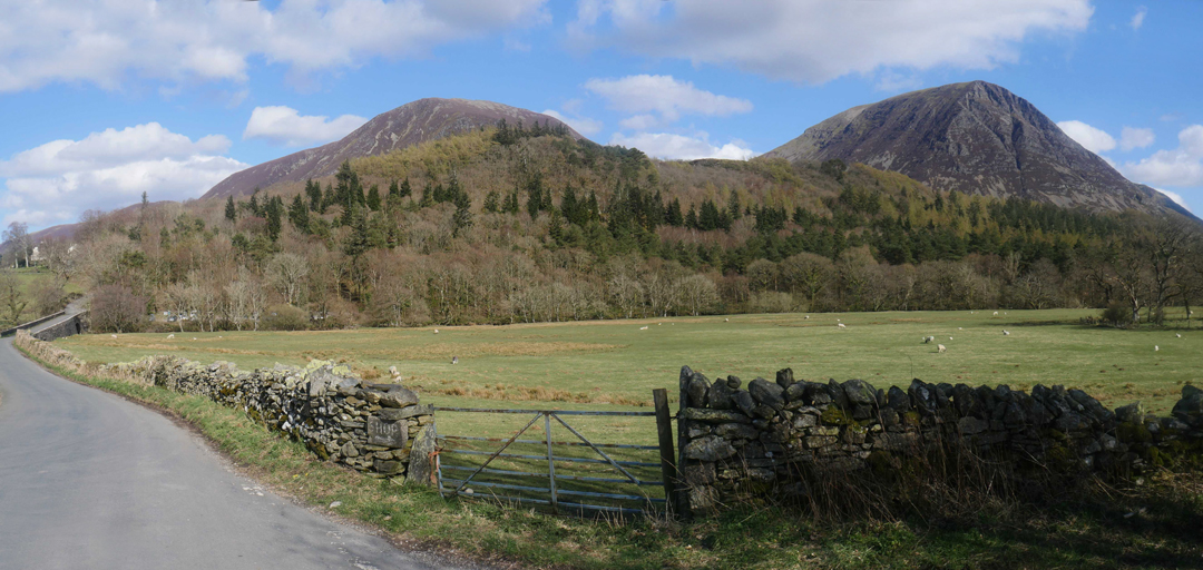
We start at the parking area just up from the Swinside Cottages (down from Whinlatter Centre) which has space for quite a number of cars. On the Whinlatter Fell opposite the Ordnance Survey have left a tree symbol to represent the forest.
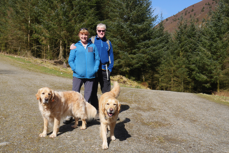
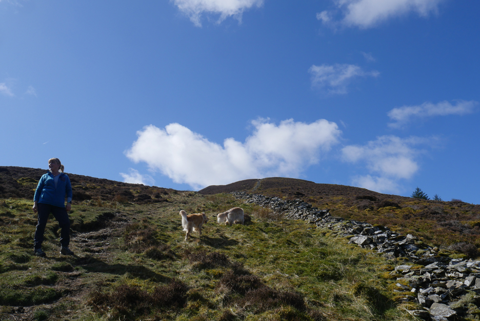
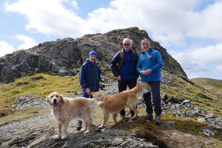
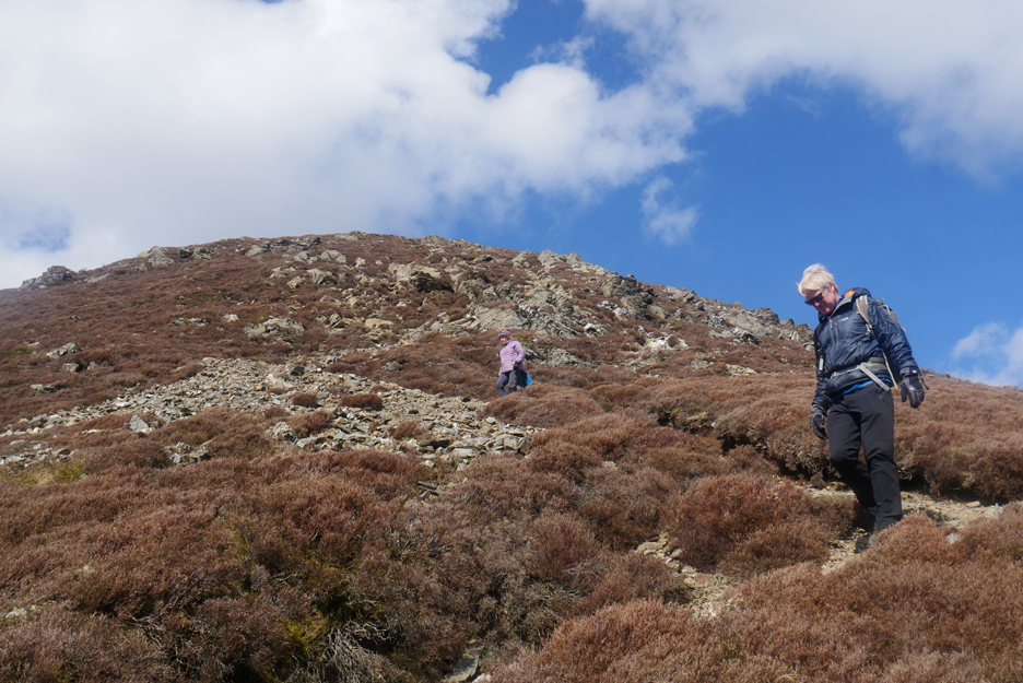
Today's walking party soon after the start.
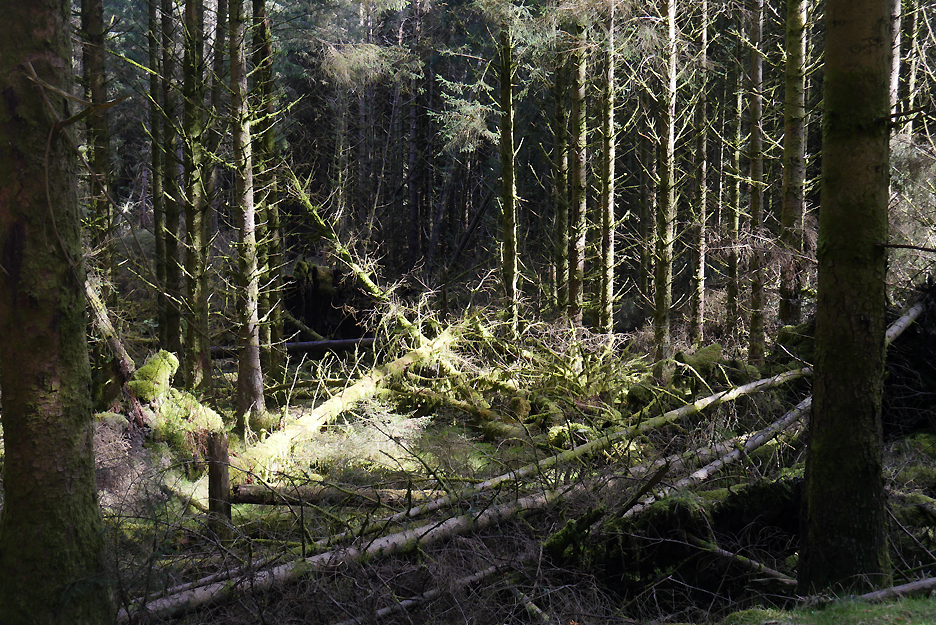
We starts along the forest track, passing several areas of storm damaged trees.
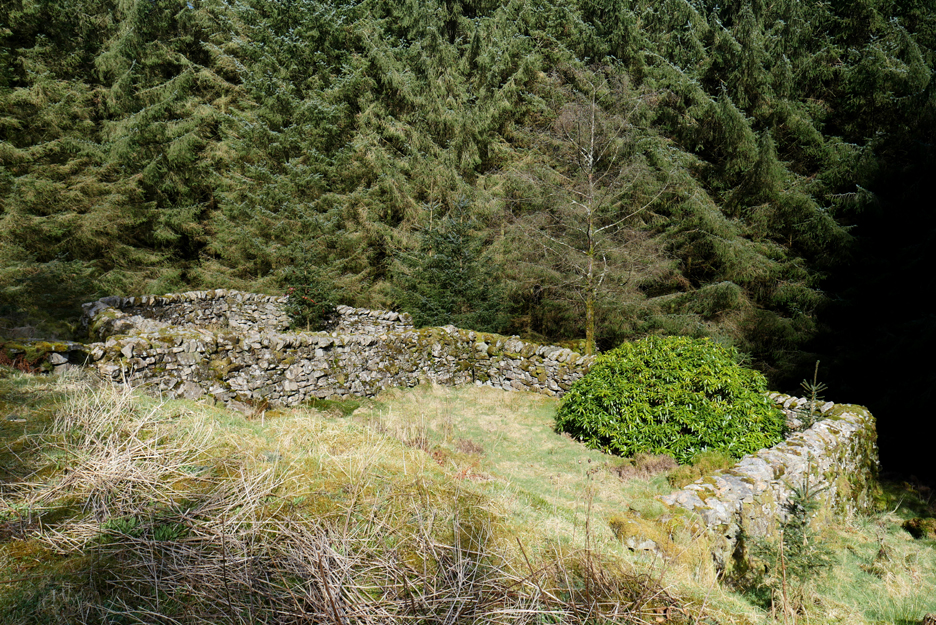
The track also passes an old sheepfold that pre-dates the planting of the forest. In there is a large rhododendron bush, origin unknown.
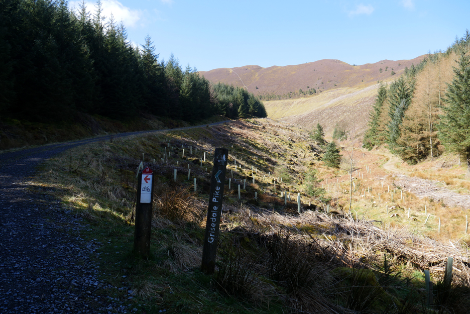
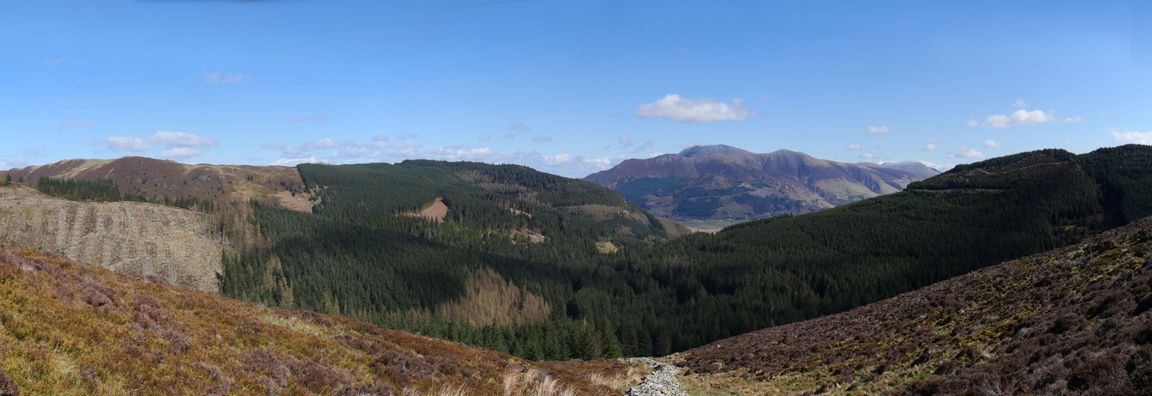
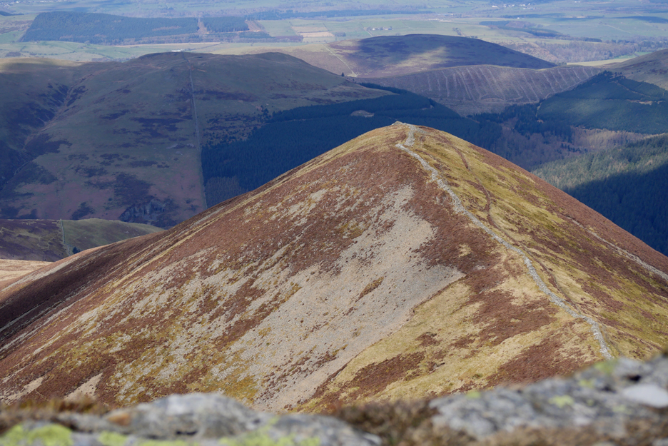
Cleared forestry since my last visit makes finding the path to Grisedale Pike so much easier than I remember.
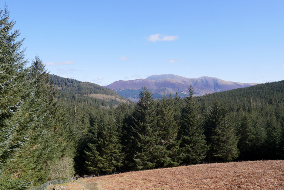
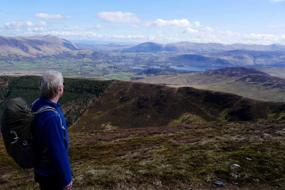
Climbing up out of the trees and we get our first view of Skiddaw.
This is the start of a steady, straight climb up alongside an old wall, direct to the top. Navigation is easy, even when you haven't got good weather like today !
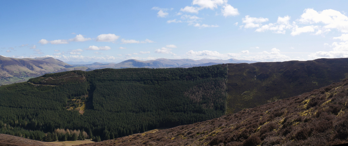
As we climb the view widens to include the Whinlatter fells and a lot more forestry.
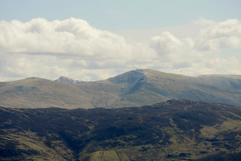
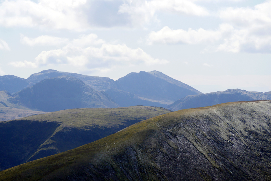
To our left the Helvellyn Ridge can be seen over the Hospital Plantation.
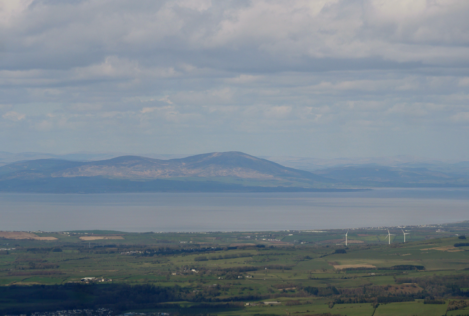
The views are so clear today that Mark can see the detail on distant Mell Fell and the Pennines through the Greta Gap behind Keswick.
The easy way to identify Helvellyn is to look for the triangular peak of Catstycam to its left. It is the landmark that stands out as different from the other, more rounded fells on the rest of the ridgeway.
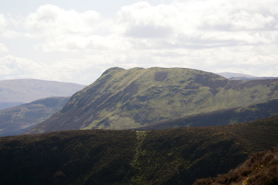
Another distinctive fell is Causey Pike, recognisable by its summit corrugations.
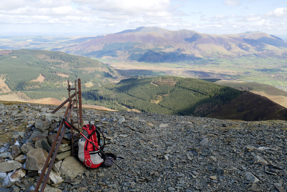
Officially above the snow line . . . ground frost shielded from the southern sunshine by the dip in the path.
Near the top, the final climb is noteable by a change to more barren rock and gravel paths. Again the northern slope is hanging onto the residual snow / hail of recent weeks.
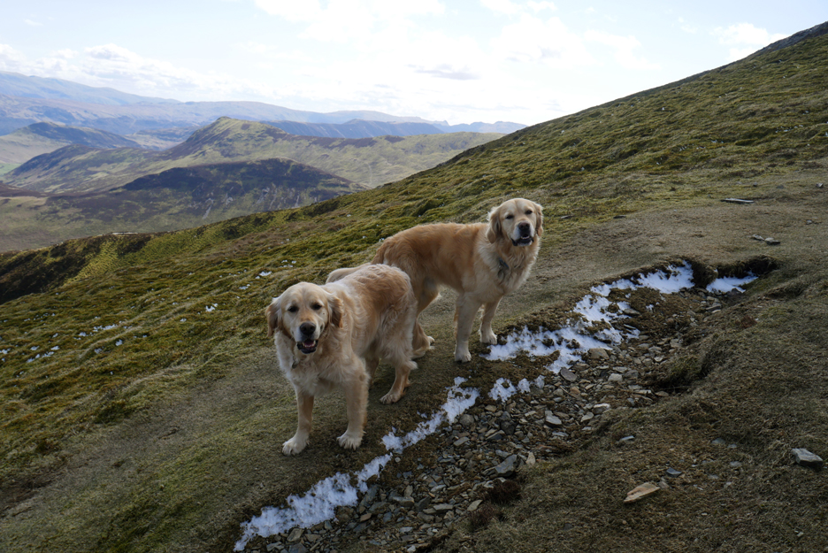
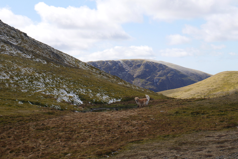
Dougal finds a watering hole even though he's never been here before.
That tiniest of tarns is a landmark that leads you onto the Hobcarton Ridge should you wish to make the walk into a shorter round trip from Whinlatter. Half way down that path is the 'Magic Tree', a conifer that traditionally has Christmas decorations all year round.
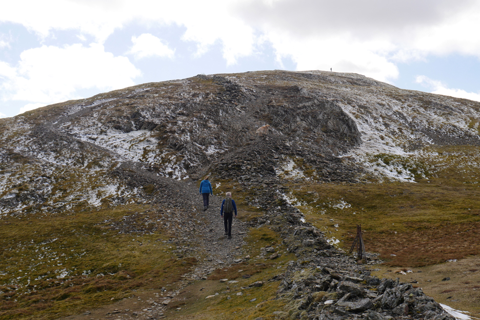
Just short of the top, the old wall and fence line takes a right turn . . . which means we are almost there.
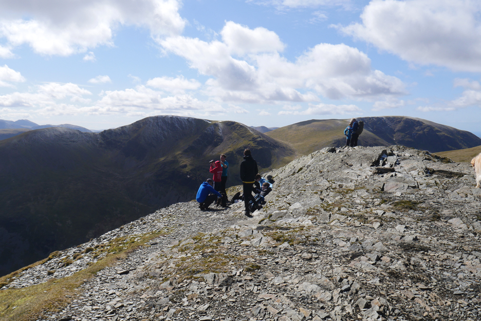
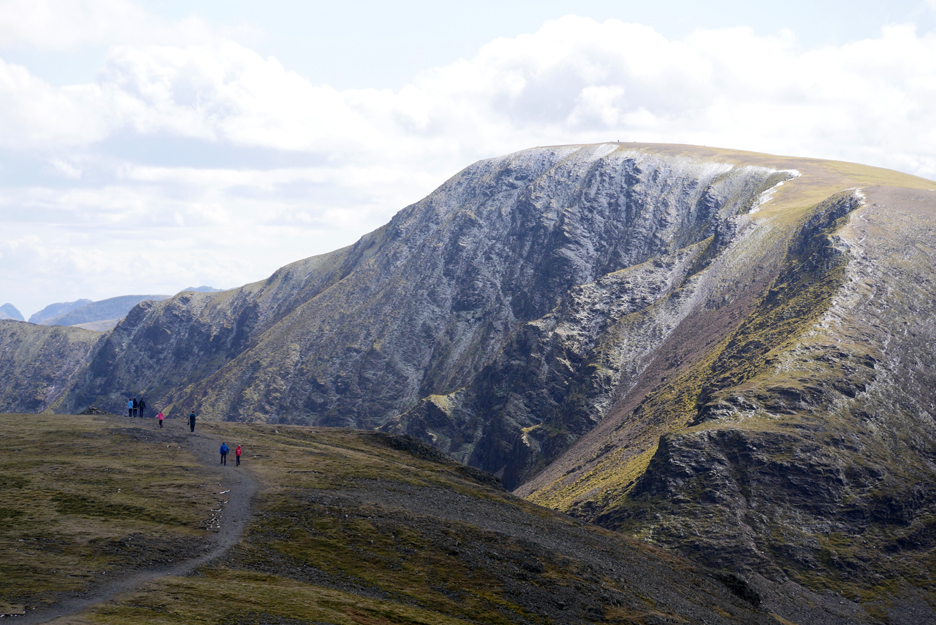
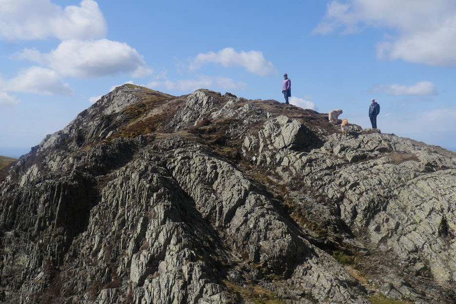
We are not alone on the top as there's a group of youngsters already there.
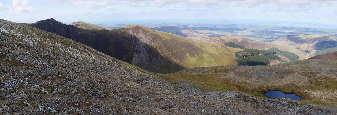
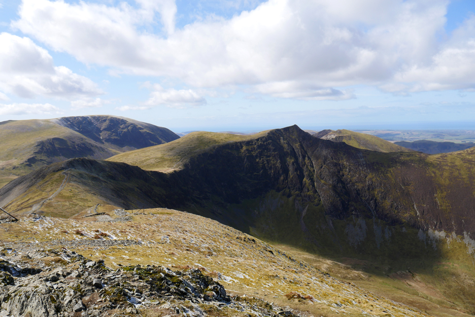
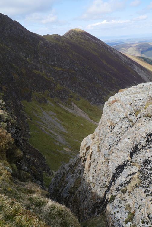
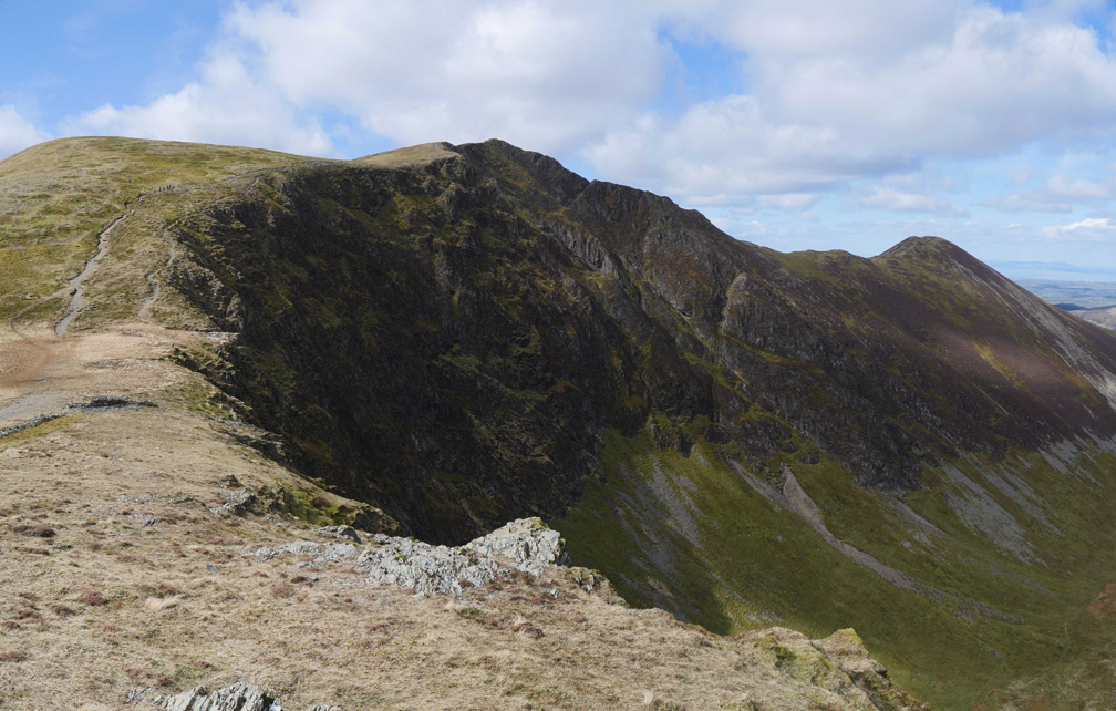
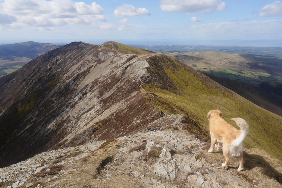
There's a fine view of our route ahead . . . around the Hobcarton crags to Hopegill Head.
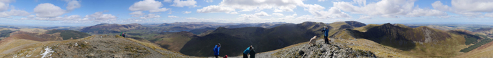
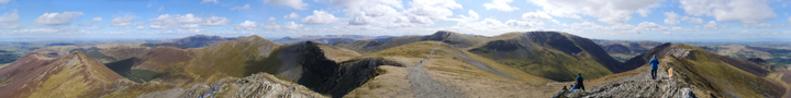
The visibility is so good I took a special photo for you ! Click here or on the photo above for a 360 degree annotated panorama.
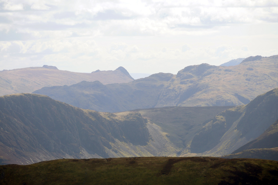
which is one of the famous Langdale Pikes.
Around to the right are the high summits of Scafell Pike and Scafell.
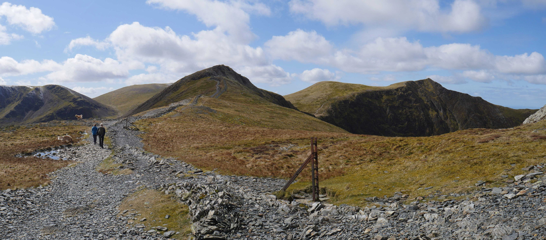
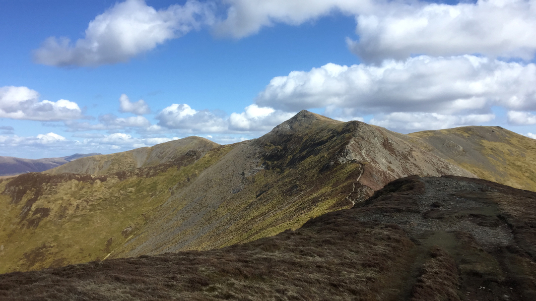
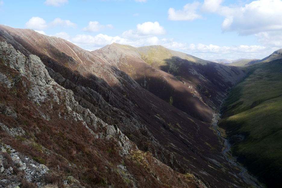
No time to linger as we walk the old wall that follows around the back wall of the Hobcarton Valley (down to the right). The peak ahead, though seemingly large, does not qualify for any name on the map.
Walking the other way towards us was Geoff Davidson, who lives in locally in Braithwaite. presumably he is a distant cousin of mine (several times removed) as he my sister in law Elaine's dad's cousin. Work that one out ! He considers the Coledale fells his 'home turf' and recognised myself and the dogs and so stopped to say hello. After a pleasant chat we each continued on our way.
Looking back from whence we came as we reach the second dip on the ridge walk.
The prospect ahead of the last major climb of the day. The high point is Hopegill Head, which will be our second summit of three.
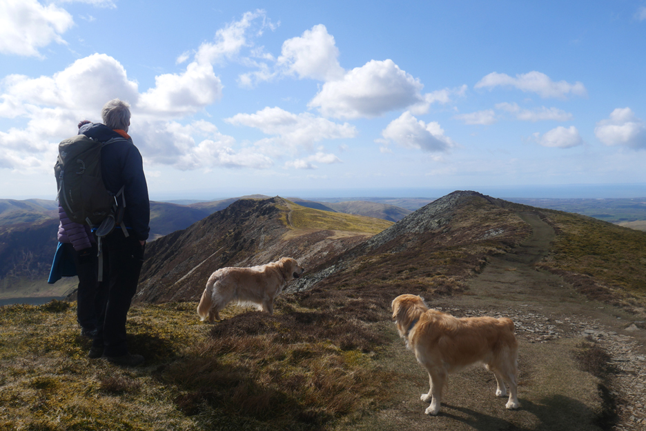
Summit duly reached and Cathy takes a moment to enjoy the new vista ahead.
With the big lens I do likewise . . . but here the view is of Ladyside Pike to our right.
Looking more directly out at the sunshine on Criffel in Dumfries and Galloway (Scotland).
Over Sand Hill this time to the wintery slopes of Ill Crag.
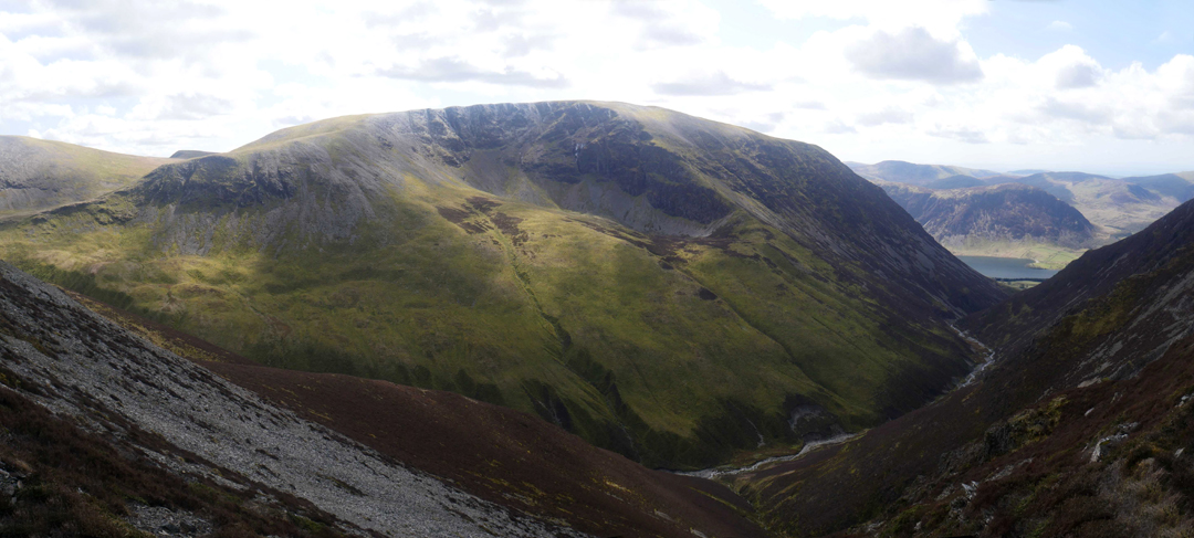
Grasmoor across the Gasgale Valley.
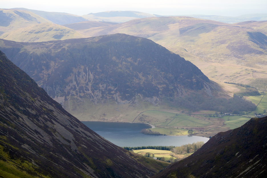
Crummock Water and Mellbreak, plus the houses of High and Low Park.
These are all drawn together and placed in context in my sunny, summit panorama. Click here or on the photo above for the larger 360 degree annotated picture.
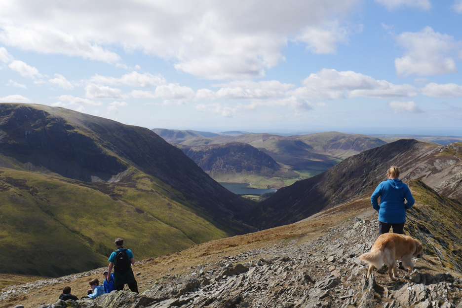
Lunch enjoyed, albeit slightly down from the summit to get out of the cool breeze, so we're on the move again along one of the best high level ridges in Lakeland.
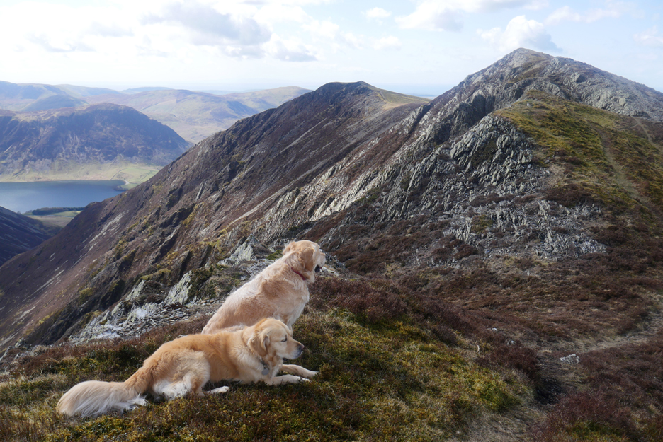
The dogs add foreground character to this lower level view along the ridge.
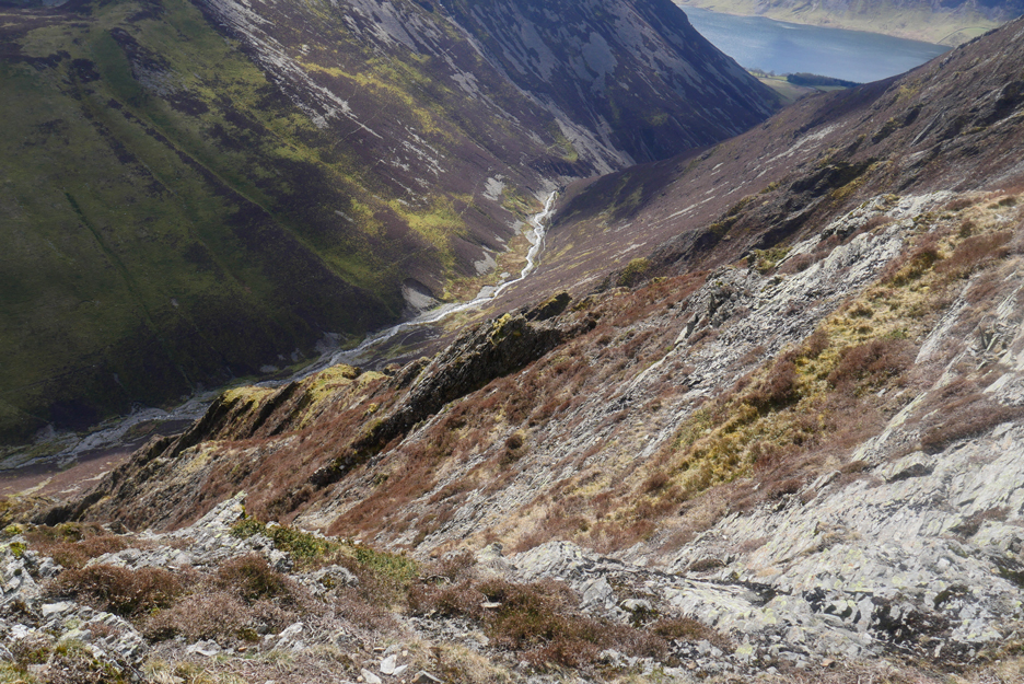
We could be lower . . . we could have returned home by the path that follows the Rive Lisa in the valley below.
But no, we'll take the high ground and work our way along the ridge. As a result of all these photos Iseem to be lagging behind a little.
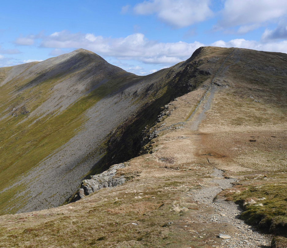
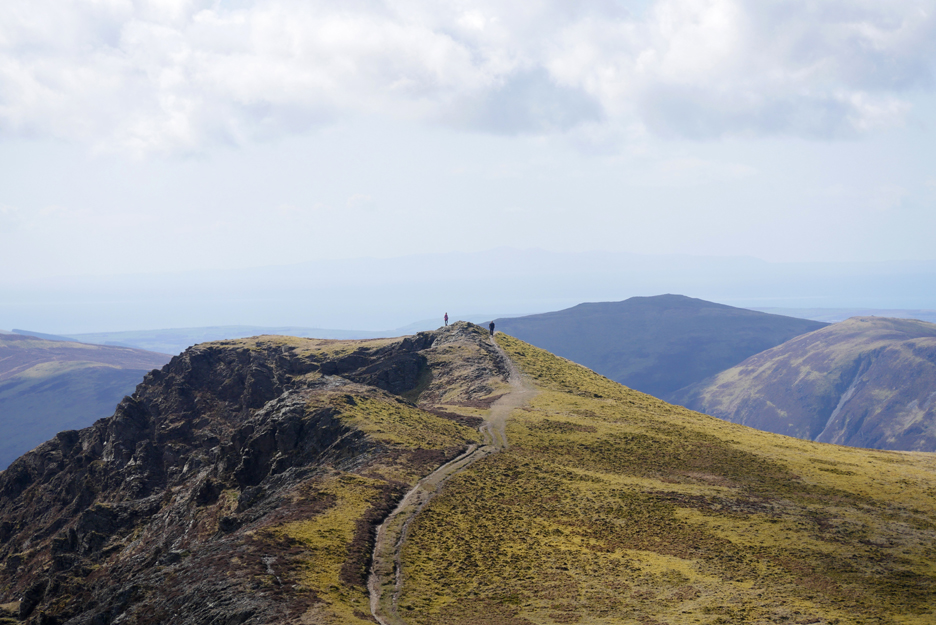
Still, with views like this why rush ? This is a retrospective view of our walk so far, with Grisedale Pike now some distance away on the left.
Just one final undulation and we'll be at the Whiteside summit in the distance.
If your imagination is that good you may also be able to make out the Isle of Man as a faint shadow above the distant Blake Fell.
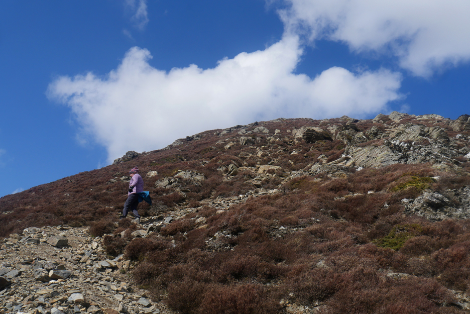
From Whiteside the only way is down. It is steep and rocky as the path zig-zags its way down through the heather.
Mark still has his warm coat and gloves on due to the coolness of the breeze on the descent.
Looking back across the Gasgale Crags from half way down, still some distance above the Whin Ben outlier.
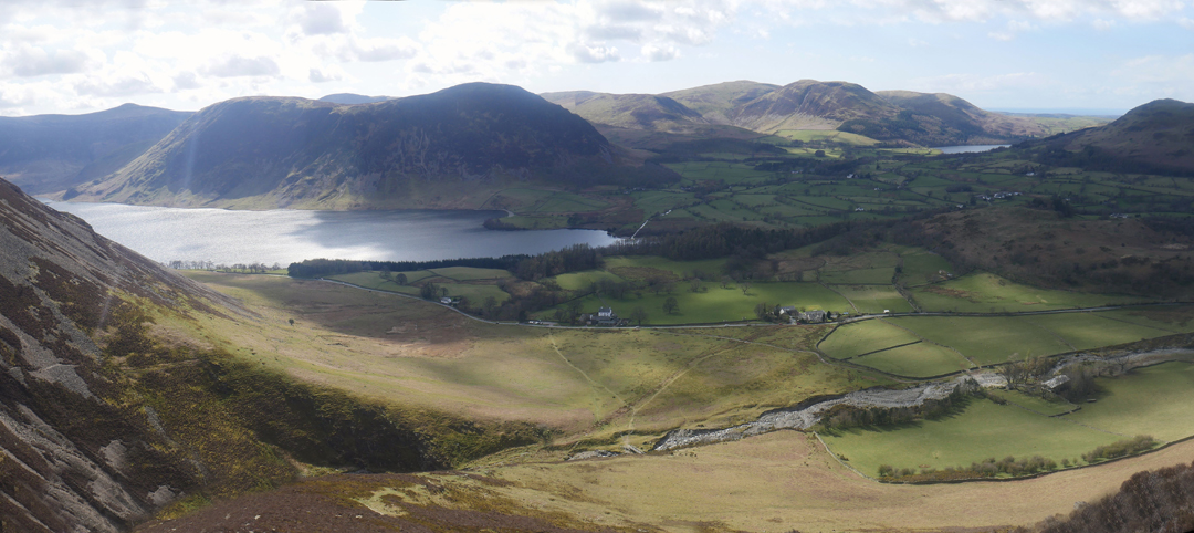
A path through the heather avoids a further lose rock descent and now slightly below Whin Ben we get a clear view of Lanthwaite Green below and the various houses alongside the Buttermere Road that crosses it.
As we have decided to do a linear walk there's no car waiting at Lanthwaite so we cross the fields and enter the Scale Hill / Lanthwaite Woods.
A gentle descent on the bridle path down through the woods and we emerge at the car park by Scale HIll bridge almost at the end of a lovely day's walking. Just a few hundred yards back to the cottage. [ Mark dropped his gloves on the lower slopes of Whin Ben so had gone back to find them. Cath and I returned to the cottage where I promptly turned round and drove back to Lanthwaite, picked up Mark (and the gloves) and together he and I returned to Whinlatter to fetch the other car.] - - - o o o - - - |
|
Technical note: Pictures generally taken with my Panasonic Lumix Gx8 Camera. Resized in Photoshop, and built up on a Dreamweaver web builder. This site best viewed with . . .someone at home putting the kettle on. Go to Home Page . . . © RmH . . . Email me here Previous walk - 7th April - Ulverston and Roa Island A previous time up here - 15th July 2013 - Dale Head and Grisedale Pike Next walk - 11th April - Four Seasons Causey Pike
|