![]()

Remember: Press F11 for a full
screen view of this page.
Web Counter when published 1 740 588
|
|
|
Remember: Press F11 for a full
screen view of this page. |
Web Counter when published 1 740 588 |
|
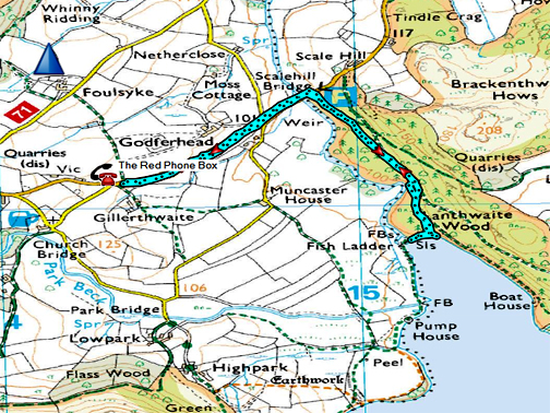
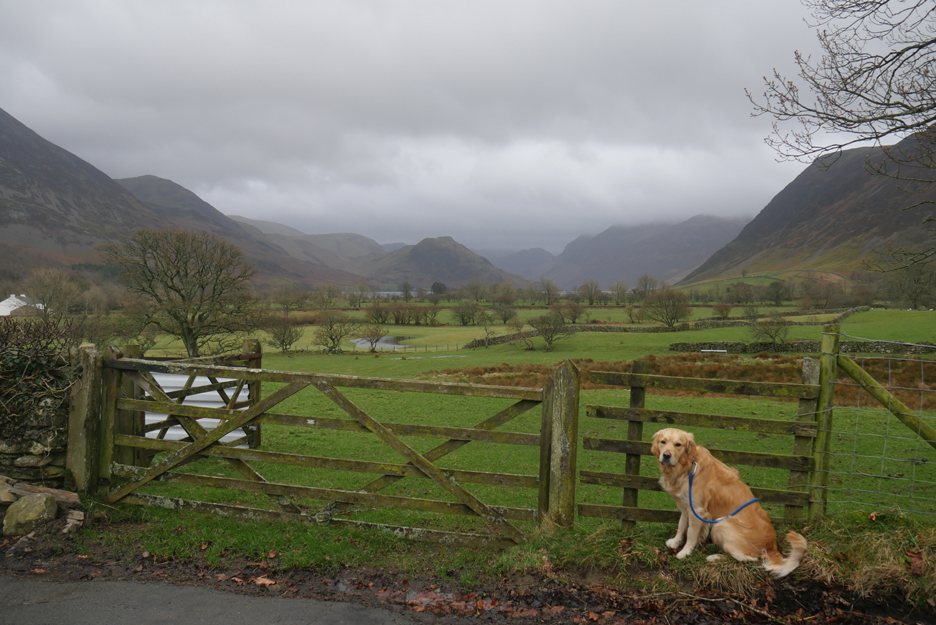
" Storm Ciara Flood Waters " Date & start time: Sunday 9th February 2020. 3 pm start. Location of Start : By the red phone box, Loweswater, Cumbria, Uk. ( NY 143 211 ) Places visited : Scale Hill Bridge, Lanthwaite Wood, Crummock Water. Walk details : 2 mls, negligible feet of ascent, 1 hours 20 mins. Highest point : Staying clear of the water on a rather wet forest walk. Walked with : Myself and our dog, Dougal. Weather : The calm after the storm; mild, windy with occasional showers. |
© Crown copyright. All rights reserved. Licence number PU 100034184. |
|
In between the showers we've had some lovely days this last few days, midweek being particularly sunny. However, Saturday night it was a real belter . . . high winds and horizontal rain . . . as Storm Ciara blew through.
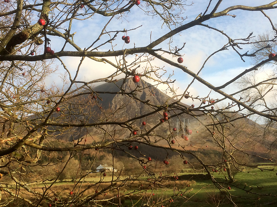
Grasmoor was looking good . . . especially as it was draped in baubles left over from Christmas.
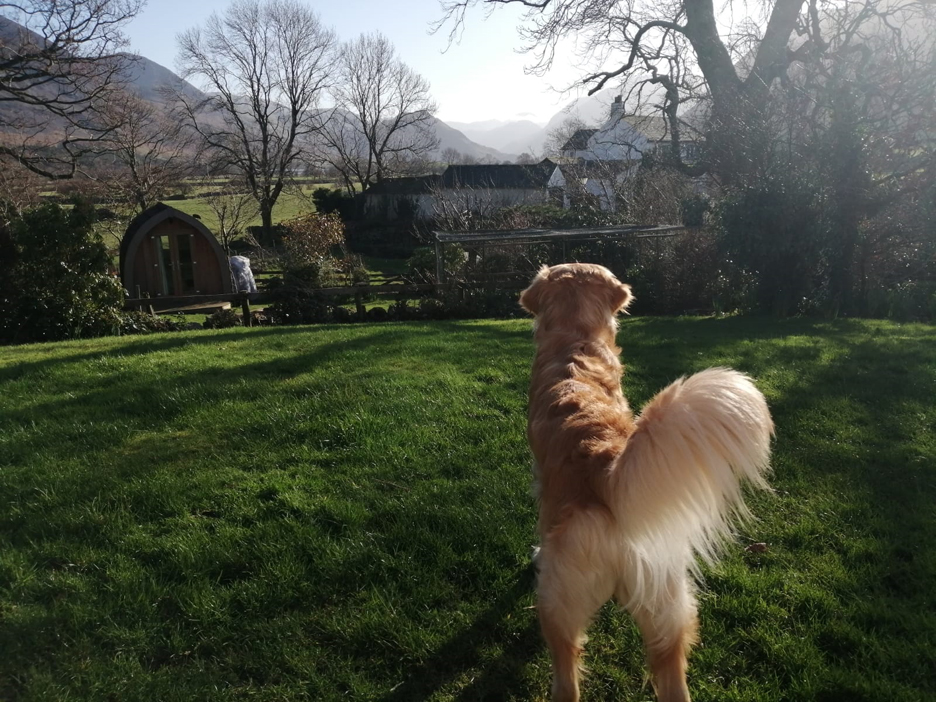
Dougal in the garden during the week, his attention captures by a noise of someone walking down the lane to the house next door. The photo was taken by Ron, our decorator, as he sat out eating his lunch in the garden.
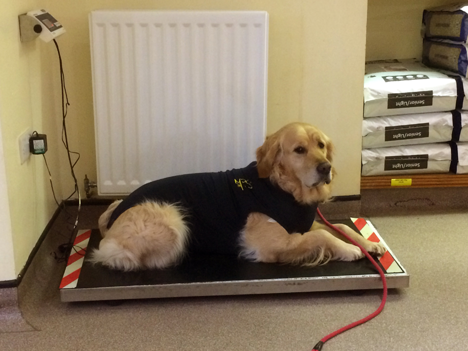
He's been in for a minor operation to remove a small skin lesion, the suit replacing the traditional vet's collar. This was him on a follow up visit, not surprisingly he preferred the weighing scales to the consultation room ! No wet walks for him and for that matter no big walks either, at least for the next few days.
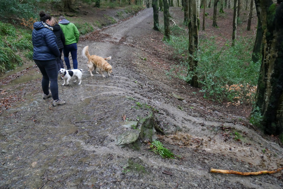
So after a blustery Sunday morning in and around the house, I took Dougal out to check out the state of the river after the night of heavy rain. Storm Ciara appears to have blown through, and Dougal and I have the chance a drier walk this afternoon.
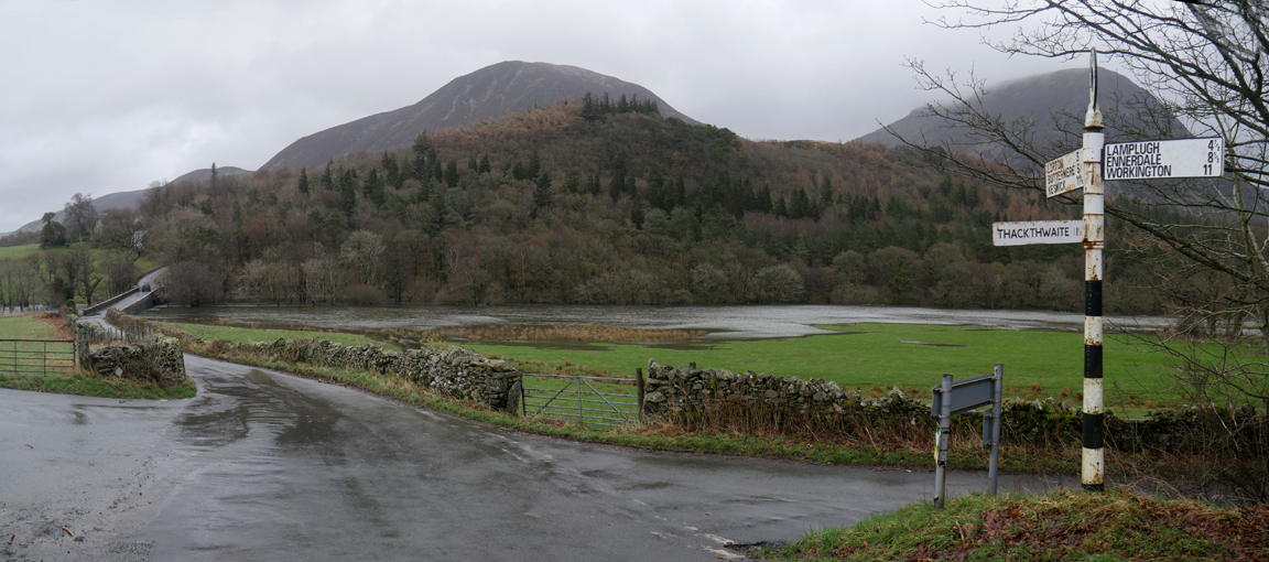
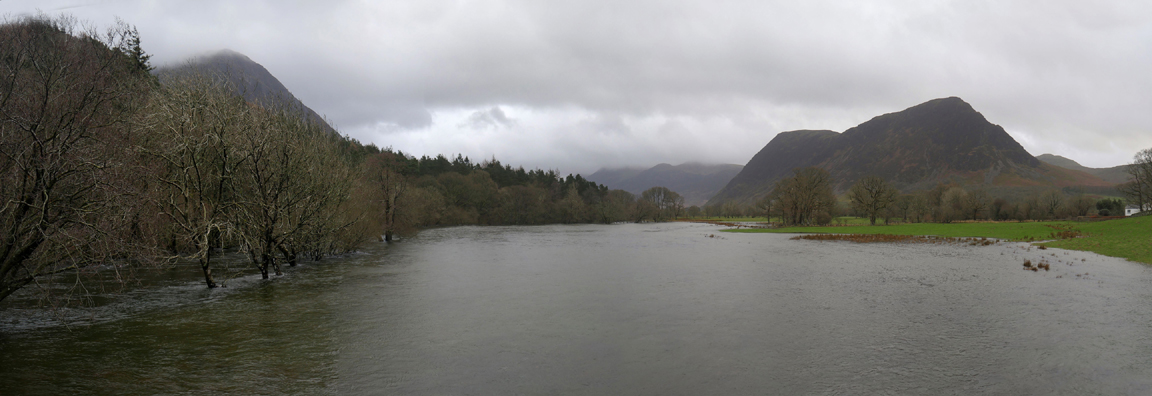
Our first view of the River Cocker alongside Lanthwaite Woods, as seen from the signpost at the Godferhead cross roads.
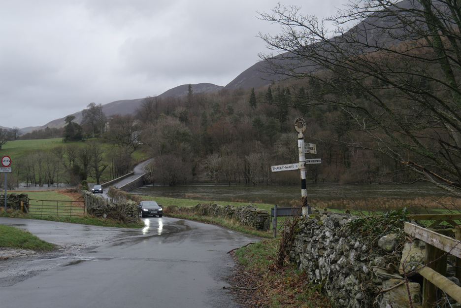
Car lights reflect off the wet roads . . . it is a grey afternoon here in the north western Lakes.
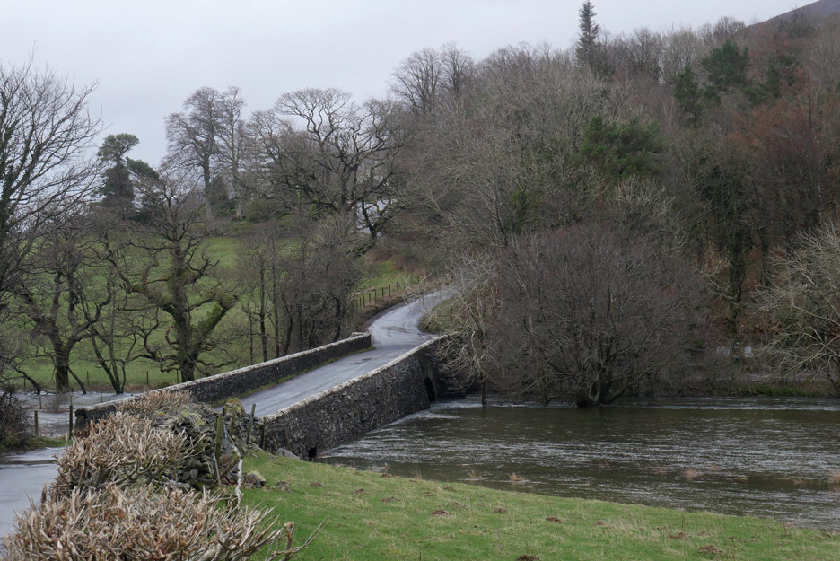
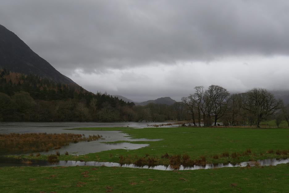
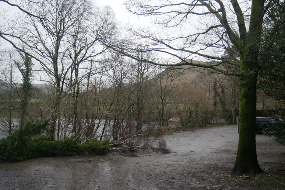
We've an extra lake too as the flood water backs up against Scale Hill Bridge.
The stream in the foreground is the one that passes through our garden, before making its way across the fields here to the river. Its journey is shorter today as the river has risen across the fields to meet it.
Looking up the valley towards Mellbreak from the bridge.
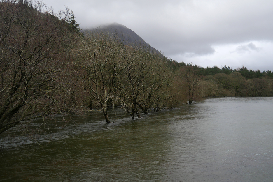
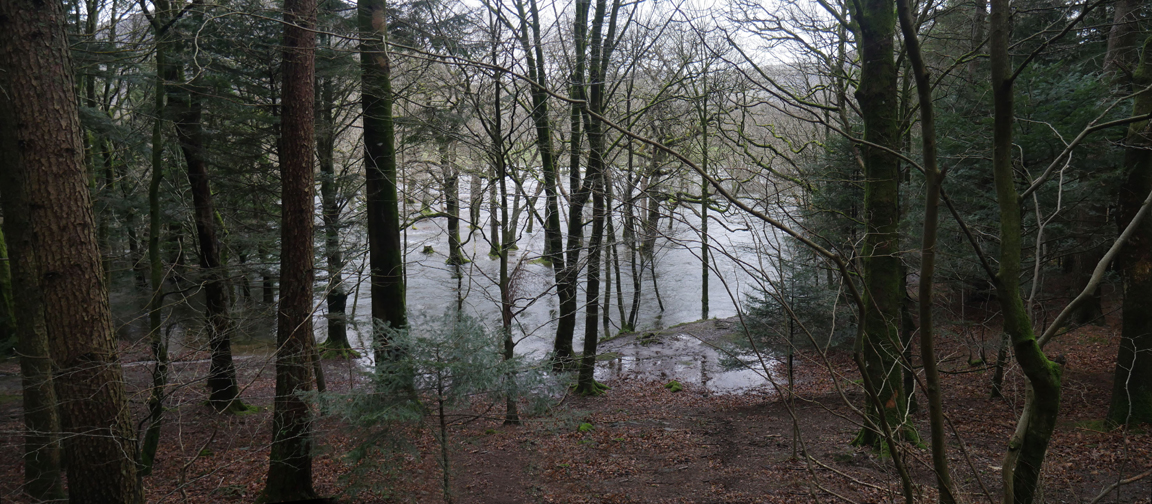
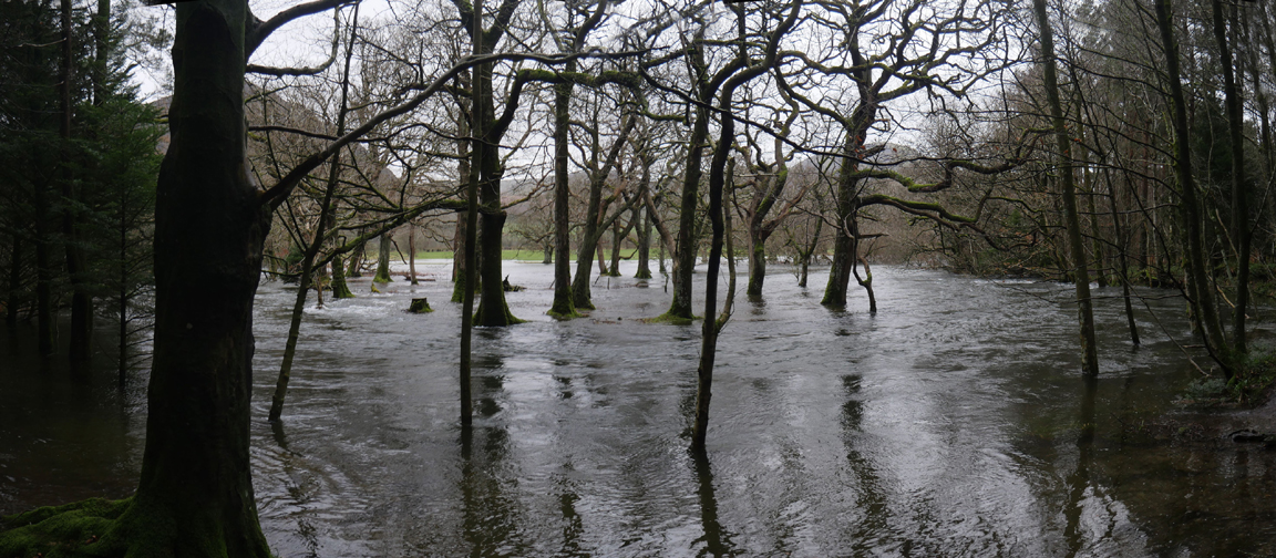
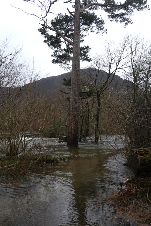
The river is normally contained within the trees.
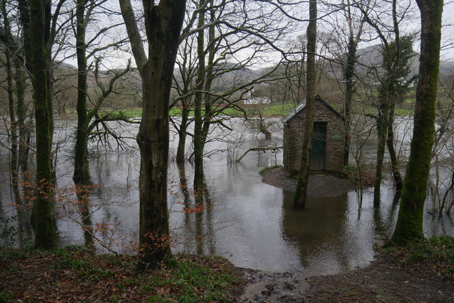
The measuring station records the water level in the river and is normally high and dry, some six feet above the water level. It was raised up on an earth mound after the 2009 floods, and the green plaque represents the height of the water level at that time. Still some way to go before those dizzy 2009 heights are reached.
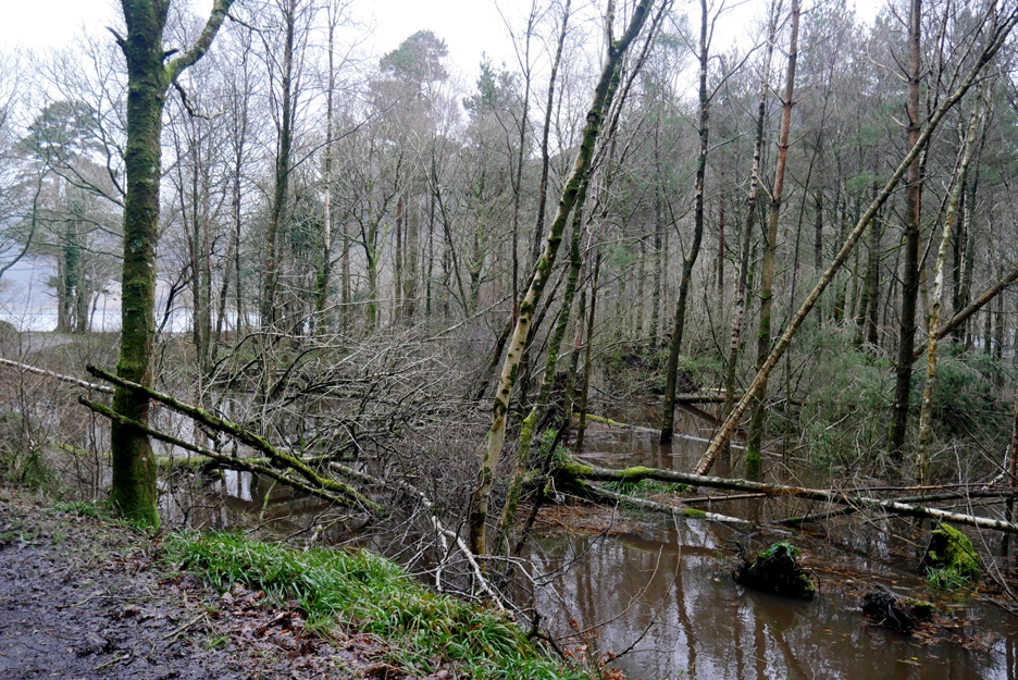
Surface water has been flowing over the forest tracks due to autumn leaves blocking the gullies. A determined poke with the stick and this pipe was cleared and a sudden rush of brown water and leaves emerged from the other side.
The big bend in the river is also hidden today. Hold your cursor over the picture to see the difference in the water level. ( If the roll-over doesn't work on your computer, check out the pictures from last week here )
" Down by the riverside" . . . not a place to go swimming today and the distant pool is not even identifiable due to the high water level.
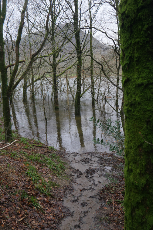
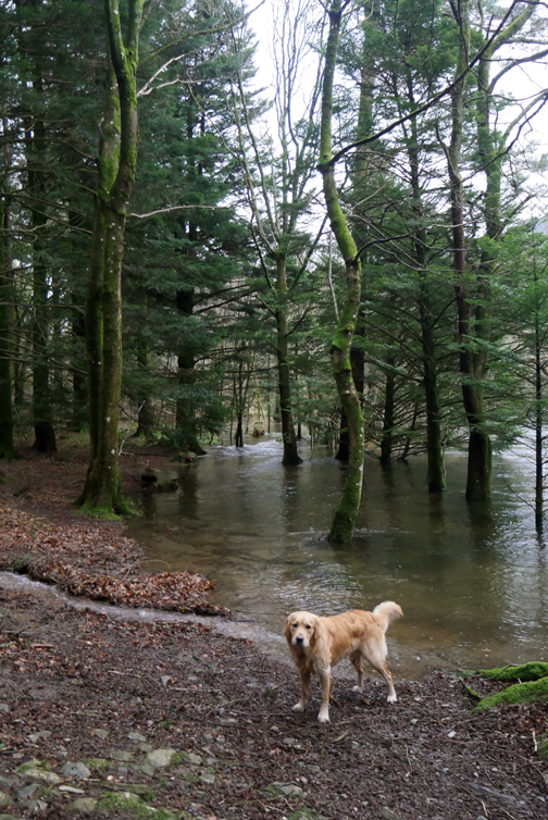
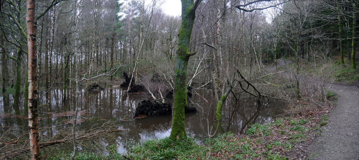
The temperate rain forest has become a temperate swamp as the damp area between the trees has become waterlogged.
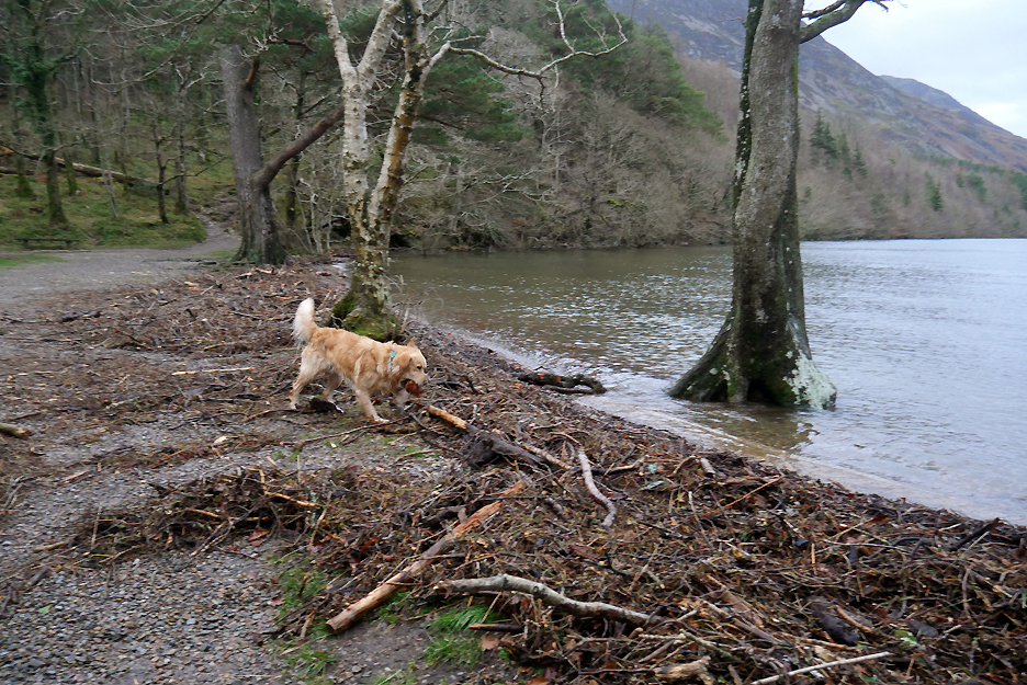
Down on the lake shore there's an extensive build up of debris along the "high tide" line. Dougal is spoilt for choice for a stick to play with today.
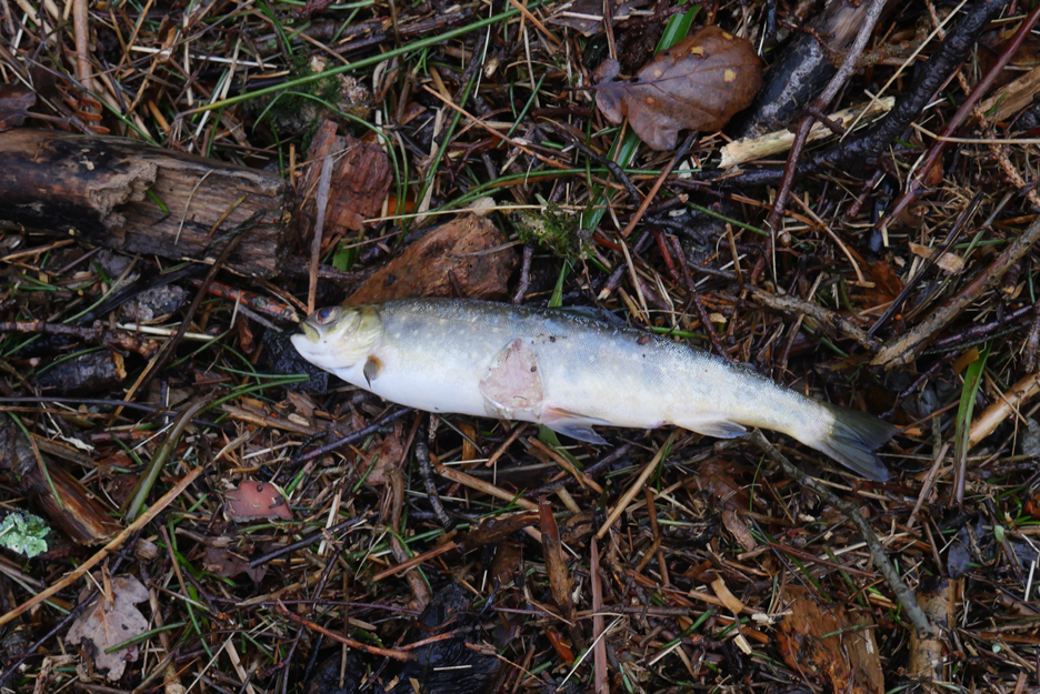
Sadly, amongst the debris were several young fish, this being one of two I saw. From the concave nature of the rear fins, it looks like a young salmon, though I could be wrong.
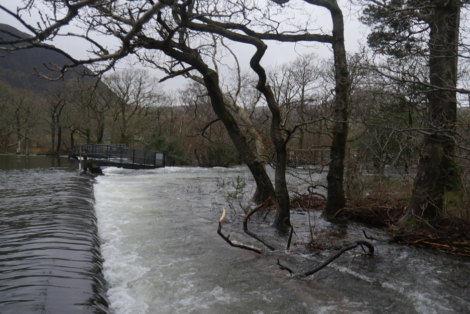
The water is flowing over the full width of the weir.
It is filling the overflow channel and then flooding over the side wall too.
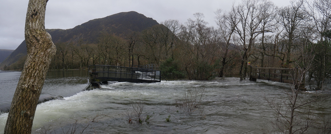
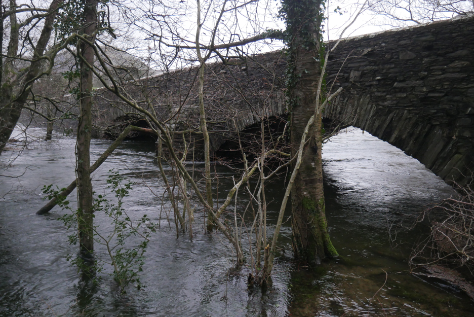
From patches of higher ground amongst the trees you could see the high water flooding under the bridge.
The only sensible way home now is on the same forest track back through the woods.
The only complete tree that I've seen blown over is an older one in the car park back at the bridge.
Last week this was the view of the bridge from close underneath.
Today, with the high water level, this is the closest I could manage. Oh well . . . time to head back before the next rain shower. - - - o o o - - - |
Technical note: Pictures taken with either Ann's Panasonic Lumix TZ60, or my Panasonic Lumix Gx8 Camera. Resized in Photoshop, and built up on a Dreamweaver web builder. This site best viewed with . . . waterproof shoes or wellies ! Go to Top . . . © RmH . . . Email me here Previous walk - 29th January 2020 - Dylan's Birthday and a local walk A previous time up here - 19th Nov 2009 The 2009 November Gales - Day 1 Next walk - 9th February 2020 - Loweswater Tree Planting
|