![]()

Remember: Press F11 for a full
screen view of this page.
Web Counter when published 1 720 950
|
|
|
Remember: Press F11 for a full
screen view of this page. |
Web Counter when published 1 720 950 |
|
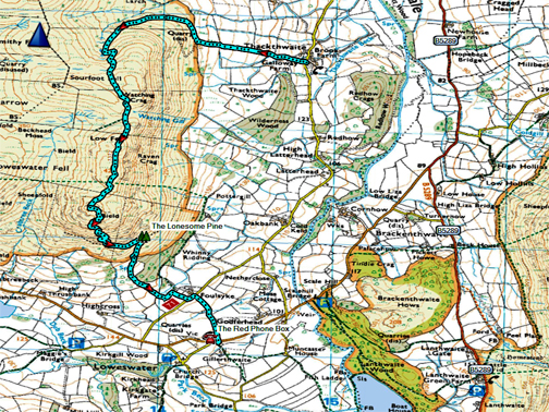
" Low Fell with the clarity of Autumn " Date & start time: 30th November 2019. 12 noon start. Location of Start : Thackthwaite Village, Vale of Lorton, Cumbria, Uk ( NY 148 236 ) Places visited : Thackthwaite, Watching Crag, Low Fell, southern viewpoint and home. Walk details : 3.5 mls, 1250 ft of ascent, 3 hours exactly, including a short biscuit stop ! Highest point : Low Fell, 1375 ft - 423 m. Walked with : Ann and our dogs, Dylan and Dougal. Weather : A lovely late, autumn blue sky day, with a cool southerly breeze on top. |
© Crown copyright. All rights reserved. Licence number PU 100034184. |
|
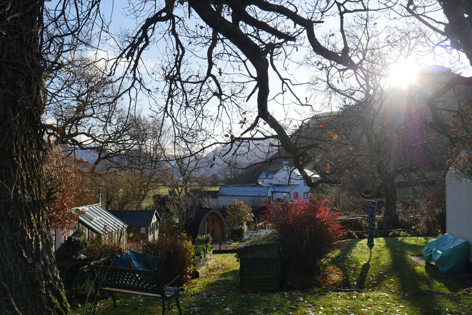
We awoke to a fine morning and the bright light of a cloudless dawn streaming in through the windows. Time to get up . . . it was 9 o'clock after all !
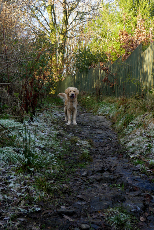
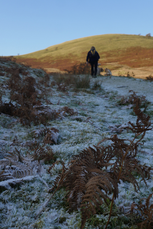
The cold night had left a covering of ground frost, some of which had cleared by the time I took this photo after breakfast.
The prospect was for another cool but cloudless, blue sky day and Low Fell was calling. - - - o o o - - -
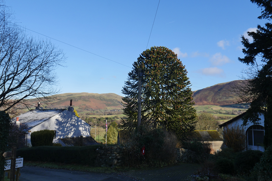
By the time we had done all the jobs and driven round to Thackthwaite it was twelve o'clock. The evergreen monkey puzzle tree in Thackthwaite was contrasting strongly with the bare branches of other trees in the village and the flag in the garden near Brook Farm was hanging limp in the calm air of the valley.
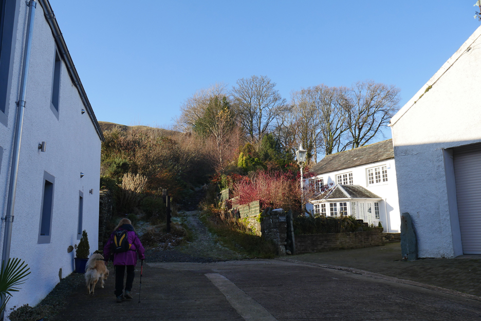
The path leads up onto the fell from the old yard between Galloway Farm and Thackthwaite House.
The view across Lorton towards the valley leading up to Whinlatter Pass.
Warm sunshine but hat and gloves were the order of the day.
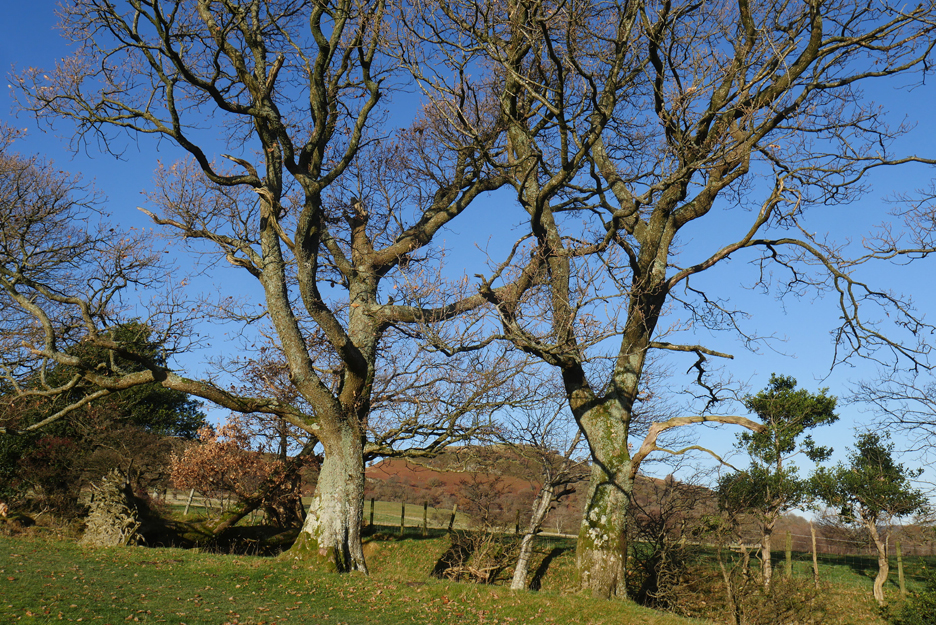
Two of the old oaks that line the old lane. The path now takes to the field this side of the hollow as the stream has made the original route impractical.
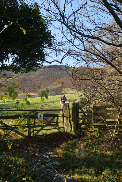
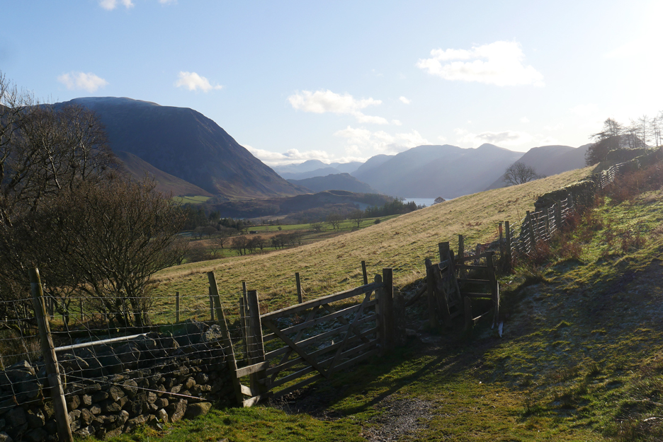
The view back to the high fells from the 'out-take' wall, where we leave the fields and enter the fell. Maintenance of this gate area seems to be a problem, every time they fix one part (the gate, the fence or the walls) another falls apart. At present the kissing gate has rotted through and fallen to the ground.
No matter, we continue on with the walk, looking across here to enjoy the view of the frost covered summits of Hopegill Head and Whiteside.
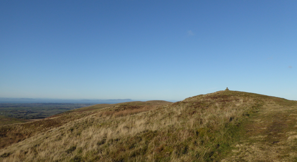
The path, possible an old coffin route over to Mosser Church, now travels around the fell and heads up the hidden valley of Meregill Beck. The bracken and tree covered outlier to the left is Broadmoor Hill. Technically it is not open access land so is rarely visited.
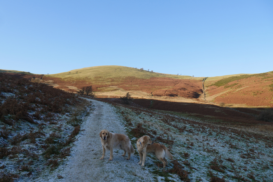
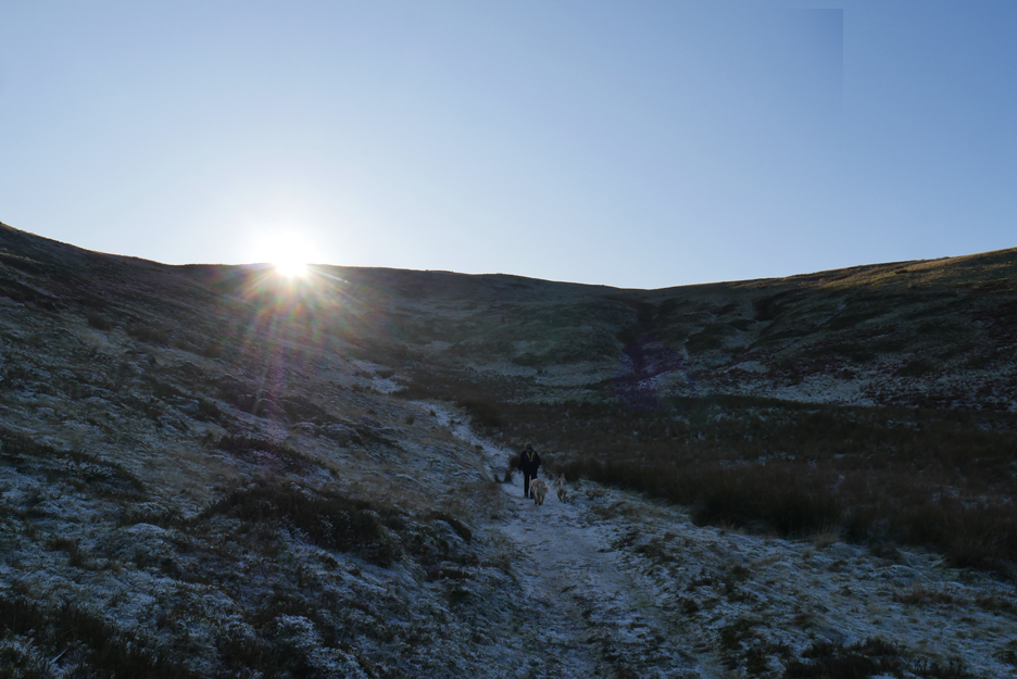
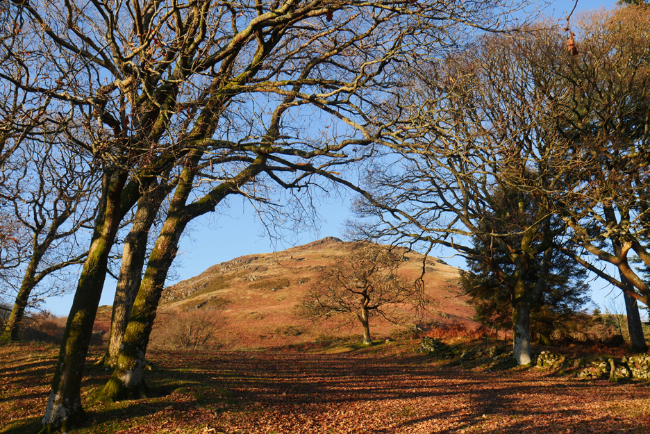
Ahead as we walk up the frost covered path, is the summit of a second Wainwright fell, that of Fellbarrow. We'll pass on a visit today . . . been there . . . done that . . . and the day will be short enough with the early winter sunset today.
The path curves round and gradually climbs to the head of the valley. It is cold here in the still air and shadows. We talked to two paragliders who had just walked down from the summit as the wind up there was too strong and unpredictable. They were off to climb Fellbarrow as the more southerly midday breeze could be more amenable for a take-off from there.
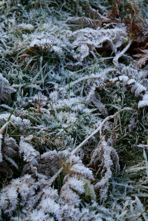
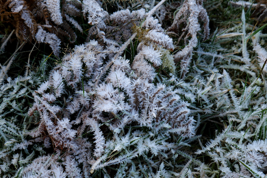
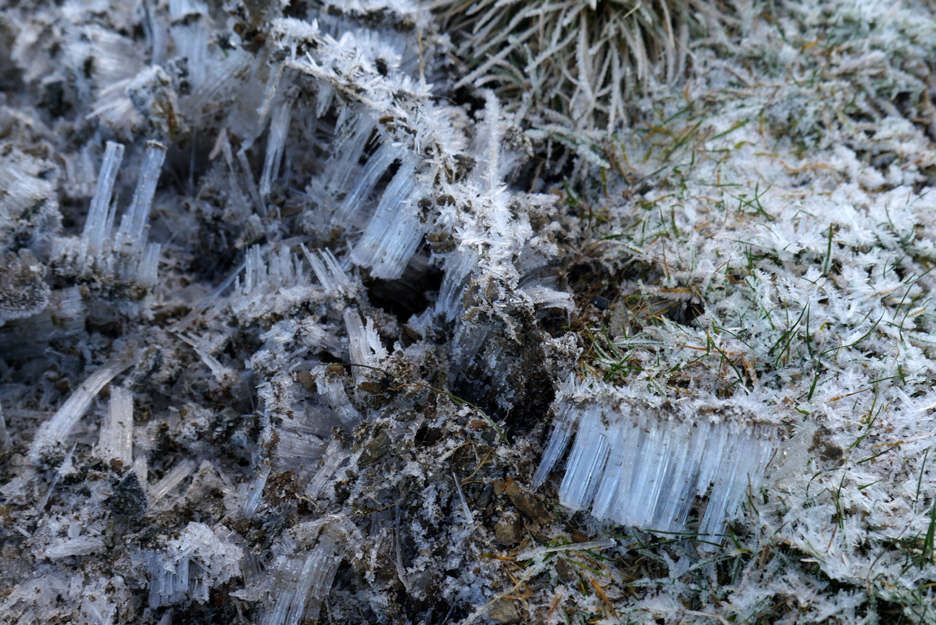
The frost at the cold end of the valley was even thicker and the path slightly more slippery as a result.
Where the path had been muddy and wet the ice crystals had grown and lifted the surface of the soil up into the air. When you walked on it your foot compressed the frost as you collapse it back down to the normal soil level. This is visible, real time freeze and thaw action leading to soil instability and greater long term erosion of the path surface. Peter Wilson, in his book Lake District Mountain Landforms calls this needle ice.
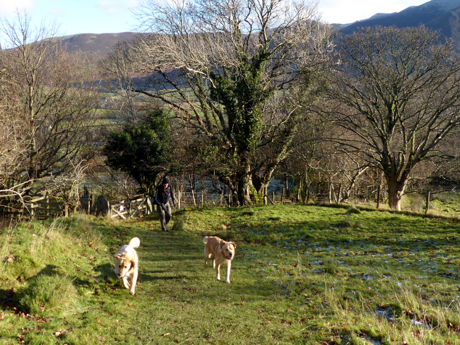
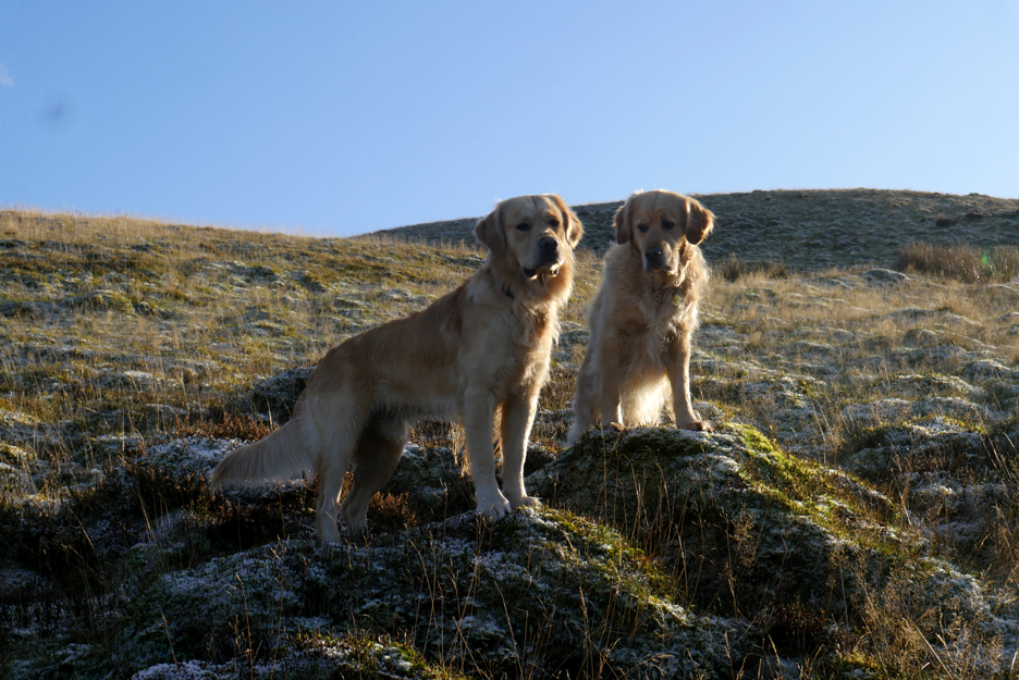
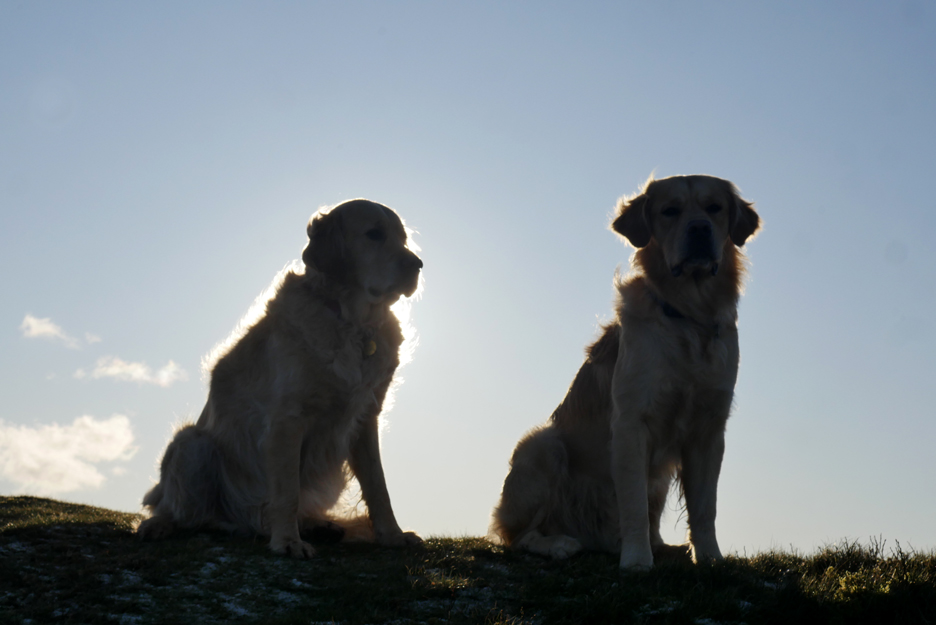
Not ice but nice . . . the light highlights the dogs colour as we climb out of the valley and back into the sunshine.
The excitement of the open fell and Dougal races ahead across the moorland grass.
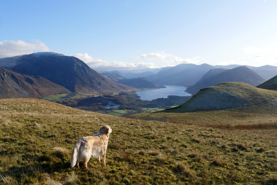
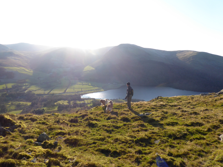
The more mature of the species is happy to walk across and pause to admire the view of Crummock Water.
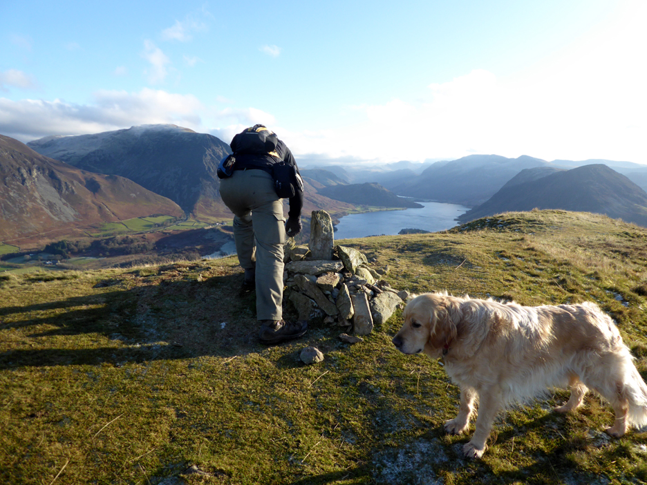
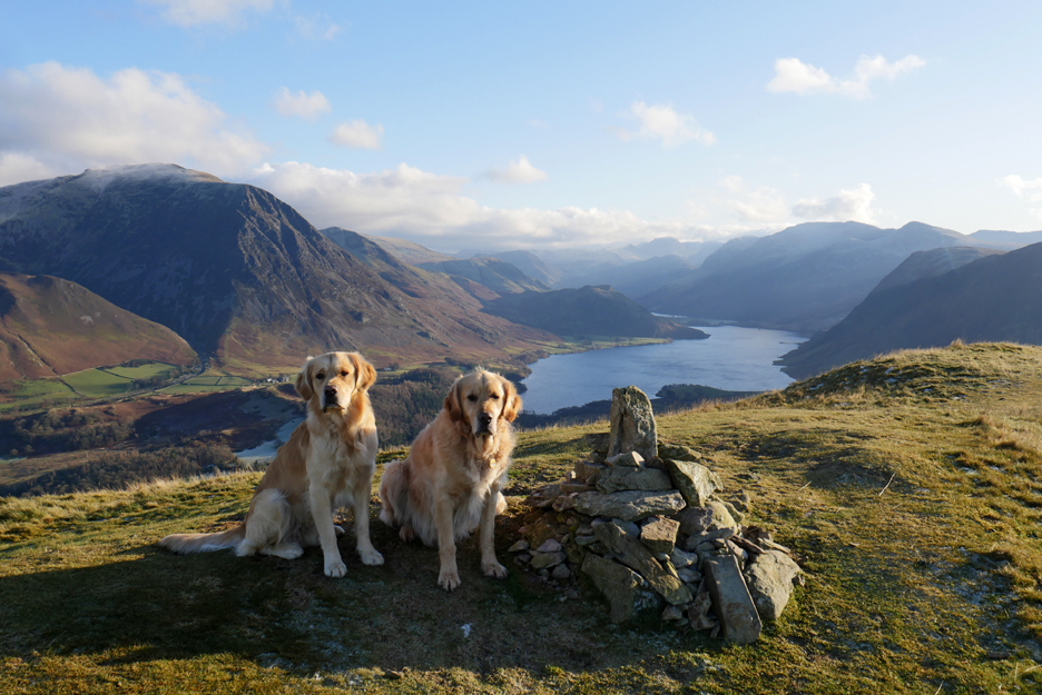
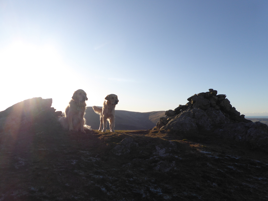
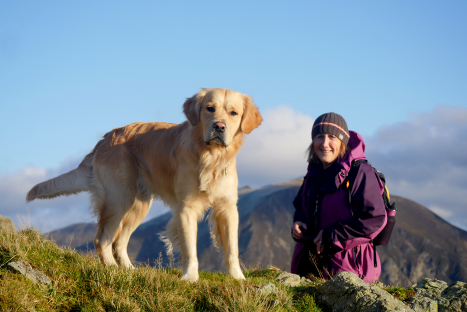
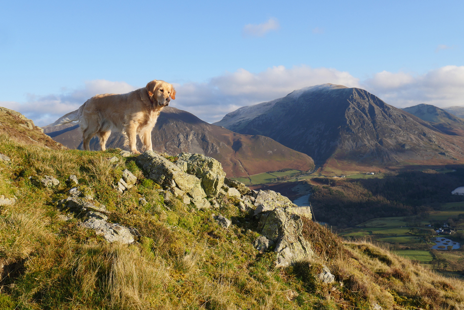
Time for a summit photo . . . just tidy up the cairn first.
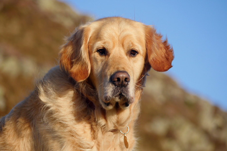
" You might at least look happy after all my efforts "
Moving on but looking back at the summit of Low Fell. Beyond, to the north are the Scottish hills across the Solway.
When I zoom in more of the detail emerges. There are a fair scattering of land based wind farms around Workington. The white steam/smoke is from Iggersund's biomass power station. In mid-channel there is a whole plethora of wind generation equipment. I wouldn't like to navigate that by boat on a misty day !
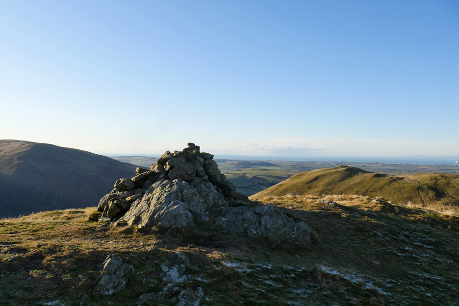
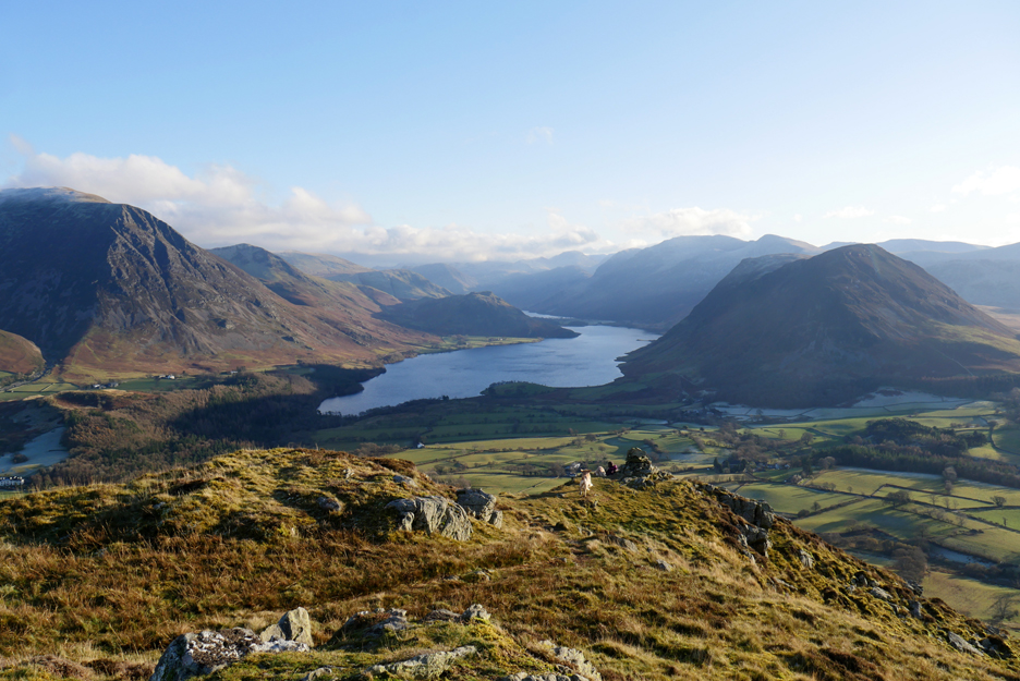
Another summit and another cairn . . . this one the southern top of Low Fell.
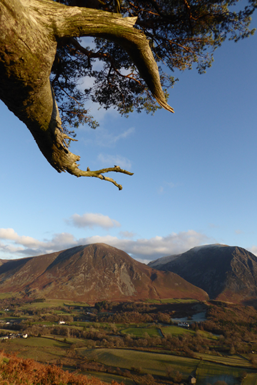
Frost on the shaded side of the fell again as we look over to Darling Fell and beyond to the west and the Irish Sea.
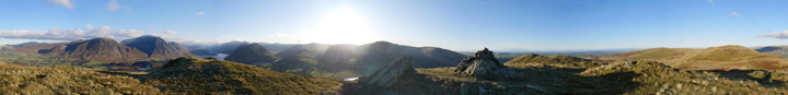
The photo comes from this panoramic set which shows the complete view in the round. Click here or on the photo above for a Loweswatercam 360 degree annotated panorama.
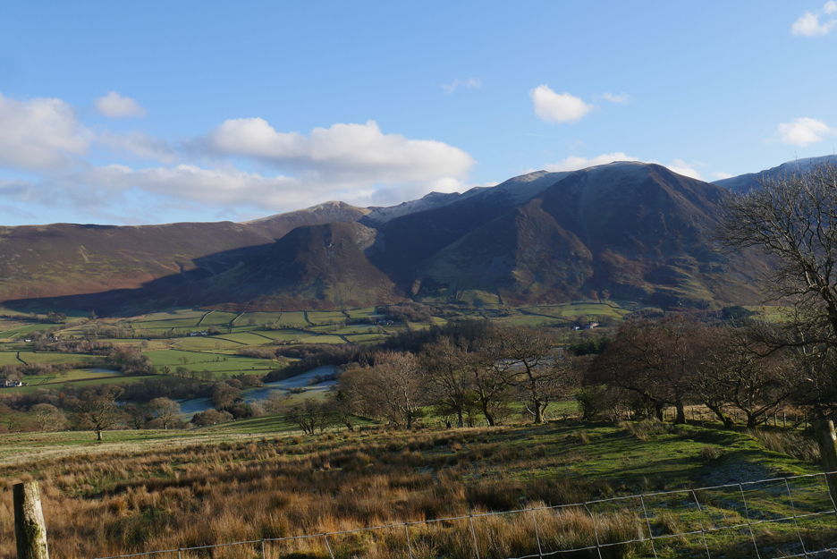
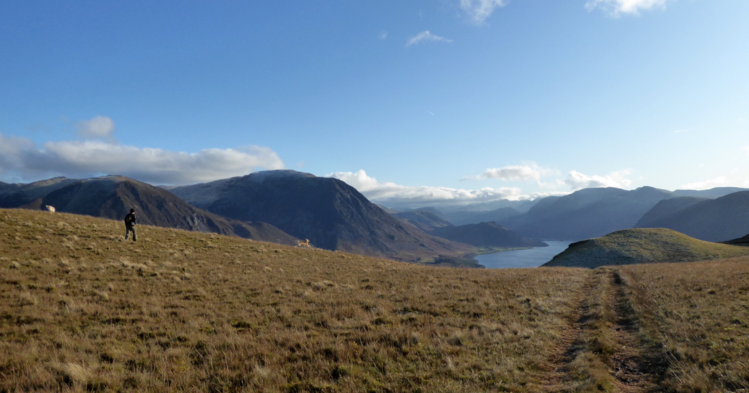
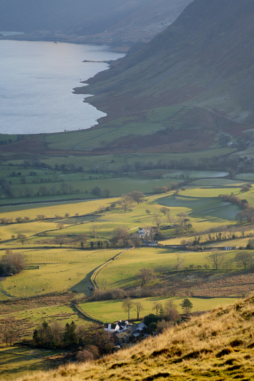
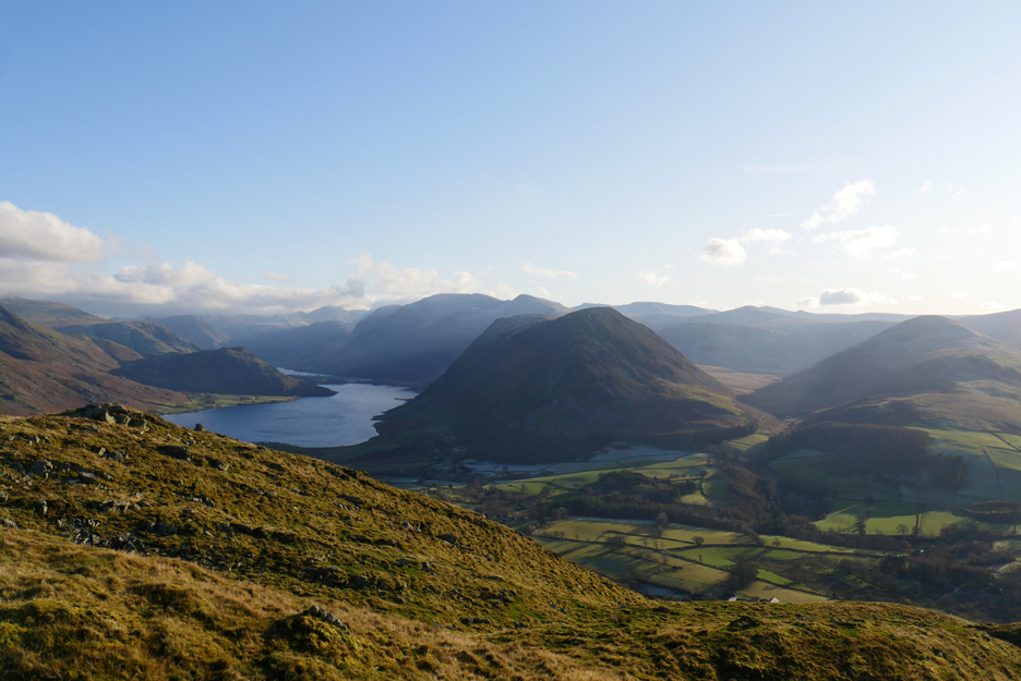
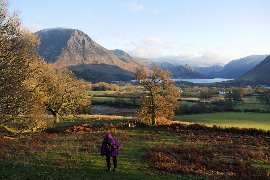
Looking down on Loweswater and across to Blake and Burnbank, somewhere out there in the haze of the low sun.
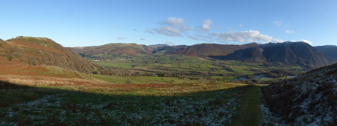
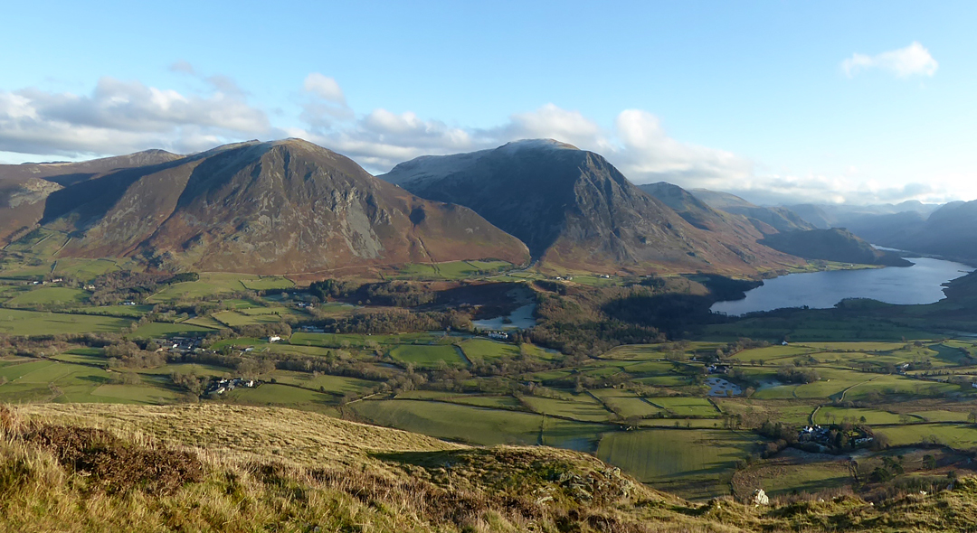
Mellbreak centre stage as we head on towards the southern viewpoint. The narrow divide between Crummock and Buttermere can be seen beyond the darker outline of Rannerdale Knotts on the left.
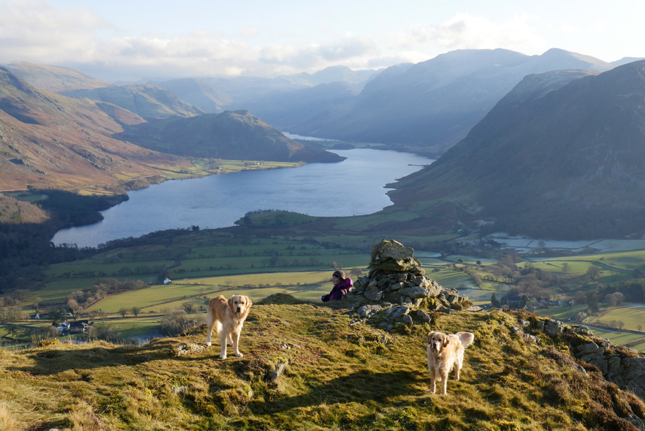
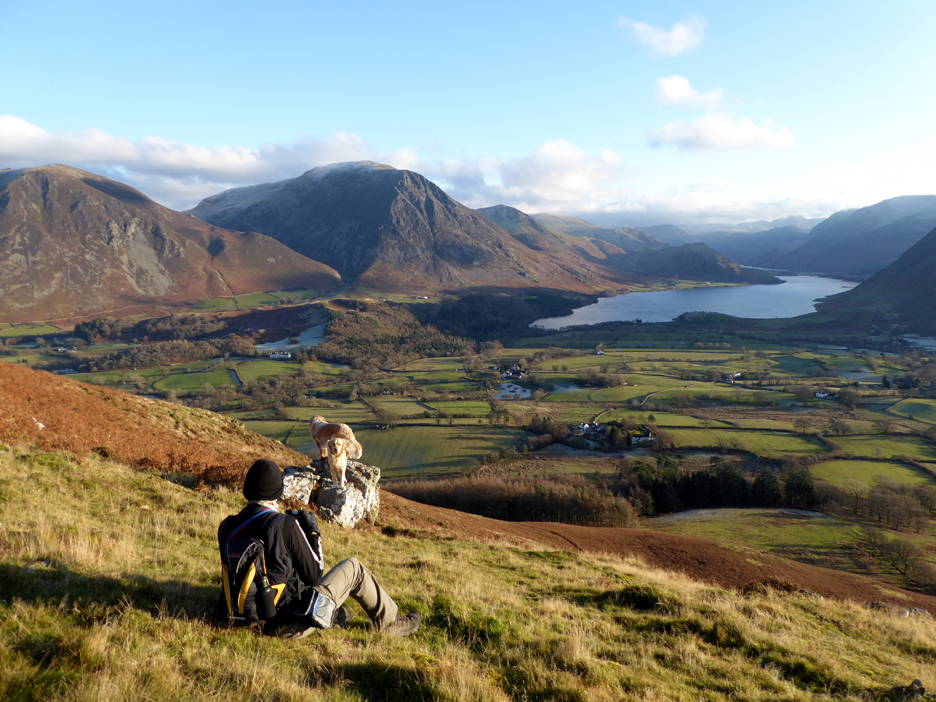
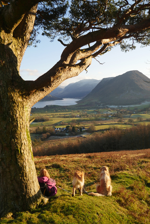
Ann and the dogs are already down at the lower cairn.
A welcoming committee waits for my arrival.
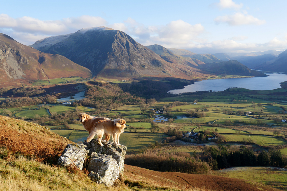
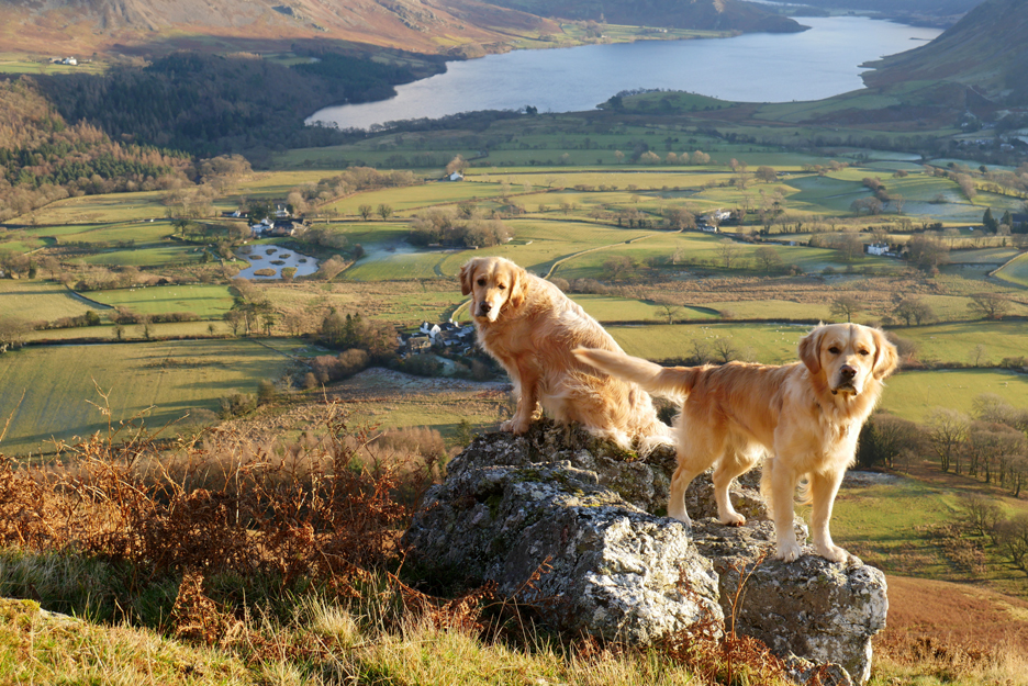
The view from here must be one of the best in the Lakes.
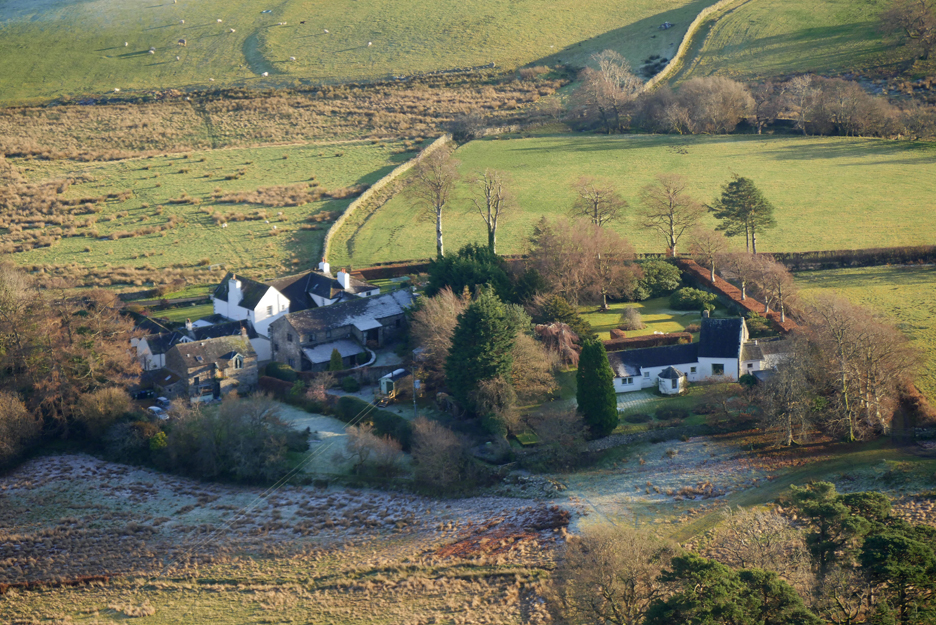
Looking down on the many and varied buildings that surround Foulsyke House.
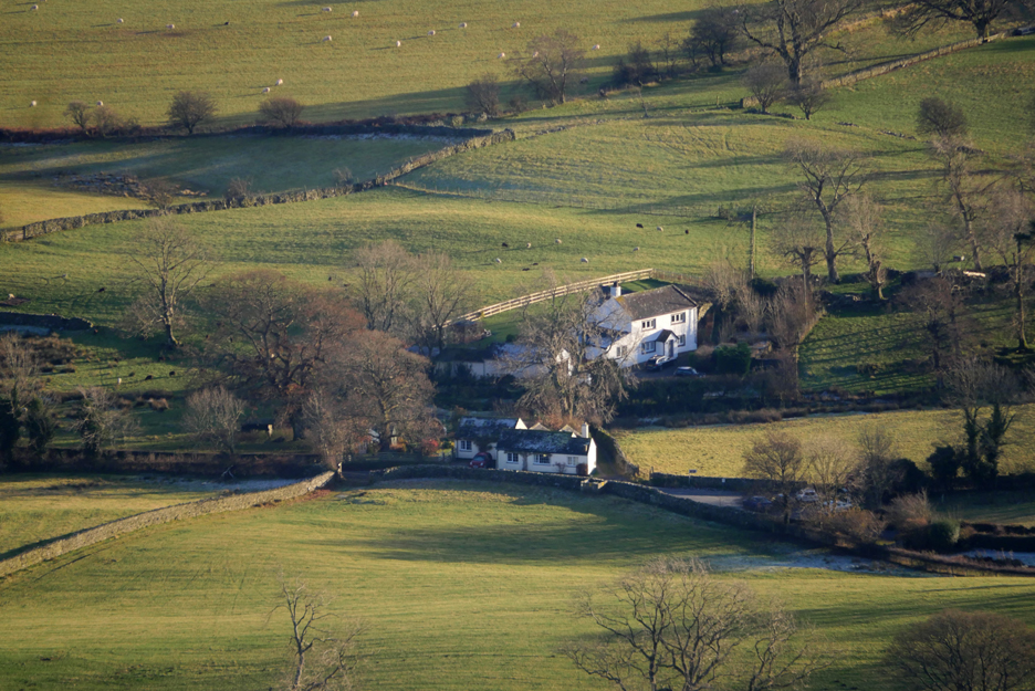
Just two of us further across the fields, ourselves and Gillerthwaite.
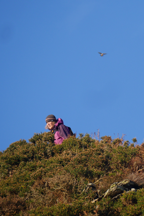
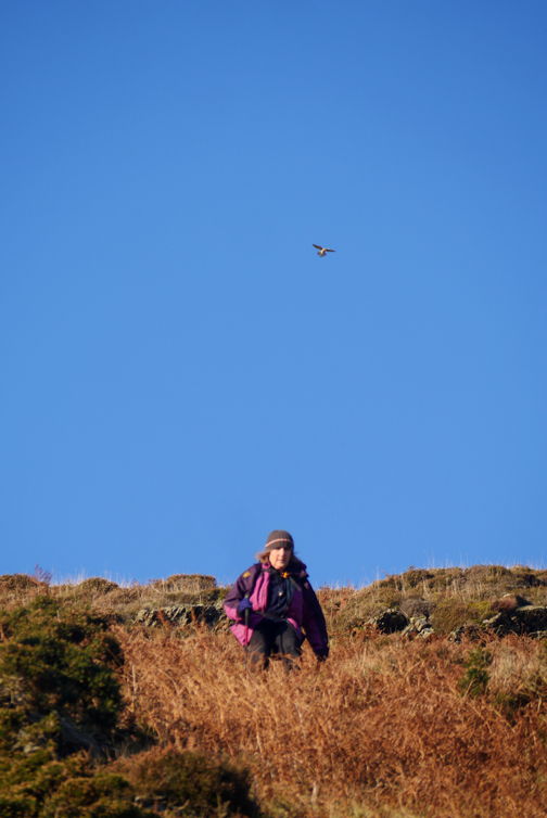
My fellow photographer.
Okay . . . you want a photo too !
You've got to give equal treatment to each dog . . . a bit like kids really !
Ready for the steep descent.
They know the route and also the photo opportunities.
Sharing the rock.
A slightly different angle includes Godferhead's large wild life pond with its islands.
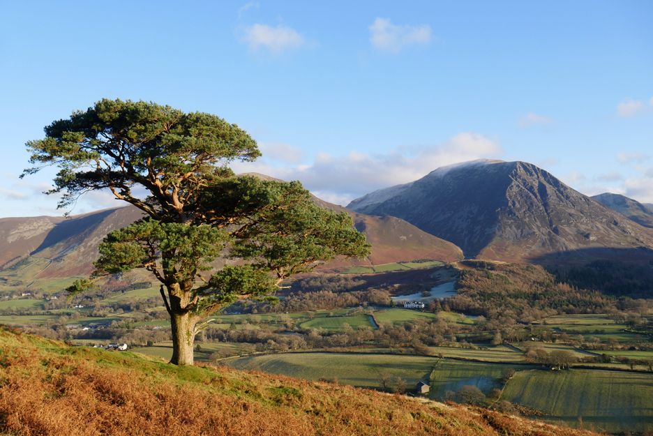
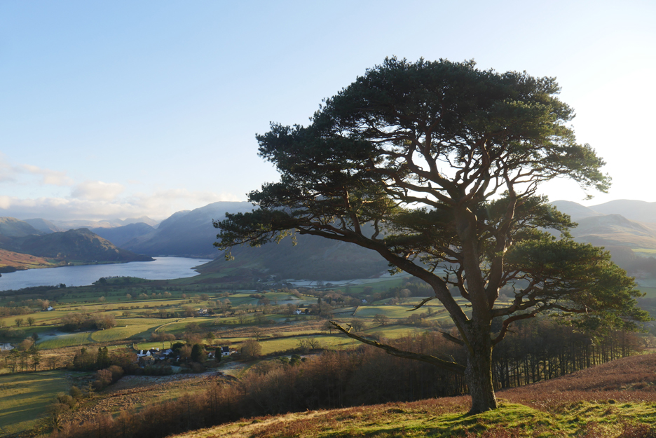
It is always nice to divert the short distance across to the pine tree.
Looking down on the houses of Loweswater, bathed in warm afternoon light.
Heading down to valley level and a late lunch at home.
Low Fell looked so inviting this morning . . . it didn't disappoint. - - - o o o - - - |
Technical note: Pictures taken with either Ann's Panasonic Lumix TZ60, or my Panasonic Lumix Gx8 Camera. Resized in Photoshop, and built up on a Dreamweaver web builder. This site best viewed with . . . the clear air of a fine, late autumn day. Go to Top . . . © RmH . . . Email me here Previous walk - 29th November - Askill Knott from Waterend A previous time up here - 21st November 2015 - Low Fell and the First Snow Next walk - 1st December - Low, lower and High Rigg
|