![]()

Remember: Press F11 for a full
screen view of this page.
|
|
|
Remember: Press F11 for a full
screen view of this page. |
|
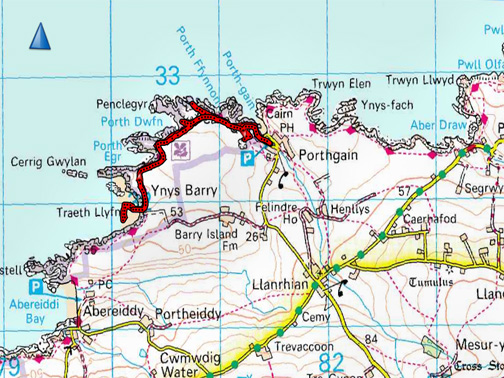
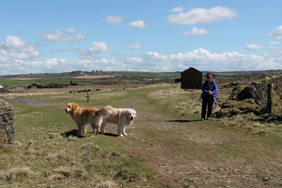
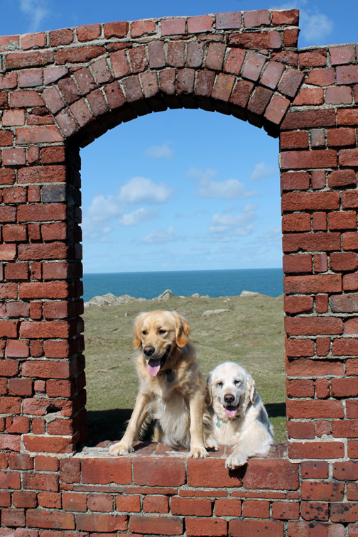
" West Wales - 4 - Traeth Llefn " Date & start time: Wednesday 27th April 2016. Location of Start : Porthgain, North West Pembrokeshire, Wales, Uk ( SM 815 325 ) Stayed at : Doves Cottage, Abercastle, North Pembrokeshire. Places visited : The main walk was from Porthgain to Traeth Llefn and back. Walk details : 3.25 mls, 500 feet of ascent, 2 hours 20 mins. Highest point : Cliff top views and a glimpses into the past. Walked with : Ann and our dogs, Harry and Dylan. Weather : Sunshine and blue skies after lunch, a cold northerly breeze. |
© Crown copyright. All rights reserved. Licence number PU 100034184. |
|
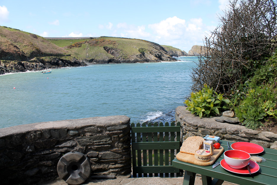
Today we drove the short distance to Porthgain to walk the other section of the coast path from the village that we didn't do last time. No need to rush because of the long summer days . . . so we stayed locally to start and enjoyed a nice lunch at the cottage.
Soup and a sandwich back at Abercastle . . . who needs to go abroad ? ( I wish the wind and the water were a bit warmer and the tide was full in, then it would be really nice to swim from the steps )
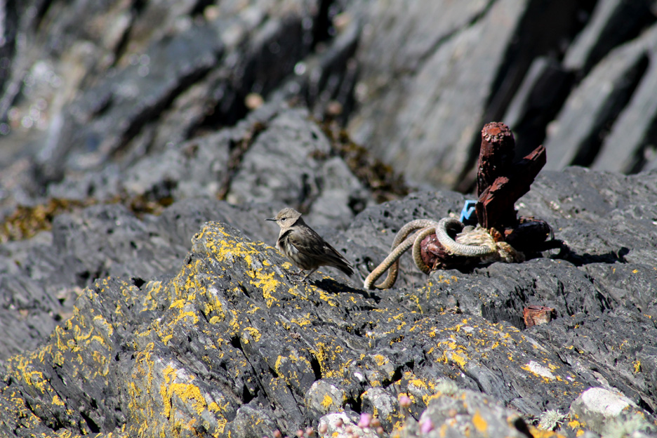
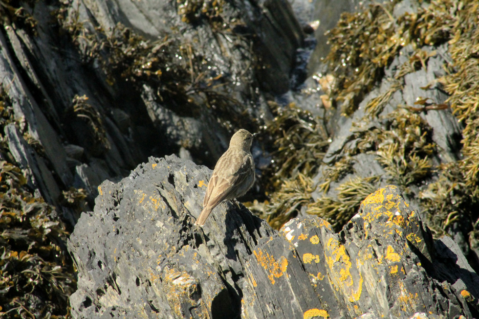
A local visitor today . . . an " LBJ " (little brown jobby). If this had been the fells back home it might have been a Meadow pipit.
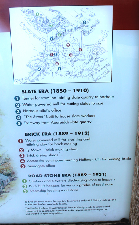
As it is within 50 yards of the shore . . . and it is scavenging on seafood . . . then it it a Rock pipit - - - o o o - - - Time for that other walk along the coast path from Porthgain, investigating the cliffs and the old mining heritage along the way.
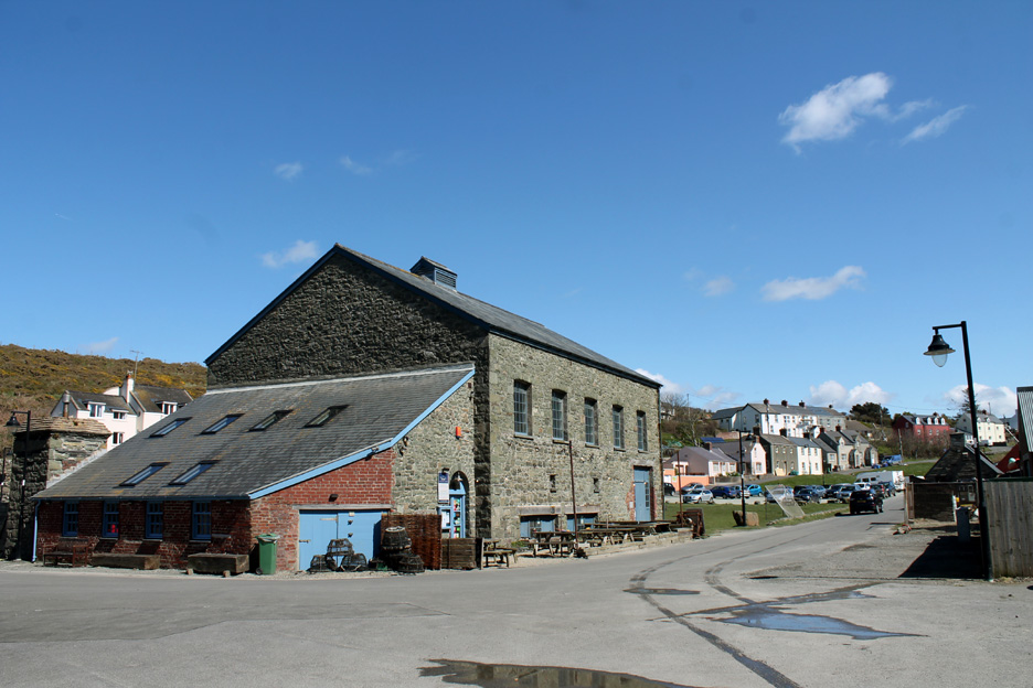
Starting point, the car park up from "The Shed" bistro where we ate last night.
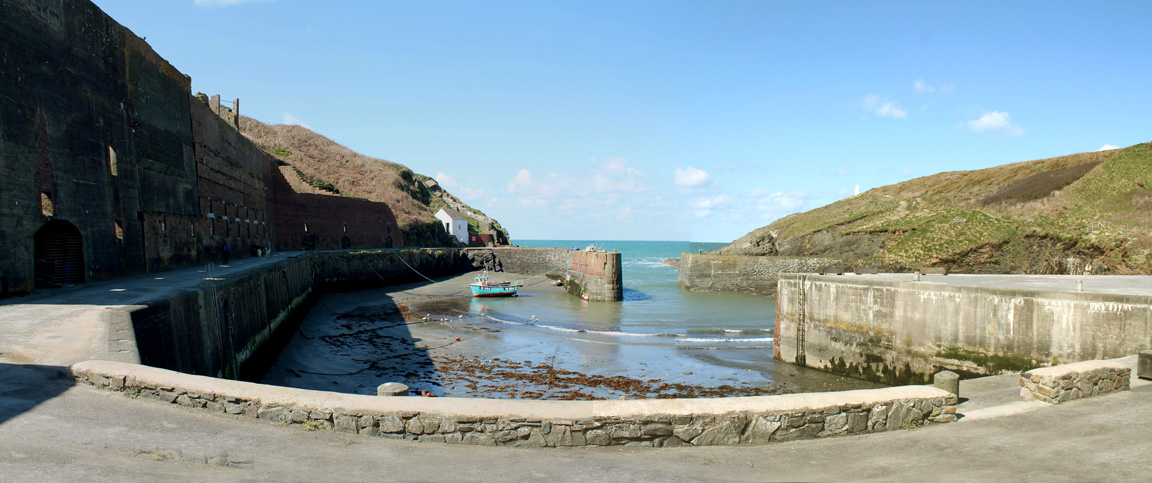
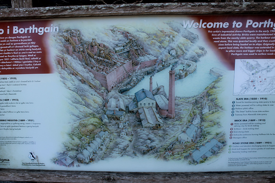
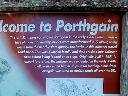
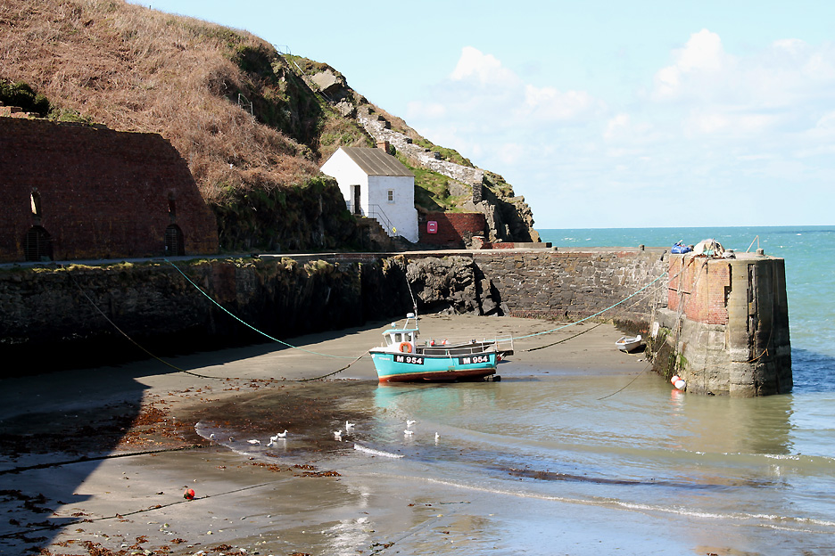
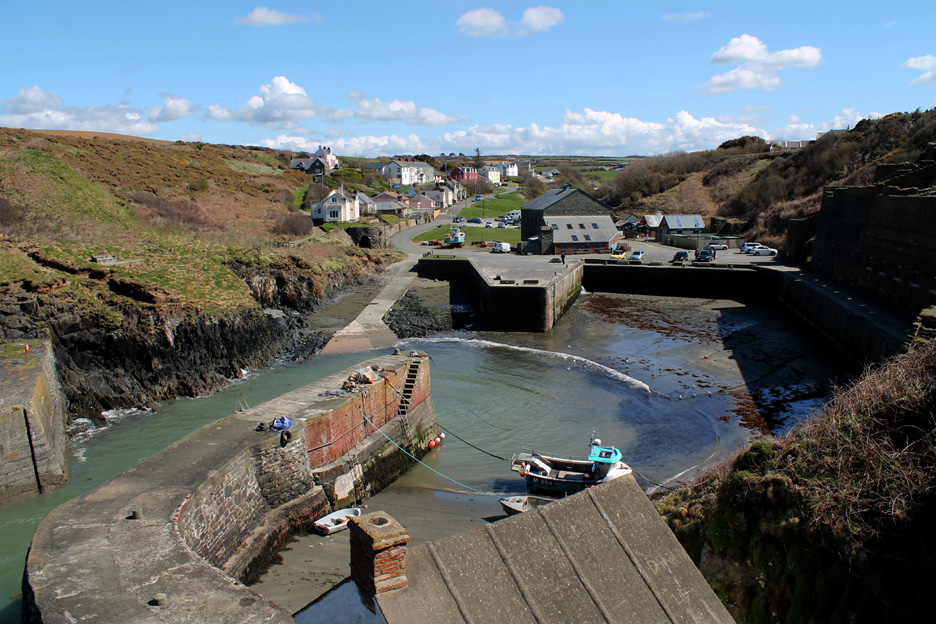
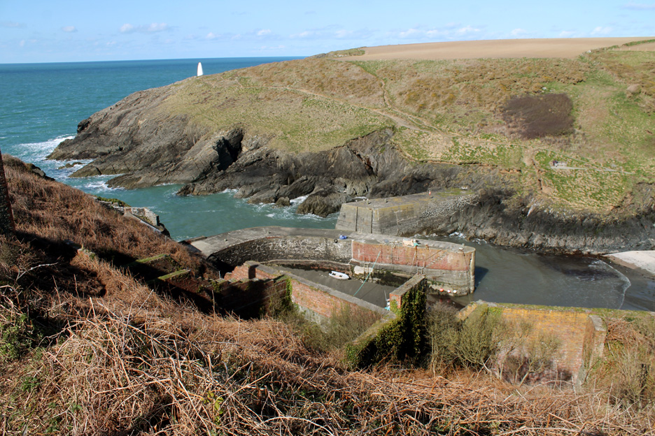
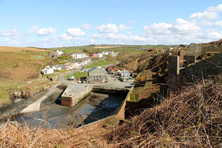
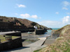
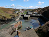
The seemingly oversized and over-equipped harbour (compared to the inlet at Abercastle ) The answer is in the history of the village . . .
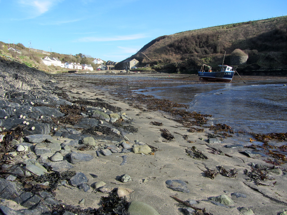
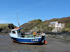
Just the one local boat in the harbour today. The signboard above shows it full of coastal boats exporting the stone to ports further afield.
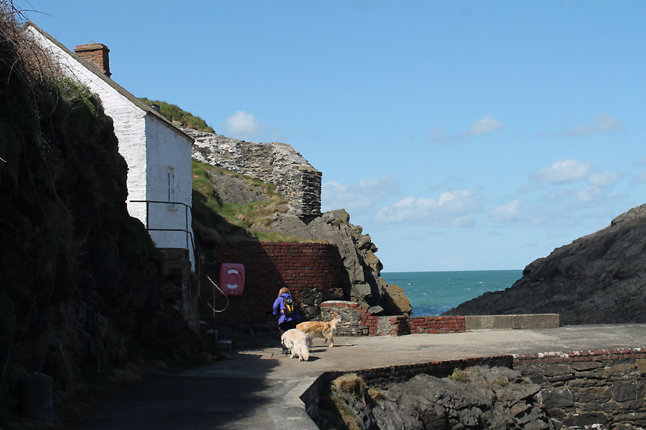
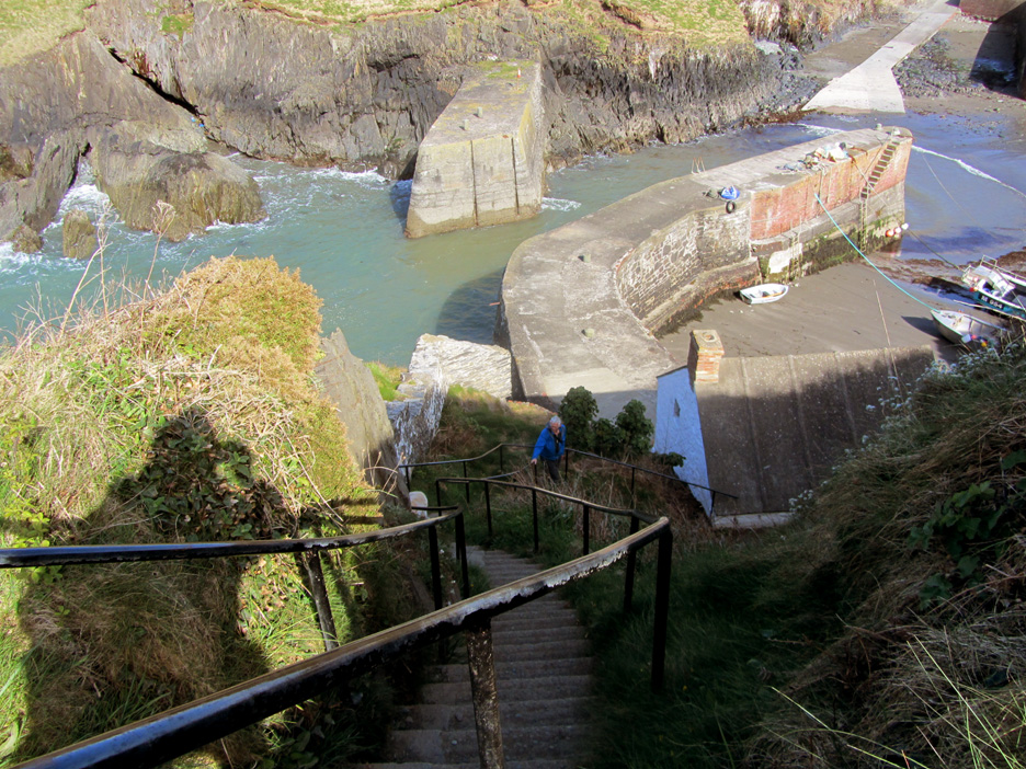
The main part of the walk starts by climbing the steep steps up alongside the wall behind the old Pilot's House.
Told you it was steep !
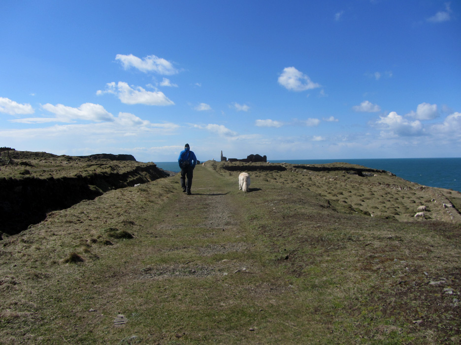
On the headland now and the land levels out. There are signs of old buildings and track ways.
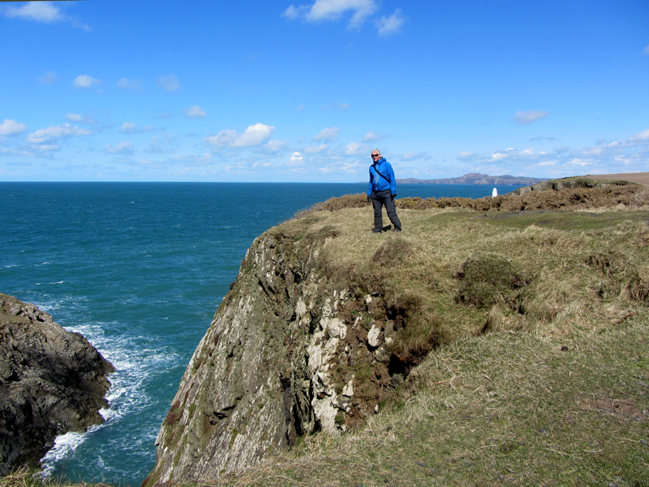
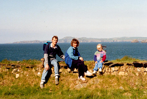
Venturing close to the edge . . . note the warm coat and gloves despite the brilliant sunshine.
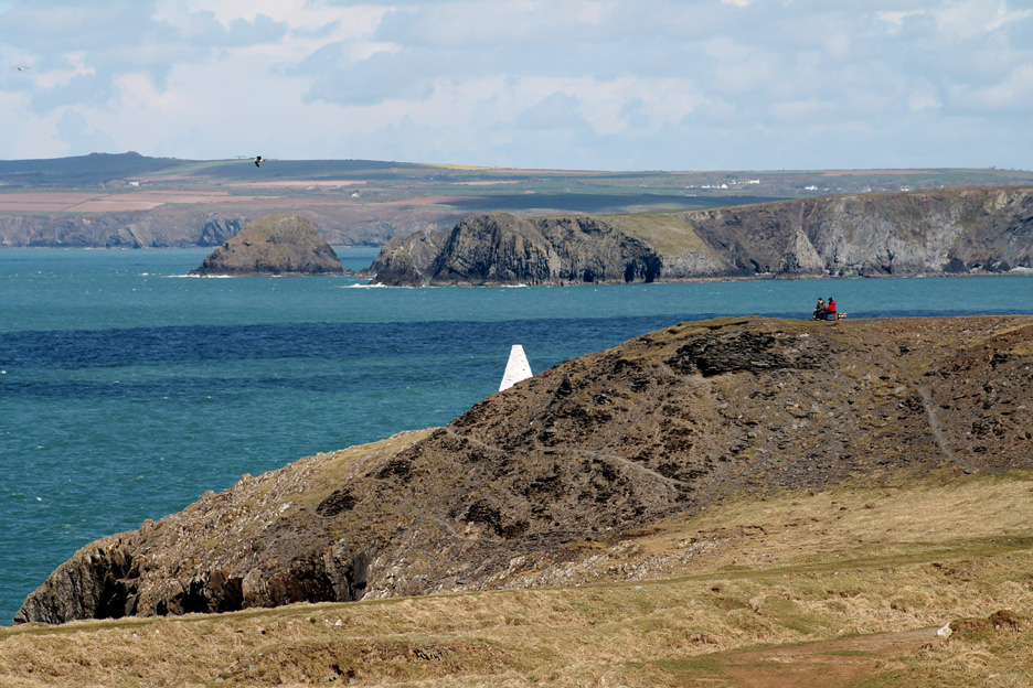
Two walkers grab a late lunch on the chair at the end of the old quarry tip. Beyond them is the white harbour marker for ships approaching Porthgain.
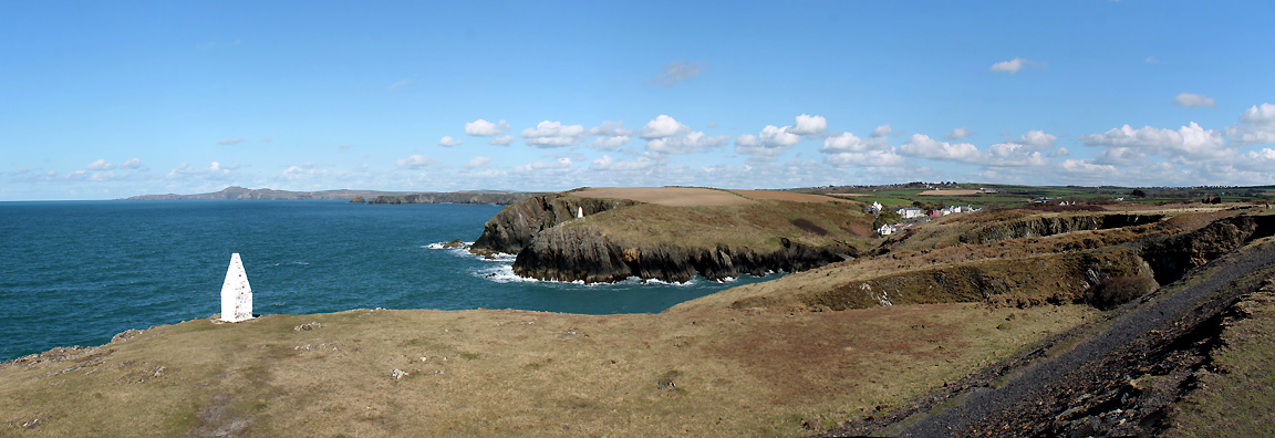
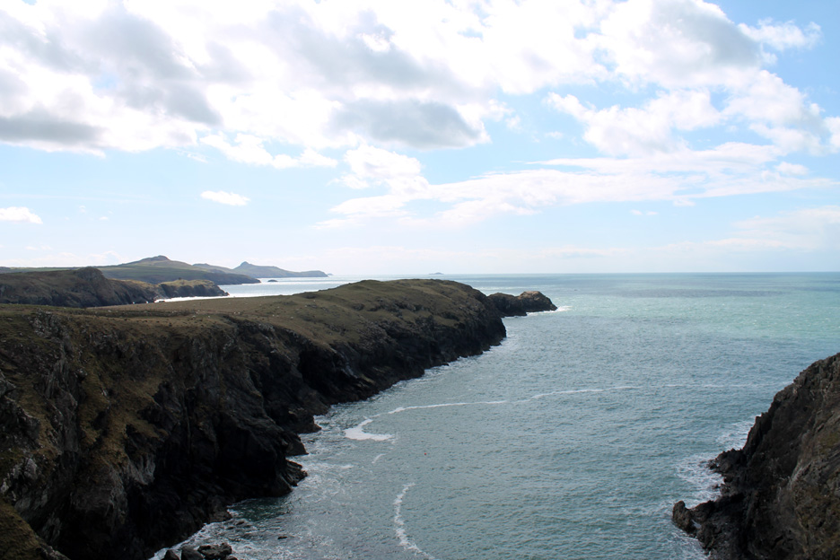
With a wider view near the chair then we can appreciate the importance of the two markers which identify the small safe inlet amongst a coastline of rocky bays.
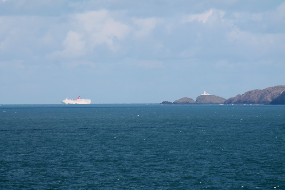
Zooming in on Strumble Head and the Stena Line Ferry leaving Fishguard for Rosslare, Ireland.
The old track bed still shows signs of the sleeper positions as regular indentations in the ground.
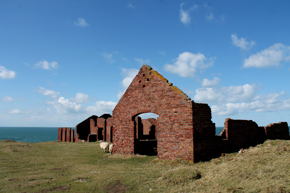
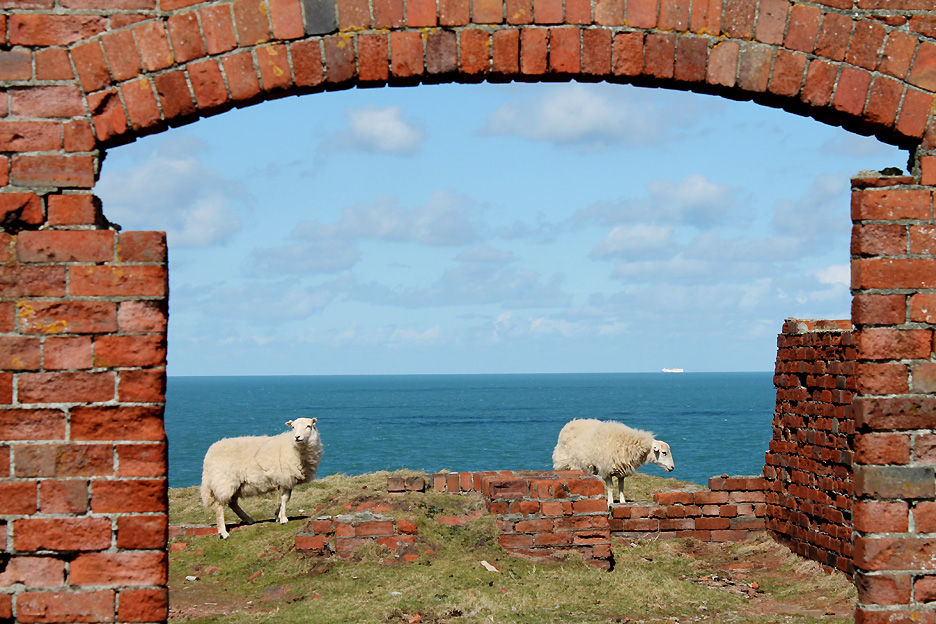
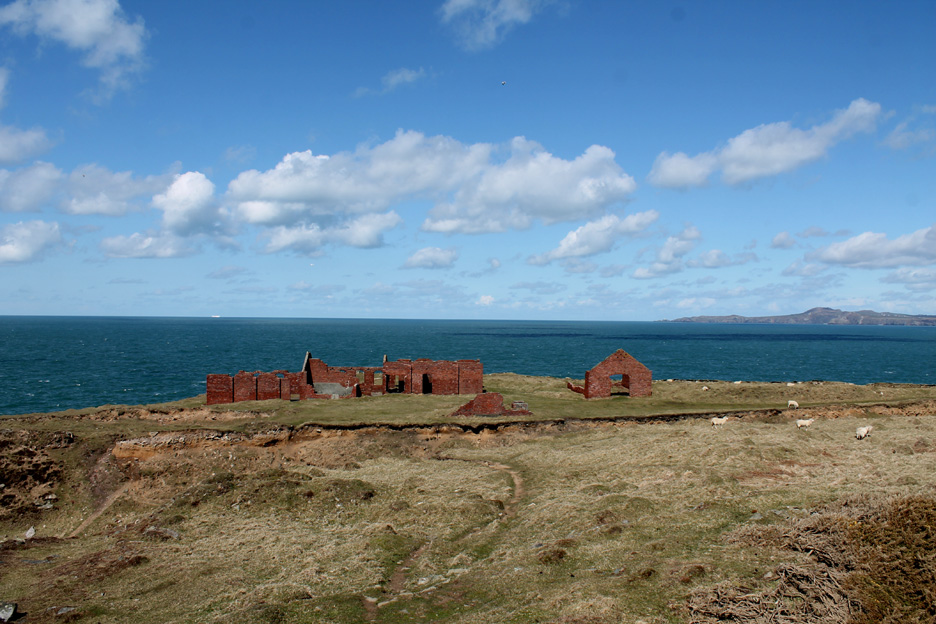
No doubt Porthgain bricks were used in the buildings that serviced the old stone quarry.
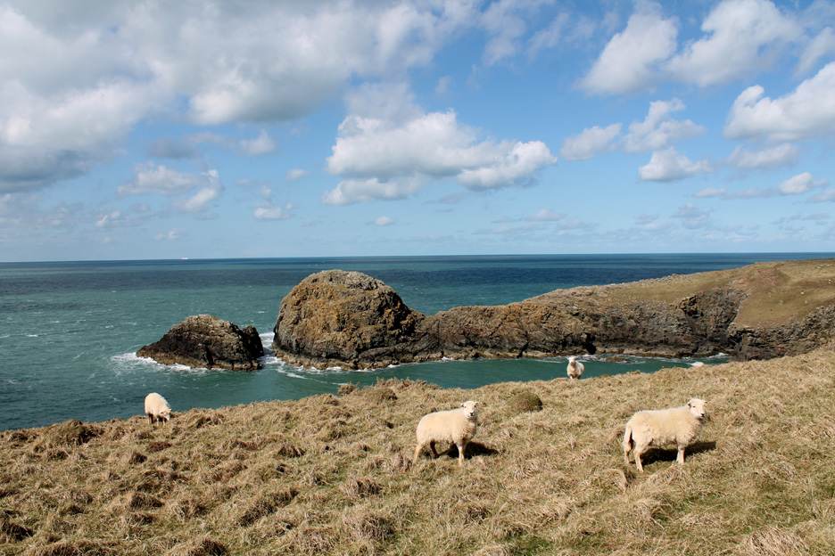
Today the sheep are in the majority compared to other walkers on the headland today. Notice the Irish ferry is now well out to sea.
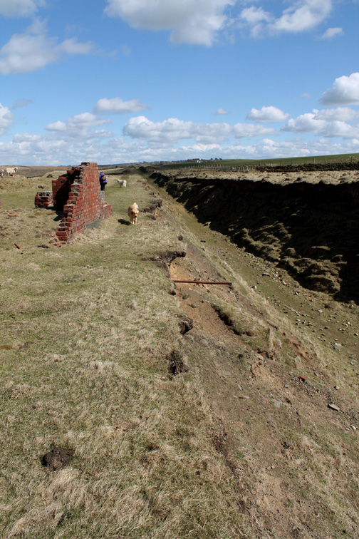
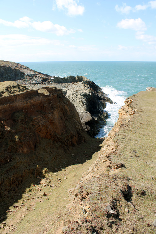
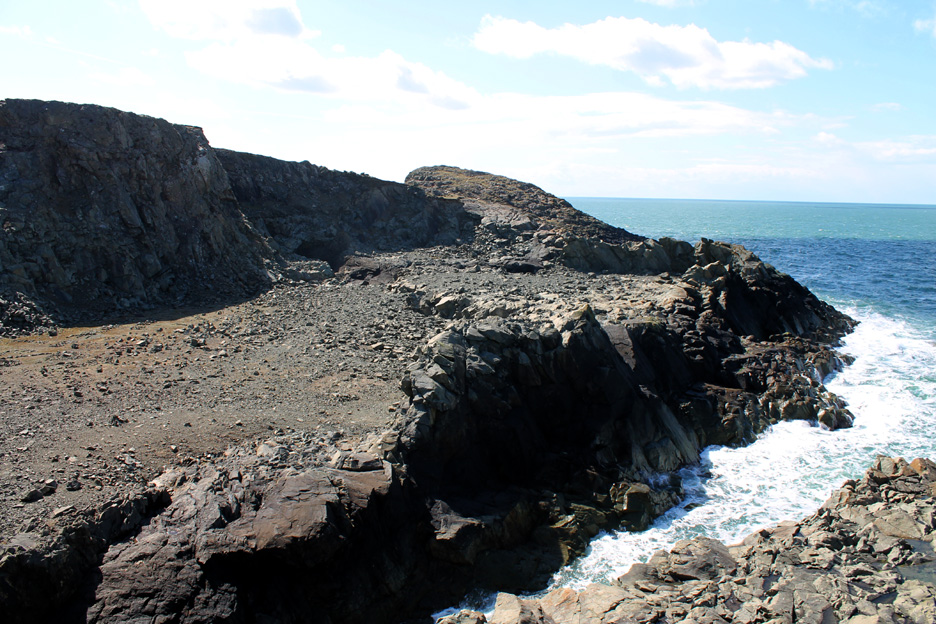
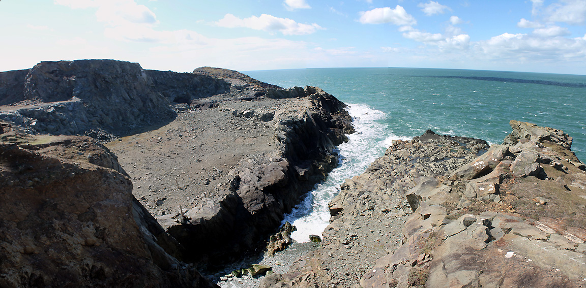
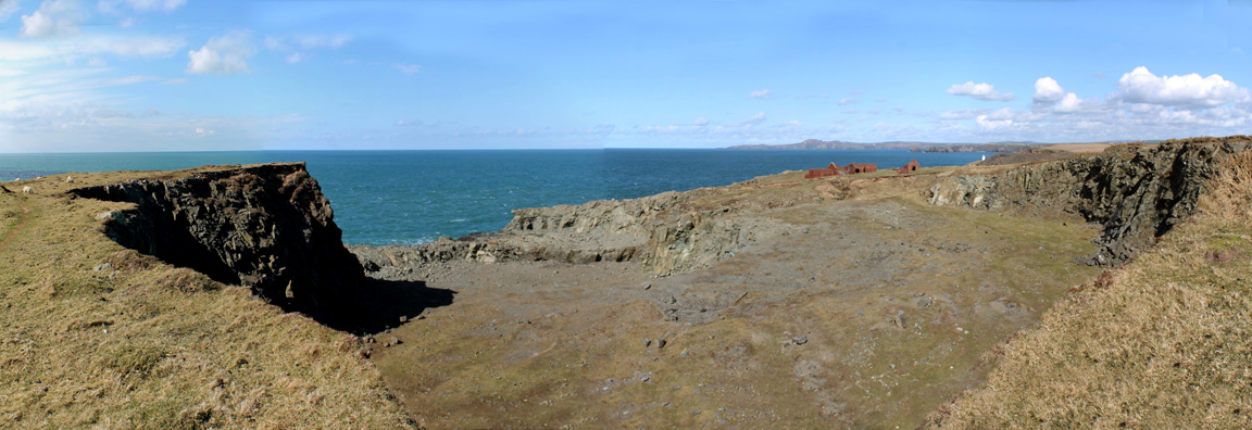
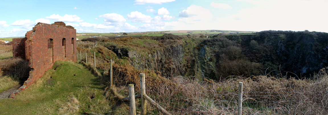
It was a huge excavation that has taken away a whole chunk of headland.
It is even bigger when one takes the wider view. There's more excavated ground this side and on an upper level to the left of the picture.
Whilst taking the picture, Ann noticed a big, dark shadow approaching. . . . makes a change from seeing these shadows and shapes dotted across the Lakeland fells.
Skirting round the deep cutting of the railway we continue on round the coast.
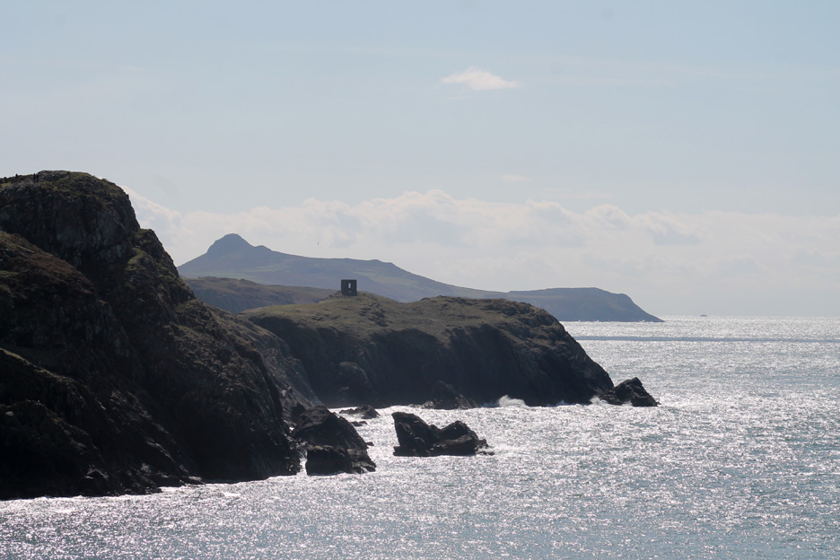
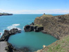
Port Dwfn bay (inlet) which is only accessible by sea. From here we can see all the way down the coast to Carn Lledi near St Davids.
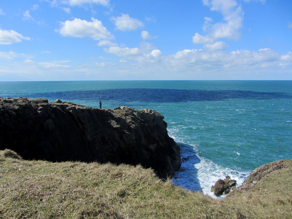
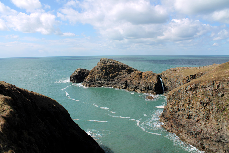
The headland has a rather impressive natural arch.
Spot the ferry . . . it's moving faster than we are . . . but then we're on holiday !
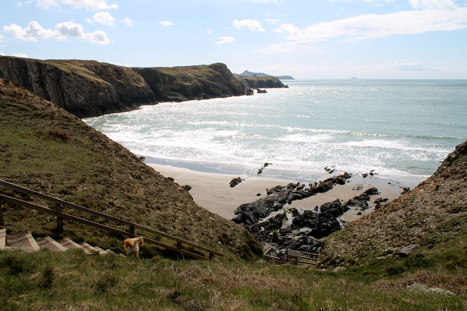
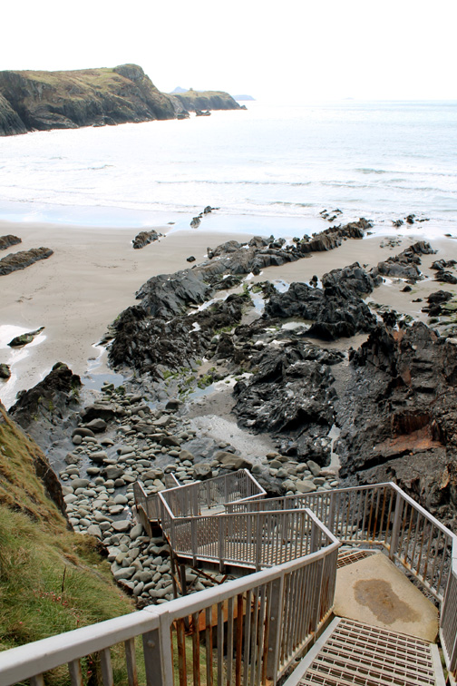
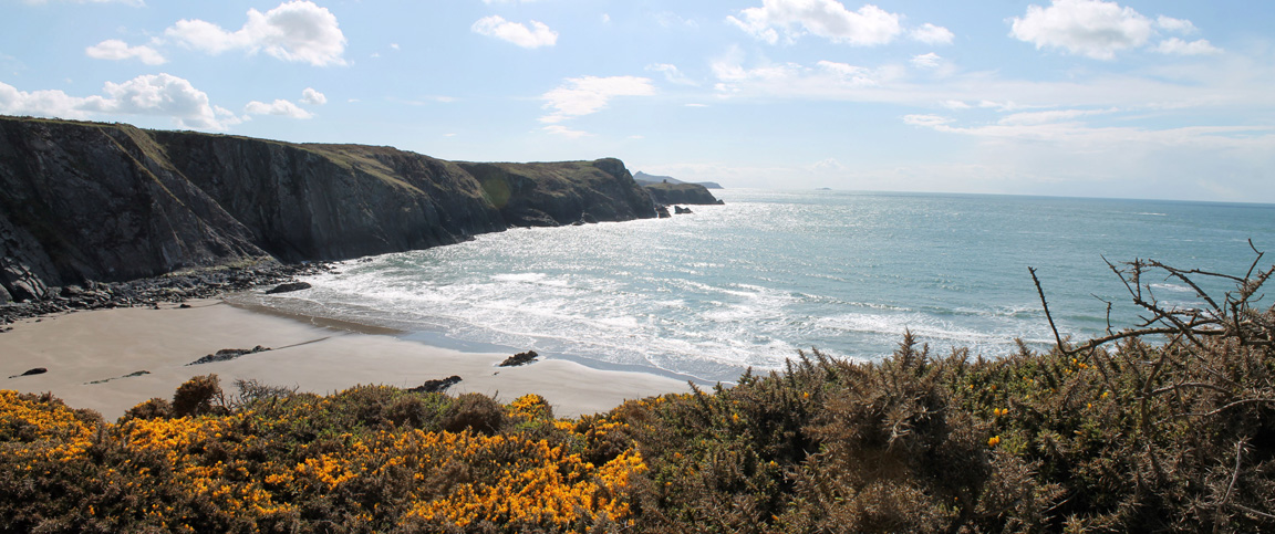
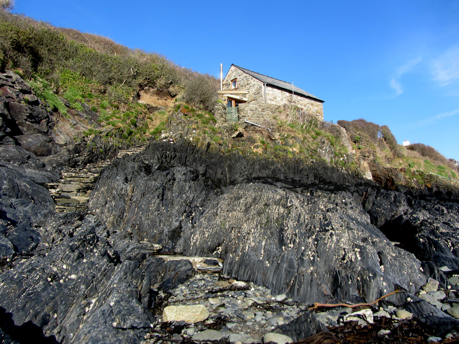
The major beach here, and the object of our desires, is Traeth Llefn Bay a beautiful sandy beach at the base of the steep cliffs.
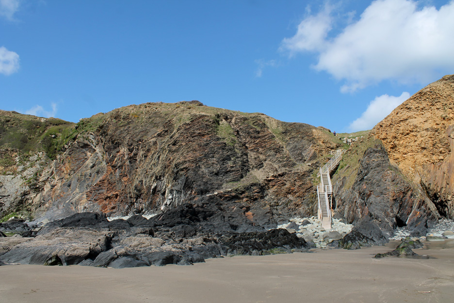
Unfortunately the nature of the griddle they have used on the steps make it rather dog-unfriendly as their feet and pads tend to get caught in the open metal lattice work of the treads. [ They haven't got boots on and it is too far down to carry them, or should I say carry them back up afterwards.]
Consequently Ann elected to stay on the top as I take a quick visit to the bay.
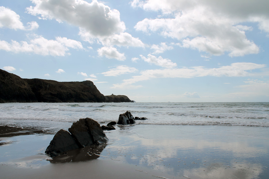
The tide is out and there's plenty of sand.
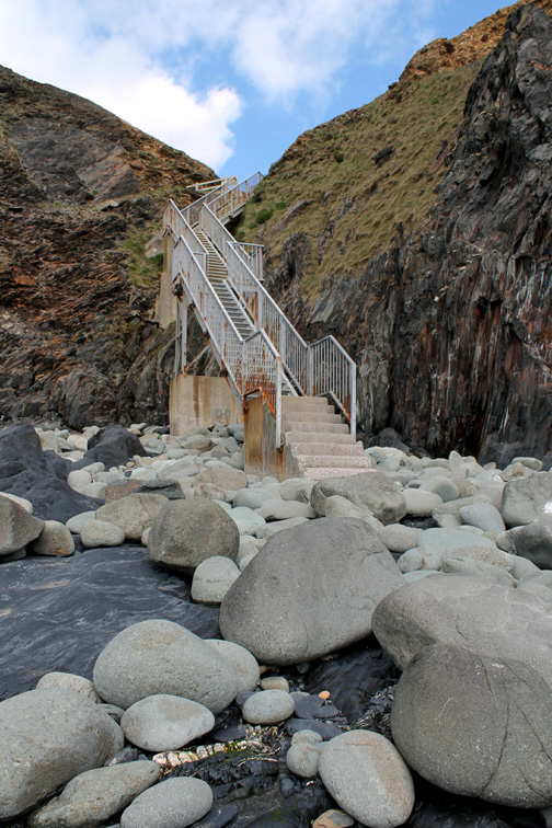
Ann is returning to the top of the ladder as I head back. The old path can be seen as a diagonal line down the cliff from the top part of the fence. Now covered in loose shale, I'm sure we used it on that 1989 visit and definitely prior to that date.
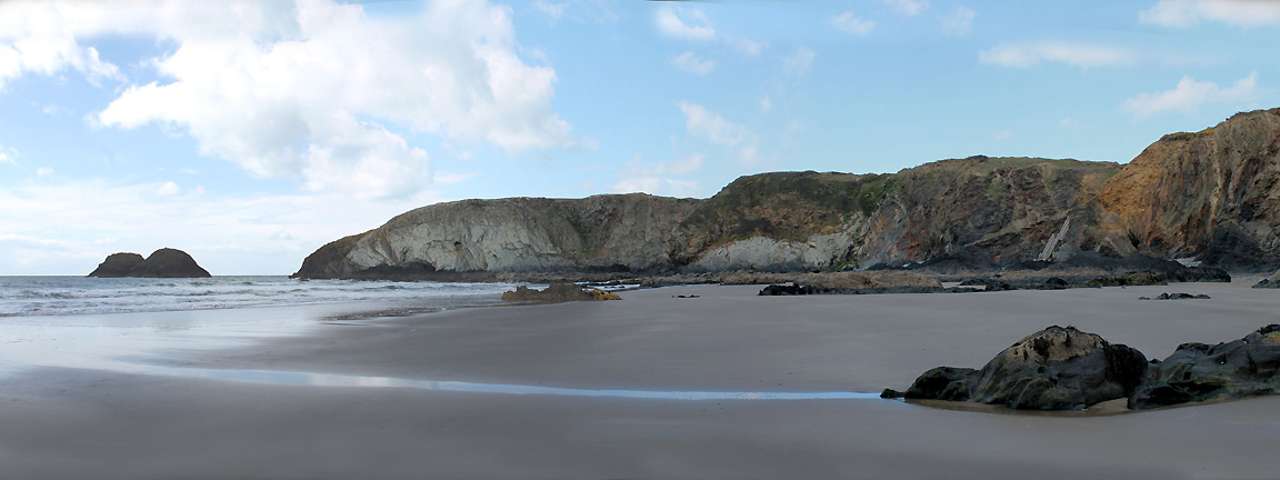
The view from Ann's perspective with some of the gorse bushes in full flower.
Zooming in on the tower that marks the entrance to Abereiddy Bay and the slate quarry that is situated over there. - - - o o o - - - Time to turn around today . . . and make our way back to Porthgain.
A close visit to the edge of the top quarry on the way back.
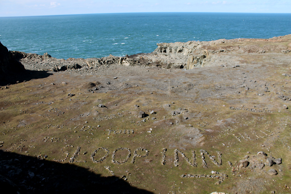
A well-placed advertisement for the Sloop Inn . . . using local materials no doubt it has been made by someone else who also has a passion for the place
This time, after reading the information board, I made a definite effort to find the old slate quarry. The deep hole in the cliff is well protected and rather overgrown so you can't see much. There appears to be an old funicular down into the quarry from the other side, but the main access for the later quarry was via a tunnel that came out directly on the edge of the harbour.
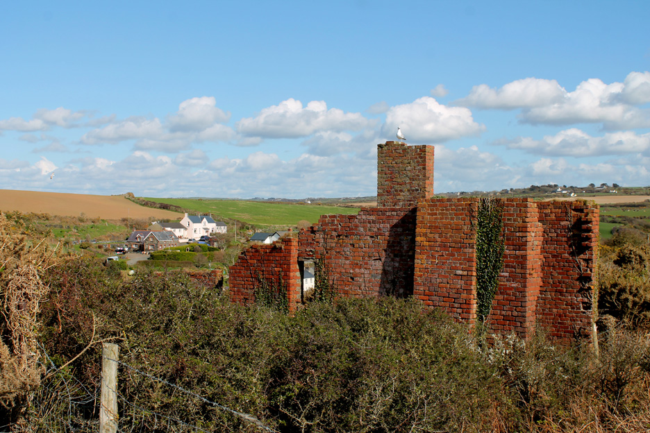
More brickwork at the top of the hopper system above the harbour.
The brick walls that allowed quarried stone to be sorted and stored ready for the visiting boats.
A side view giving a better idea of the huge extent of the storage bins.
Back down those steep steps to the harbour below. - - - o o o - - -
Back at Abercastle at the end of another fine afternoon.
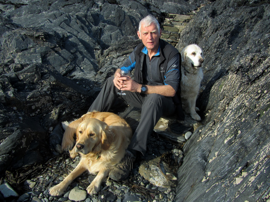
Chance to sit at the base of the steps . . .
. . . with a little pre-diner refreshment.
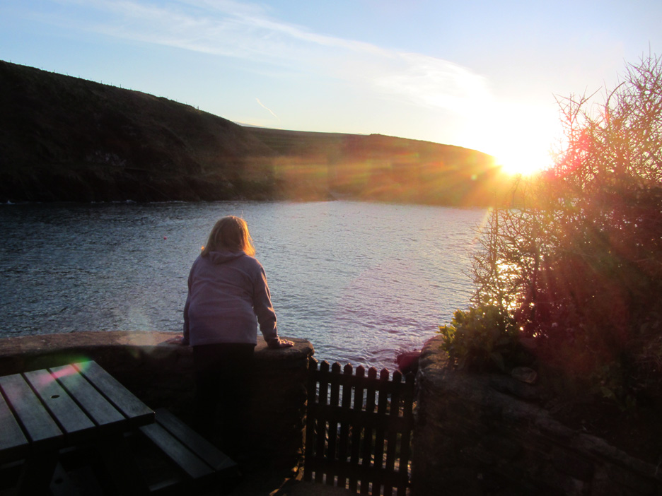
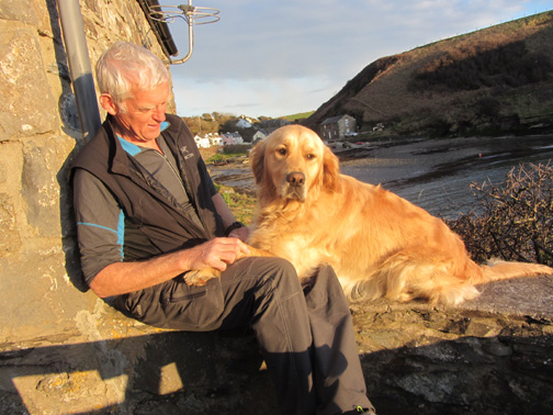
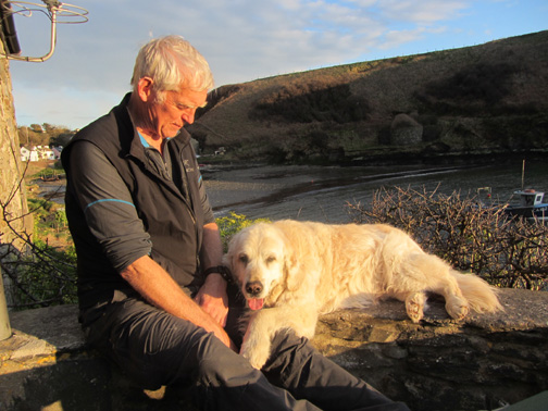
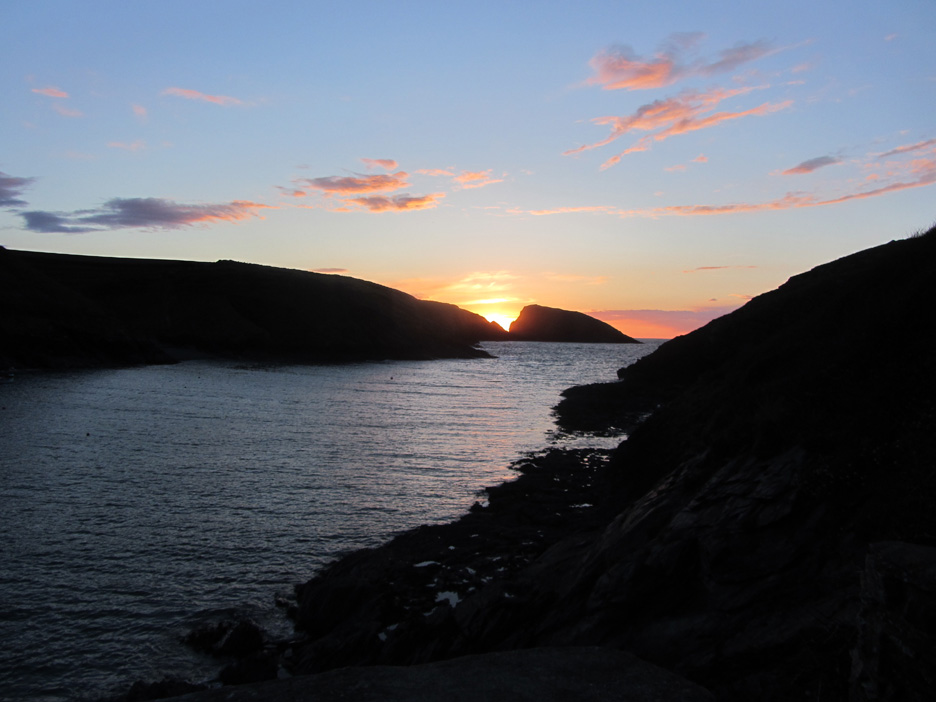
The rising tide and the setting sun encourages us back to the patio of Doves Cottage.
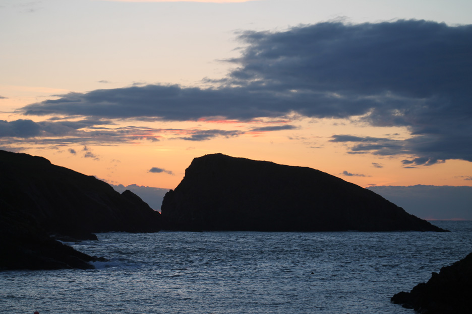
The setting sun across Abercastle's outer harbour.
Time to turn the light on to make some supper . . . sunset time was nearly 8pm tonight. - - - o o o - - - |
Technical note: Pictures taken with either Ann's Canon Sureshot SX220, or my Canon 1100D Digital SLR. Resized in Photoshop, and built up on a Dreamweaver web builder. This site best viewed with . . . A well indexed set of old photo albums. Go to Top . . . © RmH . . . Email me here
Previous walk - 26th April 2016 - 3. St Justinian's A previous time up here - 10th to 18th May 09 Our 2009 Pembroke Holiday Next walk - 27th April 2016 - 5. Abereiddi
|