![]()

Remember: Press F11 for a full
screen view of this page.
|
|
|
Remember: Press F11 for a full
screen view of this page. |
|
Buckden Pike in Wharfdale Date & start time: Saturday 17th April 2010, 11.15 am start. Location of Start : Buckden Village car park, Wharfdale, N.Yorkshire, Uk ( SD 942 774 ) Places visited : Buckden Beck, Buckden Lead Mines, Buckden Pike, Cray Village, Scar Hose, Yockenthwaite Village, back to Hubberholme and Buckden along the river. Walk details : 9.6 mls, 2050 ft, 6 hrs 30 mins including lunch. Highest point : Buckden Pike ( 2281 ft - 702m) Walked with : David and Josie, Lorraine, Steve, Neil, Richard, Jo, Ann (and the dogs, Jodie, Amber, Harry and Bethan) plus Gary and Sheena with Tim dog, Liz and Barrie with Sam. Weather : Blue skies all the way but a stiff breeze on the summit.
|
|
Today was an official OFC walking day . . . that is, someone has put the extra effort in to plan, check and publicise the walk in advance of it happening ! So it was with Dave and Josie's summons ringing in our ears we set off over the county boundary into 'injun' country.
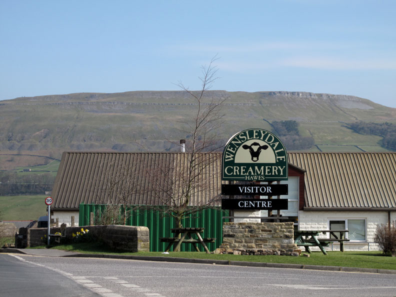
Our route passed through the delightful village of Hawes where the 'injuns' make extremely good cheese . . . don't you agree Gromit ?
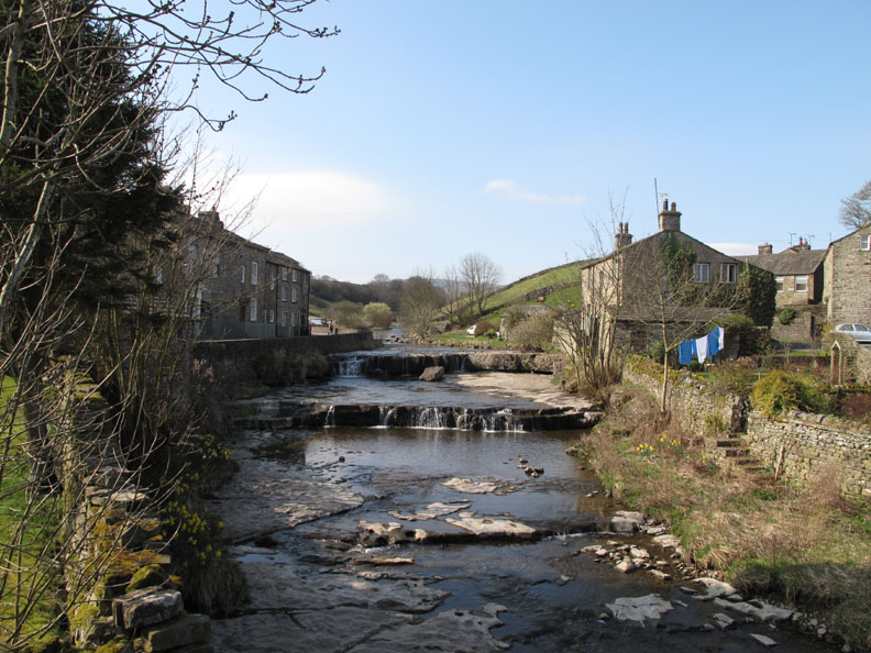
At the top end of Hawes is the hamlet of Gayle. They have a delightful series of waterfalls and a working mill . . . but no sign of honey production.
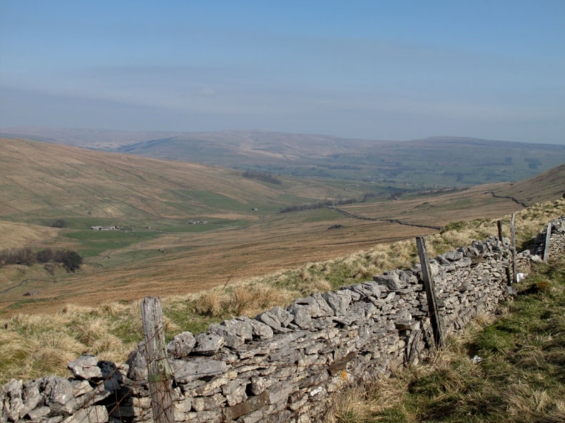
The mountain road climbs out of Wensleydale and up the valley of Sleddale (seen here) before descending into Langstrothdale which is a tributary of Wharfdale, home to Buckden.
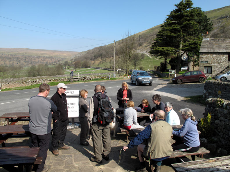
There we found a waiting band of fellow walkers and after initial greetings we adjourned for tea or coffee at the local tearooms . . . good plan so far Dave.
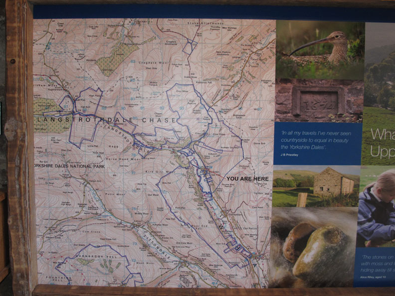
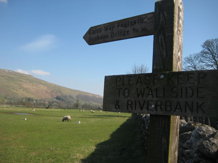
A brief visit to the renovated barn next to the car park provided us with a map overview and a comprehensive wall display of the local flora, fauna and other points of interest in the valley.
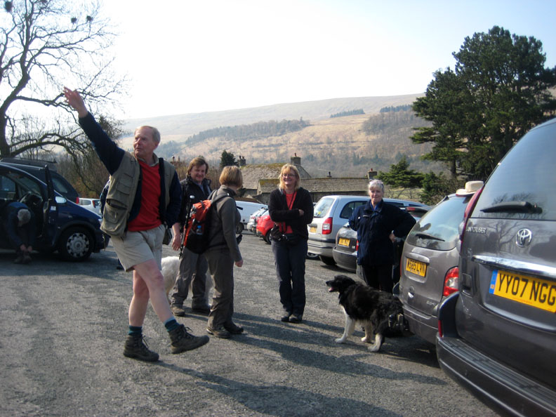
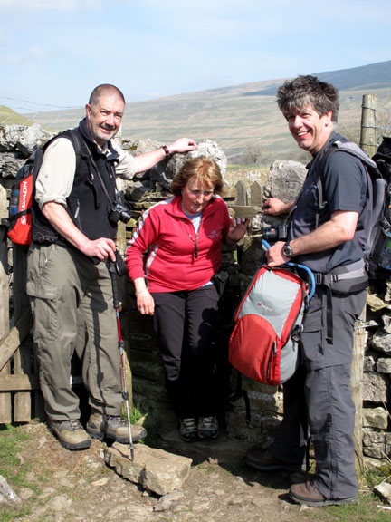
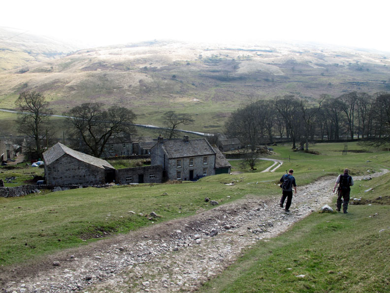
Back at the cars Barrie points out where we will be walking today . . . the first of many fun photos I have a feeling. Gary and Sheena (in the background) were unable to walk with the group today. They had managed an earlier walk in the valley before our coffee break but said their goodbyes at the car park before they left for home. Likewise, Liz and Barrie declined the full walk but we arranged to meet afterwards . . . and possibly even at Scar House during the day.
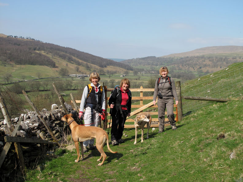
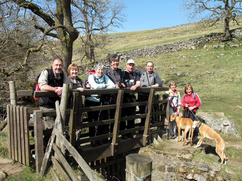
So it was nine people and four dogs in the party as we set off from Buckden Village in the warm sunshine.
The first of many gates and Jo, Ann and Josie stop for a quick photo.
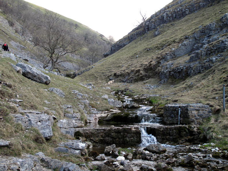
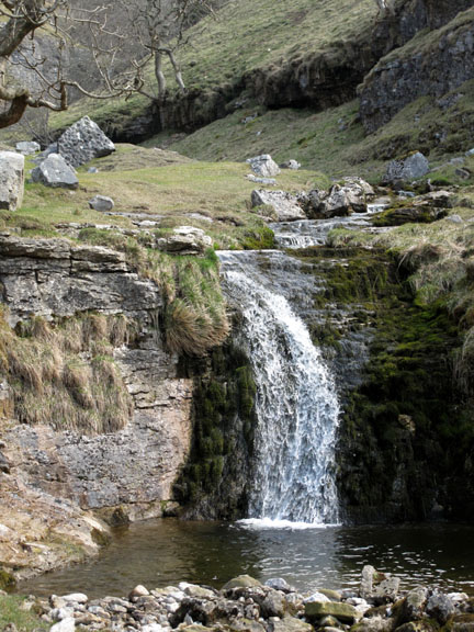
. . . and the first of many waterfalls as we enter the valley. This small one was in fact the extraction point of a local water supply, hence the pipe work.
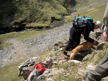
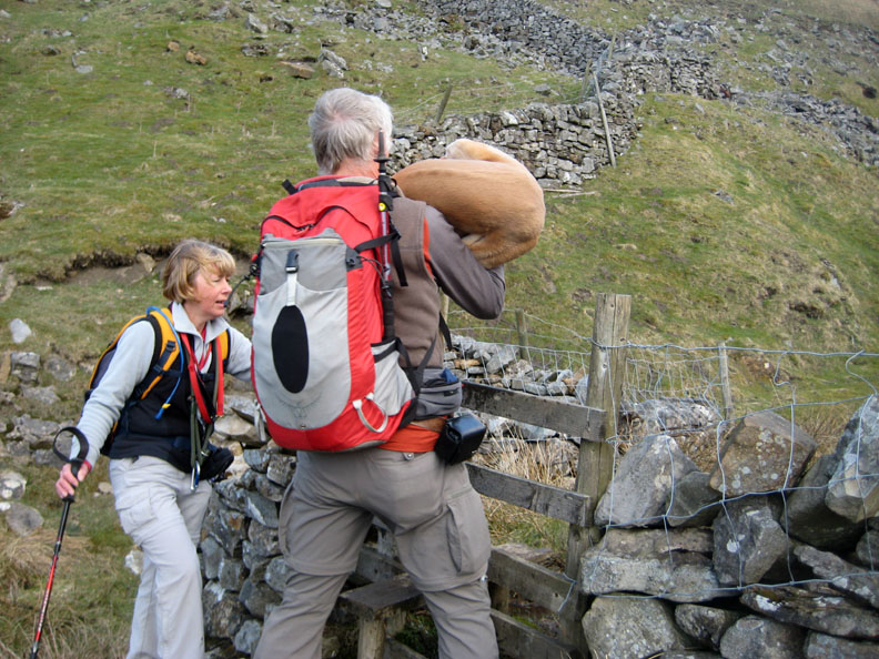
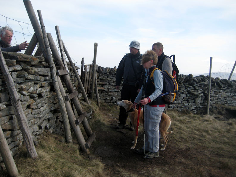
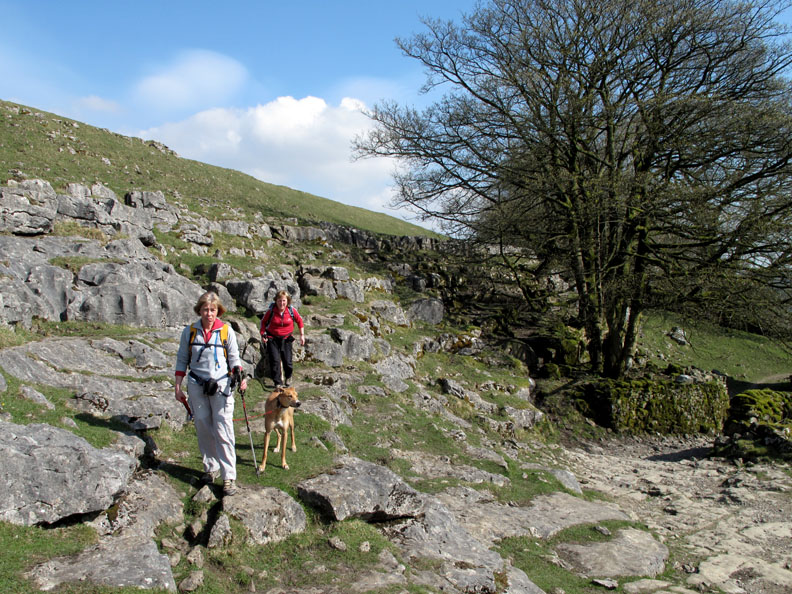
More fences this time but Jodie can't cope safely with the stile. Fortunately she doesn't weigh too much so can be lifted over relatively easily.
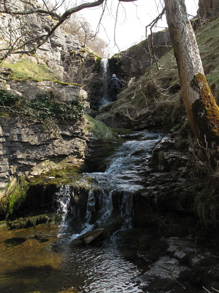
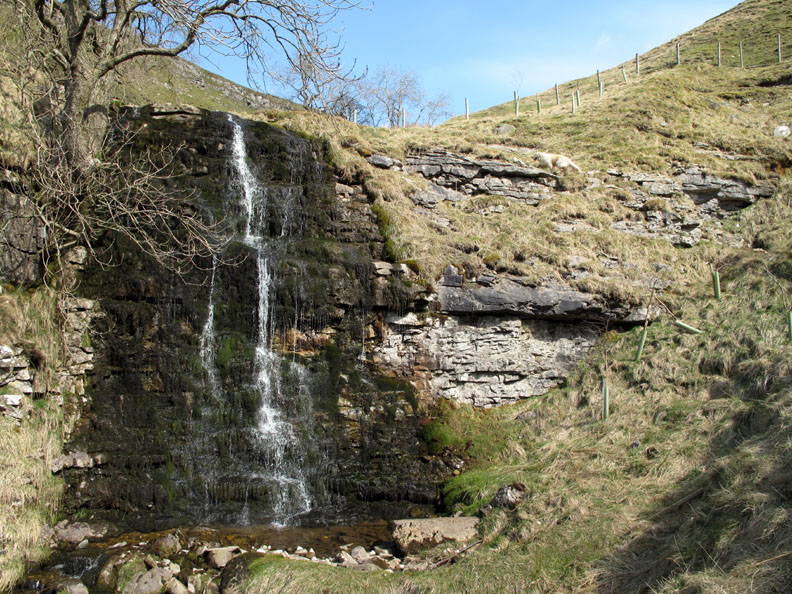
And one last one . . . The climb up the valley has been a real delight. The scenery was about to change after this final waterfall as we entered the next section of the walk.
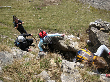
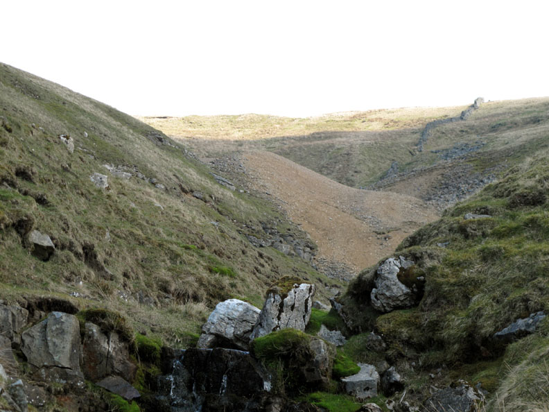
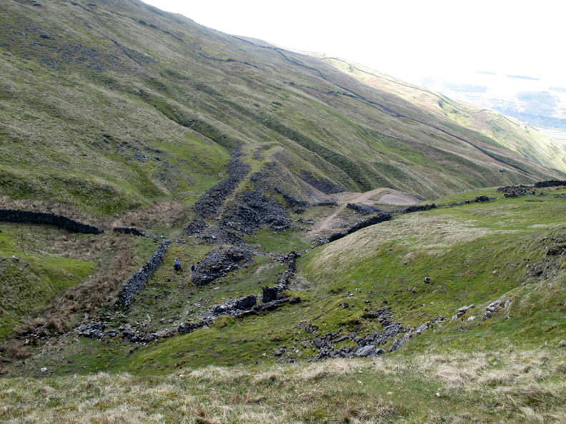
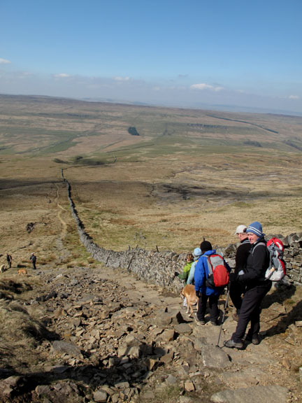
Ahead is the first signs of the Buckden Lead Mines. An old spoil heap devoid of vegetation . . . classic signs of lead mining where the mine waste prevents re-growth.
The first of the small number of buildings on this small mining site
Lead mining developed at Buckden from the 1650's but had ended by 1830 due to a drop in demand and a collapse in the price of lead.
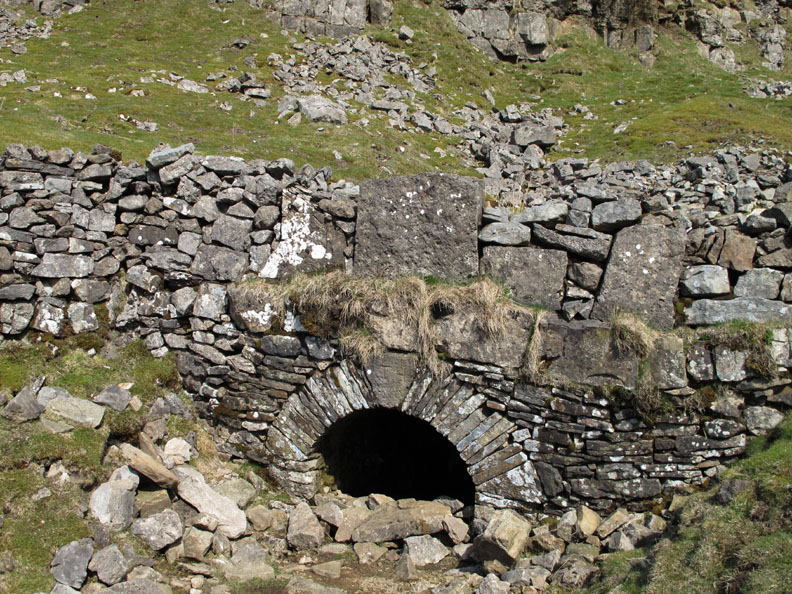
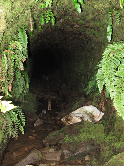
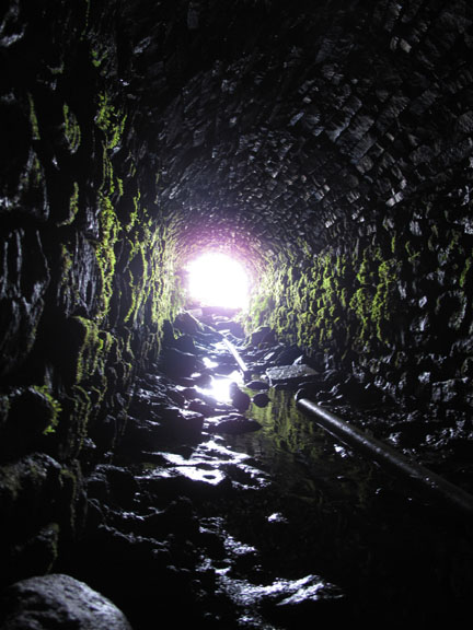
The entrance to the main addit or mine tunnel.
Due to the secure nature of the initial tunnel I ventured in a short distance until the tunnel turned slightly and the floor was covered in mud and water. I turned and made my way back. [ A few more internal shots are available from the Mine Explorer site here ]
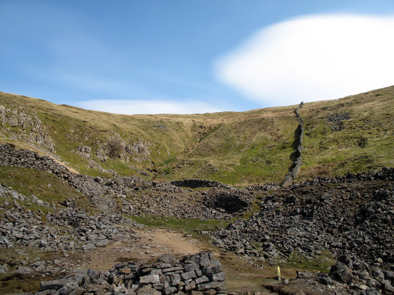
Looking back at the mines the layout can be seen, with a trackway taking spoil out to the left, a small hut immediately below and an ore processing area and waste heap in the centre of the valley area. The larger building that we passed on the way up was probably miners accommodation or workshops.
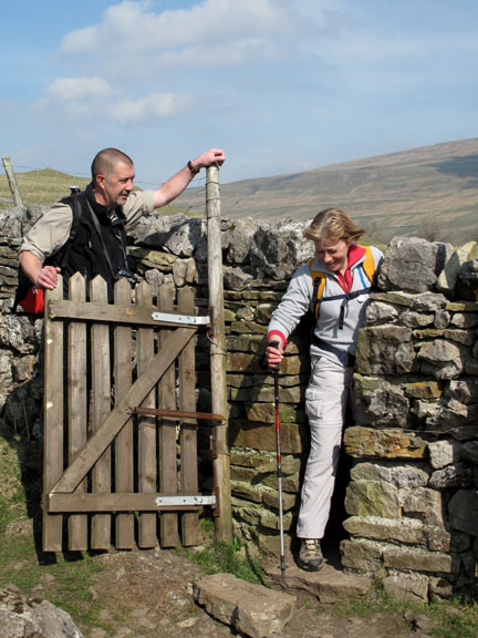
At the top of the hill now and the wind is much stronger. As a result Jo has difficulty seeing how to get Jodie over the ladder stile !
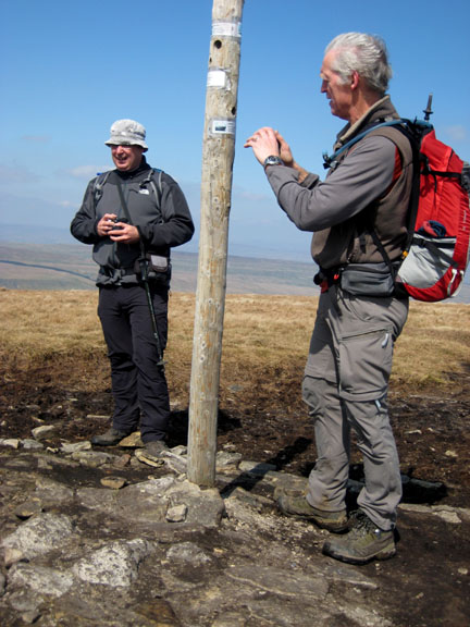
The flat top of Buckden Pike is now in view complete with its trig point, cairn and viewing post. Note that due to the volcanic eruption on Iceland and the closure of the flight paths over Britain and Europe there are no contrails to be seen today in the sky today as there are no aircraft up there.
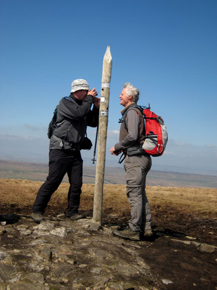
Everyone watches as Dave stops to take a photo of one of the summit stones . . . or was he just setting his camera up for his version of the next photo ?
Yes we made it . . . an OFC (and complete) group photo on Buckden Pike summit. David, Neil, Lorraine, myself, Richard, Ann, Steve, Josie and Jo . . . we even managed to include the four dogs !
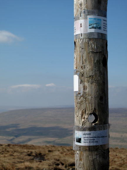
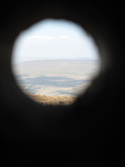
Instead of a pointer on a stone plinth, someone had come up with the idea of holes cut at the correct angle through the wood and then suitably labelled with the view to be seen through it.
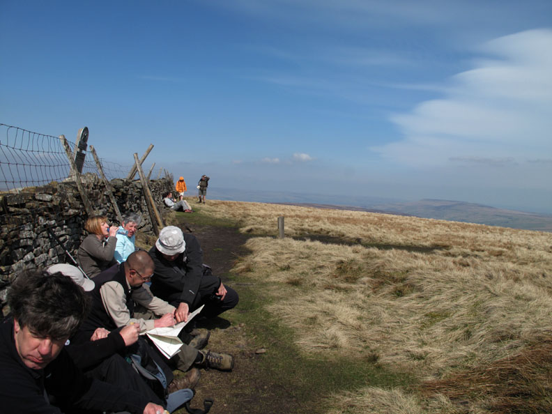
Sunny and blue but a strong wind encourages us to shelter behind the wall for our lunch stop.
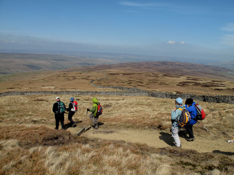
Setting off again after lunch, we head for Cray Village. Maybe the haziness of the sky is partly to do with the dust in the upper atmosphere.
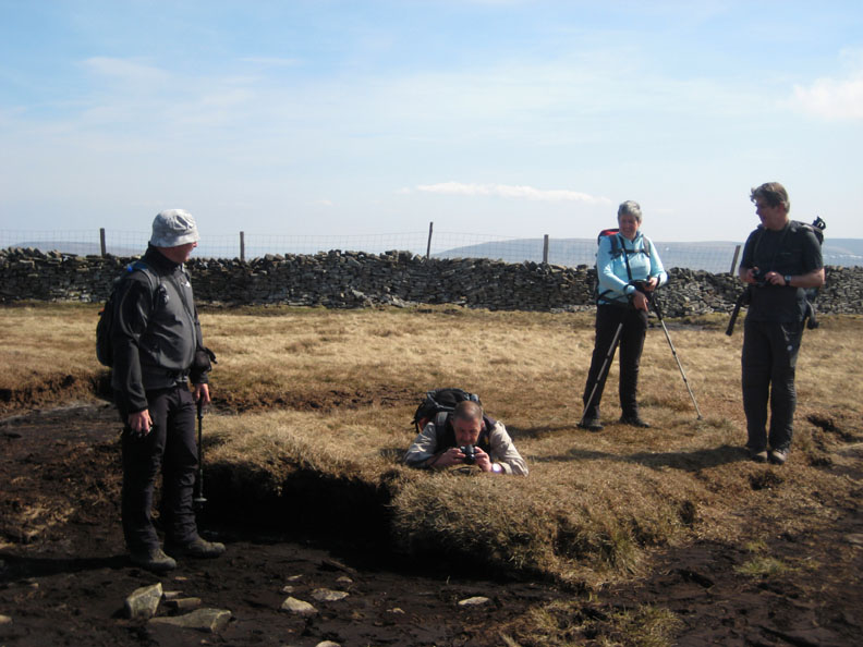
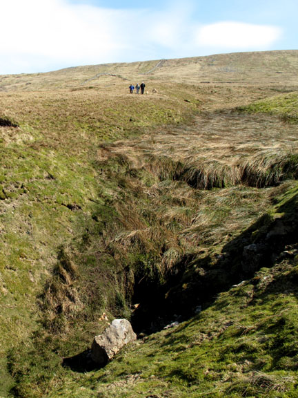
The small stream from the hillside has been channelled into a pothole and dives underground.
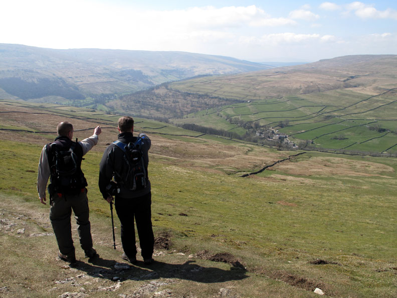
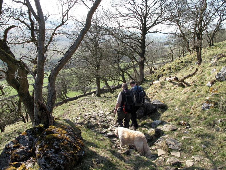
David and Steve discuss the route down to Cray Village below.
One last field to go as we cross the line of the old Roman Road from Ilkley to Bainbridge.
The stepping stones at Cray Village as we cross Cray Gill.
Steve wishes for a pound for every gate he has opened today. With the money he might even be able to buy a nice sun hat like Richard's !
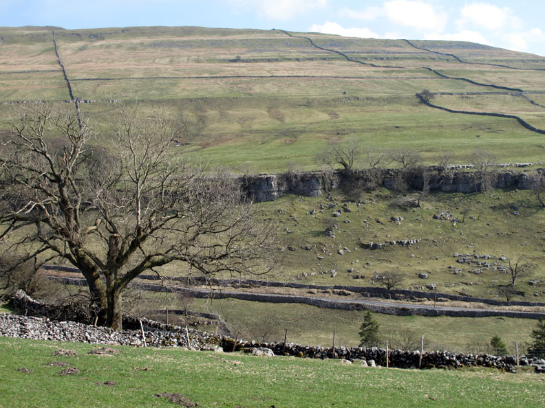
Looking back at Buckden Pike and our descent route. The limestone layers form characteristic escarpments of various heights all the way up the hill.
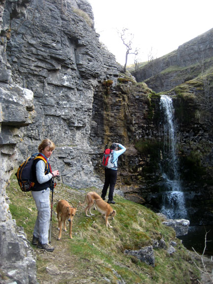
Crossing Crook Gill and time for another photo opportunity. [ No self timer this time so I'm not in there ]
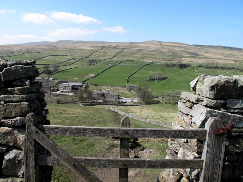
David suggested this was the classic view of Wharfdale and apart from the slight haze today . . . I tend to agree with him.
This is sheep country . . . you certainly couldn't plough this lot for arable crops.
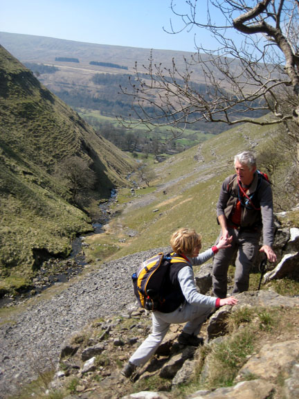
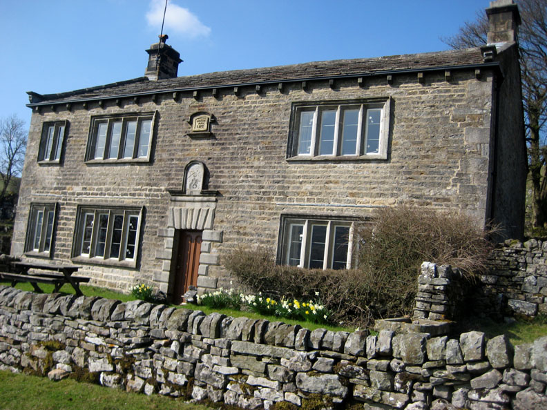
Taking the advantage of an alternative route, Ann and Josie break off at this point and descend to the valley past the lovely old building known as Scar House.
The rest of us continue on a further mile or so in order to visit the hamlet of Yockenthwaite. Here we start our descent into the valley.
The many natural stone farm buildings that make up the delightfully named Yockenthwaite. [ Unfortunately bright sunshine made good photography difficult.]
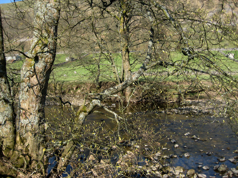
A large bridge would imply a high river flow, but apart from a few pools the stream bed was dry as the river had dived underground and has stopped running at this point.
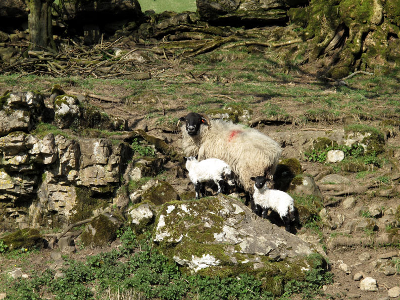
Down in the valley the breeze is low and the sunshine is warm as the young lambs enjoy the start of their new lives.
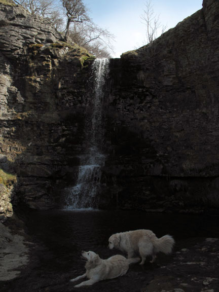
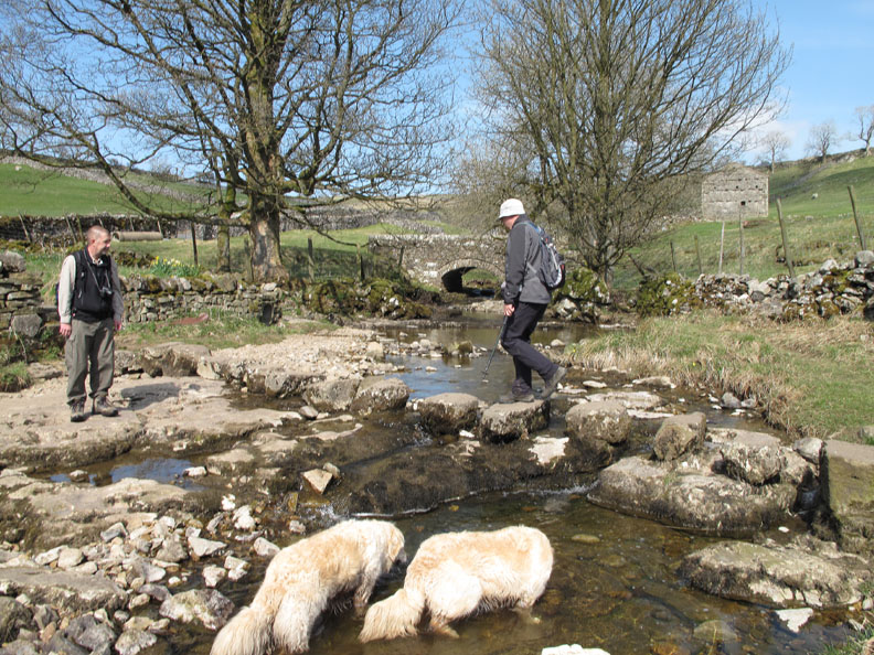
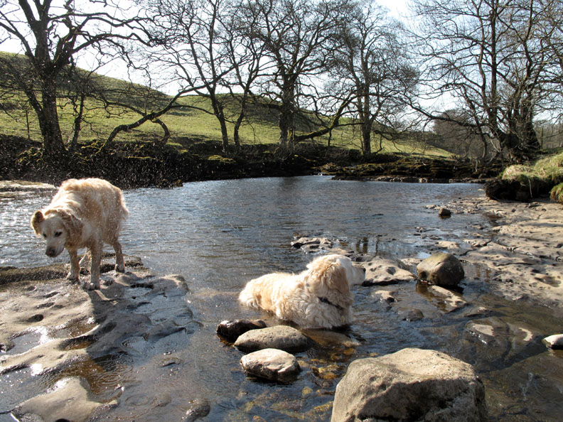
However Harry and Bethan only wish to cool down . . . and so take a dip in what is now a reasonably sized river.
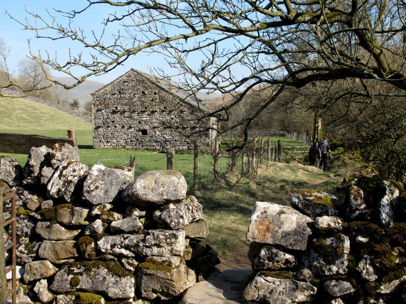
We pass yet another classic Yorkshire Dales stone barn as we made our way along the riverside path.
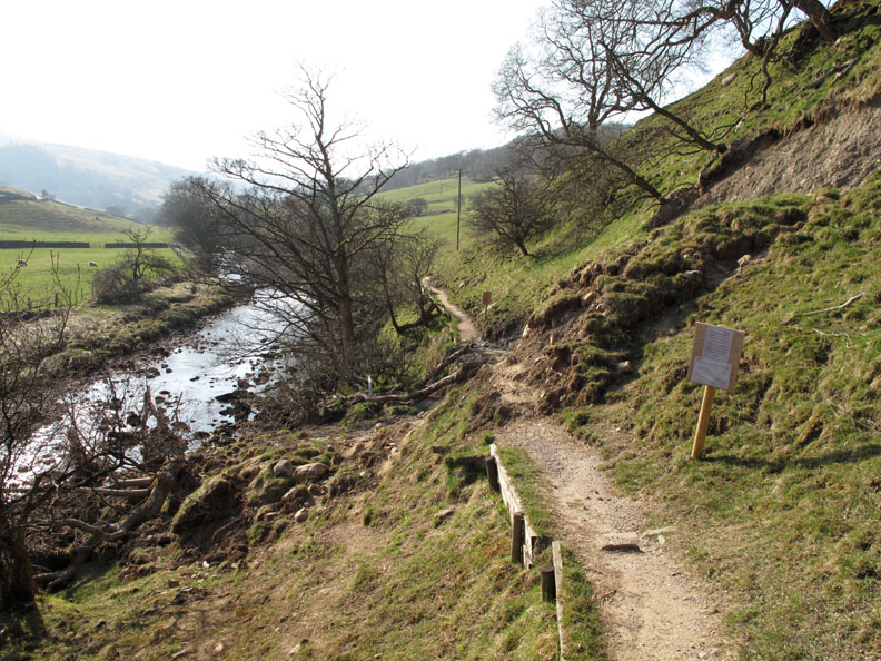
A minor landslip blocks the path. I reckon that with that amount of signage (these were just two of at least six) the manpower spent on health and safety could be have been better spent by employing two good blokes and a shovel !
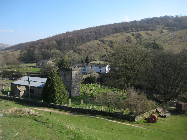
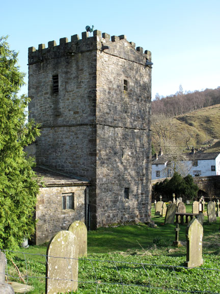
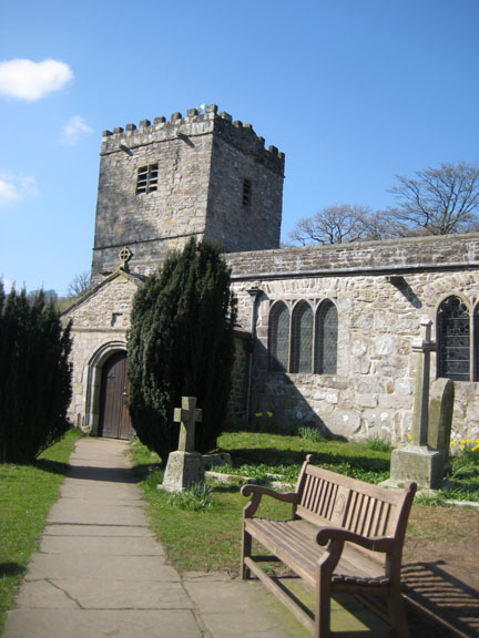
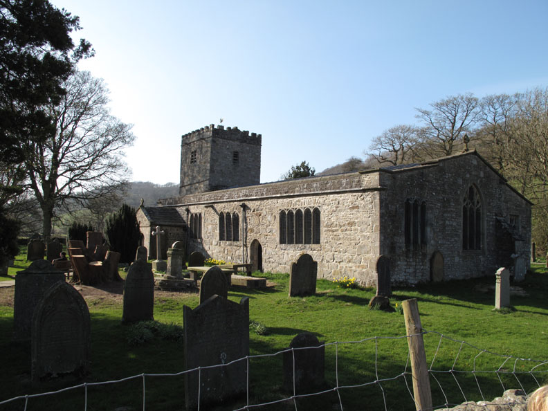
A photo by Ann as she descended the Scar House track to Hubberholme Church. Here our routes coincided again, but of course she and Josie were three quarters of an hour ahead of us now.
I remember this juxtaposition being mentioned in the Bible I think it went something like " Thirst after Righteousness" if I remember correctly.
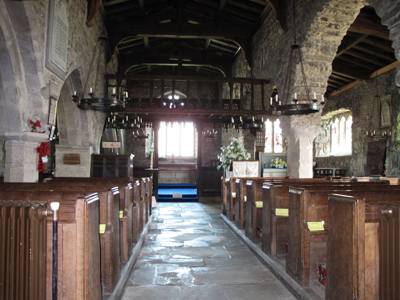
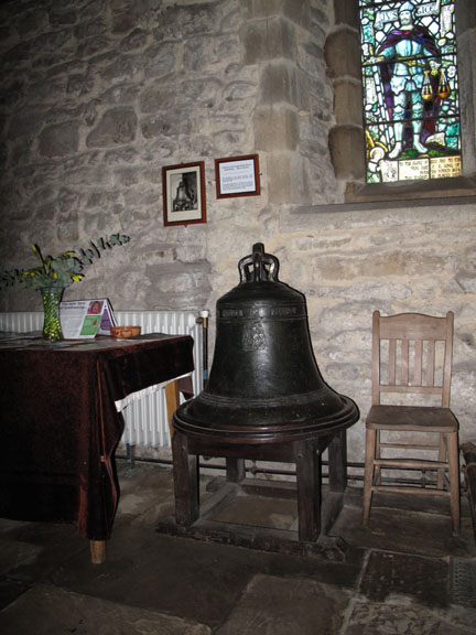
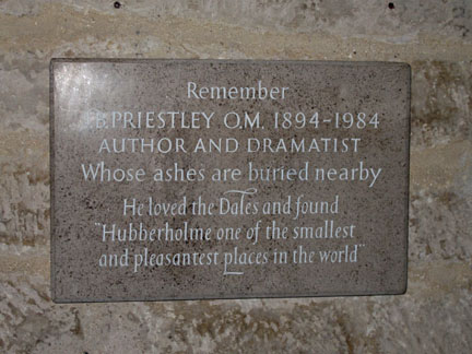
Inside, one of only two examples of a medieval Rood Loft in Yorkshire . . . it is said to be over 500 years old. Also the church has some pews bearing the mark of the carpeter Robert "Mouse man" Thompson
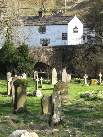
One last look back at the church before we continue on our way.
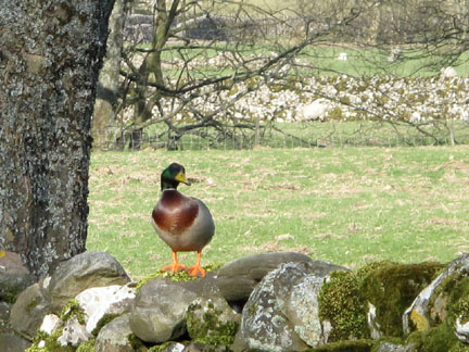
It was unusual to see this Mallard quietly sitting on top of the wall as we passed. [ usually you see three together flying across the walls in older city houses ] Perhaps he was pretending to be a Crow ?
First signs of spring in the trees as Ann takes a photo of the first leaves appearing by the riverside.
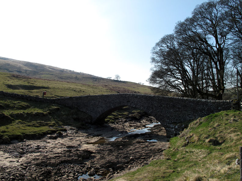
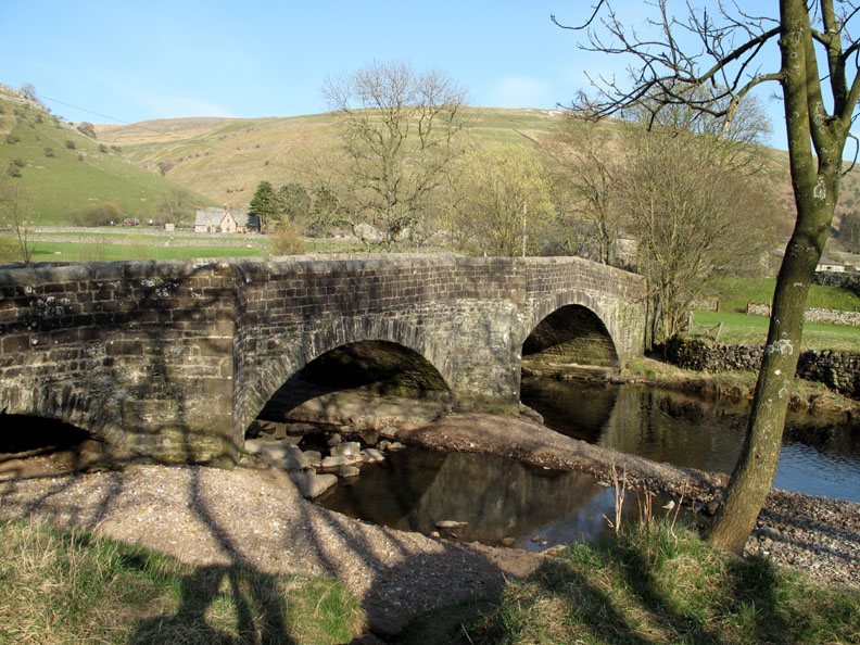
We rejoin the road into the village by the Buckden Bridge, a fine three arched span with much evidence of erosion and recently disturbed pebble banks after the winter floods.
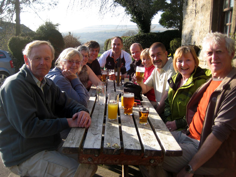
Re-united again over a beer at the Buck Inn at the end of a fine walk.
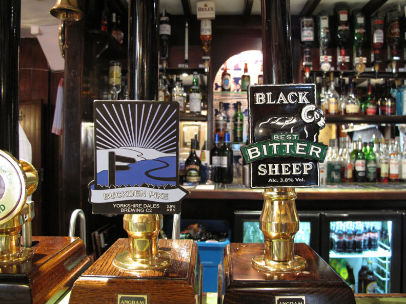
Mmmm . . . what shall it be ? A Buckden Pike or a pint of Black Sheep ?
The delayed start time allowed folk like us plenty of time to reach the start of the walk despite travelling from further away, and it also meant that the end of the walk coincided with the start of the pub serving evening meals . . . more good planning by Dave. 6.15 pm . . . our table was waiting.
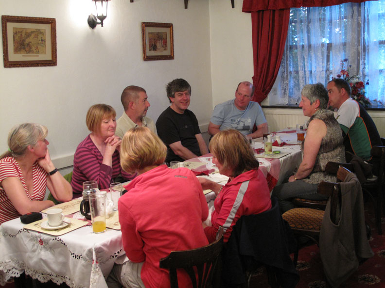
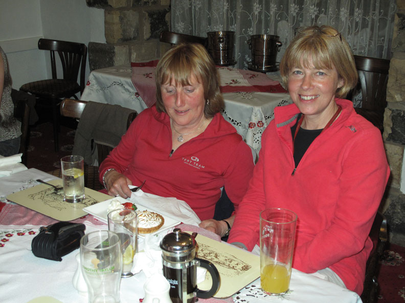
Finally, time for desert before we leave for our respective homes (or in our case Liz's home) tonight. Ann and Jo share a lemon meringue pie . . . that main course was rather good wasn't it. - - - o o o - - - |
Technical note: Pictures taken with either Ann's Canon 75 or my Canon G10 digital camera. Resized in Photoshop, and built up on a Dreamweaver web builder. This site best viewed with . . . Dave's information sheet re-read over a pint of Yorkshire's finest. © RmH.2010 # Email me here # or leave me a Guest Book Entry Previous walk - 11th April 2010 Darling Fell with Anne & Jo A previous time up here - Saturday 6th June 2009 Kisdon Hill and Waterfalls [ Each person's own photo sets and personal interpretation of our joint day out are available via their highlighted names at the top of this page ] Next walk - 18th April 2010 Ilkley Moor Sunday with Liz
|