![]()

Remember: Press F11 for a full
screen view of this page.
|
|
|
Remember: Press F11 for a full
screen view of this page. |
| Date & start time: Friday 26th June 2009. 11am start. Location of Start : Brackenclose car park, Wasdale, Cumbria, Uk. ( NY 182 075 ) Places visited : Brackenclose up to Lingmell Gill, Brown Tongue and Hollow Stones. Ann also visited Wast Water itself. Walk details : 3.25 mls, 1675 ft, spread over 8 hrs. Highest point : Hollow Stones 1900 ft ( 584 m ) Walked with : Ann and the dogs, Harry and Bethan, our local marshalling team, the Global Challenge organisers and about 200 Three Peaks charity participants ! Weather : Sunshine and blue skies but gradually changing, with cloud spreading from the east. [Click on the drop down menu bar
for your choice of Google map or photo display ] |
Railway
Children's Scafell Pike 3 Peaks |
|
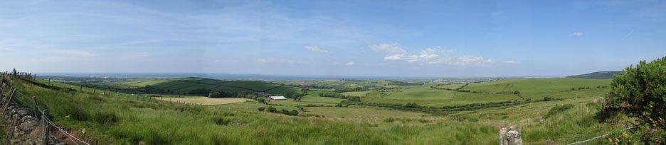
Today we are well and truly into the fine weather and Ann and I set off round the coast to Wasdale. Driving over the Cold Fell road avoids a few of the west coast towns and is actually the quickest way for us to get round to the western valleys. After last night's wonderful sunset here we are again, looking west over St Bees, but this time from a little further away.
Click here or on the photo for a larger panorama. - - - o o o - - - Today I'm helping supervise (as part of a team of marshals) a 3 peaks charity event. This time it is a Global Challenge organised event raising money for the Railway Children Charity. About two hundred folk in 38 teams are on the Scafell Pike leg of their weekend attempt at climbing the three highest peaks of mainland Britain. The nice thing about the way this event is organised is that they are not rushing about the country using their own transport, but have been sponsored by Virgin Trains with a spare main line train to travel between the major walking centres. The money raised, which is likely to exceed several hundred thousands of pounds, goes to helping homeless children that live on the streets and railway stations round the world where they struggle just to survive. Find out more about the charity and should you feel moved to add a little to their total, or help in other ways, a link can be found by clicking here.
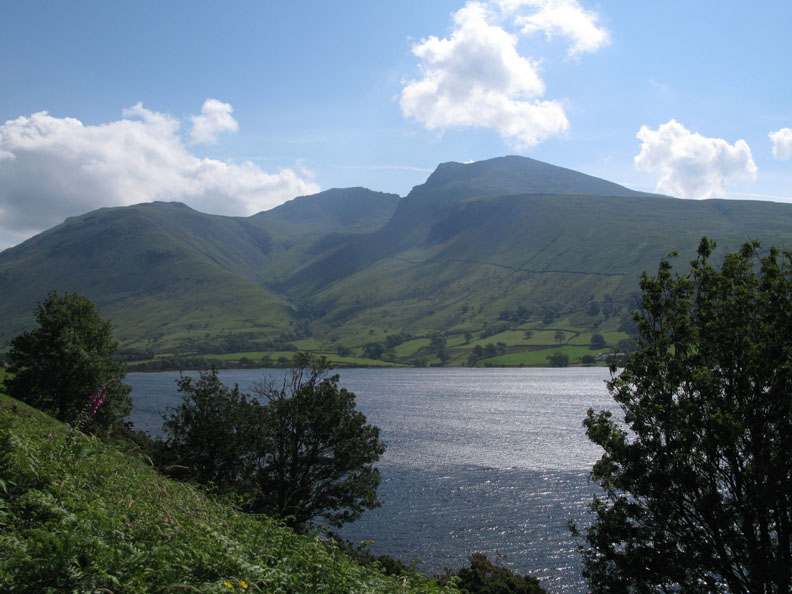
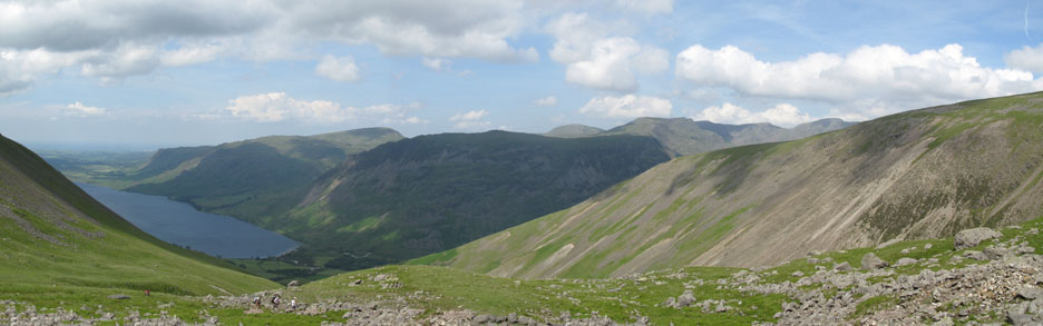
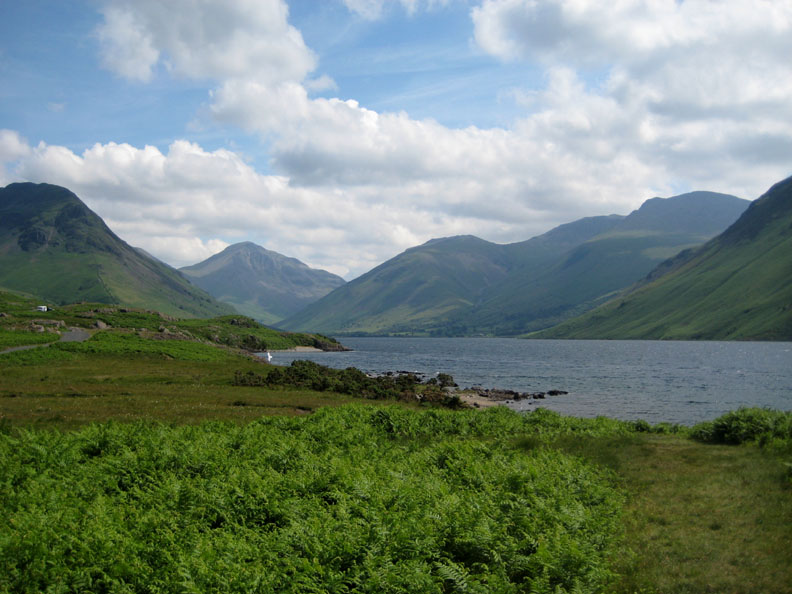
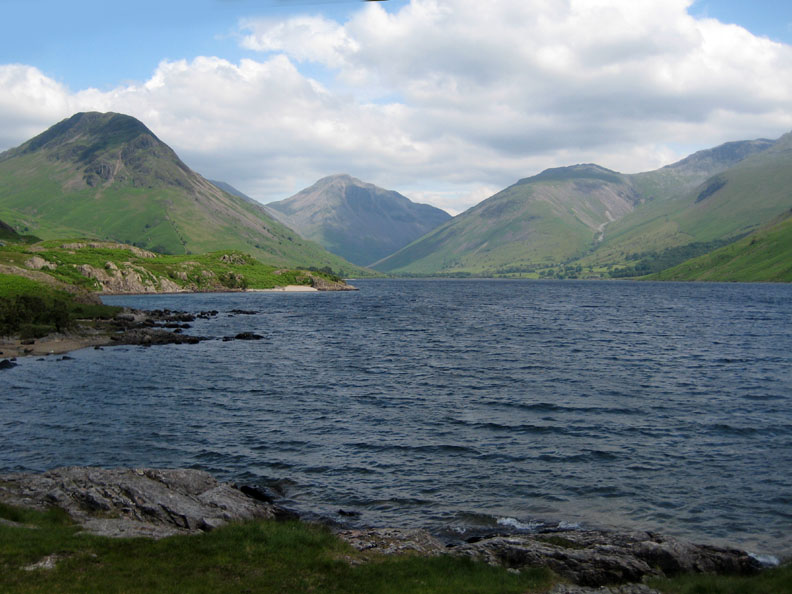
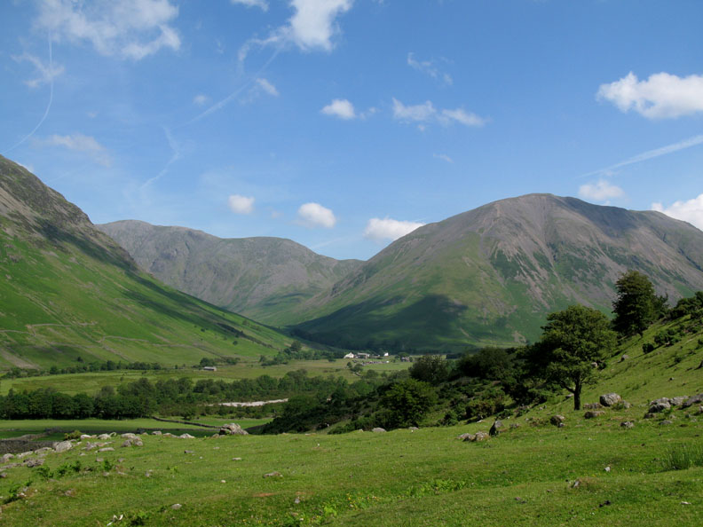
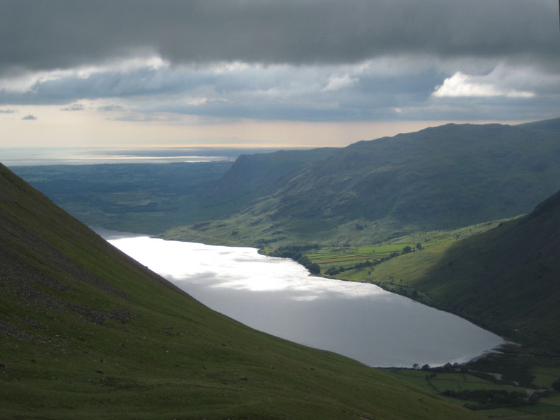
Wasdale, a sparkling Wast Water and the Scafells. The three summits are Lingmell, Scafell Pike (England's highest at 3,210ft) and Scafell which funnily enough always looks bigger from this angle.
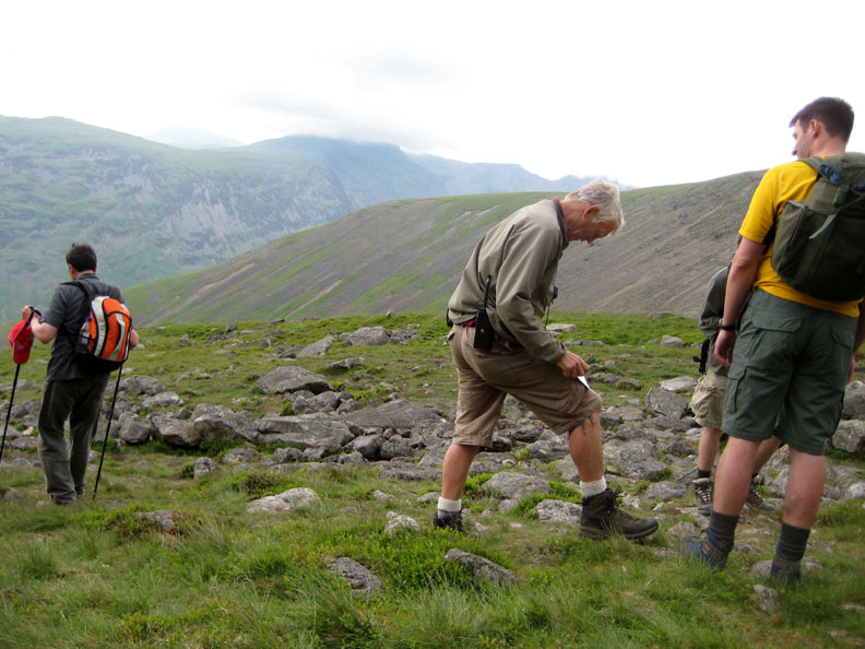
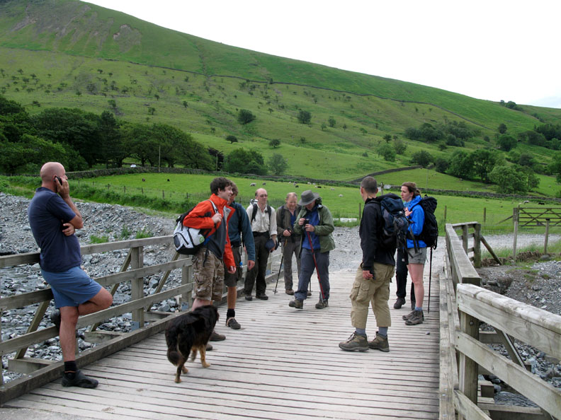
Ann drops me at the car park and drives away to enjoy the rest of the morning locally. I collect my radio, team lists and sharpened pencil and head off up the fell side, passing fellow marshal Liz who is already enjoying the view from the Brackenclose footbridge.
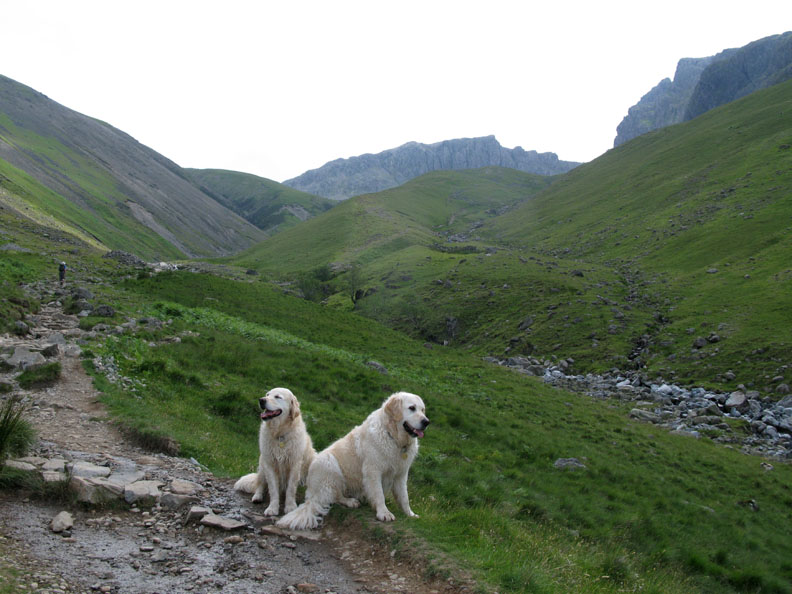
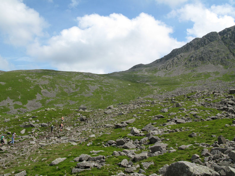
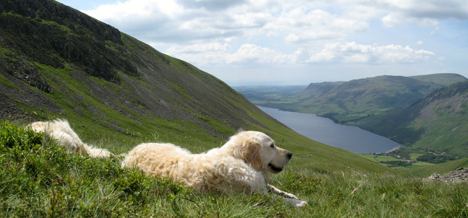
Onward and upward and the view becomes more extensive as the dogs and I climb above the tree line.
Ahead is the river crossing, and in today's heat the three of us stop for a breather . . . again.
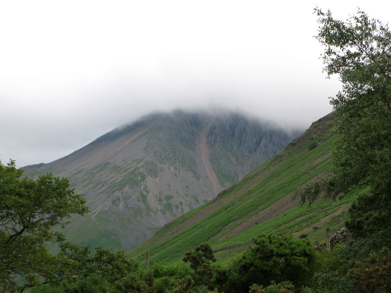
Another breather on the steepest part of the pitched path climb up Brown Tongue gives me chance to appreciate the towering cliffs of Scafell, high overhead.
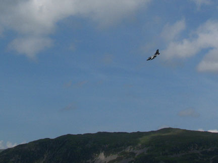
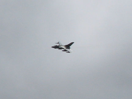
I was going to say it was a peaceful scene looking down the valley !
With the aircraft quickly away, tranquility returns to Wasdale as I look back on my ascent. This is as far as I need to climb today as two others (Claire and Malcolm) have been allocated the Lingmell Col and Summit checkpoints. Below me are distant steep sided Buckbarrow (in shadow), Middle Fell, Seatallan, Yewbarrow (again in shadow) and the rise to Lingmell summit to my right. Behind them is Haycock, Scoat Fell and Pillar. [ The aircraft in the first photo above was dropping down to almost lake level, past shaded Yewbarrow, giving you an idea of scale.]
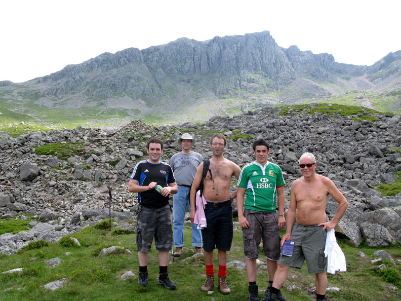
A fine bunch of lads (with Dad in the glasses) who were climbing the peak at the same time as myself. Having joined them in conversation, they very kindly gave me a donation to the cause, which I have subsequently donated on-line.
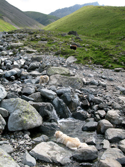
I have a little time to spare so I have chance to wonder round and check out the area. This is the path everyone will follow up to Lingmell Col and subsequently on to the summit. The last running water today was found under the grassy fell side above the walkers. The dogs enjoyed it and I don't seem to have suffered from a quick sip either !
Looking back down from Hollow Stones . . . the rocks do make a hollow noise sometimes as they you walk over them but basically I think this area is named after the hollowed out fell side which is full of theses stones.
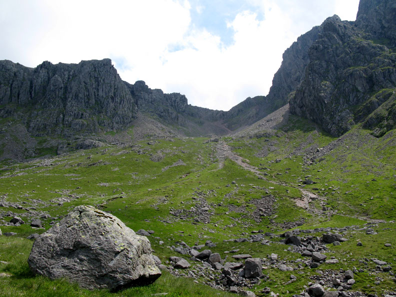
The alternative path to the summit via Mickledore.
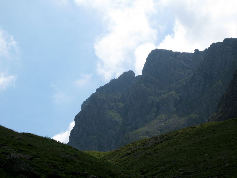
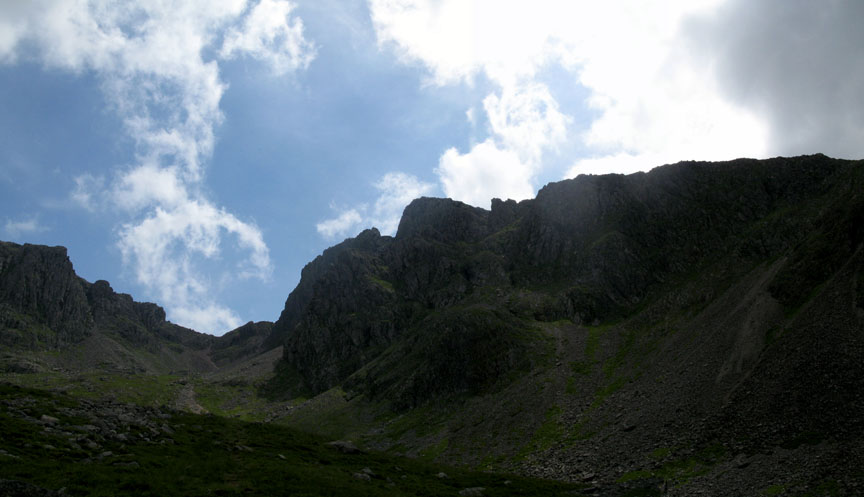
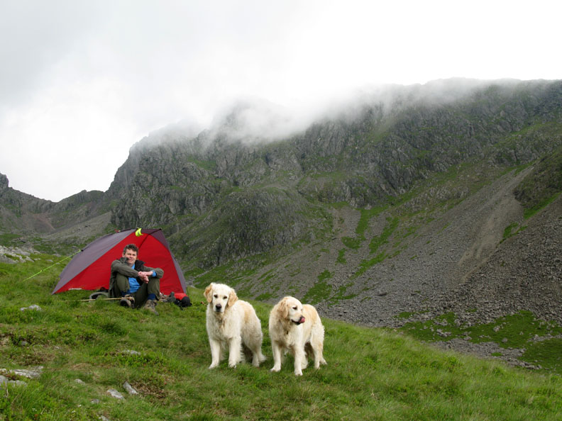
A fast moving high cloud casts a darker aspect on the imposing crags of Scafell which tower over my location today.
Time to relax and enjoy the view.
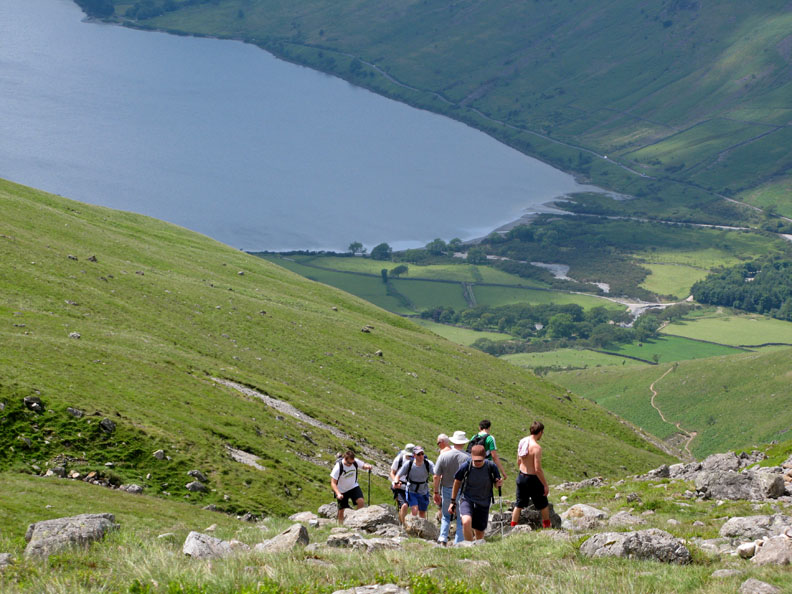
Slightly sooner than expected, the first teams had made the hot climb up towards myself. Time to start being busy. - - - o o o - - -
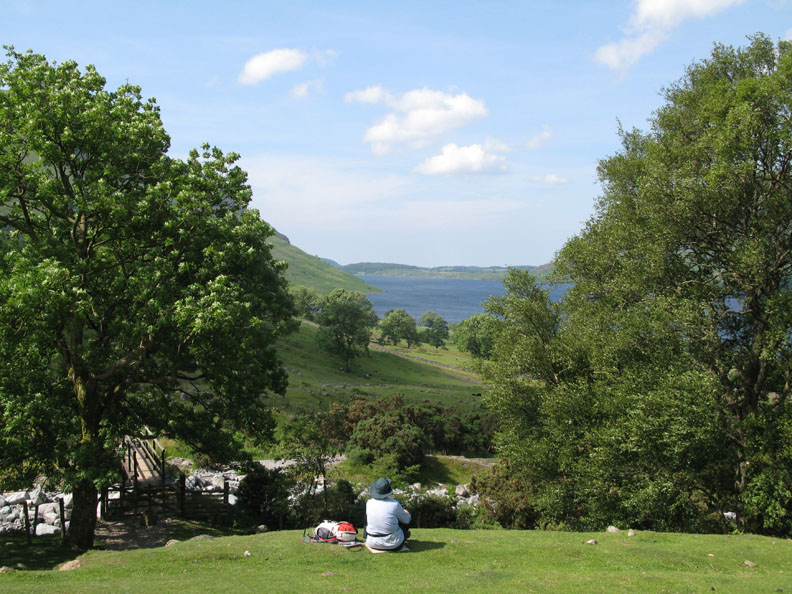
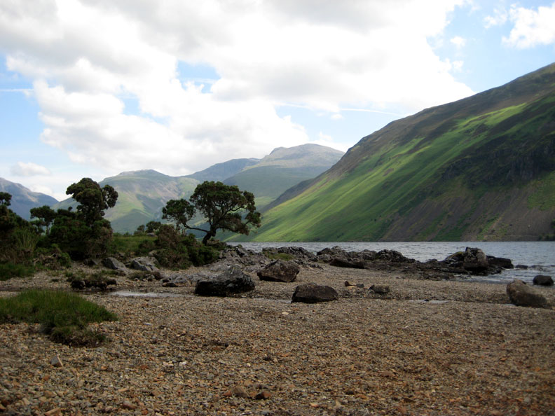
Meanwhile, with Roger and the dogs settled into position for the day I decided on a spot of relaxation by the side of Wast Water. I parked the car and walked this path through the bracken to a small beach by the side of the lake.
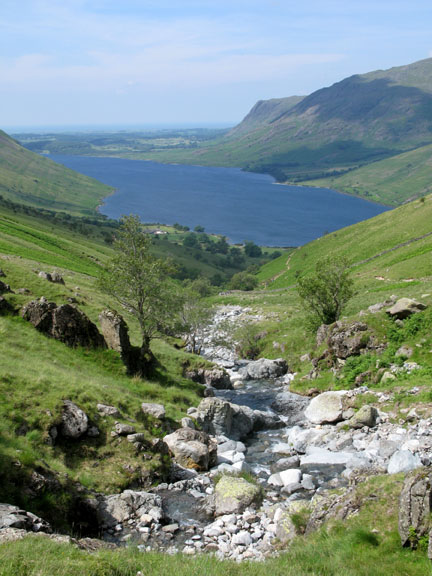
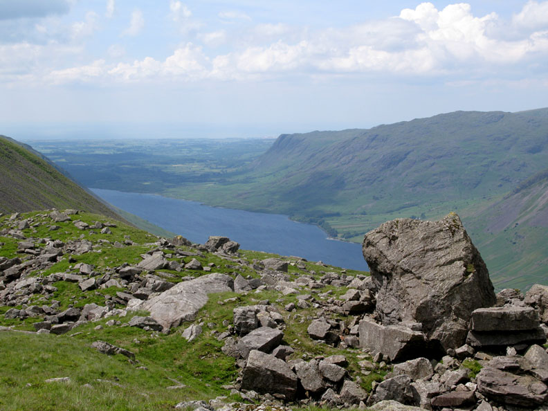
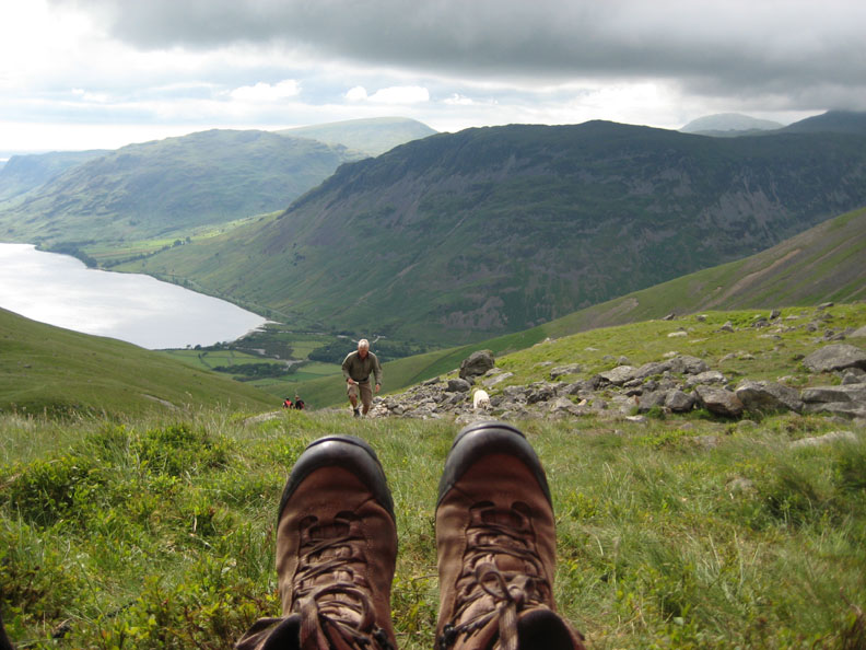
Glorious views across the lake towards the head of Wasdale. [ Lingmell Gill with Hollow Stones is the valley just right of centre in this photo ]
Lingmell, Scafell Pike and Scafell with the steep sided slopes of Illgill Head as seen from the beach. This is one of many similar small stoney beaches down the length of Wast Water.
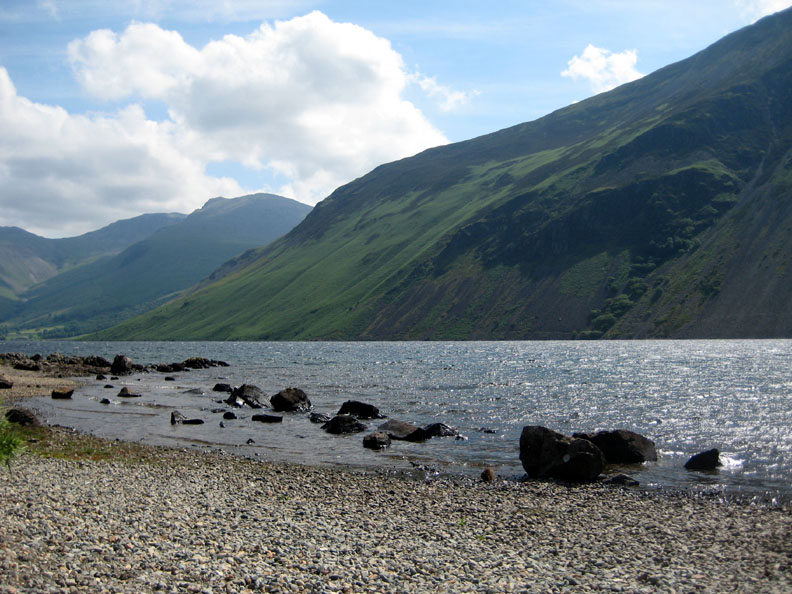
I had come prepared . . . book, sunhat and sunscreen . . . to while away the morning in a perfect spot enjoying the waves gently lapping the shoreline.
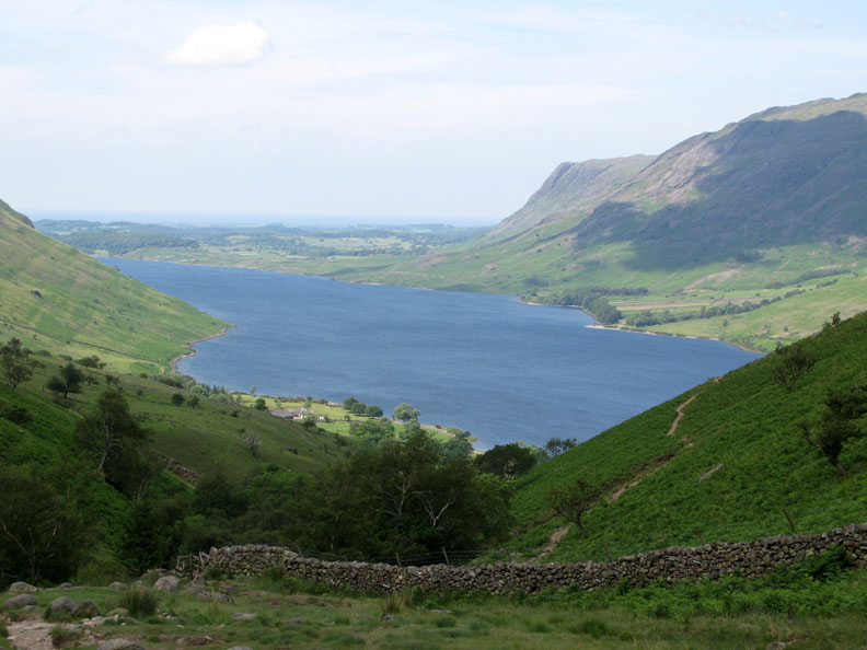
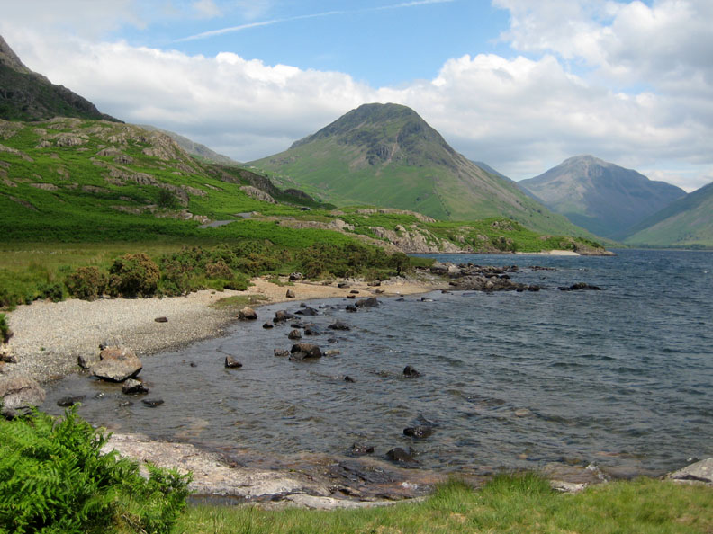
Yewbarrow is the conical shaped fell here, with Great Gable in the distance.
After my lunch and the solitude I had enjoyed all morning, it was time for me to return with the car to Brackenclose car park in order start my ascent of Lingmell Gill to join Roger.
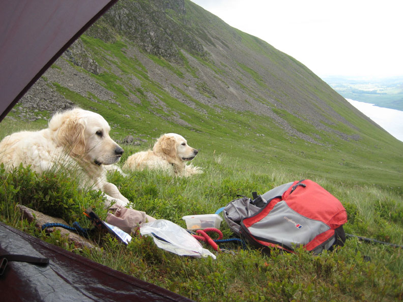
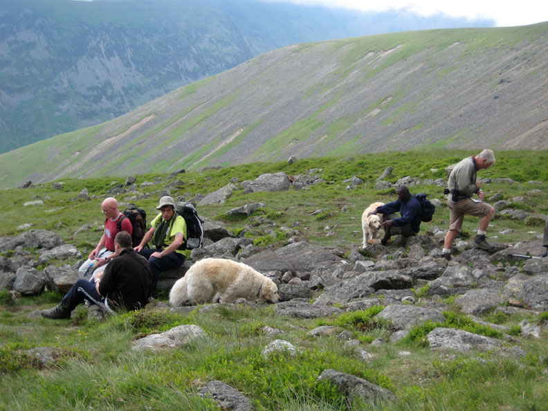
My rucksack on the grass means that I have arrived at our shelter. It had been a hot steep climb and the dogs had given me a warm welcome, though it has to be said, they are looking a bit sleepy in this photo !
Simon, one of the competitors, chose not to climb any further and chatted to us for a while as he waits for the rest of his team to descend from the summit.
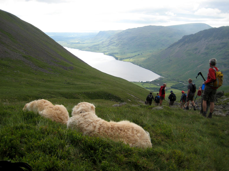
It's busy now as all the teams pass our checkpoint on their way back down.
Man at work !
Roger is noting the teams arrival times and keeping in touch by radio with Challenge Base in the car park far below. Harry and Bethan love all the attention they are getting and look around for remnants of any goodies. A special mention must be made here (on the dog's behalf) to the party of Irish Scouts and their leaders who donated several spare sandwiches to the dog's good cause ! They were aiming to climb the five highest peaks, including those of northern and southern Ireland, in the year.
Another successful team departs the high fell, heading for their next train journey north.
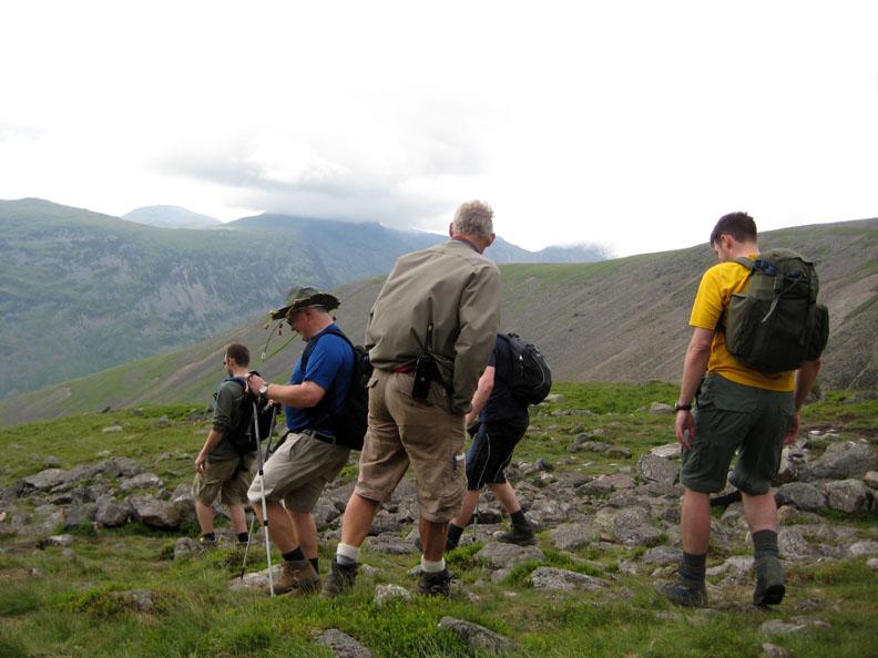
The last but one team is on their way and it's time for me to get on my feet again. All that remains is to take down the shelter and follow the last team down the hill.
The weather has changed again as another batch of cloud passes overhead. Underneath the air has cleared and we get distant views of the Isle of Man for the first time.
It's gone six thirty but there are still plenty of people going UP, most of them on their own personal 3 peak Challenge, as we make our way down Brown Tongue. [ We chose an off path route in order to make it easier for one of the competitors who had injured his knee. The grass was softer than the pitched path ! ]
The last team safely down to Brackenclose bridge in time to catch the last mini-bus back to Ravenglass Station. They were greeted by the Challenge staff with a round of applause and a several large drinks of water on their return.
For us it was a short drive home, supper and bed. For them . . . a train ride and Ben Nevis awaits ! - - - o o o - - - |
Technical note: Pictures taken with with my Cannon G7 Digital camera. Resized in Photoshop, and built up on a Dreamweaver web builder. This site best viewed with . . . a full house on the team sheets, recording all the ups and downs, © RmH.2009 # Email me here # or leave me a Guest Book Entry Previous walk - Thursday 25th June 2009 A St Bees Sunset Walk A previous time up here - 8th June 2007 Illgill Head and the Railway Children Next walk - Saturday 27th June 2009 Kirk Fell with Jo
|