![]()

Remember: Press F11 for a full
screen view of this page.
|
|
|
Remember: Press F11 for a full
screen view of this page. |
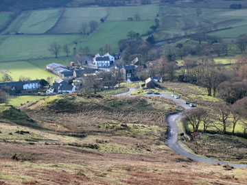
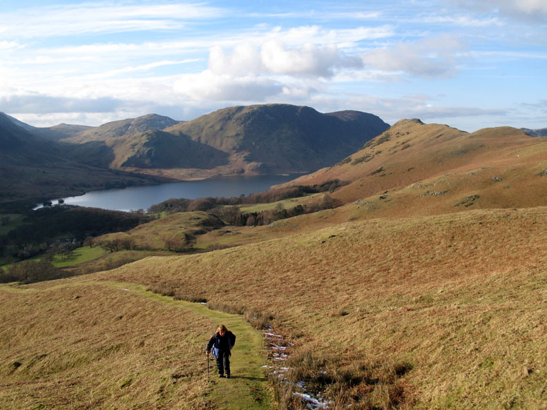
| Date & start time: Monday 9th February 2009. 2.30 pm start. Location of Event : The Newlands Pass road, Buttermere, Cumbria, Uk ( NY 178 171 ) Places visited : The Peat Track up onto High Snockrigg and across to Goat Crag. Walk details : 2.25 ml, 1200 ft of ascent, 1 hour 55 mins. Highest point : High Snockrigg 1709 ft ( 526m ) Walked with : Ann and the dogs, Harry and Bethan. Weather : Blue skies and sun, but with a gentle cool breeze from the east. Buttermere Village from the start of the walk |
|
|
The sun shone after lunch as the clouds rolled away so we chose another walk at the head of the Buttermere valley to give us views of the high fells which are still holding their ice and snow cover.
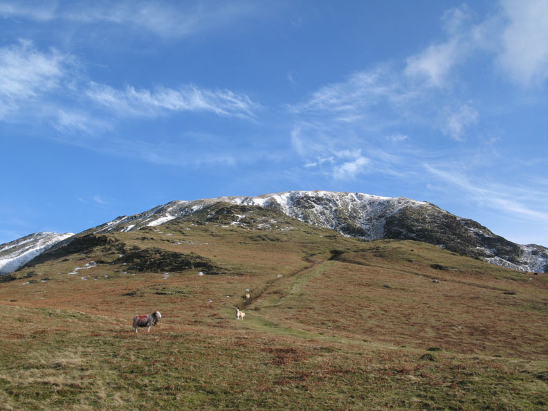
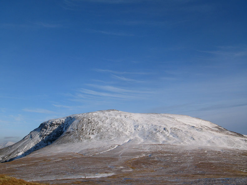
High Snockrigg is the prominent fell that looks down on Buttermere Church and the village. The top appears to be just above the snow line, although the snow line is getting rather less clearly defined as it starts to melt.
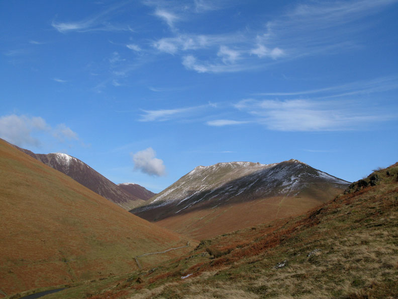
Knott Rigg that we climbed last week. There's a lot less snow on it than there was last Thursday.
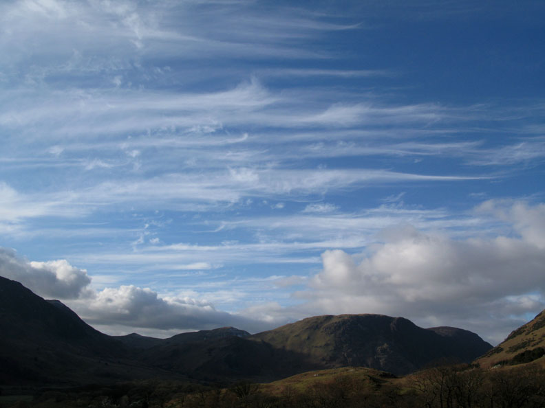
Beautiful ice clouds being blown across the skies above Mellbreak.
We follow the green path up the hillside. I believe this was an old peat track which was built to ease the carriage of peat (turf) from the fell top down to the village in centuries past.
It climbs steeply and just when you begin to wonder where it goes next you find a quick turn, yet another zig-zag, and it continues steadily up the fell side.
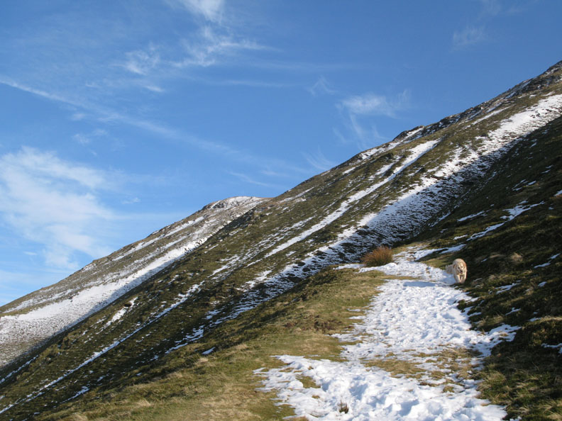
A difficult bit at the head of Steep Gill was avoided by taking to the grass and making our own route up the remaining distance to the top. [ The O.S. 1:25k actually shows the right of way as taking a similar route but there was no sign of any pathway ]
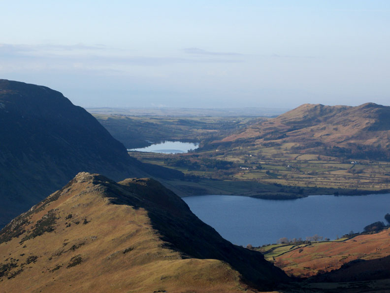
Rannerdale Knotts, Crummock Water, Loweswater and the Solway Coast line up between Mellbreak and Darling Fell.
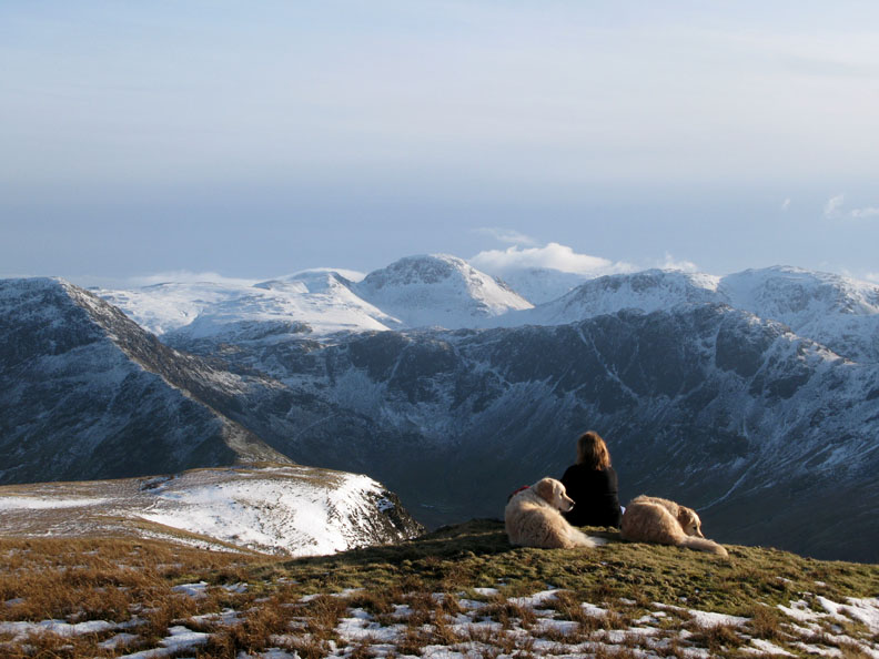
Reaching the ridge we pause, and Bethan pauses too for a view of the North Western fells.
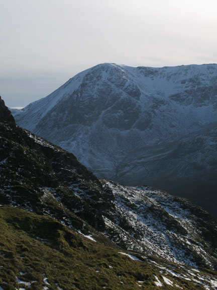
Wind blown skies again, this time over Robinson, taken from the summit of High Snockrigg. The flat ground in front of the fell is known as Buttermere Moss, and was presumably the local source of peat in the old days.
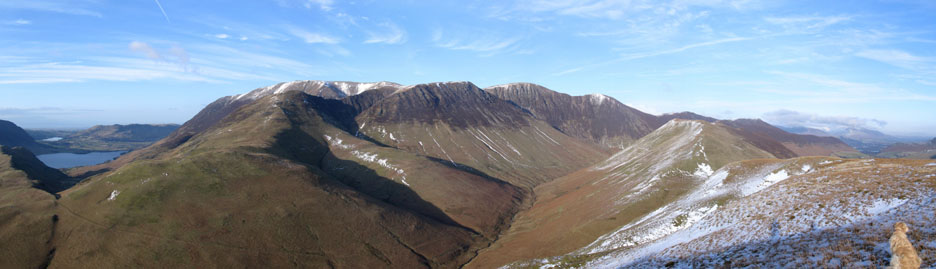
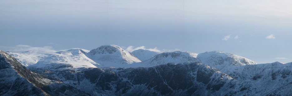
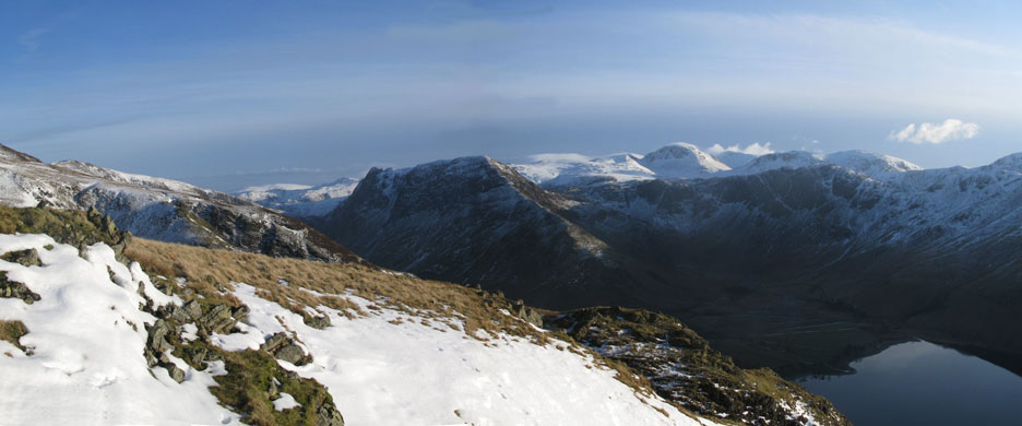
The summit reached and there's a magnificent view of the Central Fells including Scafell Pike.
A wider panorama with Green Gable almost hiding Great End, likewise Kirk Fell almost obscures Scafell behind it. Scafell Pike, the highest fell of course, is seen through the gap in the centre. The cloud that lightly shrouds the high fells in the background is moving reasonably fast so I imagine it will be rather cold up there.
Time to get the sit-mat out and enjoy the view.
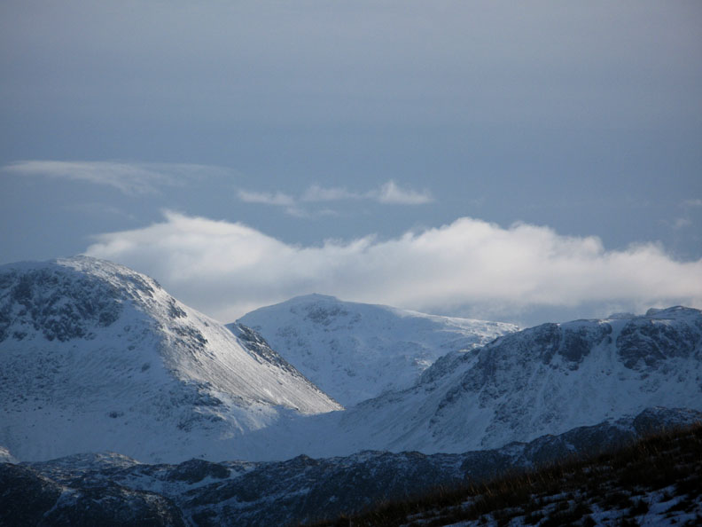
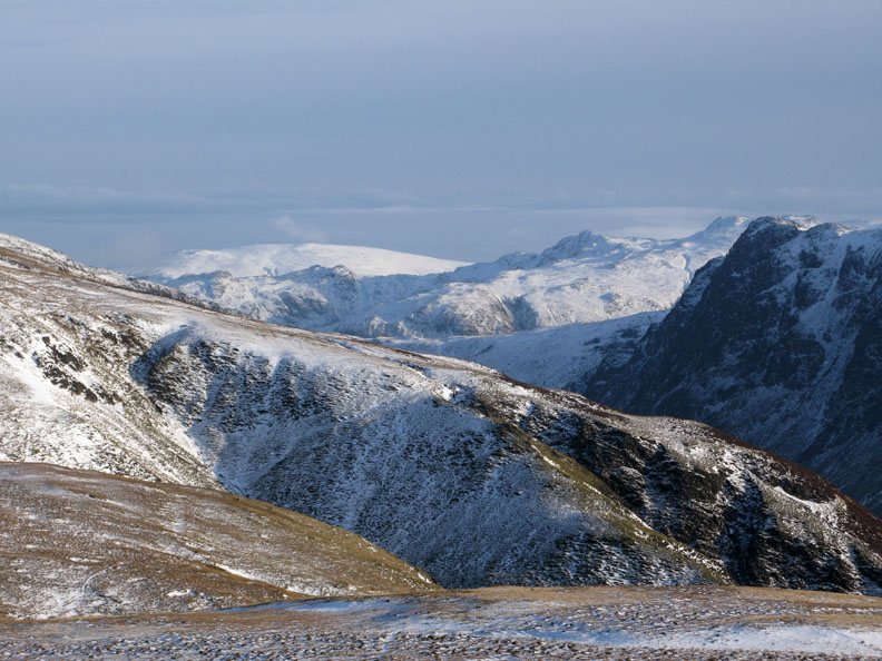
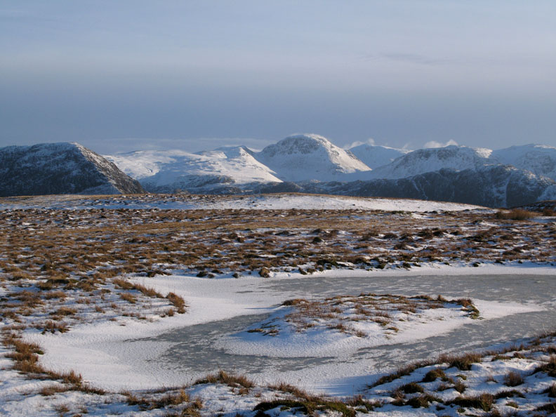
High Raise is the white, snow covered fell in the distance, seen here over Goat Crag, Honister Hause and the Rosthwaite Fells.
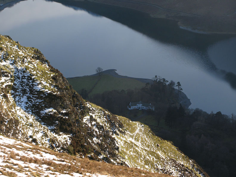
Hassness House . . . seen in the cold dark of day. The sun sets early deep in the steep sided Buttermere Valley.
A final look at Fleetwith Pike and the high fells as we turn around.
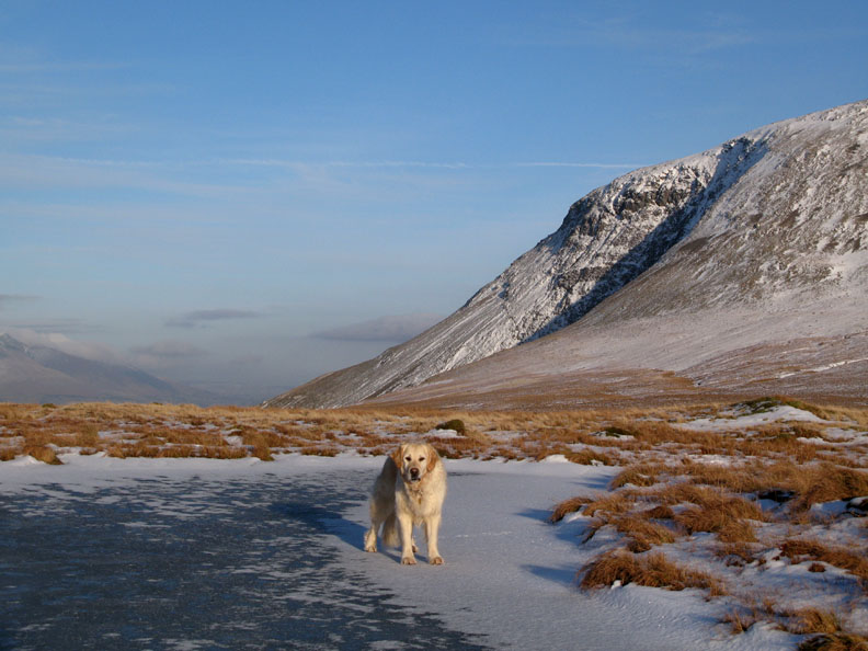
We make our way back, skirting round the Moss, passing the small tarns on the Buttermere edge of the flat ground.
Harry tries unsuccessfully for a swim !
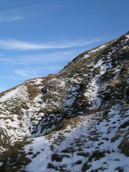
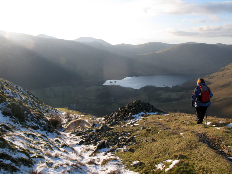
Finding ourselves at the head of the peat track we start our descent.
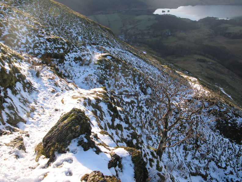
The narrow rock section at the head of Steep Gill. We avoided it on the way up, but with the assistance of our micro spikes (for a few minutes) the ice and narrow path were negotiated successfully on the way down. - - - o o o - - - |
Technical note: Pictures taken with with my Cannon G7 or Ann's Ixus 75 Digital camera. Resized in Photoshop, and built up on a Dreamweaver web builder. This site best viewed with . . . a sit mat in order to stop and enjoy the view from the top. © RmH.2009 # Email me here # or leave me a Guest Book Entry Previous walk - 6th February 2009 Lonscale over to Little Man A previous time up here - 27th October 2005 Buttermere on a wonderful day
|