![]()

Remember: Press F11 for a full
screen view of this page.
|
|
|
Remember: Press F11 for a full
screen view of this page. |
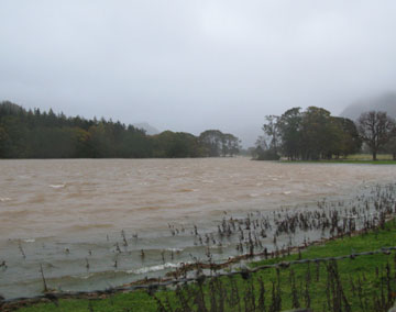
| Date & start time: Thursday 23rd October 2008. Location of Event : The red phone box, Loweswater , Cumbria, Uk ( NY 143 211 ) Places visited : Crummock Water from Scale Hill bridge. Walk details : 1 ml, negligible feet of ascent, 40 mins including photo stops. Highest point : The water level. Walked with : Ann and the dogs, Harry and Bethan. Weather : The predicted storm has arrived. Gusts to 70 mph probably, torrential rain, low cloud. The River Cocker above Scale Hill Bridge . . . the highest we have ever seen it. |
|
|
Today's forecast was a belter of a low pressure bringing high winds and heavy rain. The Mountain Weather Information Service suggested walking the high fells would be impossible today ! The BBC, for the record, also judged the weather correctly.
It's been stormy since late last evening and there has been a considerable amount of rain falling. The local Red Raven Weather Station in Lorton Village reports 55mm today, 95mm since the storm began. 95mm . . . that nearly four inches in old money !
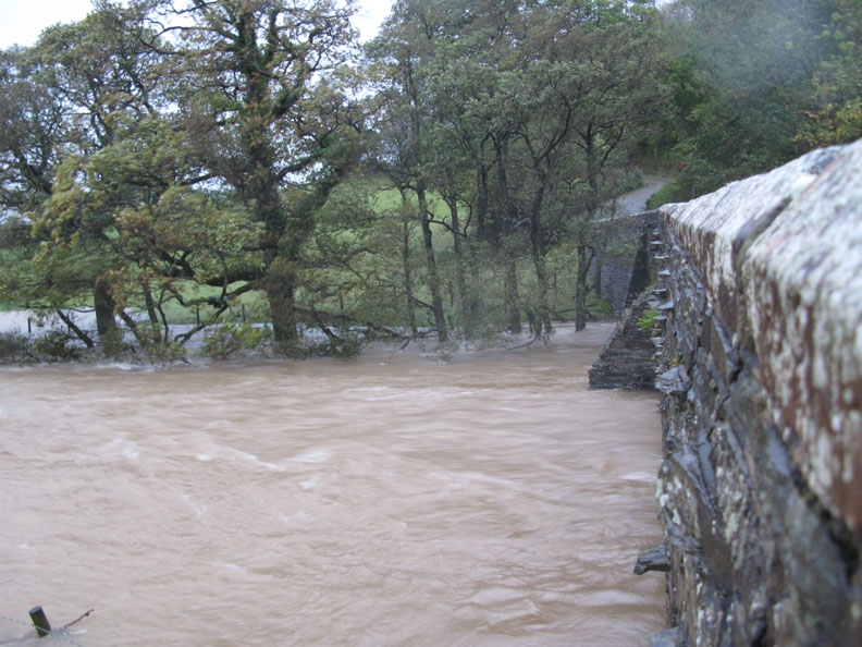
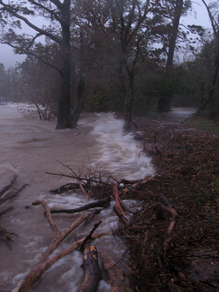
That amount of water over the Buttermere / Crummock catchment area means flooding. Here the water is backed up against Scale Hill Bridge on the Loweswater to Lorton road.
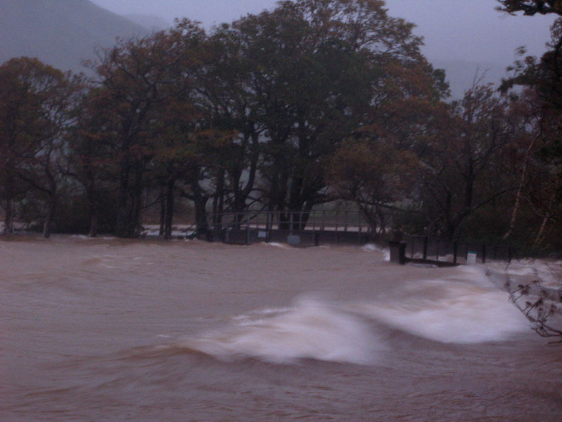
Heavy rainfall backed by strong winds means this normally grassy field looks like Morecambe seafront in a north easterly gale. It looked better in motion . . . . click here or on the photo for a brief video The video should open and play in your Windows Media Player. [ It may take a minute or so to download on slower connection speeds - please be patient]
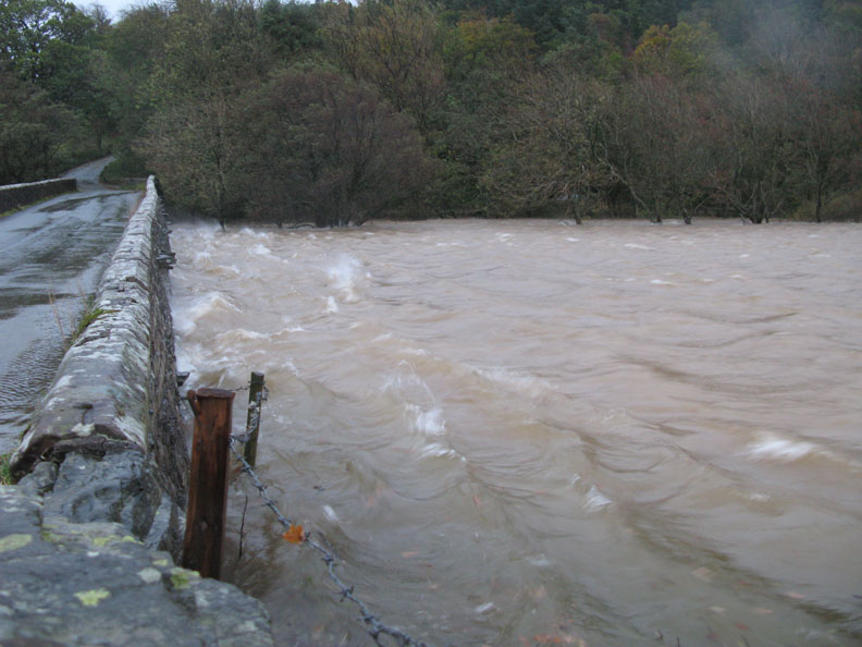
The arches are not yet up to full capacity but the river is certainly flowing through at considerable speed.
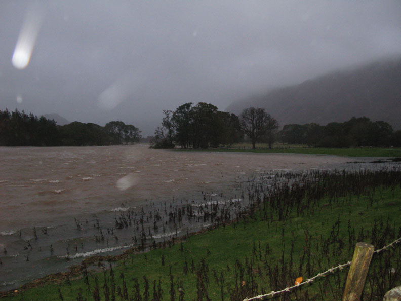
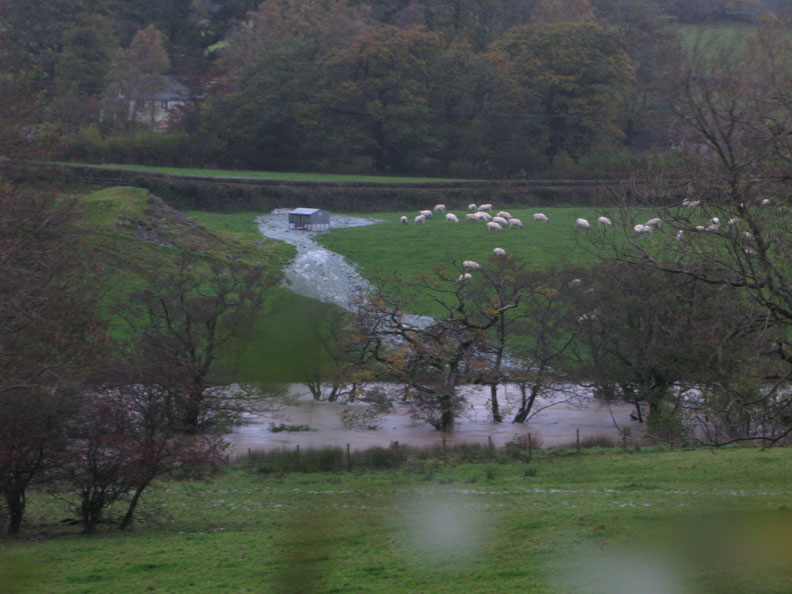
The land is so water-laden due to a summer of rain that everywhere is just flowing with water. Across the river another stream has burst it's banks and floods through a hedge and past the sheep feeder.
We park above the water line and take a closer look at the bridge.
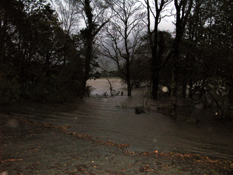
The Scale Hill car park is narrower by twenty feet or so.
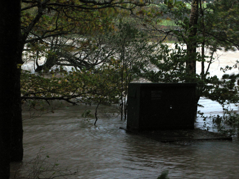
The river monitoring station usually stands on a mound about five feet high and about eight feet above normal river level. On our return, even the concrete base had disappeared beneath the water, which had risen another two or three inches in just 30 minutes.
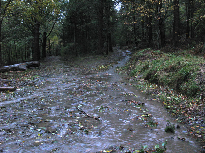
The forest tracks are running with water as culverts get blocked.
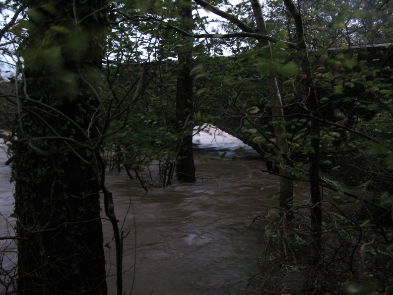
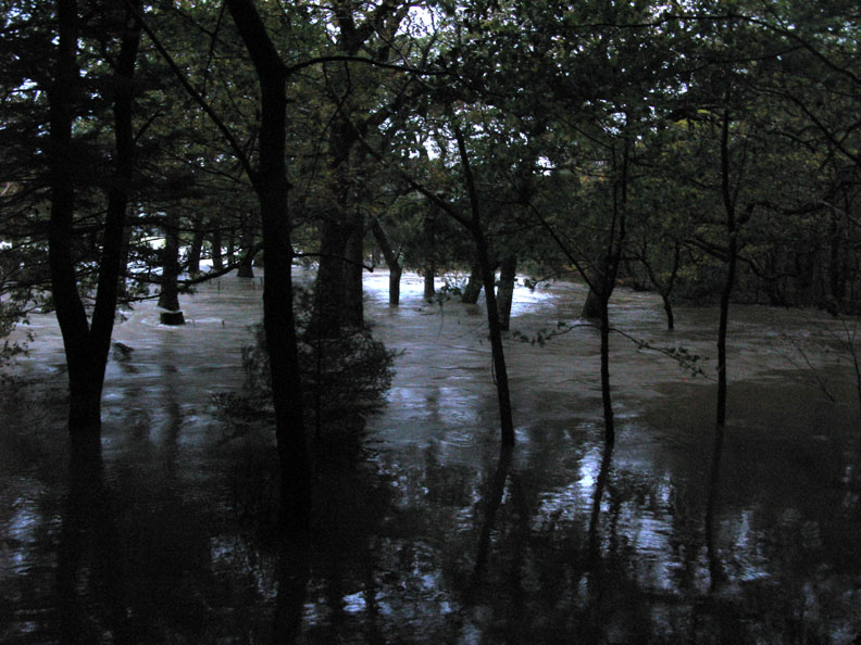
The lazy bend in the river is missing as the flood water covers the whole area.
Click here or on either photo for another brief video The video should open and play in your Windows Media Player. [ It may take a minute or so to download on slower connection speeds - please be patient]
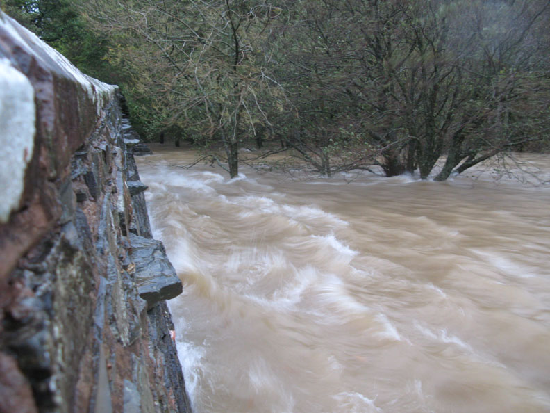
Somewhere under there is the weir. The elevated bridges leading out to the sluice gate controls are themselves underwater.
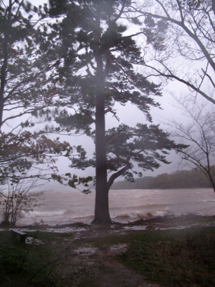
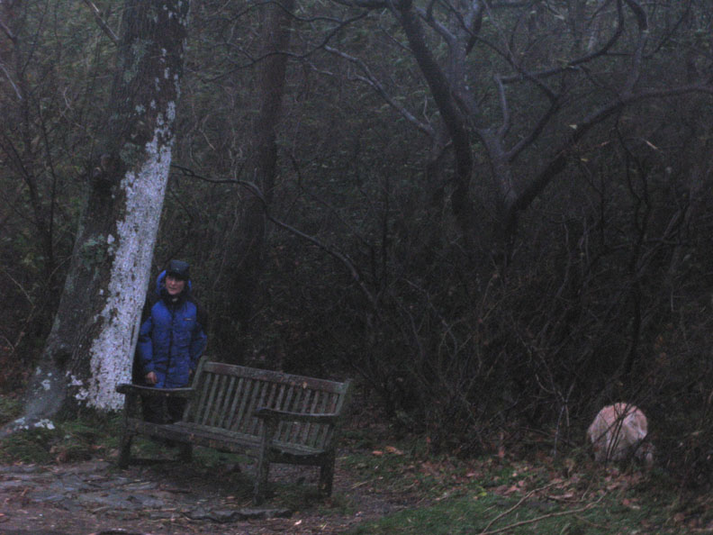
Ann considers herself safer and certainly drier out of the wind, behind the tree. The dogs don't seem bothered or excited by the spectacle . . . they are exploring just the same as ever. - - - o o o - - - Due to the storms we had a six hour power cut this morning. Full marks to the guys who were out in this weather correcting the fault. The village here has suffered slight flooding, mainly due to water run off and blocked culverts. Further down Lorton Valley we understand the river has spread to cover it's entire flood plain, and all this water is heading for Cockermouth . . . not a good day. - - - o o o - - - |
Technical note: Pictures taken with with my Cannon G7 or Ann's Ixus 75 Digital cameras. Resized in Photoshop, and built up on a Dreamweaver web builder. This site best viewed with . . . plenty of electricity and dry clothing ! © RmH.2008 # Email me direct # My Guest book (front page) Previous walk - 16th October 2008 Buttermere Round the Lake A previous time here - 1st March 2007 A local Scale Hill and Crummock walk For a flood report from the local News and Star Newspaper click here
|