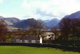
Retreat to the quiet of the Western Lakes
|
Time and place : Saturday 6th March 2004. A Pennine walk from Dufton near Appleby past Dufton Pike and round to High Cup Nick Occasion : A weekend walk with Anne and Andrew Leaney, Ann and the dogs. Walk details : 9.5 mls with approx. 1700 ft of ascent. 6.25 hours including a stop for lunch. Weather : Low cloud on the hills cleared as we climbed to give us some great views. Overcast with some good sunny periods, but a hail shower towards the end. |
|
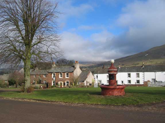
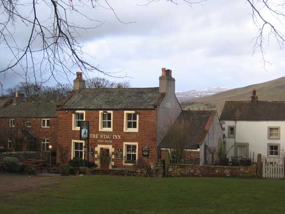
The Stag Inn at Dufton lies to the west of the Pennines near Appleby and is an overnight diversion for walkers on the Pennine Way long distance path. Dufton Fountain in the foreground.
We started the walk in fine weather but were faced with the prospect of low cloud and cold conditions on the high moors above us.
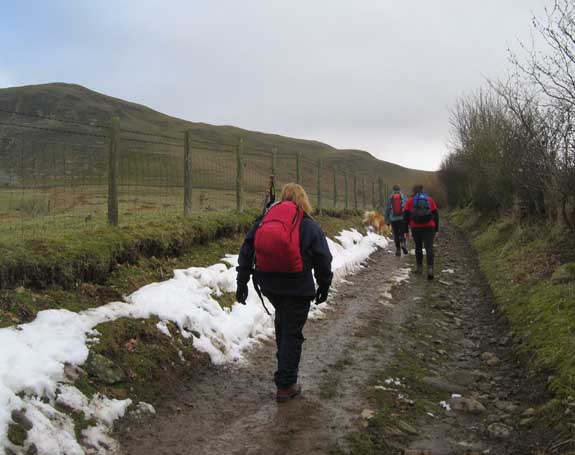
The first snow line.
Protected from the sun by the opposite hedge this patch of drifted snow had lasted since the cold weather of last weekend.
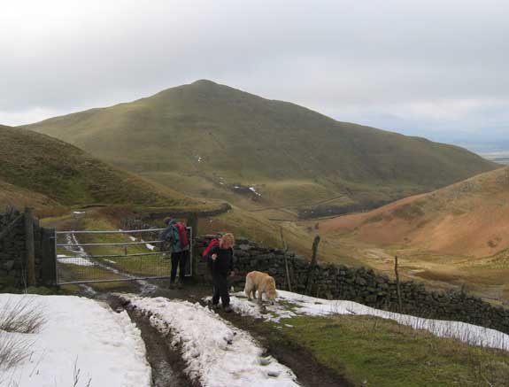
An old mine road took us into the valley of Threlkeld Side and up past Dufton Pike
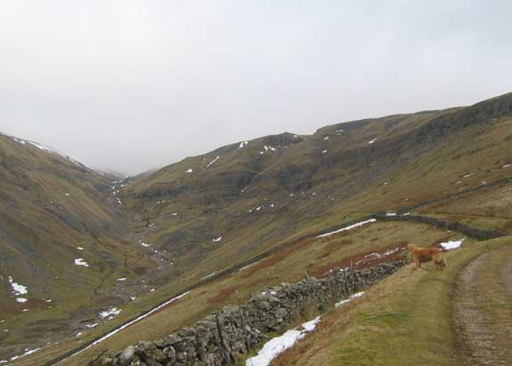
The rock band known as the Whin Sill was evident here, and in the past industry had taken advantage
of the exposed geology to mine for minerals as well as to quarry for limestone.
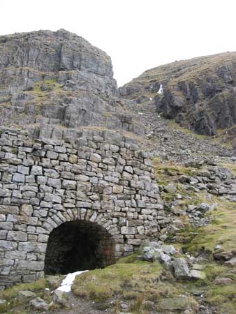
Lime Kiln at Threlkeld Side.
The rock would have been burnt (or fired) in the kiln to product lime for improving the local farm soils.
Hey - come on slowcoach - I'm the one that's 98 dog years old next Monday - not you.
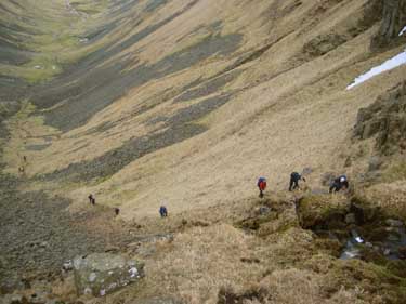
Anne and Layla climbing up through the mine workings.
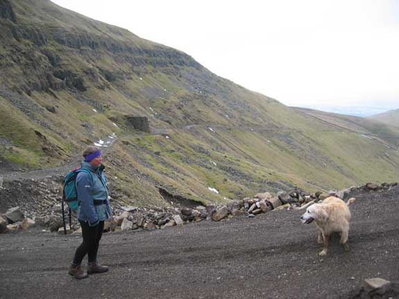
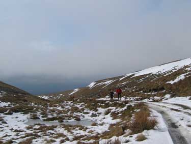
A broad view of the valley, scarred by the historic mine workings, but more recently and more dramatically by the bulldozed road which climbed up through the area to the bothy up on the top of the hill.
 |
 |
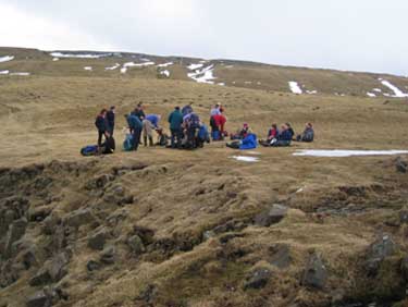
Topping out now in clear sun - time for lunch.
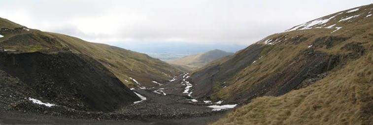
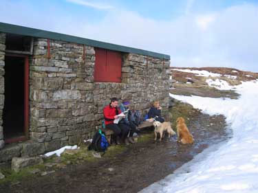
I had borrowed a Gps to use today and so we set a mark for the bothy adjacent to Great Rundale Tarn. Imagine my delight when it gave our position as 450 feet from the target. A quick walk and we were there.
Our thanks to the owners for the use of their bench which we used then replaced indoors afterwards.
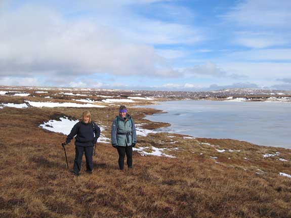
Blue skies and a cool breeze.
Ann and Anne by Great Rundale Tarn.
It would be easy to get lost up here in the mist, but fortunately that had cleared and we were left with fine views as far as the eye could see.
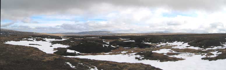
A course towards the distant high ground of Mickle Fell was required but not always possible due to the odd frozen bog and occasional extensive peat hag.
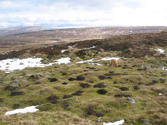
Moles at nearly 2000 ft ?
Imagine our surprise at finding this small patch of tunnelled ground. Well that's bio-diversity for you.
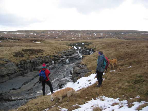
The waters of Maize Beck turn to flow east here. In times past the river probably flowed west
but the waters were captured by the Tees headwaters and the sudden drop in valley level caused a ravine to form.
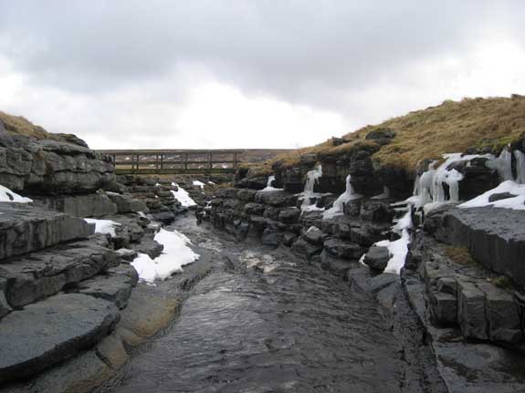
Cold weather icicles coat the ravine
The narrowness of the crossing and the solid banks formed an excellent place to bridge the river.
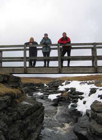
Ann, Anne and Andrew.
Anyone for a game of bridge ?
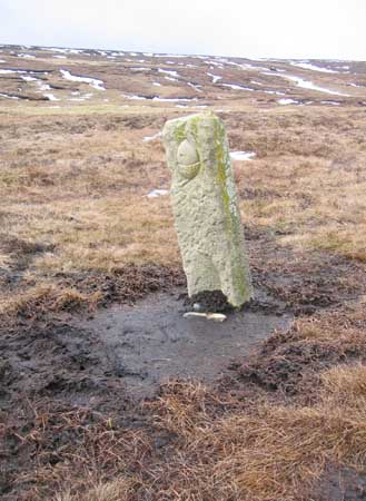
The Acorn Stone is a symbol of the Pennine Way path which crosses the bridge.
Some say the bog could be a symbol of the Pennine Way itself !
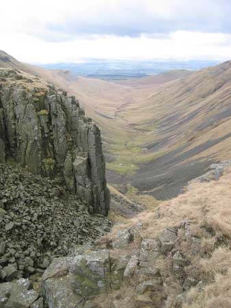
Over the brow a suddenly a dramatic view west over the Eden Valley,
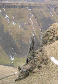
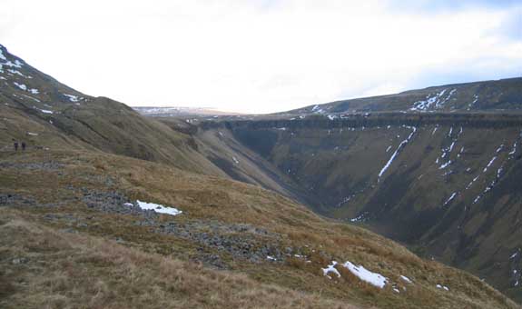
looking down the impressively shaped valley of High Cup Nick.
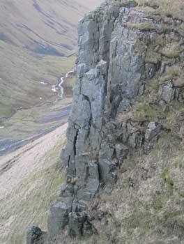
The basalt intrusion of the Whinn Sill forms fine pinnacles on either side of the cliffs.
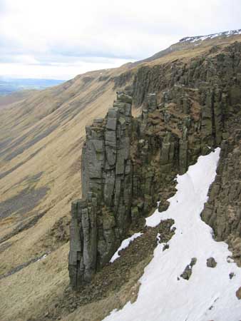
The right hand or northern side holding a larger patch of snow.
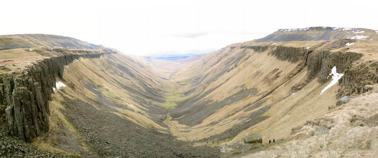
The amazing "U" shaped valley would suggest heavy glaciation.
The tiny stream in its base had been deprived of water by the diversion of the Maize Beck some 500 yards behind us and some millions of years ago. Perhaps a larger river could have caused the erosion on its own without the help of a glacier ?
 |
 |
Having seen no one all day, we were suddenly greeted with a crowd at the valley's edge.
A party of fellwalkers from (Newcastle's) Whitley Bay were out for a good day on the hills.
 |
Nichol's Chair. A fine single stack pinnacle rises out of the valley side. Andrew said that legend had it that the local cobbler climbed it and sat on the top. Looking in the cracks on the outer side now I think his modern counterpart, if one exists, would be well advised not to bother. |
 |
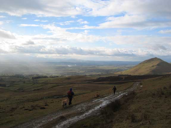
Leaving the valley.
Looking back the circular beauty is revealed again.
The weather had a sharp reminder that it was still only early March.
The hail shower moved away to reveal excellent views of the high fells of the Lakes out to the west.
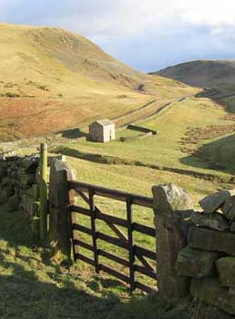
A fine stone barn captured in the late afternoon sun.
Shades of the Yorkshire Dales almost.
Back to the village and perhaps some light refreshment ?
The tops are now clear of mist at the end of the day.
Technical note: Pictures taken with a Canon IXUS 400 Digital camera.
Resized in Photoshop, and built up on a Dreamweaver web builder.
This site best viewed . . . with a pint of Black Sheep Bitter (but the coach party got there first and drank the last of it !)
Go to Top . . . Home page . . . Go To Archive 2004
© RmH . . . Email me here