Retreat to the quiet of the Western Lakes
|
Time and place : Thursday 16th Oct 2003 Occasion : A linear walk from Whinlatter to Crummock, with Ann and the dogs. Walk details : 5.8 miles 2650 ft of ascent. Weather : Sunny and warm. Blue skies all the way. Slight breeze on the tops. |
|
The start of the walk was from the top junction on the Swinside road out of Whinlatter.
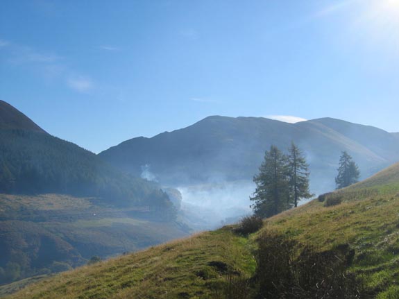
As we got out of the car we could smell burning and see the smoke from the forestry. Hopefully everything was under control
 |
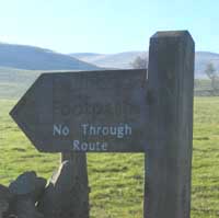
Strange . . . A public footpath to nowhere. Not even a parish boundary to explain the sudden end of the official path a short distance later at the forestry fence. Still, it gave us access to the fells. |
Climbing up towards the ridge - the moon was still out and visible despite the bright sunshine.
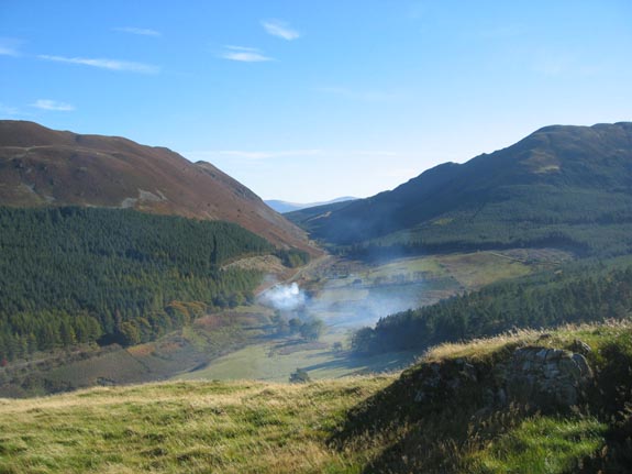
The cause of the smoke.
There was controlled burning of the waste after the clearance of some forestry earlier in the summer.
The fire burned for several days but finally was left to go out during the recent period of overnight frosts.
Above the trees but still a fair way to climb before reaching the level part of the Swinside ridge.
Ahead of us was Ladyside Pike, with Hobcarton and Hopegill Head behind.
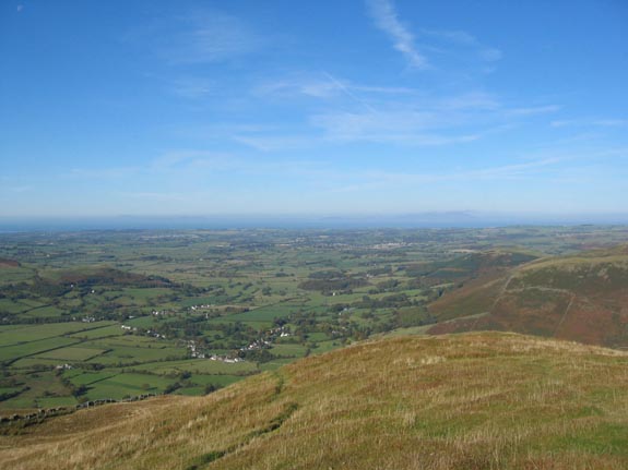
As we climbed too, the view out across the north Cumbrian lowlands and on to the Solway got better and better.
Scotland was visible, however the detail was lost in a slight blue haze.
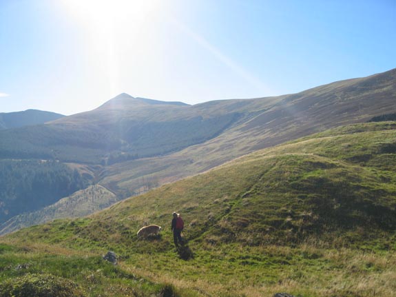
On the ridge now, and our added height gave us views of Skiddaw and Blencathra above the heather covered peak of Whinlatter itself.
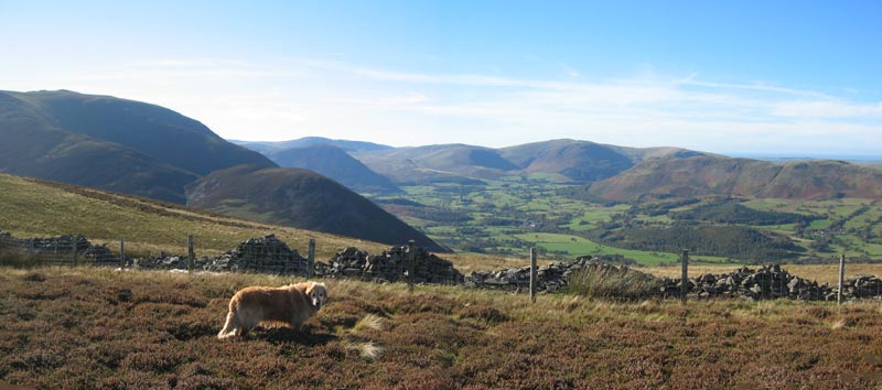
Below and to our right the Loweswater Fells and the top end of the Lorton Valley.
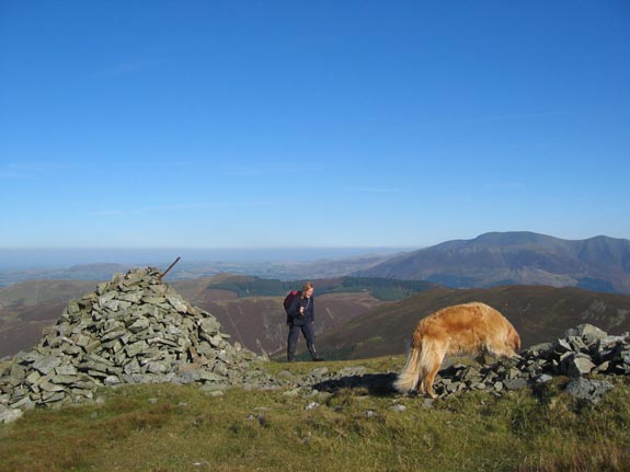
Ladyside Pike summit cairn.
The breeze just took the edge of the temperature, but for the most part this walk was a shorts and T-shirt job for me at least. An exception was made for the summits where the easterly breeze required a fleece to be worn to maintain the comfort factor at an acceptable level.
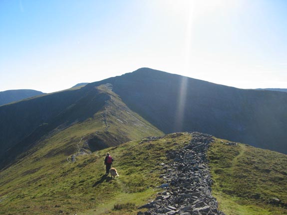
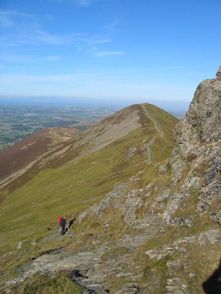
From Ladyside you follow the ridge and the old wall towards Hopegill Head itself.
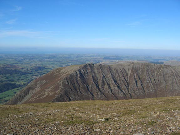
At this time of year the northern slopes of this and Hobcarton Crag to the left receive little or no sunshine and as a result are home to several rare alpine plant species found in only a few places this far south.
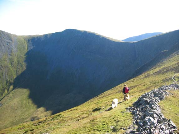
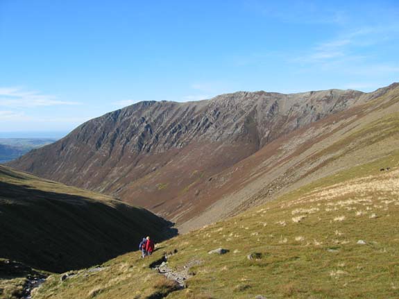
Hobcarton Crags, at the head of a beautiful glaciated valley but without a lake.
( It was about here that the words "Faux" and "pas" were creeping into our mind for some inexplicable reason. You know - that feeling you get when you are sure you've forgotten something . . . but can't think what . . . but I digress. )
From the pinnacle onward the route becomes more rocky, eventually becoming bare rock strata.
Today, after a dry spell the rock is no problem at all, but we turned back one New Year's day on Hopegill when this area was icy. The steep slope, the strong wind and proximity to a rather large drop was no place to be when the conditions were that difficult.
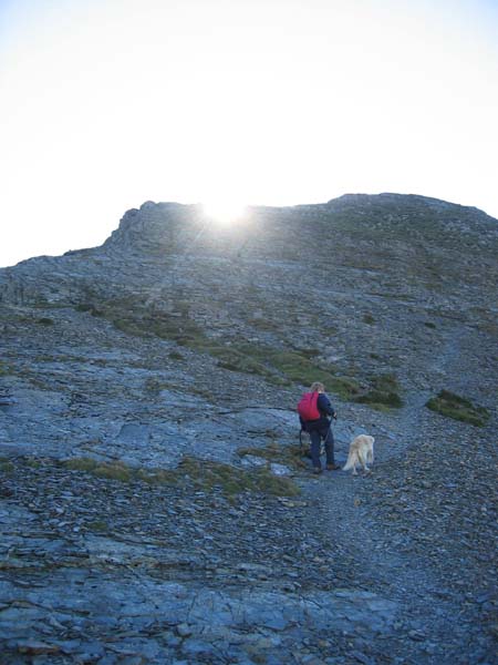
The path follows a slight zig-zag and then dissapears as you climb onto the steep slabs.
The easiest way up is to follow a fault line up towards the top.
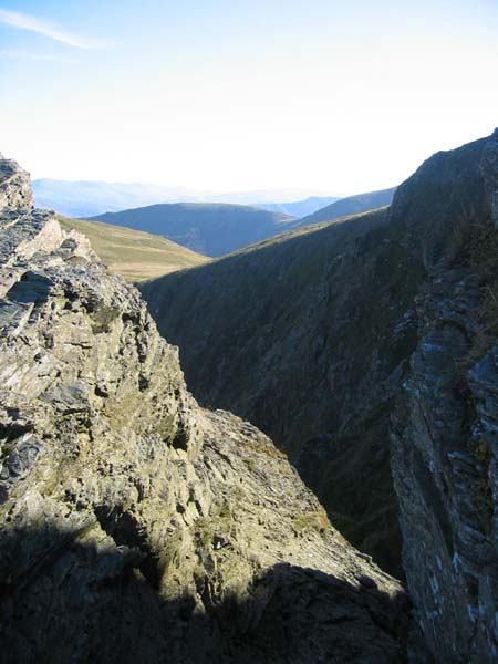
From the notch looking south west to Sail Fell and beyond.
The crags are in deep shadow now.

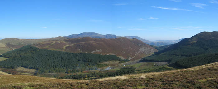
Hopegill safely negotiated, we had this beautiful view of Grasmoor presented to us as a reward.
Click here or on the picture above for a wider panorama
( High above our starting point now, we suddenly remembered what we had forgotten . . . )
Too bad, we'll have to do without it . . . Its a nice day . . . we had map, compass, lunch and a good forecast . . . What more do we need ?
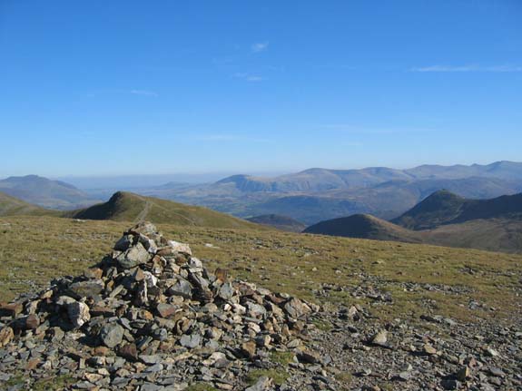
Here the view from Sand Hill summit cairn on the way south from Hopegill.
Our lunch time view . . . Gasgale Crags on the side of Whiteside.
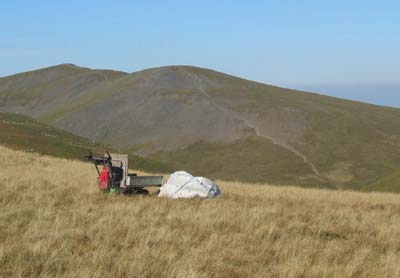 |
The National Trust have been working on the path from Coledale Hause up to Grasmoor. Here their little powered wheelbarrow and tools were left ready for another day. Hopegill and Sand Hill in the background. |
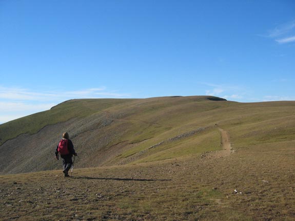
Our last up of the day, a short little pull onto Grasmoor.
Behind us the summit of Wandope, above and beyond it the distant high fells begin to show.
The summit is flat and an easy stroll across the top
and today has magnificent views all round.
To our right, Gasgale Crags on Whiteside . . . .
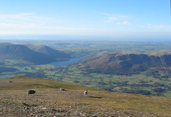
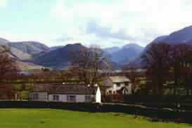
Ahead, Loweswater (and the cottage) and out to the coast . . . .
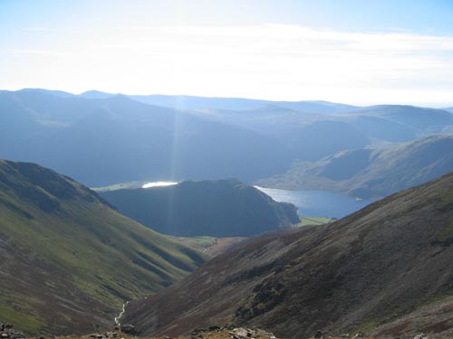
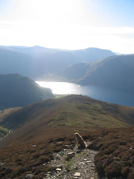
To our right Rannerdale Knotts and Crummock Water
viewed down Rannerdale Beck . . . .
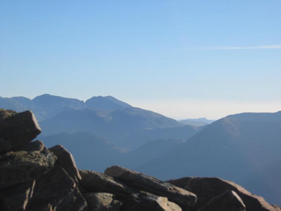
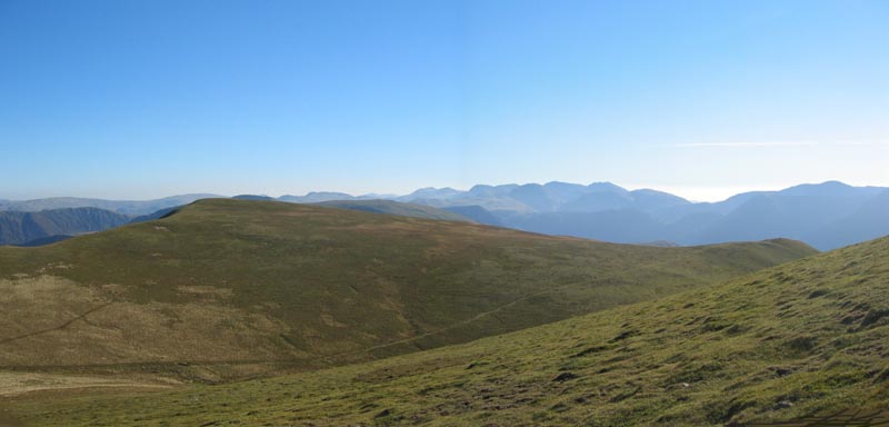
and from the summit shelter, a close up view of the Scafells, and Green crag away in the distance.
Click here or on the picture above for a larger panorama of the view
With the sun reflecting strongly on the lake ahead of us, we made our descent via Lad Hows,
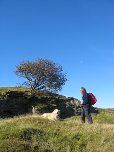
Holly leading the way as usual.
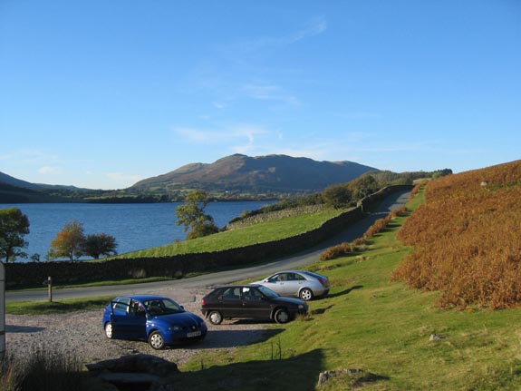
Back safely to the second car ready for the ride home.
Pity the keys fo this one were in the glovebox of the other car . . .Bit of a "faux pas" you could say.
Technical note: Pictures taken with a Canon IXUS 400 Digital camera.
Resized in Photoshop, and built up on a Dreamweaver web builder.
This site best viewed . . . with a duplicate set of car keys.
Go to Top . . . Home page . . . Go To Archive 2003
© RmH . . . Email me here